My Store
Antique Lompoc, California 1905 US Geological Survey Topographic Map – Santa Barbara, San Luis Obispo, Santa Maria, Los Padres Concepcion CA
Antique Lompoc, California 1905 US Geological Survey Topographic Map – Santa Barbara, San Luis Obispo, Santa Maria, Los Padres Concepcion CA
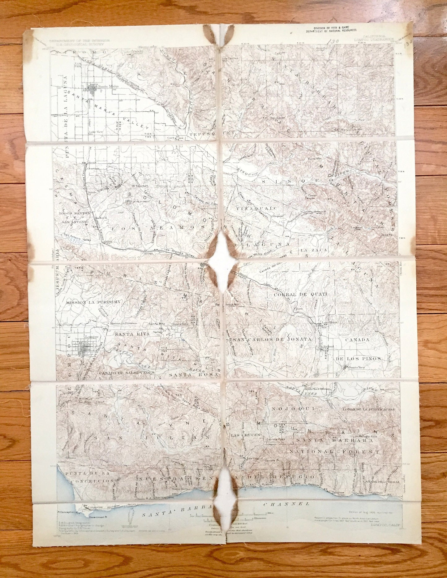
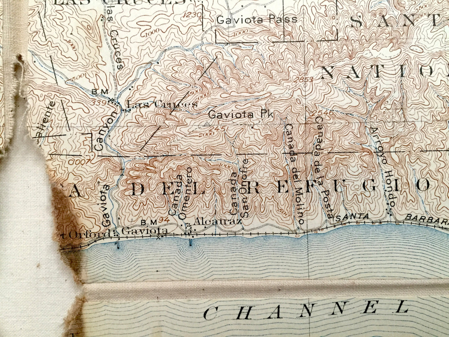
Beautiful, antique map of Lompoc, California and surrounding Santa Barbara & San Luis Obispo County coastal area. This is an authentic 1905 edition, 1931 print from the U.S. Geological Survey and NOT a computer reproduction.
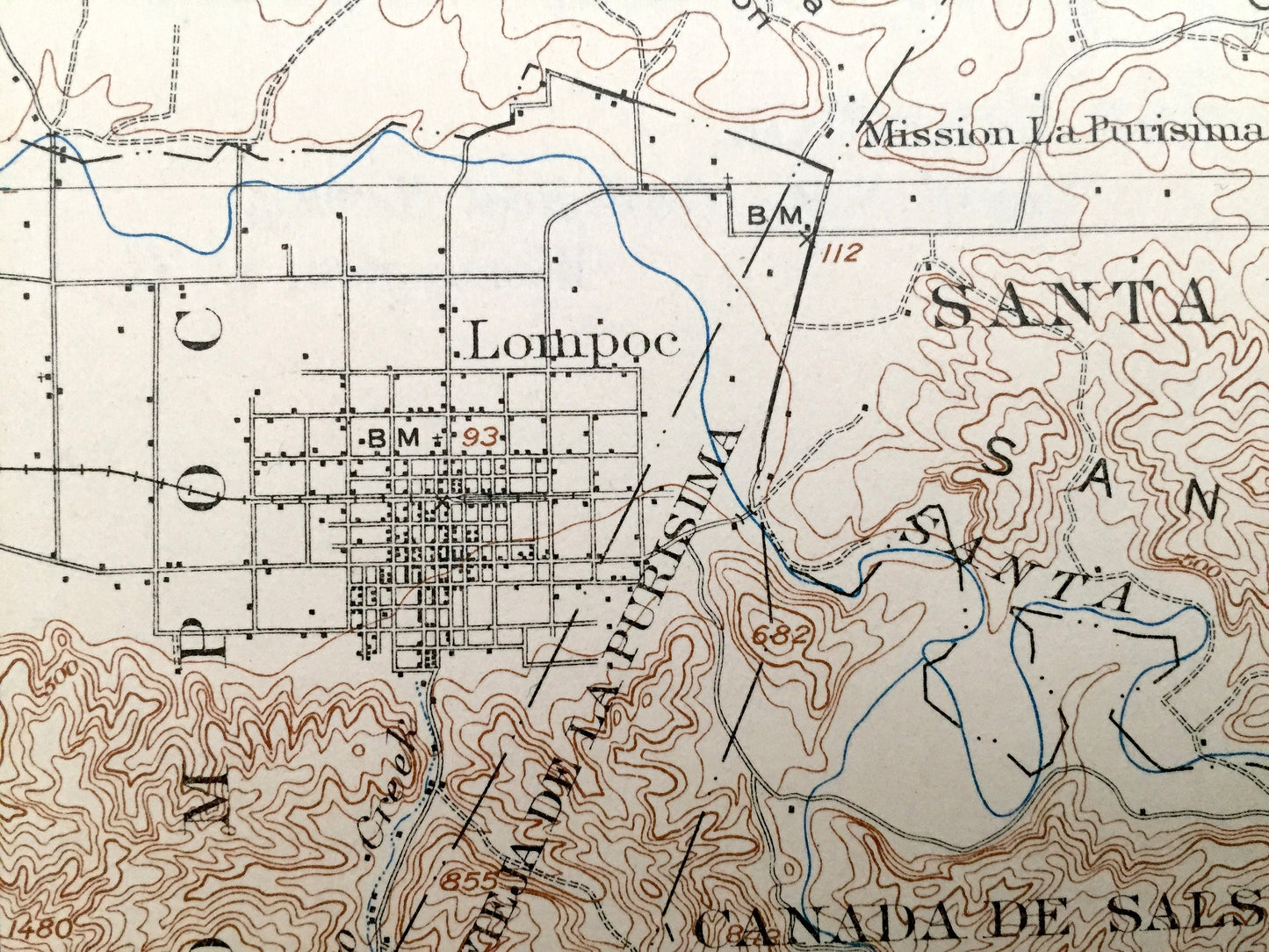
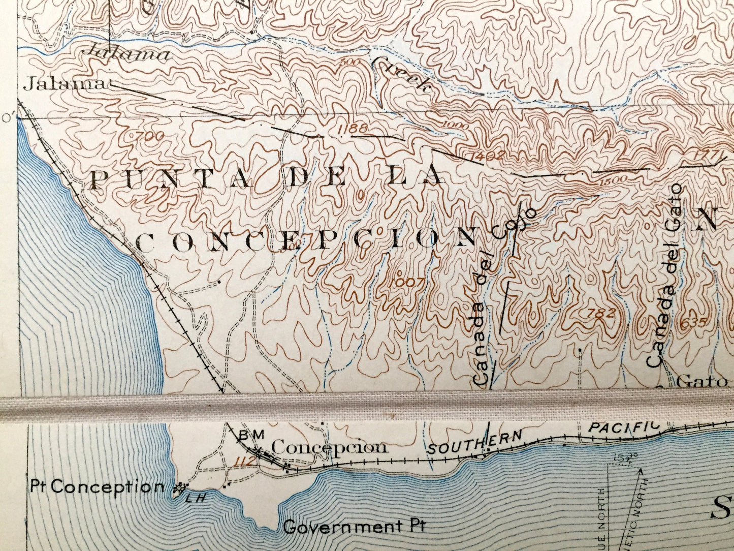
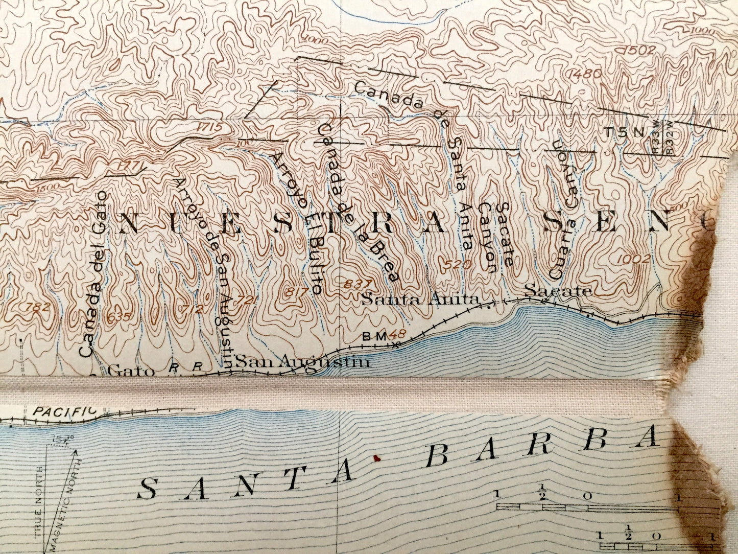
See what the Pacific Coast looked like more than 115 years ago, before serious modern development. Lots of intricate details and geological contours. Map even has little squares for every house that existed at the time. The USGS cartographers were very thorough back then! At some point the map was canvas-backed and split into quadrants, perhaps for field work.
Perfect for the historian, map-lover, the curious or just as a conversation starter. Wonderful and rare. Vintage maps such as these make great gifts.
Edition of 1905, printed 1931
Dimensions: 16 1/2" width x 22 1/2" height
----
Features
Cities & Towns: Santa Maria, Orcutt, Graciosa, Lake View, Gary, Divide, Bicknell, Harris, Careaga, Mission La Purisima, Los Alamos, Santa Rita, Zaca, Los Olivos, Lompoc, Jalama, Las Cruces, Ballard, Santa Ynez, Santa Ynez Mission, Concepcion, Gato, San Augustin, Santa Anita, Port Orford, Gaviota, Alcatraz, Tajunguas, Orella, Capitan.
Points of Interest: California Coast, Santa Barbara County, San Luis Obispo County, Santa Barbara Channel, Santa Ynez Mountains, Los Padres National Forest, Santa Ynez River, Point Conception, Purisima Hills, Santa Rita Hills, Solomon Hills, Sisquoc River, San Rafael Mountains, Los Padres National Forest, Santa Maria Valley, Casmalia Hills, and lots more mountains, canyons, rivers, small towns and train tracks.
Condition: Good or "Very Vintage" condition, commensurate with age. This map is in great shape for being 80 years old. Some edge-wear, pencil margin markings and missing pieces, but these will add to vintage character when framed.
----
We will happily adjust shipping price for multiple purchases. Maps are rolled up and shipped in sturdy mailing tubes, never folded.
Couldn't load pickup availability
Share