My Store
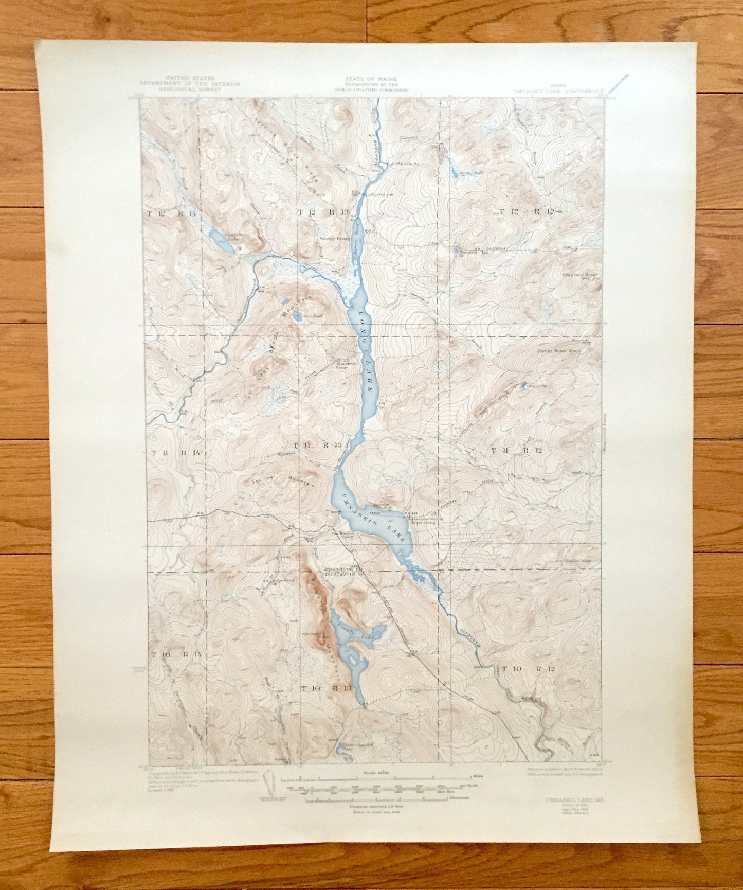
Antique Long Lake & Umsaskis Lake, Maine 1935 US Geological Survey Topographic Map – Aroostook County, Allagash River Grey Brook Mountain ME
Antique Long Lake & Umsaskis Lake, Maine 1935 US Geological Survey Topographic Map – Aroostook County, Allagash River Grey Brook Mountain ME
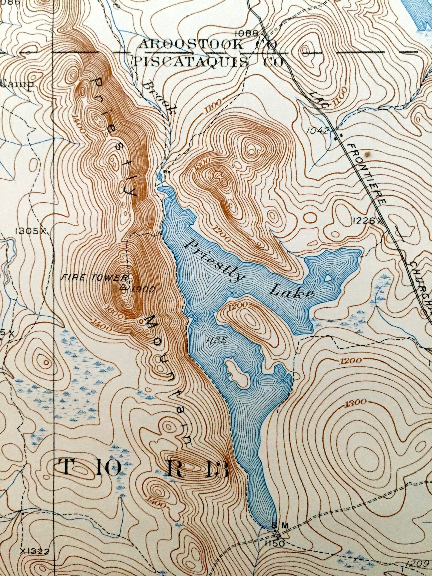
Beautiful, antique map of Long Lake and Umsaskis Lake, Maine and surrounding Aroostook and Piscataquis County area. This is an authentic 1935 edition, 1947 print from the U.S. Geological Survey and NOT a computer reproduction.
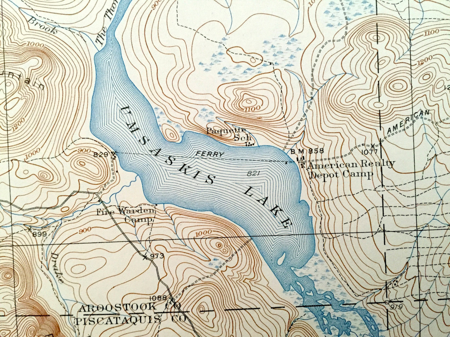
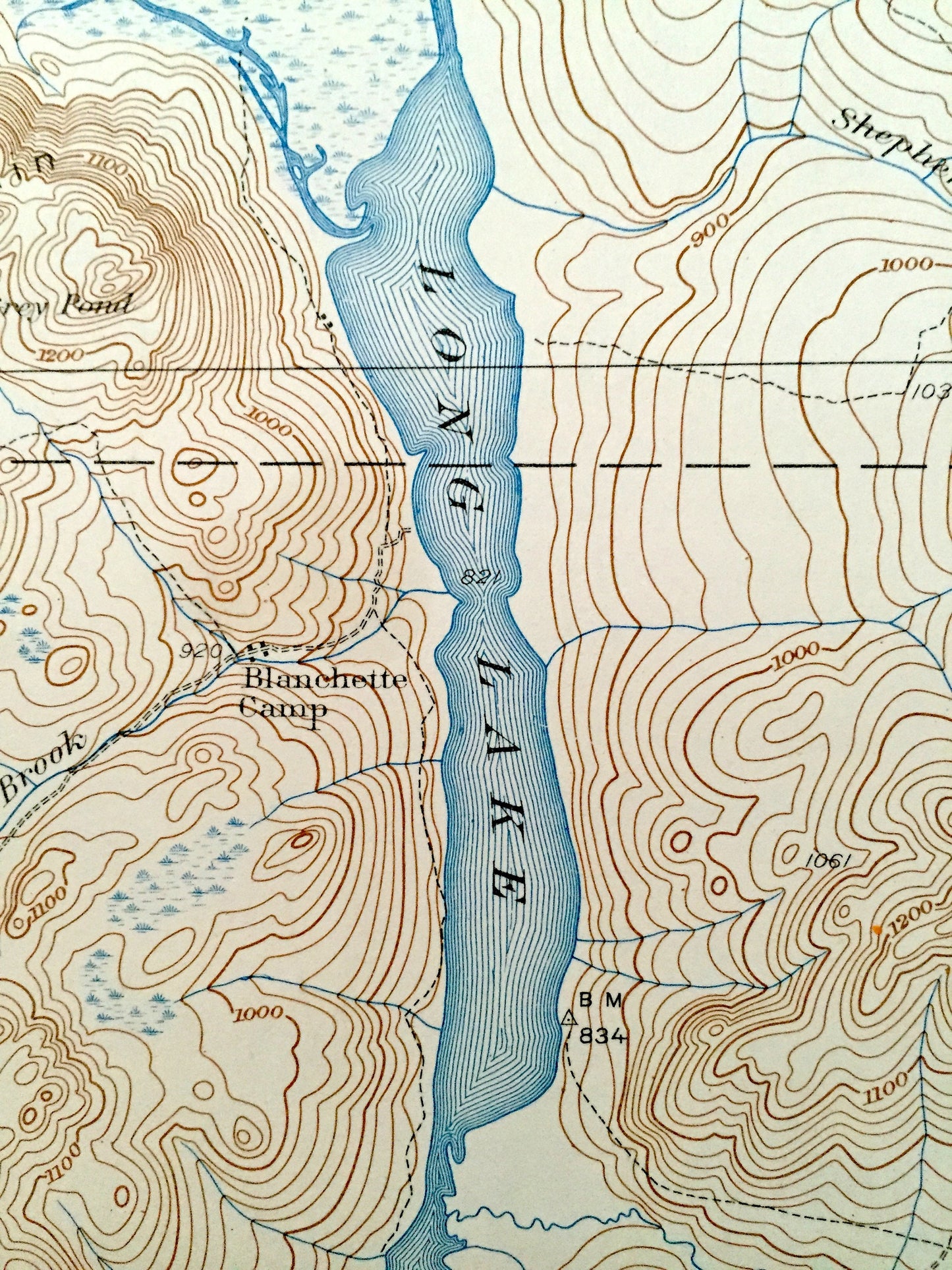
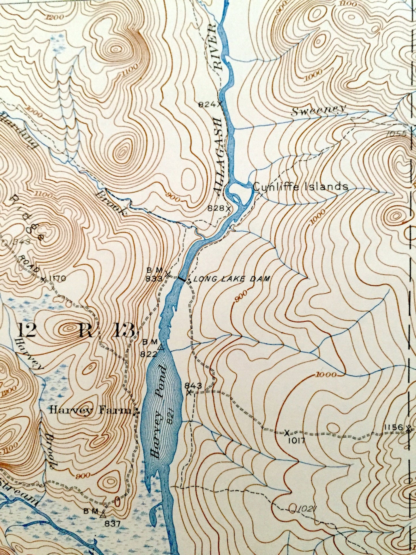
See what Long Lake looked like 80 years ago when large portions of Maine were still unnamed. Lots of intricate details and geological contours. Map even has little squares for every house that existed at the time. The USGS cartographers were very thorough back then! On the back is a description of topographic symbols and map guide.
Perfect for the historian, map-lover, the curious or just as a conversation starter. Wonderful and rare. Vintage maps such as these make great gifts.
Edition of 1935, printed 1947
Dimensions: 17" width x 21" height
----
Features
Points of Interest: Aroostook County, Long Lake, Umsaskis Lake, Allagash River, Grey Brook Mountain, Squirrel Mountain, Harding Brook Ridge, Priestly Mountain, Priestly Lake, and many more streams, ponds, and mountains.
Condition: Good Vintage condition, commensurate with age. This map is in great shape for being over 70 years old. Has light wear, but this will read as character when framed.
----
We will happily adjust shipping price for multiple purchases. Maps are rolled up and shipped in sturdy mailing tubes, never folded.
Couldn't load pickup availability
Share