My Store
Antique Longs Peak, Colorado 1961 US Geological Survey Topographic Map – Boulder, Larimer County, Estes Park, Beaver Point, CO
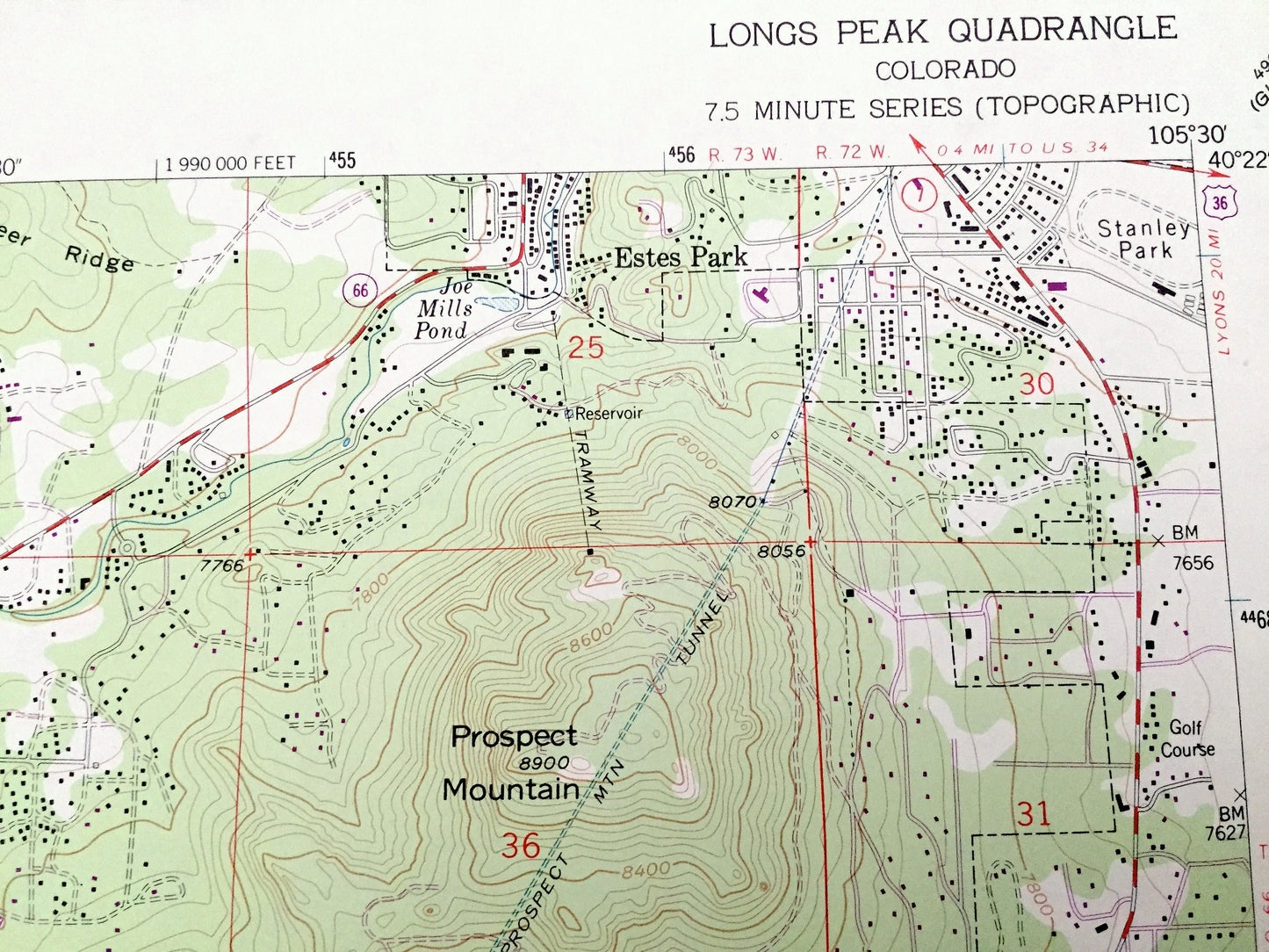
Antique Longs Peak, Colorado 1961 US Geological Survey Topographic Map – Boulder, Larimer County, Estes Park, Beaver Point, CO
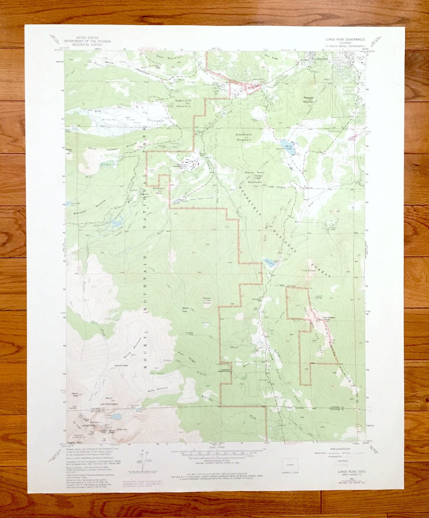
Beautiful, antique map of Longs Peak, Colorado and surrounding Boulder and Larimer County area. This is an authentic 1961 edition, 1978 print from the U.S. Geological Survey and not a computer reprint.
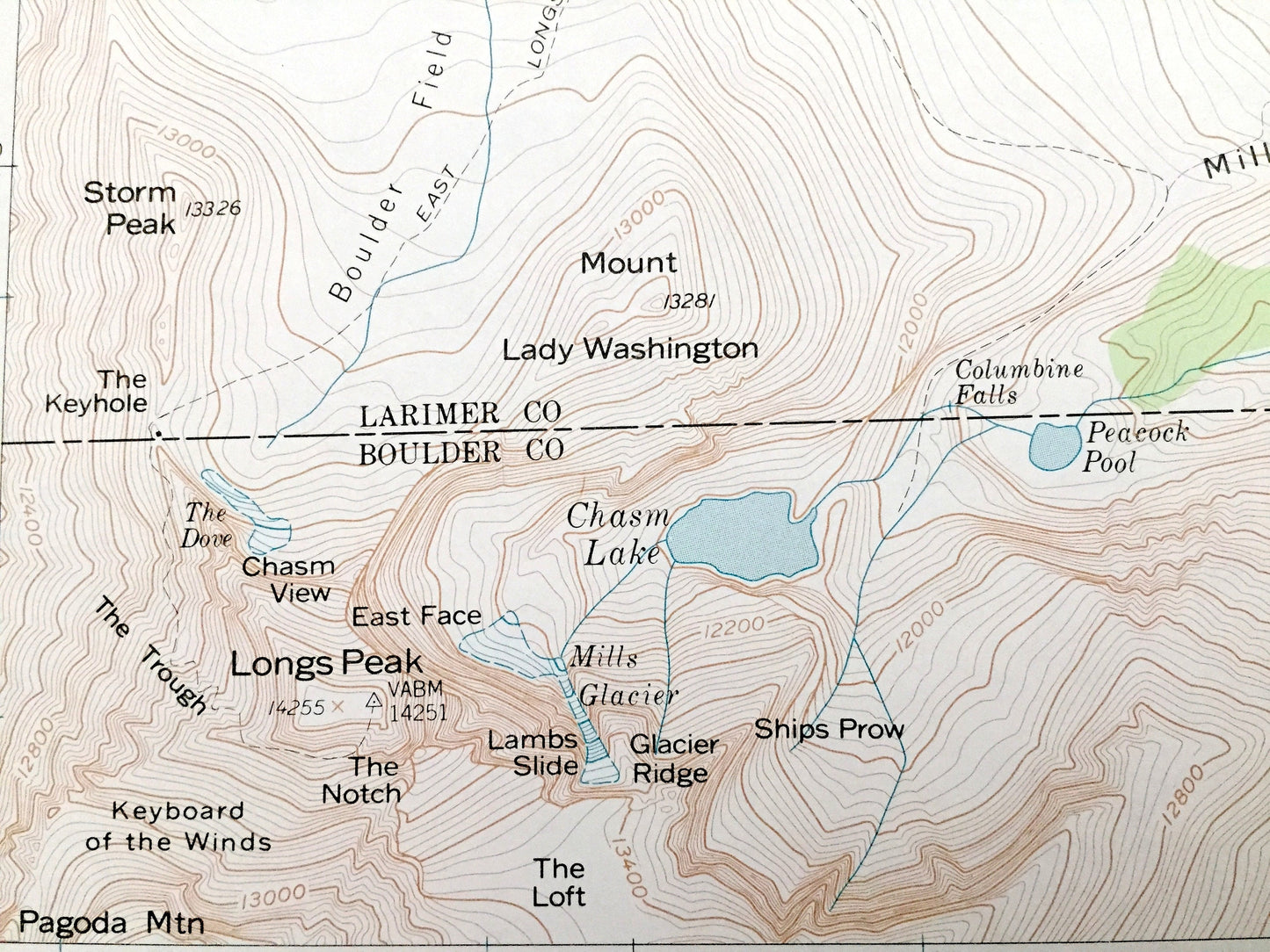
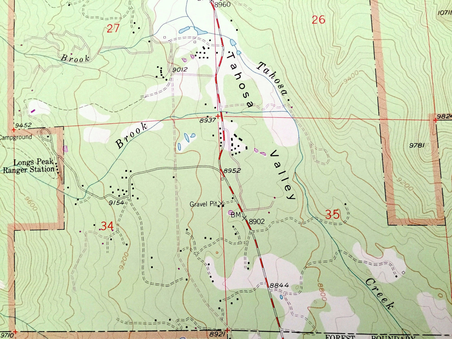
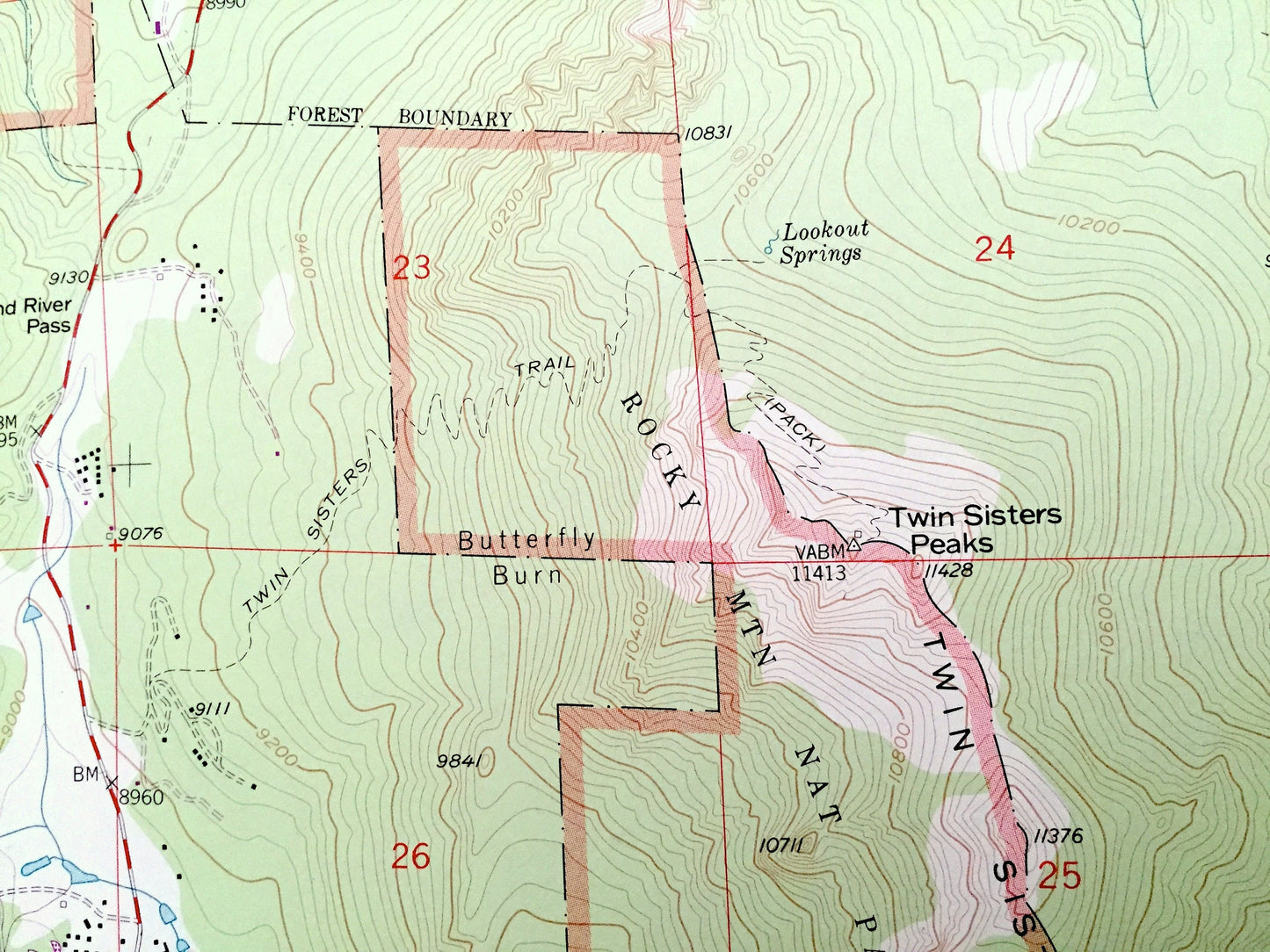
See what Colorado looked like over 55 years ago. Lots of intricate details and geological contours. Map even has little squares for every house that existed. The USGS cartographers were very thorough back then!
Perfect for the historian, map-lover, the curious or just as a conversation starter. Wonderful and rare. Vintage maps such as these make great gifts.
Edition of 1961, printed 1978
Dimensions: 22" width x 27" height
----
Features
Cities & Towns: Longs Peak, Estes Park, Beaver Point.
Points of Interest: Estes Park Conference Park (YMCA), Stanley Park, Rocky Mountain National Park, Roosevelt National Forest, Chasm Lake, Twin Sisters Mountain, Giantrack Mountain, Marys Lake, Prospect Mountain, Eagle Cliff Mountain, Moraine Park, Glacier Basin, Tuxedo Park, Deer Mountain, Rams Horn Mountain, Aspen River, Lily Lake, Battle Mountain, Estes Cone, Emerald Mountain, Boulder Brook, Glacier Creek, Aspen Brook, Tahosa Creek, Alpine Brook, and many more smaller ponds, springs, creeks, peaks and mountains.
Condition: Very Good Vintage condition, commensurate with age. This map is in great shape for being over 40 years old. Has light edge-wear and some tears, all of which will read as character when framed.
----
We will happily adjust shipping price for multiple purchases. Maps are rolled up and shipped in sturdy mailing tubes, never folded.
Couldn't load pickup availability
Share