My Store
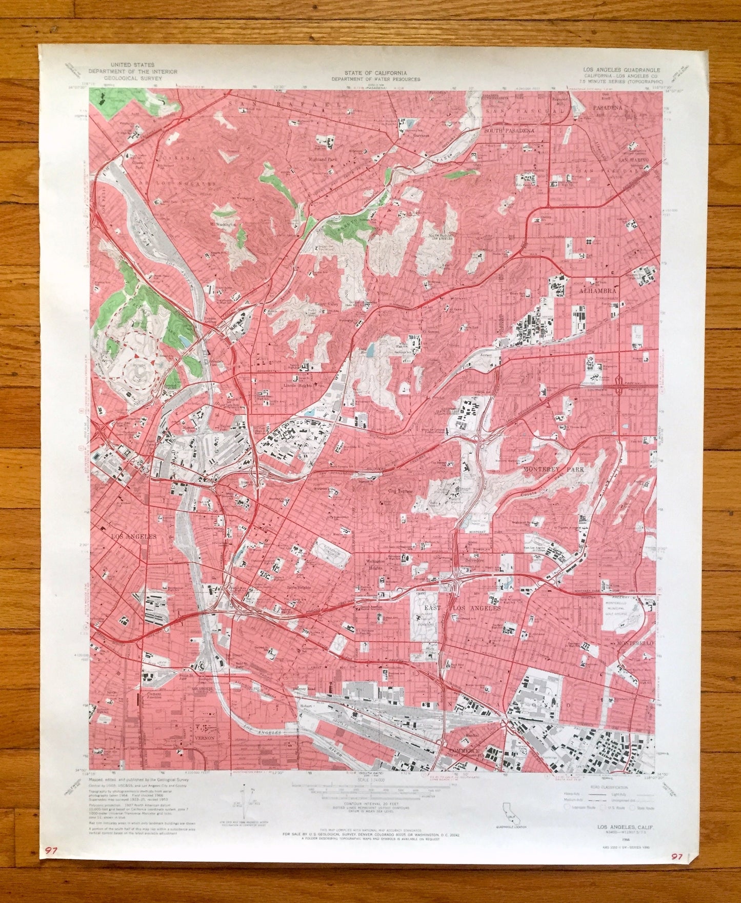
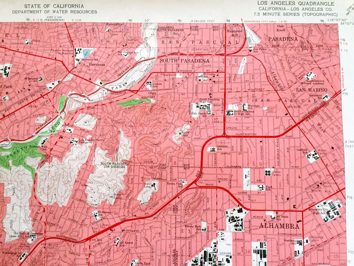
Antique Los Angeles, California 1966 US Geological Survey Topographic Map – Pasadena, San Rafael, Vernon, Monterey Park, Alhambra Elysian CA
Antique Los Angeles, California 1966 US Geological Survey Topographic Map – Pasadena, San Rafael, Vernon, Monterey Park, Alhambra Elysian CA
Beautiful, antique map of Los Angeles, California and surrounding LA County area. This is an authentic 1966 edition, 1968 print from the U.S. Geological Survey and NOT a computer reproduction. There is a duplicate map on the back.
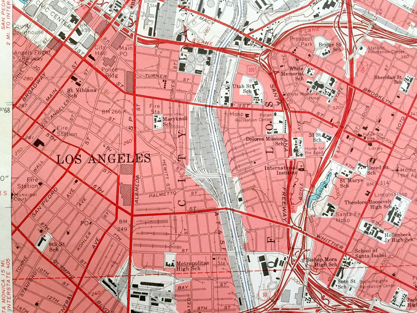
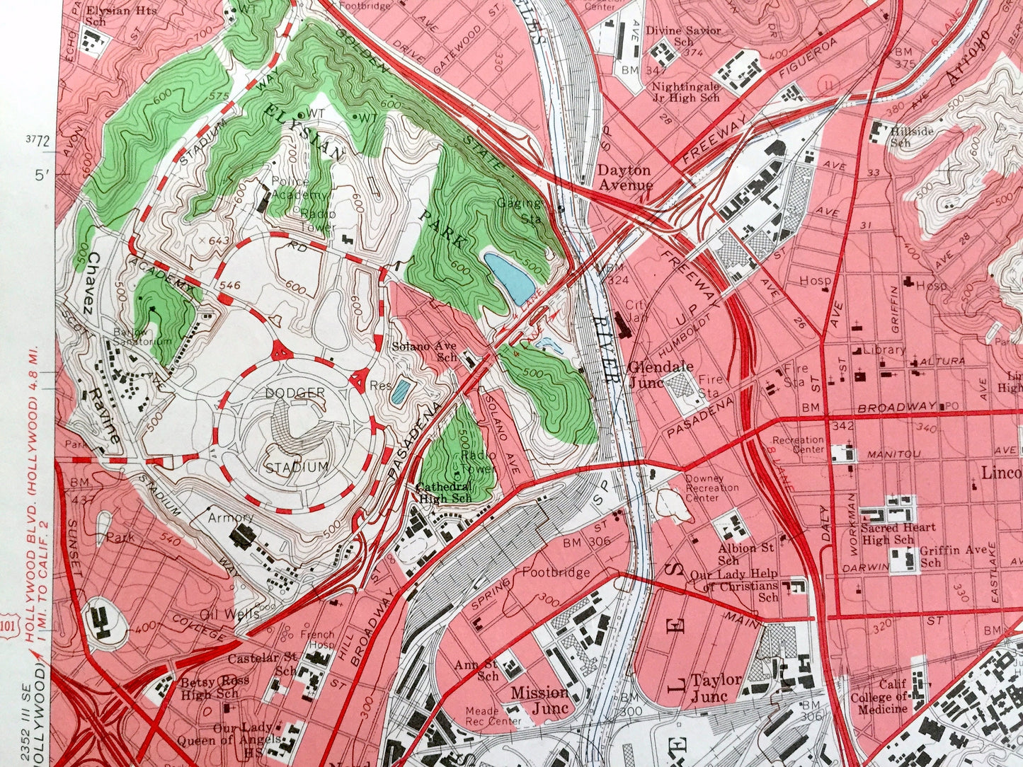
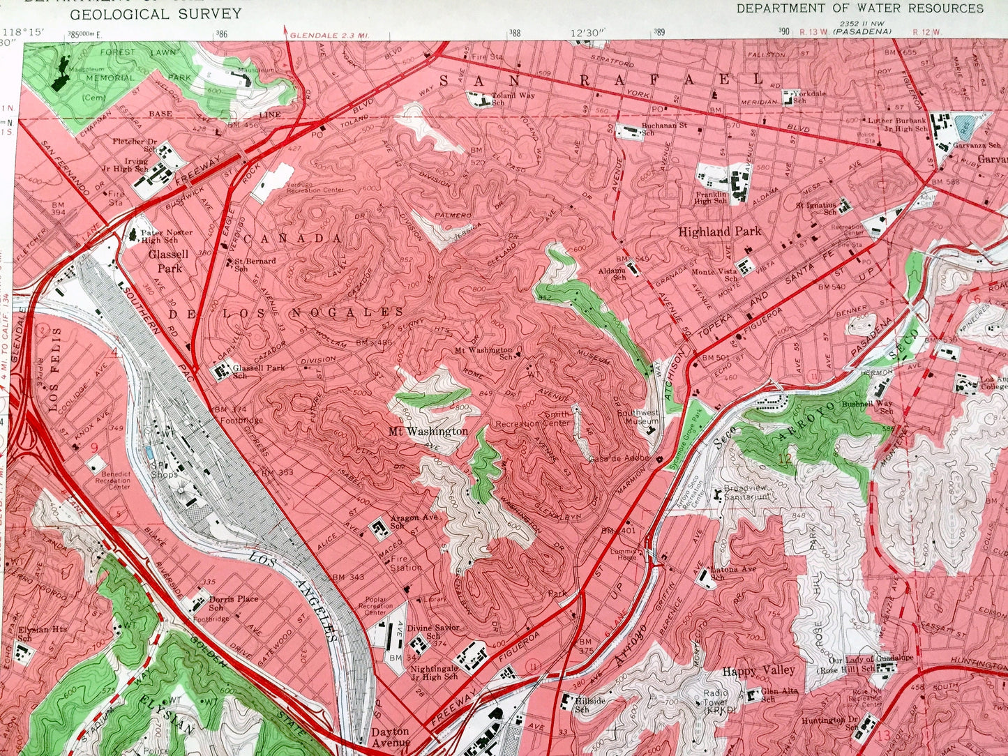
See what LA looked like over 55 years ago. Lots of intricate details and geological contours. Map even has little squares for every house that existed at the time. The USGS cartographers were very thorough back then!
Perfect for the historian, map-lover, the curious or just as a conversation starter. Wonderful and rare. Vintage maps such as these make great gifts.
Edition of 1966, printed 1968
Dimensions: 22" width x 27" height
----
Features
Cities & Towns: Los Angeles, Vernon, Boyle Heights, Belvedere, Bandini, Montebello, Monterey Park, Wellington Heights, San Rafael, Highland Park, Pasadena, South Pasadena, Alhambra, El Sereno, Happy Valley, Garvanza, Glassell Park, Mt Washington.
Points of Interest: Los Angeles River, Union Pacific Railroad, Arroyo Seco Park, Elysian Park, Coyote Pass, Ramona Convent, Ascot Reservoir, and many more hills, streams, ponds, houses, schools, churches and roads.
Condition: Good Vintage condition, commensurate with age. This map is in great shape for being over 55 years old. Has light wear and marker in bottom right corner, but this will add to vintage character when framed.
----
We will happily adjust shipping price for multiple purchases. Maps are rolled up and shipped in sturdy mailing tubes, never folded.
Couldn't load pickup availability
Share