My Store
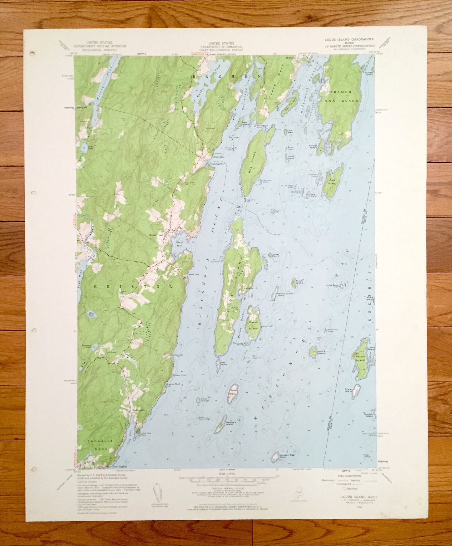
Antique Louds Island, Maine 1955 US Geological Survey Topographic Map – Knox, Lincoln County, Bremen, Bristol, Loudville, Muscongus, ME
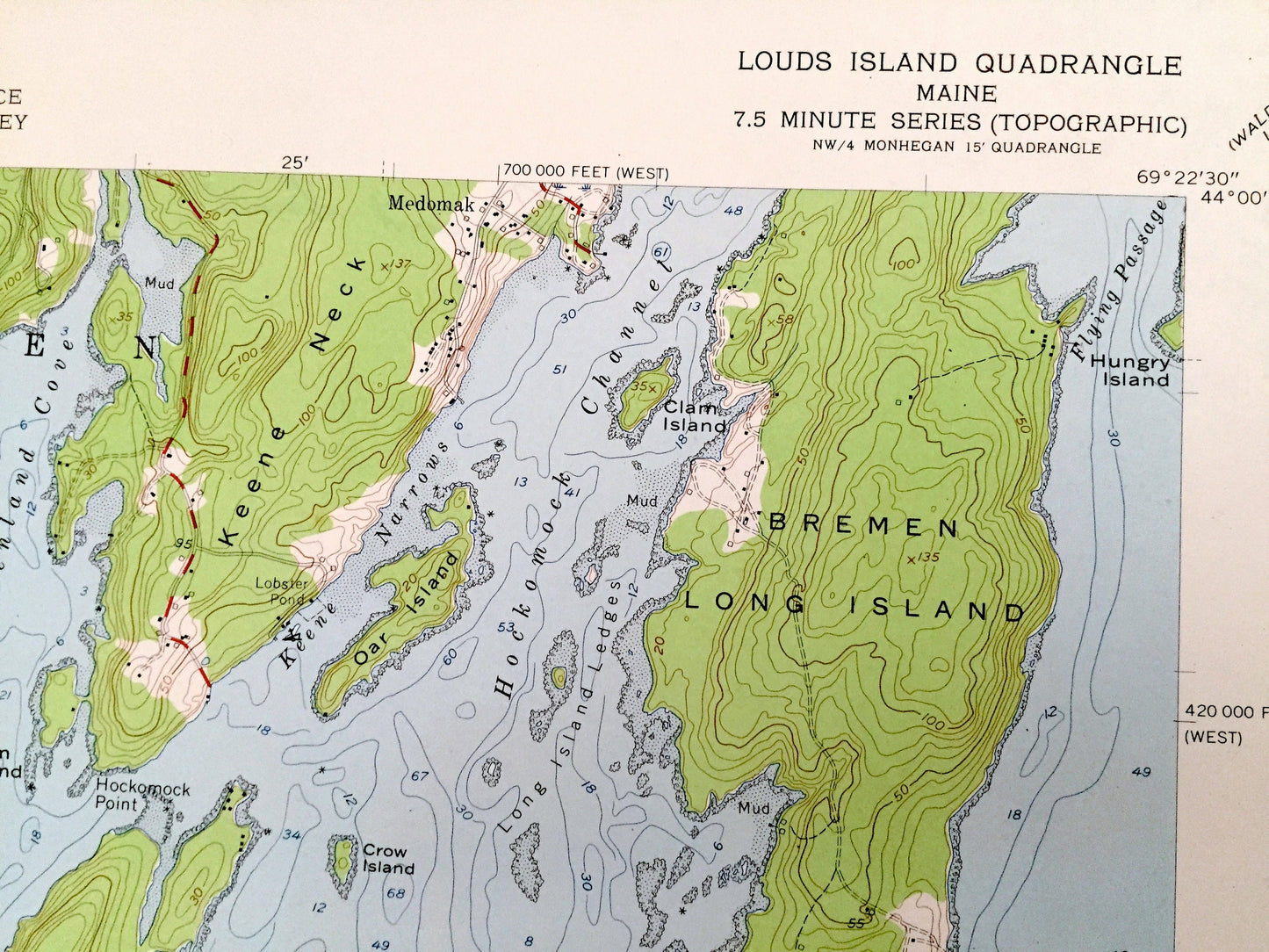
Antique Louds Island, Maine 1955 US Geological Survey Topographic Map – Knox, Lincoln County, Bremen, Bristol, Loudville, Muscongus, ME
Beautiful, antique map of Louds Island, Maine and surrounding Knox County and Lincoln County areas. This is an authentic 1955 edition, 1959 print from the U.S. Geological Survey and NOT a computer reproduction.
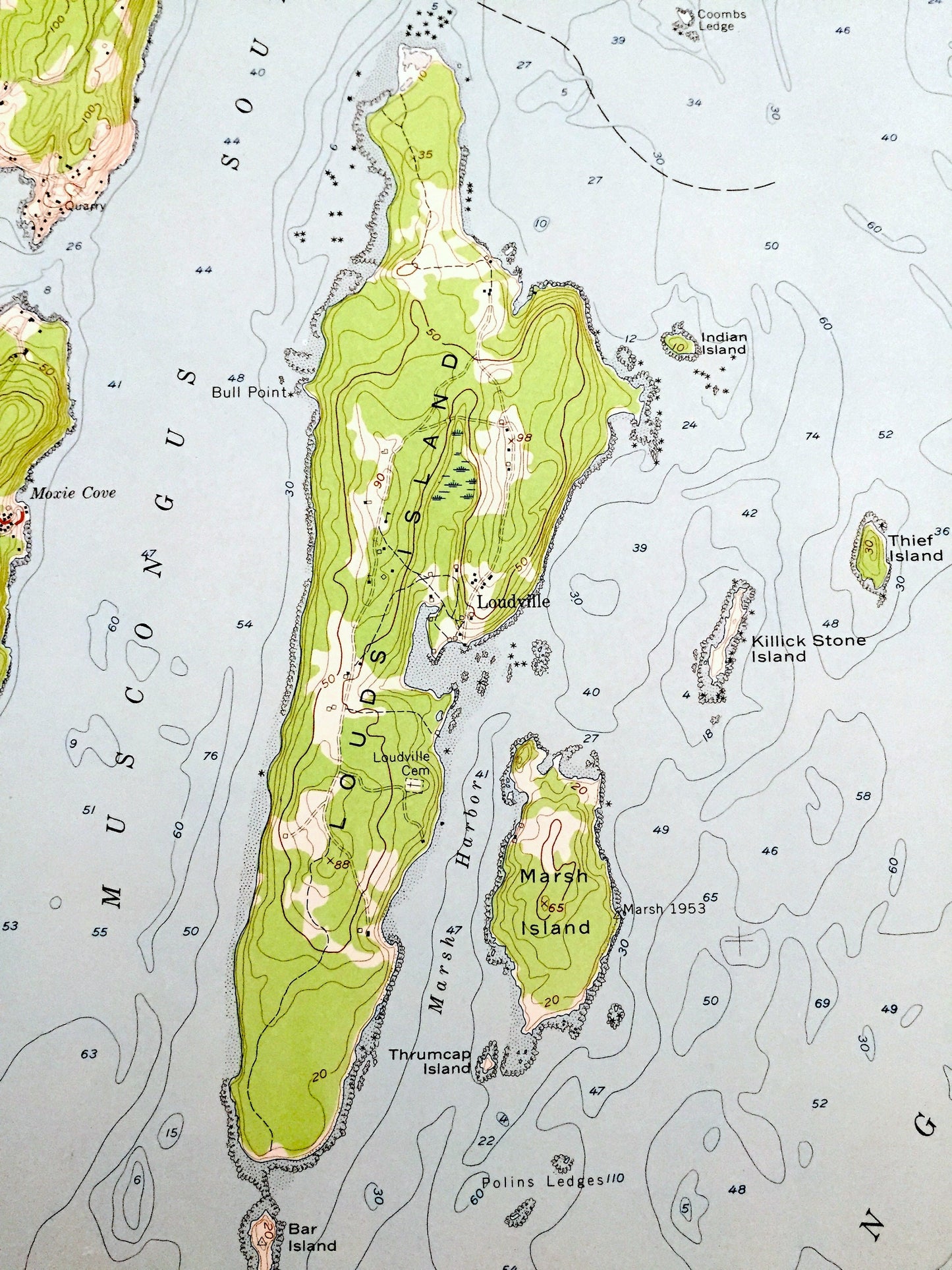
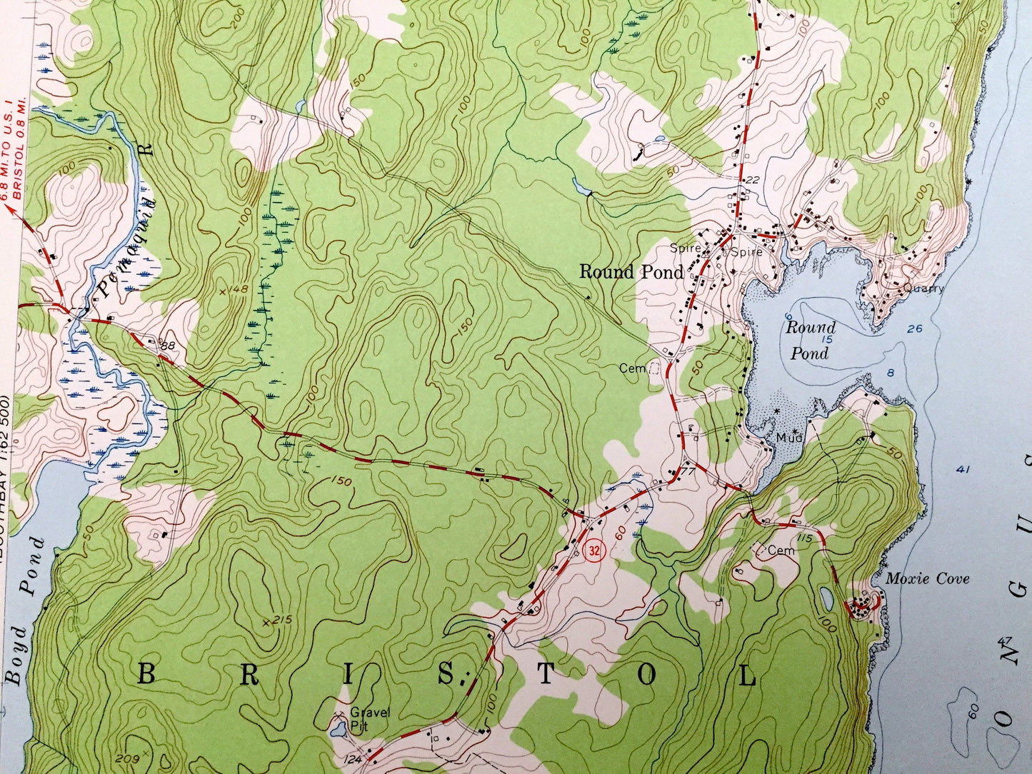
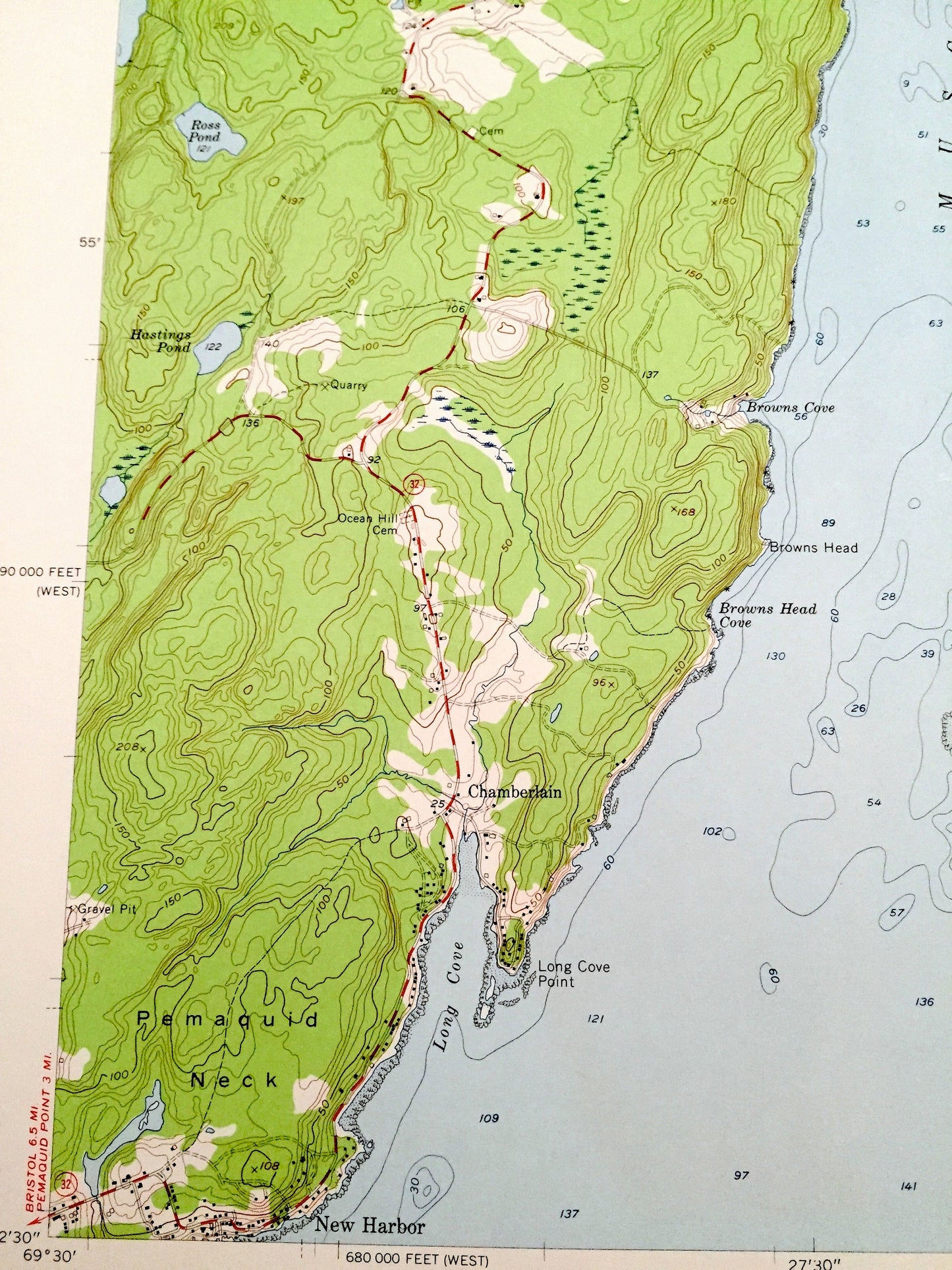
See what Maine looked like over 65 years ago. Lots of intricate details and geological contours. Map even has little squares for every house that existed at the time. The USGS cartographers were very thorough back then!
Perfect for the historian, map-lover, the curious or just as a conversation starter. Wonderful and rare. Vintage maps such as these make great gifts.
Edition of 1955, printed 1959
Dimensions: 22" width x 27" height
----
Features
Cities & Towns: Bremen, Bristol, Muscongus, Medomak, Round Pond, Loudville, Chamberlain, New Harbor, Friendship.
Points of Interest: Keene Neck, Bremen Long Island, Hog Island, Cow Island, Marsh Island, Harbor Island, Pemaquid Neck, Haddock Island, Wreck Island, Western Egg Rock, Biscay Pond, Webber Pond, Greenland Cove, Hockomock Channel, Muscongus Harbor, Muscongus Sound, Muscongus Bay, Long Cove, Boyd Pond, and many more hills, streams, beaches, islands, ponds, houses, schools, railroads, churches and roads.
Condition: Very Good Vintage condition, commensurate with age. This map is in great shape for being over 60 years old. Has subtle edge-wear with few stains and a four-hole-punch on the left hand margin, all of which will read as character when framed.
----
We will happily adjust shipping price for multiple purchases. Maps are rolled up and shipped in sturdy mailing tubes, never folded.
Couldn't load pickup availability
Share