My Store
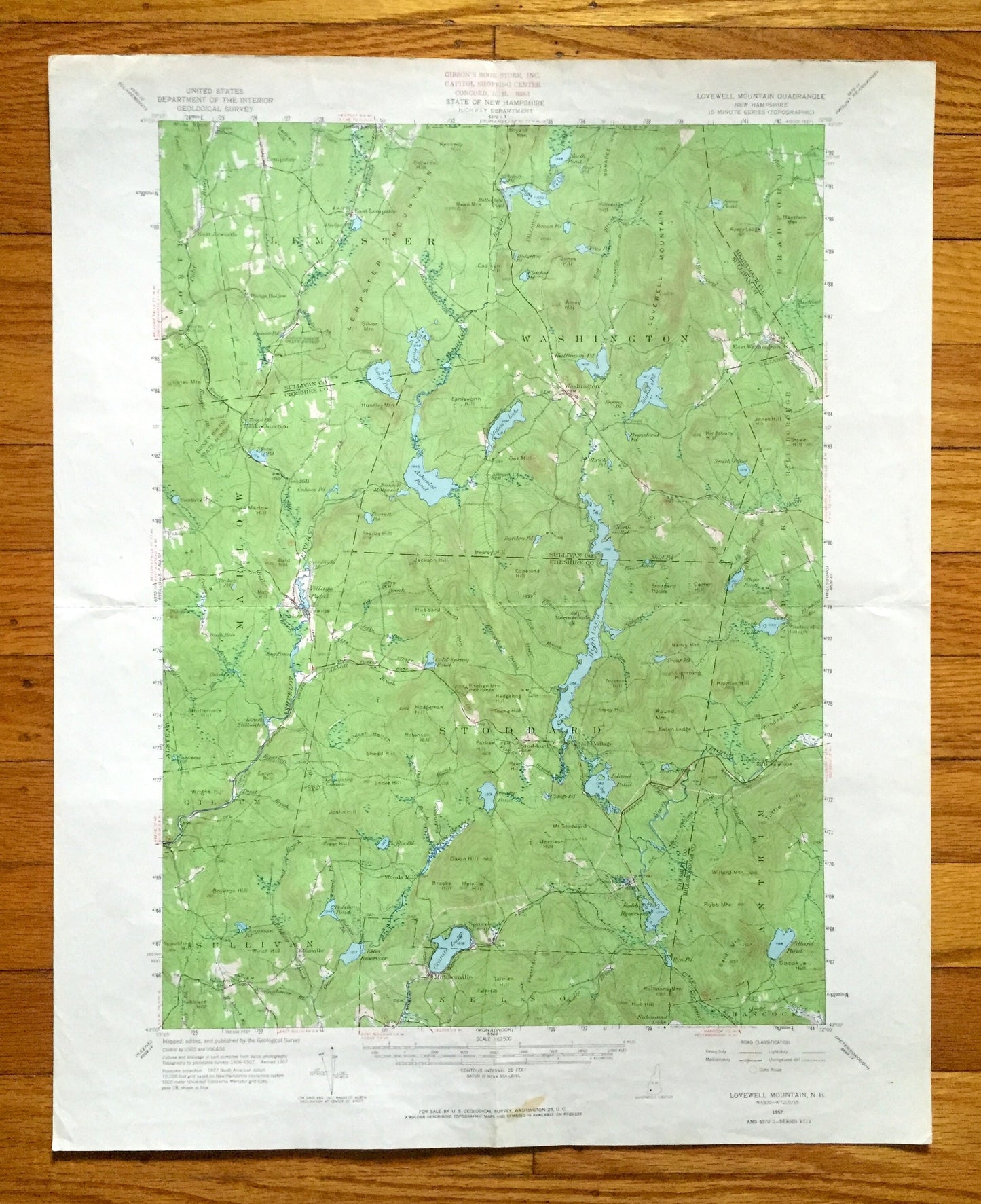
Antique Lovewell Mountain, New Hampshire 1957 US Geological Survey Topographic Map – Washington, Stoddard, Marlow, Lempster, Windsor, NH
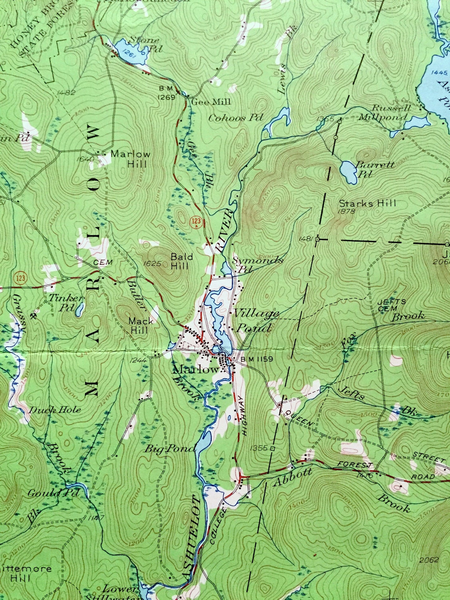
Antique Lovewell Mountain, New Hampshire 1957 US Geological Survey Topographic Map – Washington, Stoddard, Marlow, Lempster, Windsor, NH
Beautiful, antique map of Lempster, Washington, Stoddard, and Nelson, New Hampshire, including surrounding Cheshire County, Sullivan County & Hillsboro County area. This is an authentic 1954 edition, 1964 print from the U.S. Geological Survey and NOT a computer reproduction.
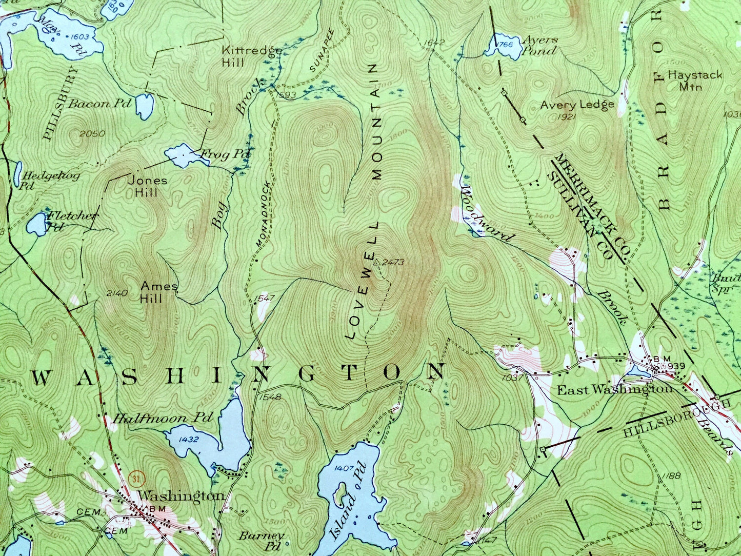
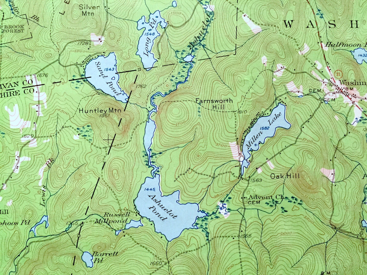
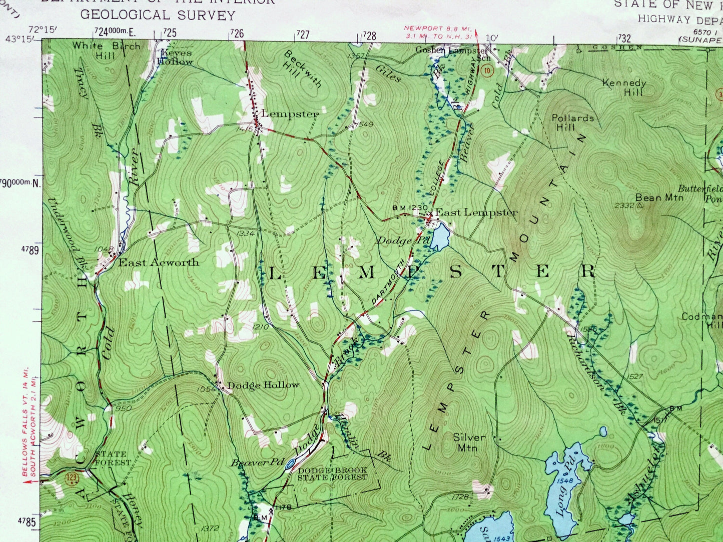
See what New Hampshire looked like over 65 years ago. Lots of intricate details and geological contours. Map even has little squares for every house that existed at the time. The USGS cartographers were very thorough back then!
Perfect for the historian, map-lover, the curious or just as a conversation starter. Wonderful and rare. Vintage maps such as these make great gifts.
Edition of 1957, printed 1964
Dimensions: 17" width x 21" height
----
Features
Cities & Towns: Acworth, Lempster, East Lempster, East Acworth, Washington, Hillsboro, Brandford, Windsor, Antrim, Hanscock, Stoddard, Mill Village, South Stoddard, Marlow, Gilsum, Sullivan, Minsonville, Keyes, Marlow Junction, Gee Mill,
Points of Interest: State Forest Camp, Halfmoon Pond, Island Pond, Highland Lake, Willard Pond, Granite Lake, Lovewell Mountain, Avery Ledge, Lempster Mountain, Dodge Hollow, Gates Mountain, Ashuelot River, Windsor Mountain Camp, YMCA Camp Washington, Bean Mountain, Sunapee Trail, and lots more hills, mountains, streams, ponds, houses, schools and roads.
Condition: Good Vintage condition, commensurate with age. This map is in great shape for being about 60 years old. Light wear, small stain in lower margin, and folds as-issued, but these will flatten easily and all will add to vintage character when framed.
----
We will happily adjust shipping price for multiple purchases. Maps are rolled up and shipped in sturdy mailing tubes, never folded.
Couldn't load pickup availability
Share