My Store
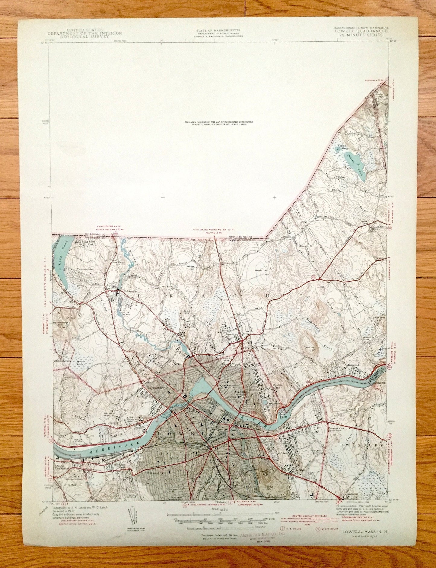
Antique Lowell, Massachusetts 1941 US Geological Survey Topographic Map – Middlesex County, Dracut, Chelmsford, Tewksbury Merrimack UMass MA
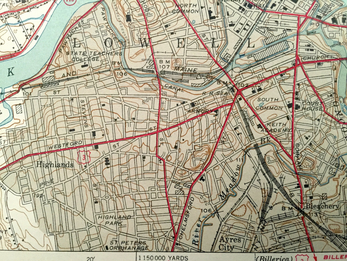
Antique Lowell, Massachusetts 1941 US Geological Survey Topographic Map – Middlesex County, Dracut, Chelmsford, Tewksbury Merrimack UMass MA
Beautiful, antique map of Lowell, Massachusetts and surrounding Middlesex County area on the Merrimack River. This is an authentic edition of 1941 print from the U.S. Geological Survey and NOT a computer reproduction.
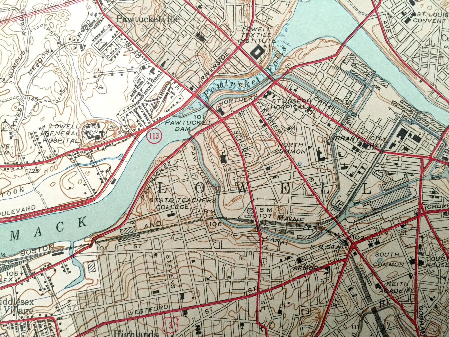
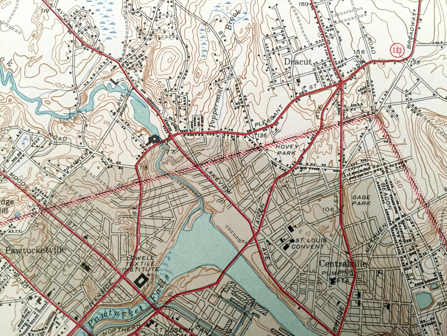
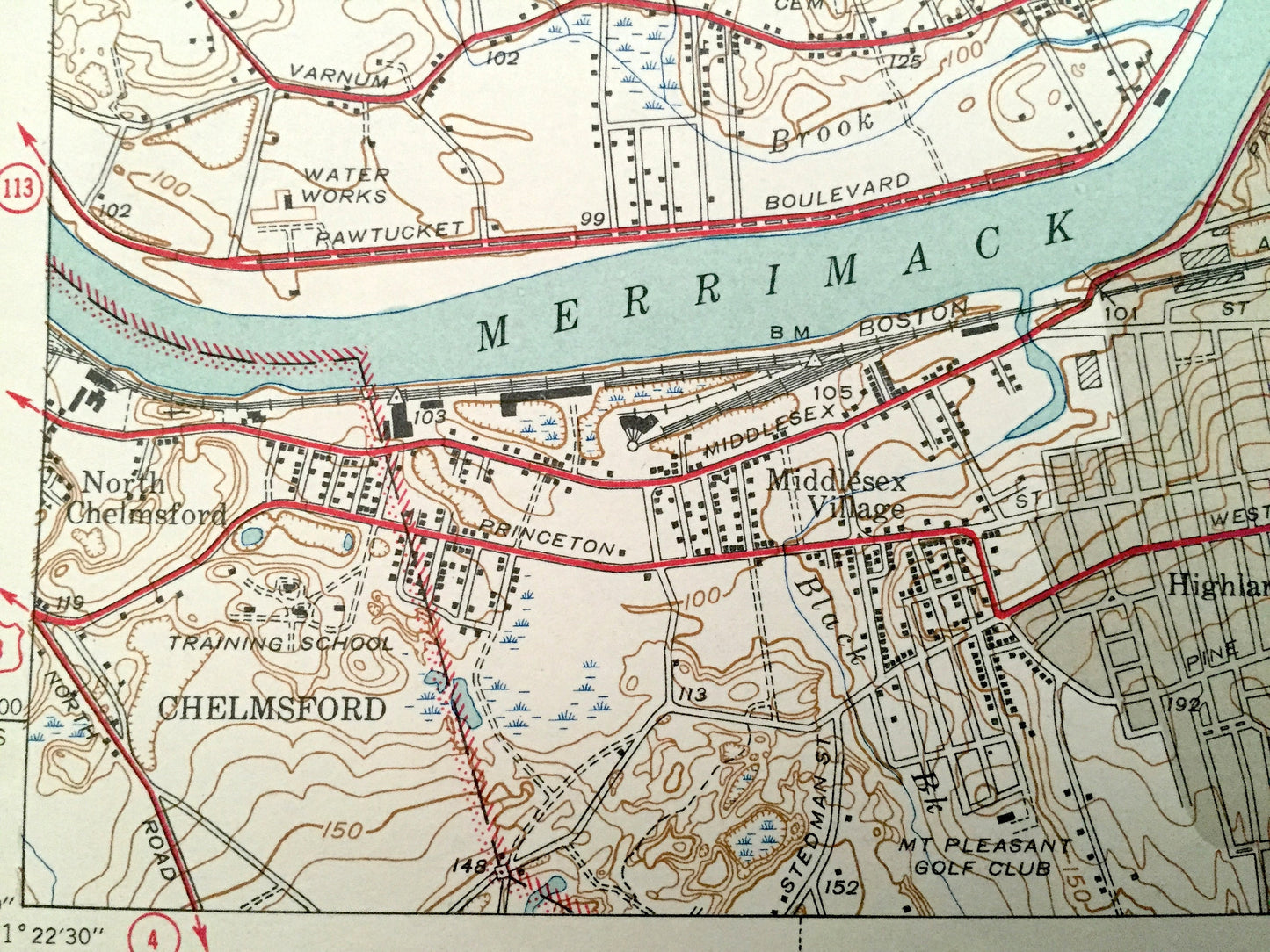
See what Massachusetts looked like over 75 years ago. Lots of intricate details and geological contours. Map even has little squares for every house that existed at the time. The USGS cartographers were very thorough back then!
Perfect for the historian, map-lover, the curious or just as a conversation starter. Wonderful and rare. Maps such as these make great gifts.
Edition of 1941, printed 1941
Dimensions: 15" width x 20" height
----
Features
Cities & Towns: Lowell, Dracut, Methuen, Chelmsford, Tewksbury, Andover, Varnumtown, Collinsville, Pawtucketville, Centralville, Kenwood, Highlands, Ayres City, Middlesex Village, North Chelmsford, Belvidere, Oaklands, Wamesit, Bleachery.
Points of Interest: Middlesex County, Merrimack River, Concord River, Beaver Brook, Long Pond, Peters Pond, Cedar Pond, Whortleberry Hill, Bump Hill, Loon Hill, Marsh Hill, UMass Lowell, State Teachers Academy, Gage Park, Fort Hill Park, and many more schools, roads, houses, ponds, hills, streams and mountains.
Condition: Very Good condition, commensurate with age. This map is in incredible shape for being over 75 years old. Has light edge-wear, but this will add to vintage character when framed.
----
We will happily adjust shipping price for multiple purchases. Maps are rolled up and shipped in sturdy mailing tubes, never folded.
Couldn't load pickup availability
Share