My Store
Antique Lubbock, Texas 1954 US Geological Survey Topographic Map – Slaton, Tahoka, Idalou, Abernathy, Floydada, Crosbyton, Aspermont Spur TX
Antique Lubbock, Texas 1954 US Geological Survey Topographic Map – Slaton, Tahoka, Idalou, Abernathy, Floydada, Crosbyton, Aspermont Spur TX
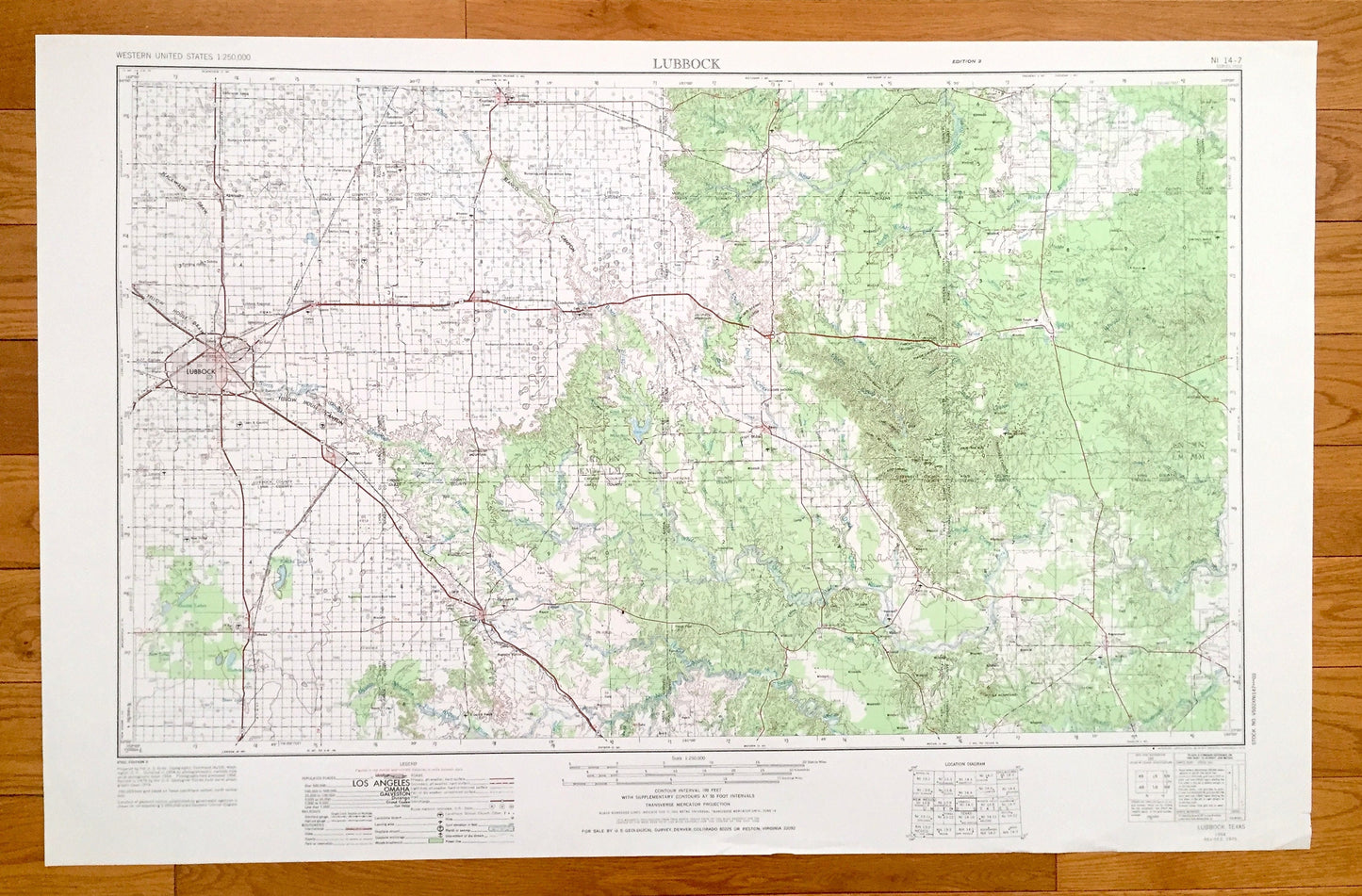
Beautiful, antique map of Lubbock, Texas and surrounding area. This is an authentic 1954 edition, 1976 print from the U.S. Geological Survey and NOT a computer reproduction.
See what Texas looked like 70 years ago. Lots of intricate details and geological contours. Map is incredibly large and in the grand 1:250,000 scale. The USGS cartographers were very thorough back then!
Perfect for the historian, map-lover, the curious or just as a conversation starter. Wonderful and rare. Vintage maps such as these make great gifts.
Edition of 1954, printed 1976
Dimensions: 32" width x 22 1/2" height
----
Features
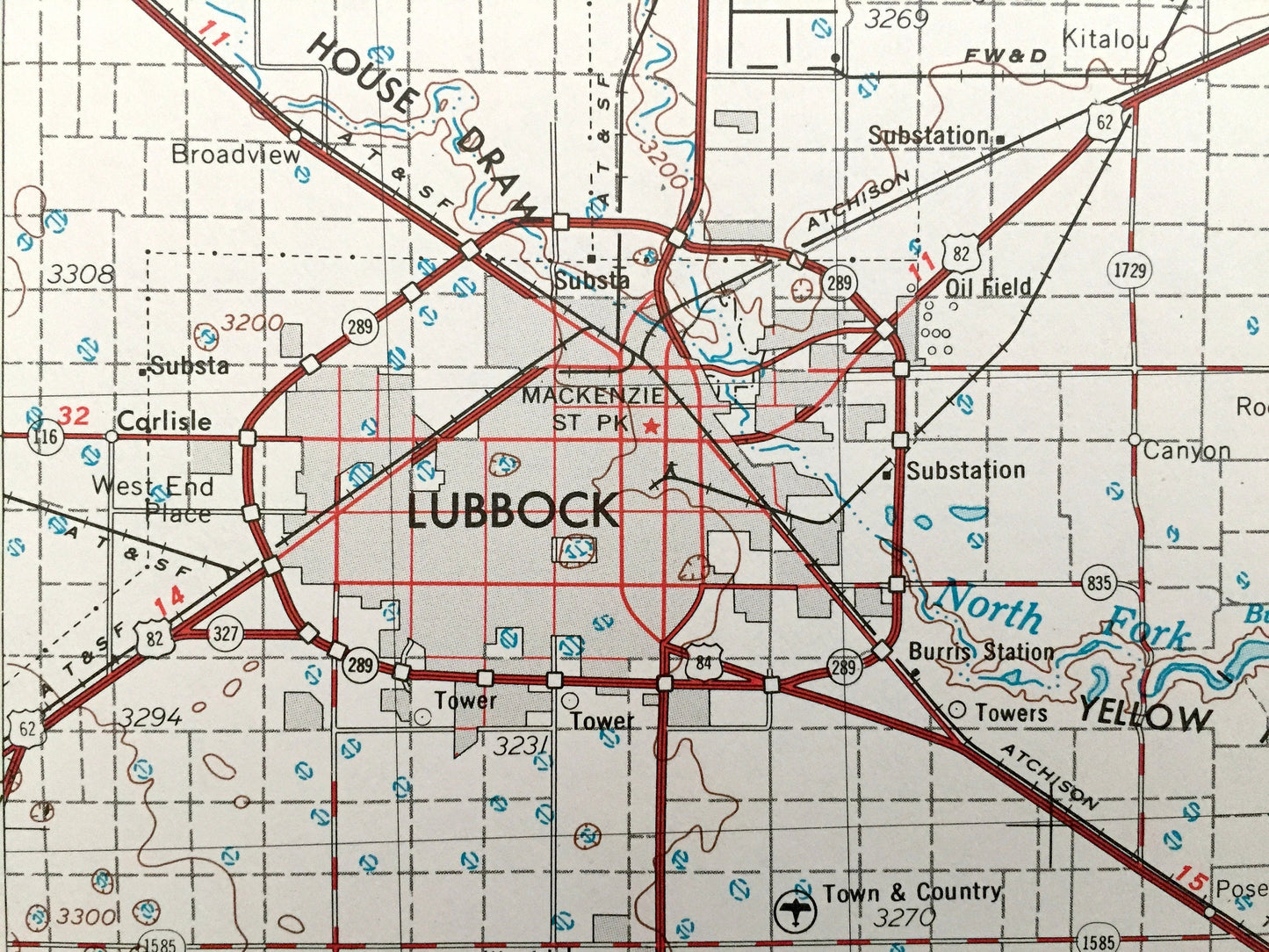
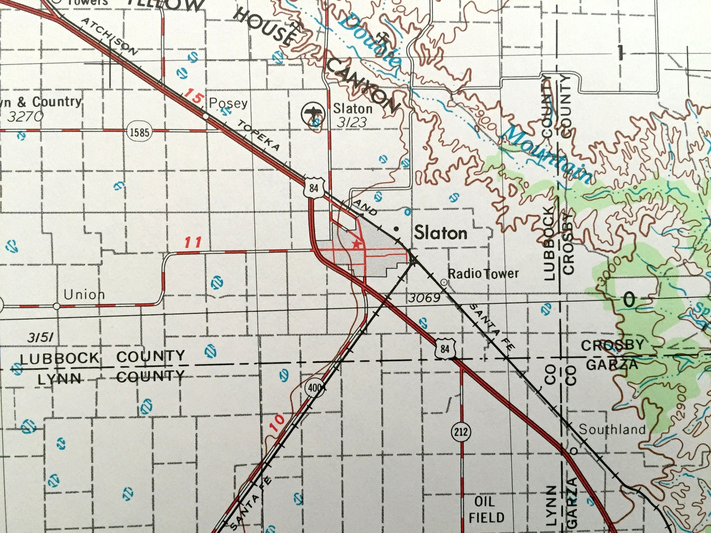
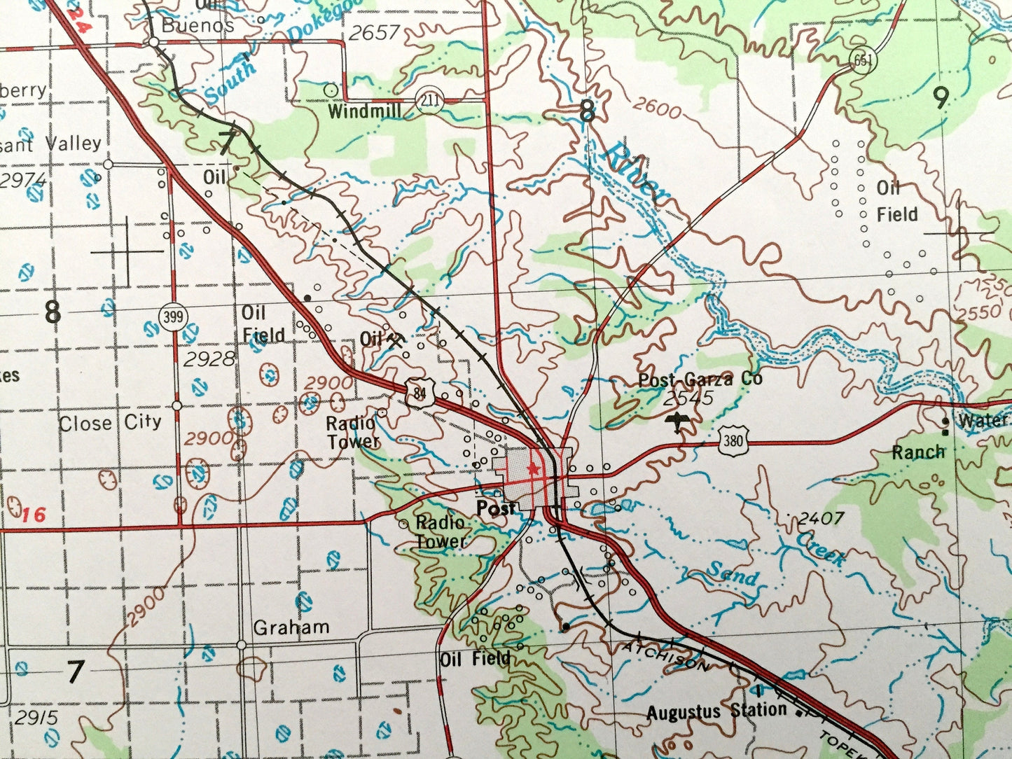
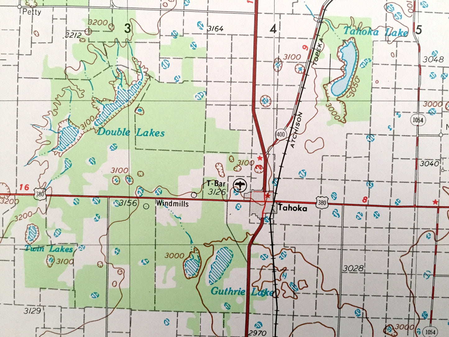
Cities & Towns: Lubbock, Carlisle, Woodrow, Union, Wilson, Grassland, Post, Lorenzo, Ralls, Dickens, Jayton, Guthrie, Gilpin, Slaton, Tahoka, Idalou, Abernathy, Floydada, Crosbyton, Aspermont, Spur.
Points of Interest: Double Mountain Fork Brazos River, White River, North Wichita River, South Wichita River, South Pease River, Yellow House Canyon, Blanco Canyon, Courthouse Mountain, Haystack Mountain, Duck Creek, Croton Creek, Cottonwood Creek, Guthrie Lake, Buffalo Springs Lake and lots more hills, mountains, lakes, rivers, creeks, roads, highways and railroads.
Condition: Good Vintage condition, commensurate with age. This map is in great shape for being over 45 years old. Has light edge-wear, all of which will read as vintage character when framed.
----
We will happily adjust shipping price for multiple purchases. Maps are rolled up and shipped in sturdy mailing tubes, never folded.
Couldn't load pickup availability
Share