My Store
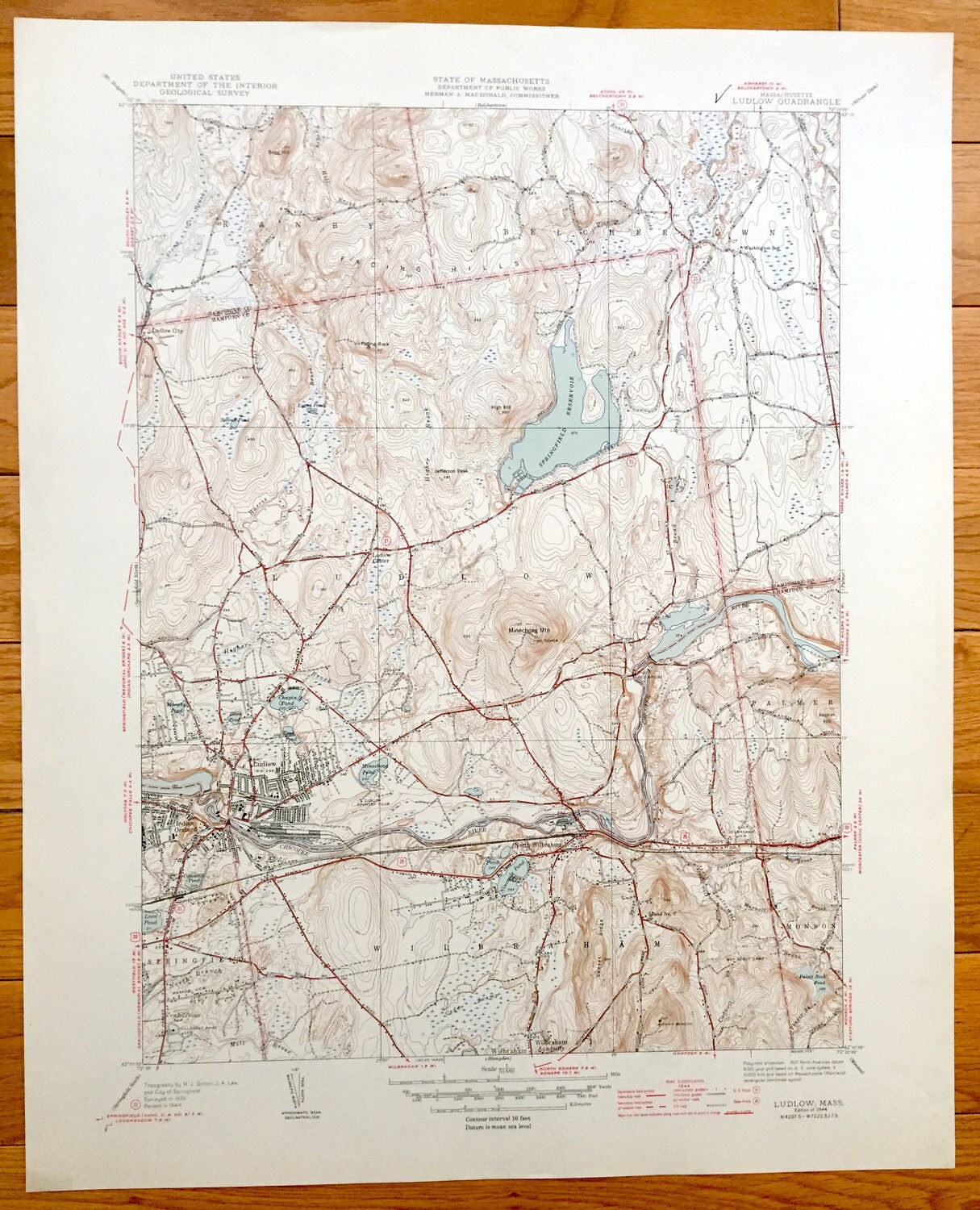
Antique Ludlow, Massachusetts 1944 US Geological Survey Topographic Map – Hampden, Hampshire County, Granby, Belchertown, Palmer, Monson, MA
Antique Ludlow, Massachusetts 1944 US Geological Survey Topographic Map – Hampden, Hampshire County, Granby, Belchertown, Palmer, Monson, MA
Beautiful, antique map of Ludlow, Springfield, Wilbraham, Belchertown and Granby, Massachusetts. This is an authentic 1944 print from the U.S. Geological Survey and NOT a computer reproduction.
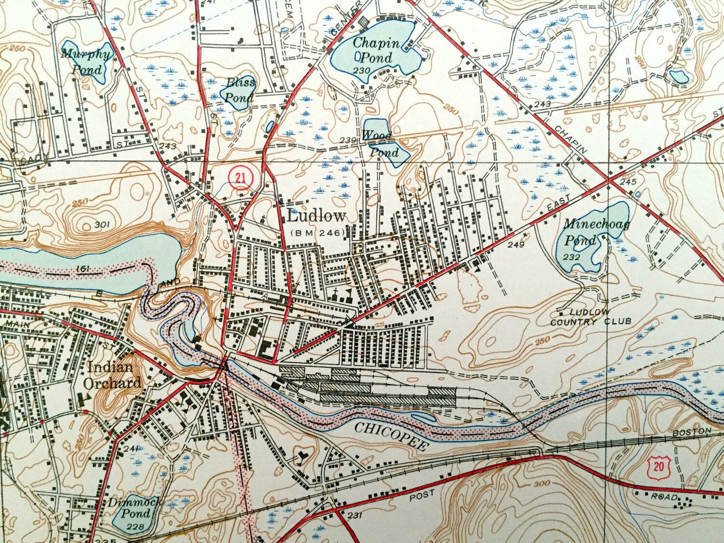
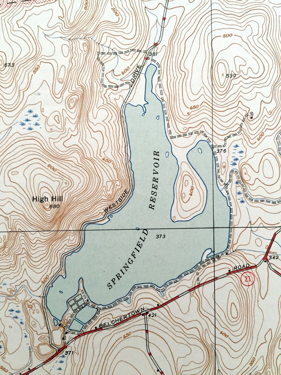
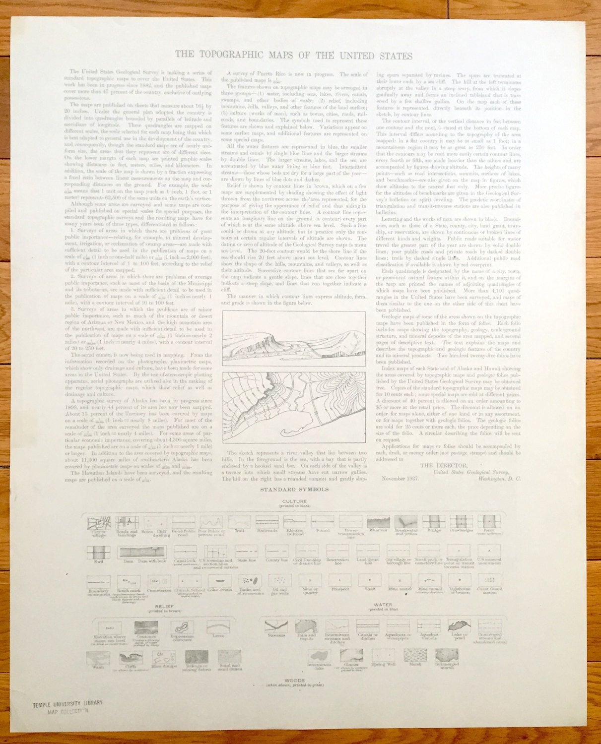
See what Hampden and Hampshire Counties looked like over 75 years ago. Lots of intricate details and geological contours. Map even has little squares for every house that existed at the time. The USGS cartographers were very thorough back then! On the back is a description of topographic symbols and map guide.
Perfect for the historian, map-lover, the curious or just as a conversation starter. Wonderful and rare. Vintage maps such as these make great gifts.
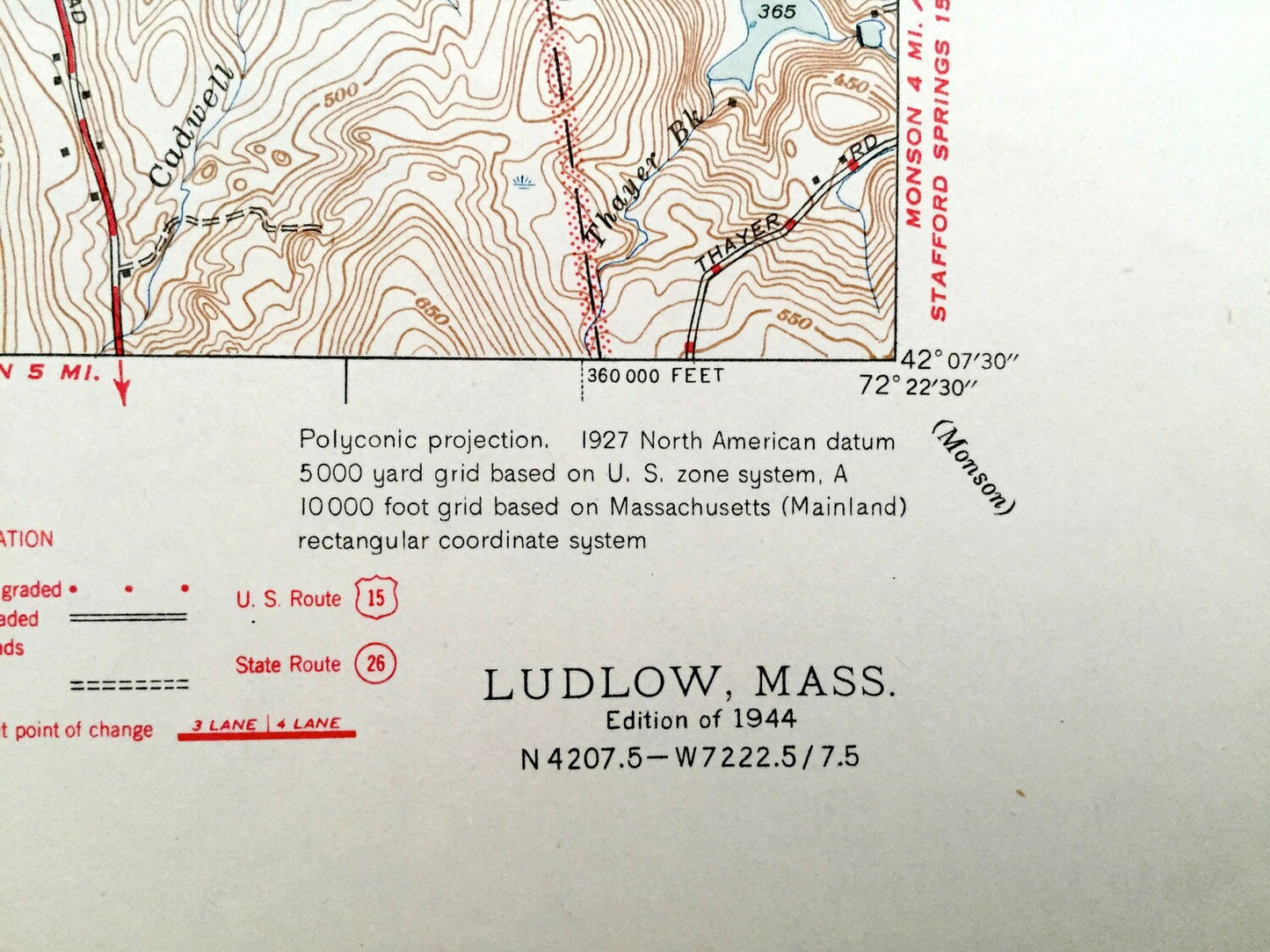
Edition of 1944, printed 1944
Dimensions: 17" width x 21" height
----
Features
Cities & Towns: Granby, Belchertown, Ludlow City, Indian Orchard, Ludlow, North Wilbraham, Wilbraham, Monson, Springfield, Palmer, Ludlow Center.
Points of Interest: Springfield Reservoir, Chicopee River, Ninemile Pond, Gimmick Pond, Pulpit Rock Pond, Washington School, Airway Beacon, School No. 6, Wilbraham Academy, Minechoag Mountain Fire Tower, Facing Hills, and lots more hills, mountains, streams, ponds, houses, schools and roads.
Condition: Very Good Vintage condition, commensurate with age. This map is in great shape for being over 75 years old. Has light wear but this will add to vintage character when framed.
----
We will happily adjust shipping price for multiple purchases. Maps are rolled up and shipped in sturdy mailing tubes, never folded.
Couldn't load pickup availability
Share