My Store
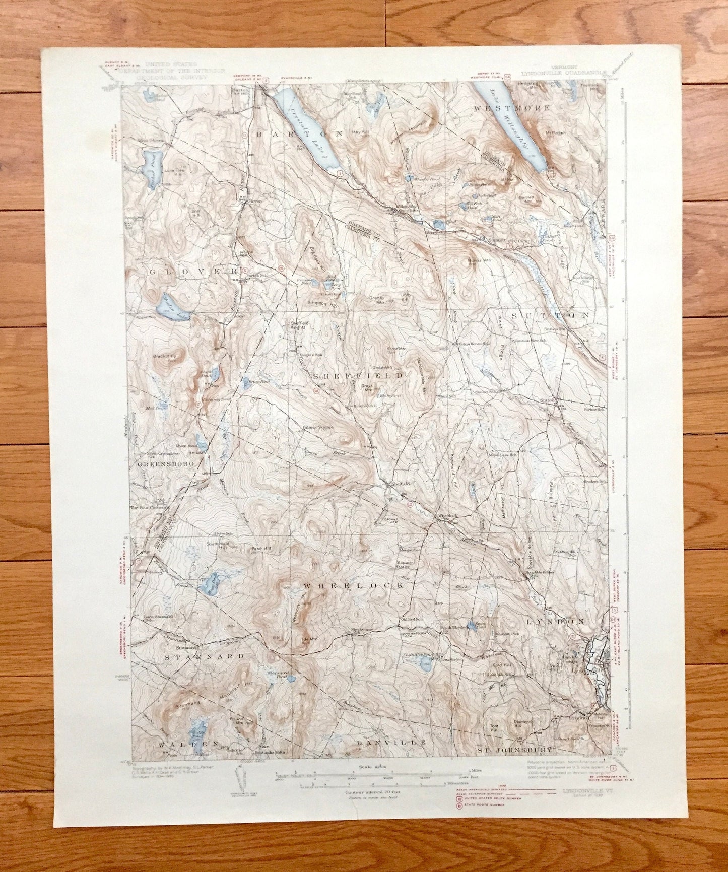
Antique Lyndonville, Vermont 1951 US Geological Survey Topographic Map – Caledonia Orleans County Barton Sheffield Sutton Wheelock Lyndon VT
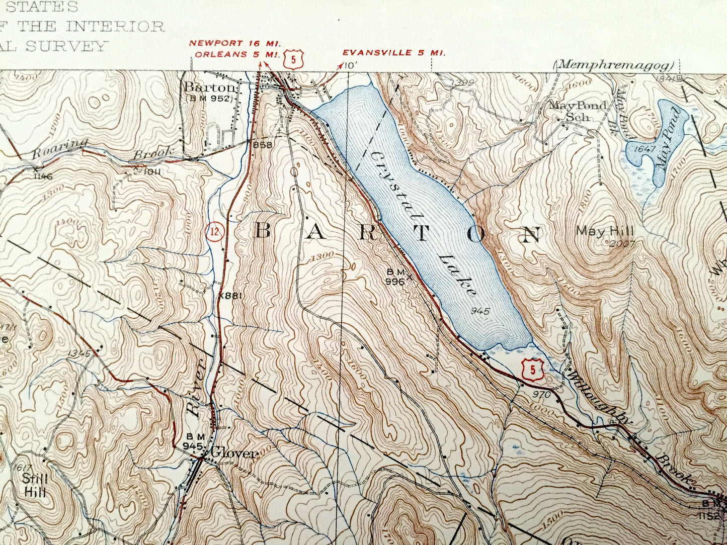
Antique Lyndonville, Vermont 1951 US Geological Survey Topographic Map – Caledonia Orleans County Barton Sheffield Sutton Wheelock Lyndon VT
Beautiful, antique map of Lyndonville, Barton, Westomore, Glover, Greensboro, Wheelock, Stannard and Lyndon, Vermont. This is an authentic 1939 print from the U.S. Geological Survey and NOT a computer reproduction.
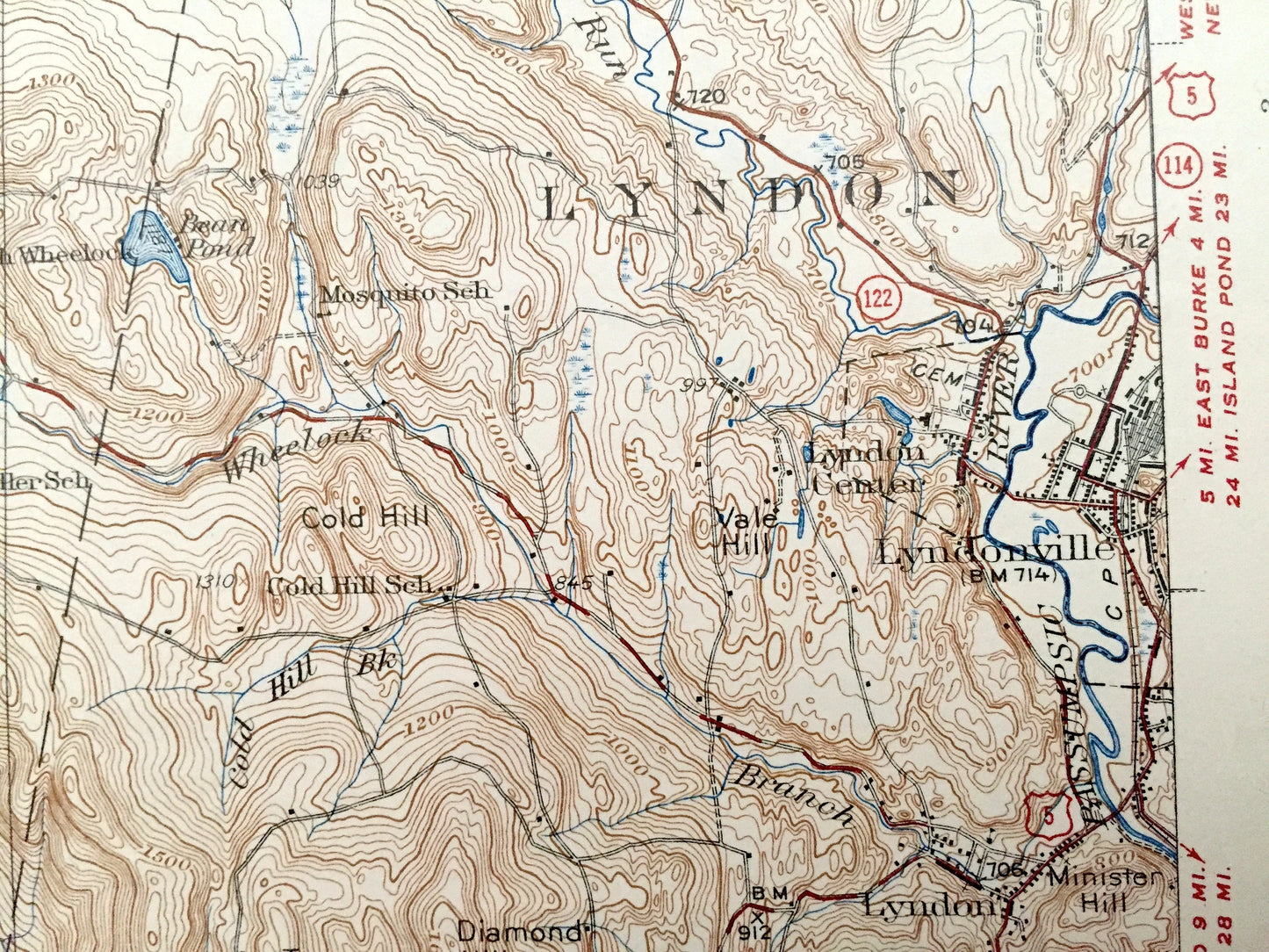
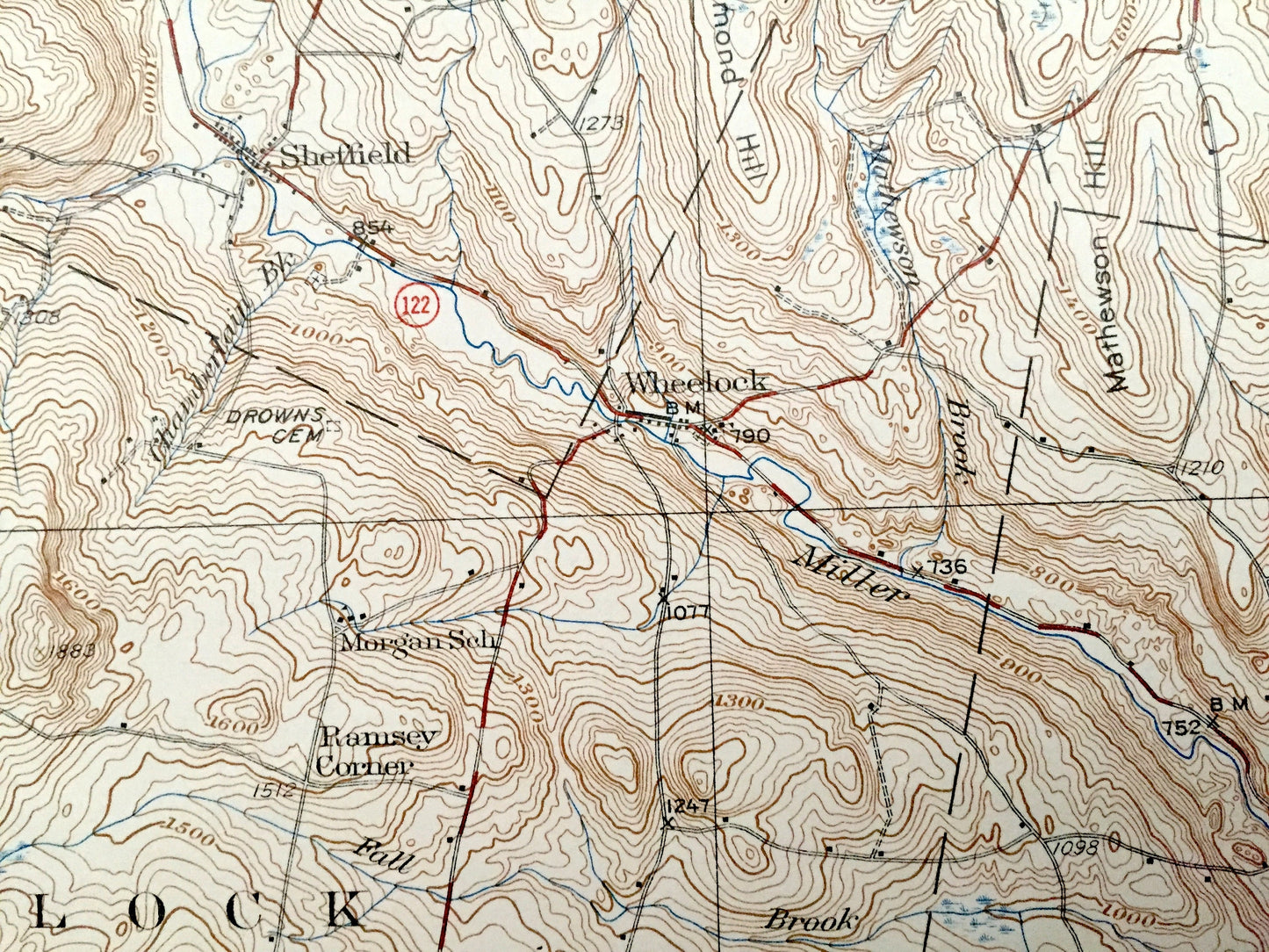
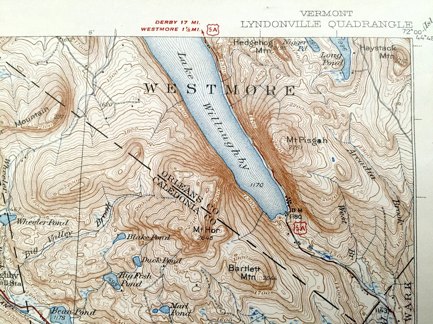
See what Caledonia and Orleans Counties of Vermont looked like over 80 years ago. Lots of intricate details and geological contours. Map even has little squares for every house that existed at the time. The USGS cartographers were very thorough back then! On the back is a description of topographic symbols and map guide.
Perfect for the historian, map-lover, the curious or just as a conversation starter. Wonderful and rare. Vintage maps such as these make great gifts.
Edition of 1939, printed 1939
Dimensions: 16 1/2" width x 20" height
----
Features
Cities & Towns: Barton, Willoughby, Westmore, Sutton, SHeffield, Sheffield Heights, Wheelock, Squabble Hollow, Lyndon, Lyndonville, St Johnsbury, Danville, Walden, Fairbanks Mills, Stannard, Greensboro, The Four Corners, Glover, Gibert Square, Ramsey Corner.
Points of Interest: Crystal Lake, Lake Willoughby, Mary Pond School, Kimball Station, Canadian Pacific Railroad, CCC Camp, Bartlett Mountain, Mt Pisgah, Heights School, Bickford School, Grays Mountain, Stratton Station, Mountain View School, Pudding Hill School, South Wheelock Church, Old Red School, Ide Mountain, Stannard Pond, Chandler Pond, Diamond Hill, Stannard Mountain, Coles Pond, Flagg Pond, Lower Stannard School, Horse Pond, North Greensboro School, Black Hills, Shadow Lake, Frost Mountain,Boston & Maine Railroad, and lots more hills, mountains, streams, ponds, houses, schools and roads.
Condition: Good Vintage condition, commensurate with age. This map is in great shape for being over 80 years old. Has light wear, foxing and toning, but this will add to vintage character when framed.
----
We will happily adjust shipping price for multiple purchases. Maps are rolled up and shipped in sturdy mailing tubes, never folded.
Couldn't load pickup availability
Share