My Store
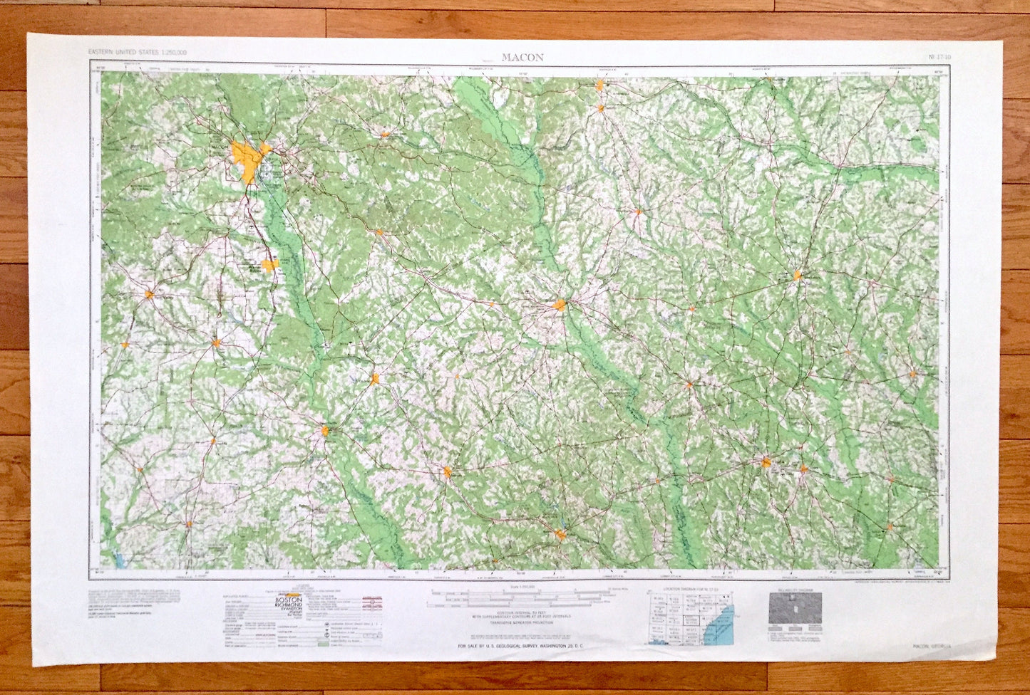
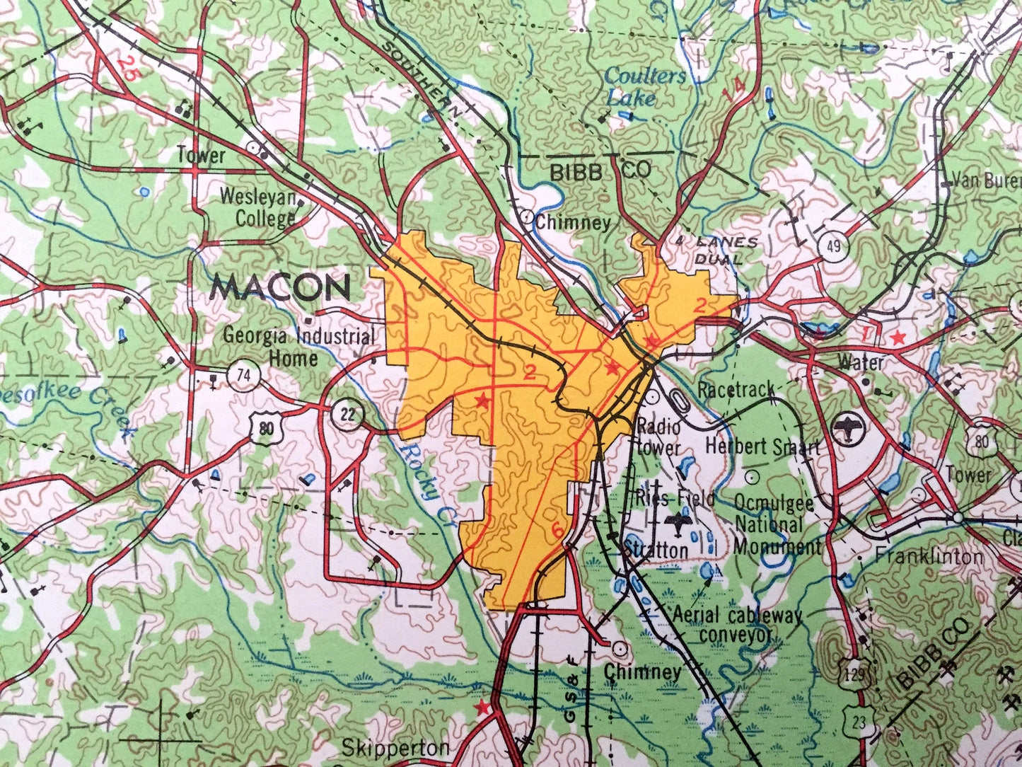
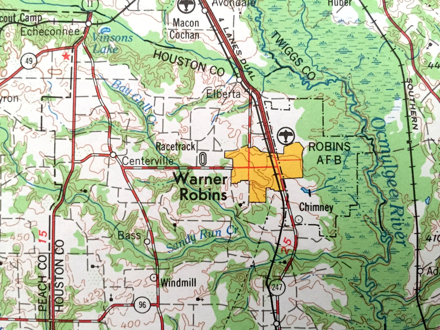
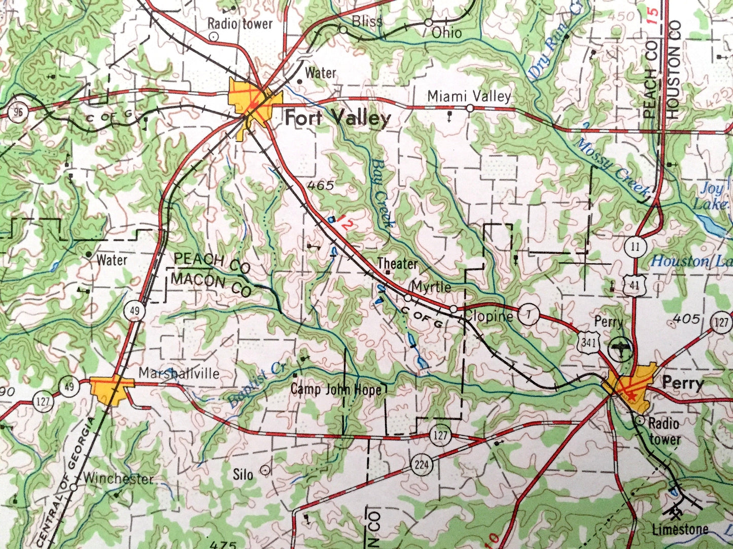
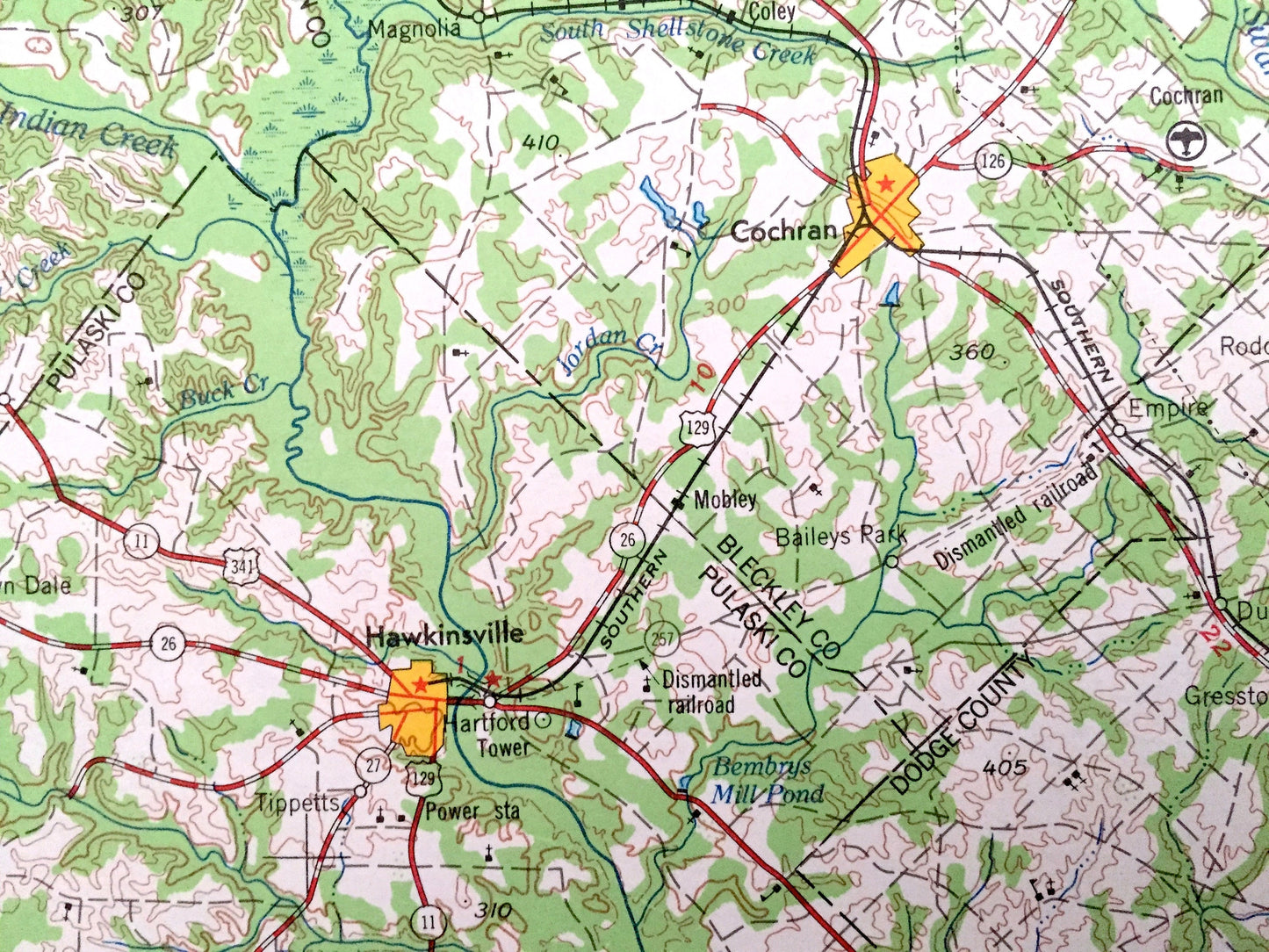
Antique Macon, Georgia 1964 US Geological Survey Topographic Map – Gordon, Warner Robins, Perry, Fort Valley, Jeffersonville, Marshaville
Antique Macon, Georgia 1964 US Geological Survey Topographic Map – Gordon, Warner Robins, Perry, Fort Valley, Jeffersonville, Marshaville
Beautiful, antique map of Macon, Georgia and surrounding areas. This is an authentic 1964 edition, 1964 print from the U.S. Geological Survey and NOT a computer reproduction.
See what Georgia looked like 60 years ago. Lots of intricate details and geological contours. Map is incredibly large and in the grand 1:250,000 scale. Lots of intricate details and geological contours. The USGS cartographers were very thorough back then!
Perfect for the historian, map-lover, the curious or just as a conversation starter. Wonderful and rare. Vintage maps such as these make great gifts.
Edition of 1964, printed 1964
Dimensions: 32" width x 22 1/2" height
----
Features
Cities & Towns: Macon, Unadilla, Vienna, Hawkinsville, Cochran, Dublin, Eastman, Helena, McRae, Wrightsville, Tennille, Sandersville, Louisville, Swainsboro, Soperton, Vidalia, Lyons, Reidsville, Collins, Metter, Stillmore.
Points of Interest: Ocmulgee River, Oconee River, Ohoopee River, Ocmoglee State Park, Robins Air Force Base, Big Sandy Creek, Sugar Creek, Alligator Creek, Beaverdam Swamp and lots more hills, mountains, lakes, islands, bays, highways, railroads.
Condition: Very Good Vintage condition, commensurate with age. This map is in great shape for being over 55 years old. Has light edge-wear, all of which will read as vintage character when framed.
----
We will happily adjust shipping price for multiple purchases. Maps are rolled up and shipped in sturdy mailing tubes, never folded.
Couldn't load pickup availability
Share