My Store
Antique Madison County, New York 1912 New Century Atlas Map – Oneida, Bridgeport, Cazenova, Chittenango, Canastota, Hamilton, Brookfield, NY
Antique Madison County, New York 1912 New Century Atlas Map – Oneida, Bridgeport, Cazenova, Chittenango, Canastota, Hamilton, Brookfield, NY
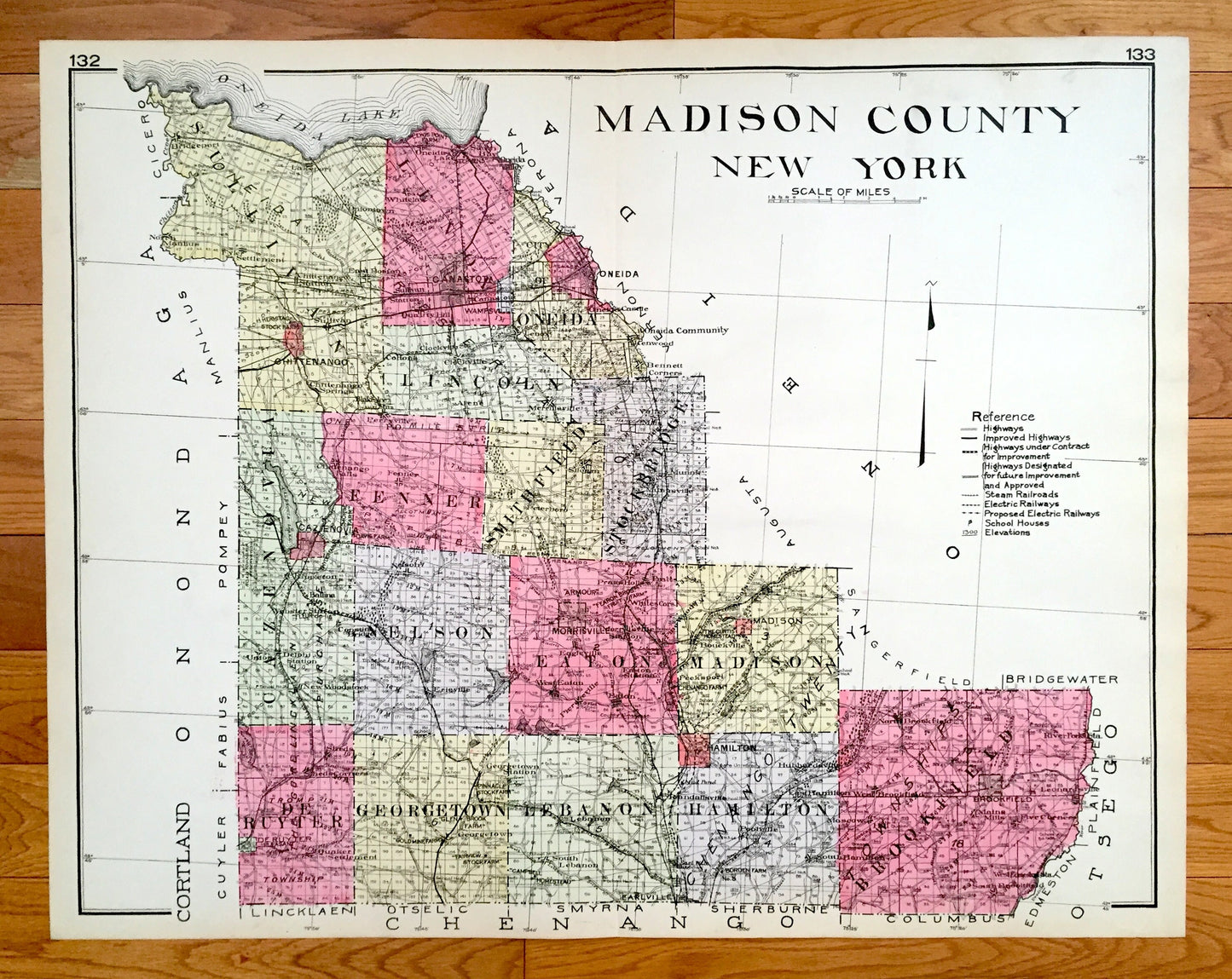
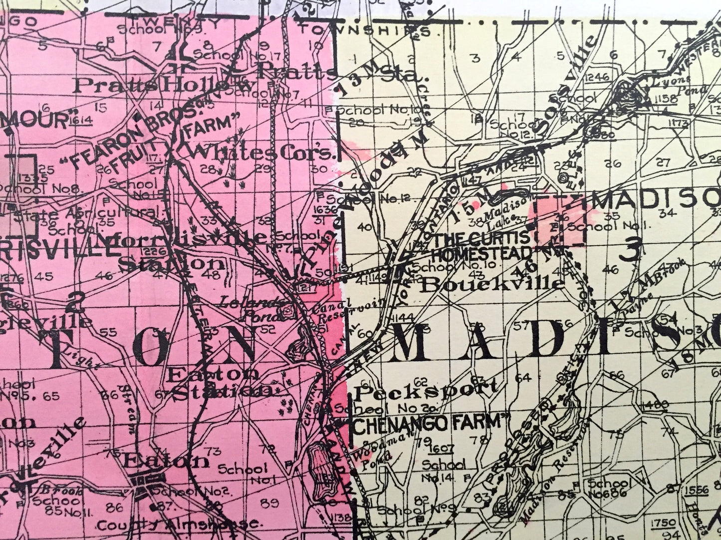
Beautiful, antique map of Madison County, New York, including Oneida, Bridgeport, Cazenova, Chittenango, Canastota, Hamilton & Brookfield. This is an authentic map taken from the rare New Century Atlas published in 1912 and NOT a computer reproduction.
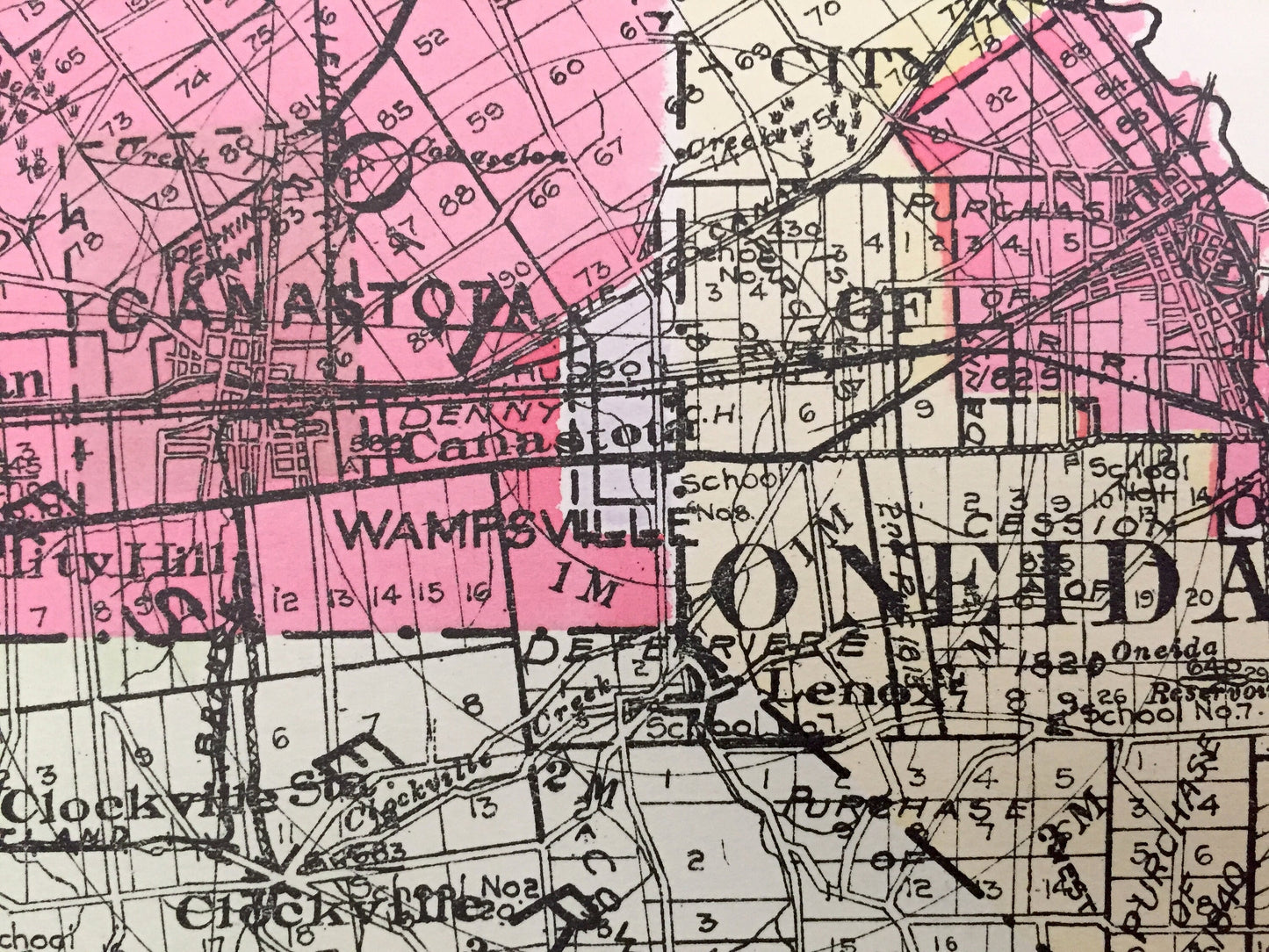
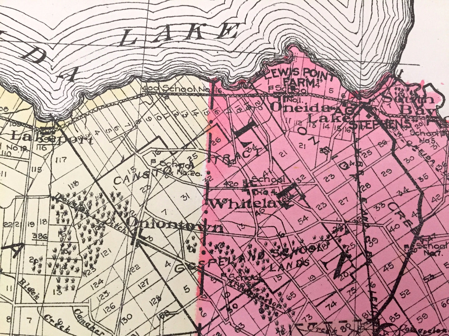
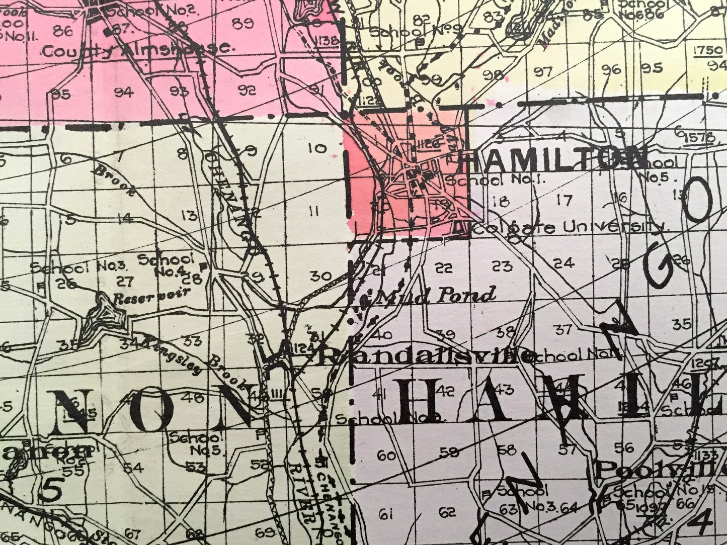
See what Madison County looked like more than 110 years ago. Lots of charming, intricate details and contours, including land allotments, names of farms and manufacturing plants and geographical points of interest. It is a very large print and will be a showpiece wherever it is presented. Hand colored. Verso is blank.
Perfect for the historian, map-lover, the curious or just as a conversation starter. Wonderful and rare. Vintage maps such as these make great gifts.
Edition of 1912, printed 1912
Dimensions: 30" width x 23 1/2" height
----
Features
Cities & Towns: Sullivan, Lenox, Oneida, Lincoln, Cazenovia, Fenner, Smithfield, Stockbridge, Nelson, Eaton, Madison, De Ruyter, Georgetown, Lenanon, Hamilton, Brookfield, Bridgeport, North Manlius, Chittenango, East Boston, South Bay, Canastota, Kenwood, Oneida Castle, Oneida Valley, Clockville, Merrillsville, Bennett Corners, Perryville, Munn's, Peterboro, Siloam, New Woodstock, Erieville, Morrisville, Pratt's Hollow, West Eaton, Bouekville, Sofsville, Pecksport, Sheds, Randallsville, Moscow, River Forks, Mains Mills, Five Corners, more.
Points of Interest: Oneida Lake, Cazenova Lake, Oneida Reservation, Gorton Lake, Madison Reservoir, Black Creek, and many more ponds, lakes, creeks, rivers, roads, highways, railroads, farms, school houses and elevations.
----
Condition: Very Good Vintage condition, commensurate with age. This map is in incredible shape for being over 110 years old. A fold, as issued, and slight edge-toning, all of which will read as vintage character when framed. (Images of New Century Atlas cover and frontispiece for information only and not included.)
----
We will happily adjust shipping price for multiple purchases. Maps are rolled up and shipped in sturdy mailing tubes, never folded.
Couldn't load pickup availability
Share