My Store
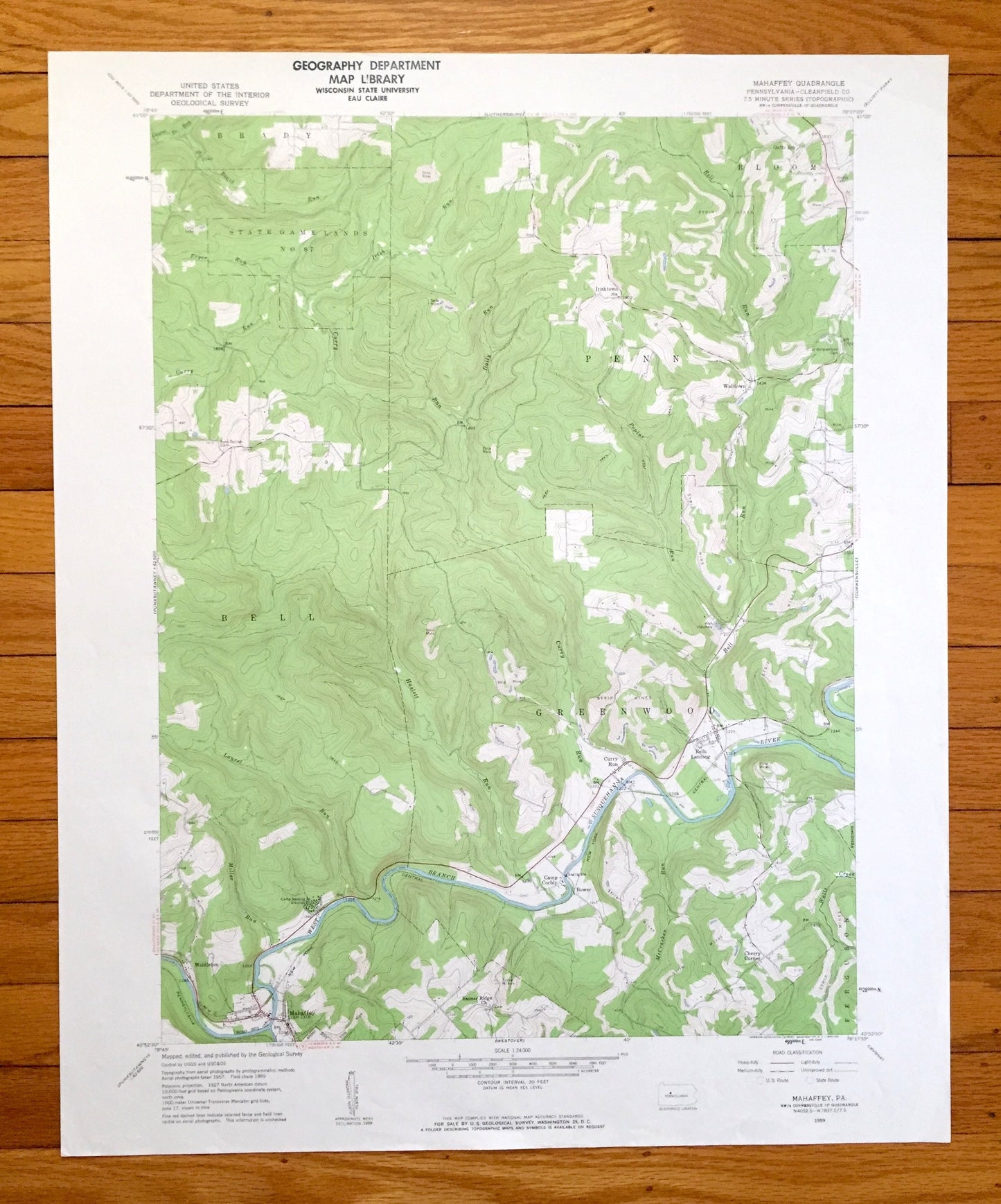
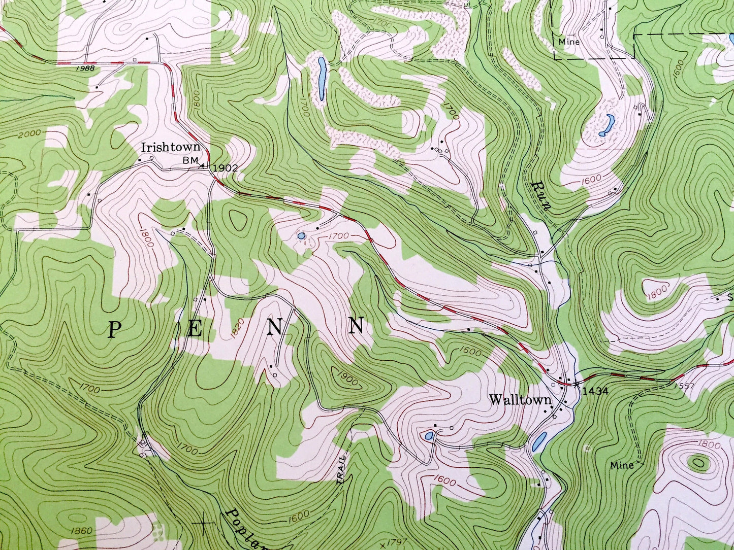
Antique Mahaffey, Pennsylvania 1959 US Geological Survey Topographic Map – Clearfield County, Brady, Bell, Bloom, Greenwood, Ferguson, PA
Antique Mahaffey, Pennsylvania 1959 US Geological Survey Topographic Map – Clearfield County, Brady, Bell, Bloom, Greenwood, Ferguson, PA
Beautiful, antique map of Mahaffey, Pennsylvania and surrounding Clearfield County area. This is an authentic 1959 edition, 1960 print from the U.S. Geological Survey and NOT a computer reproduction.
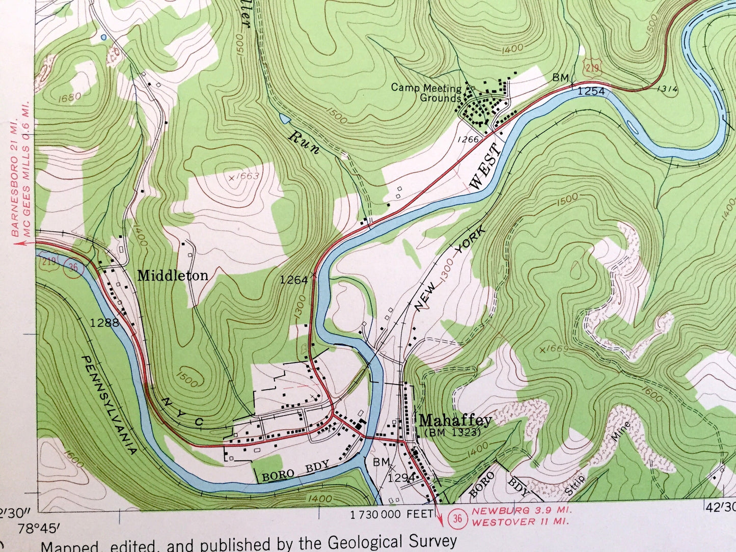
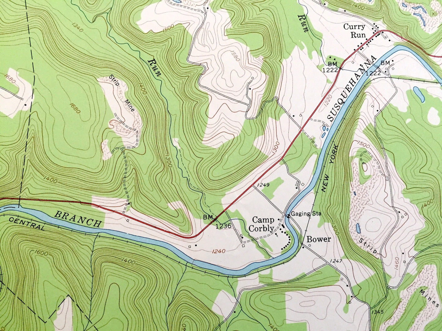
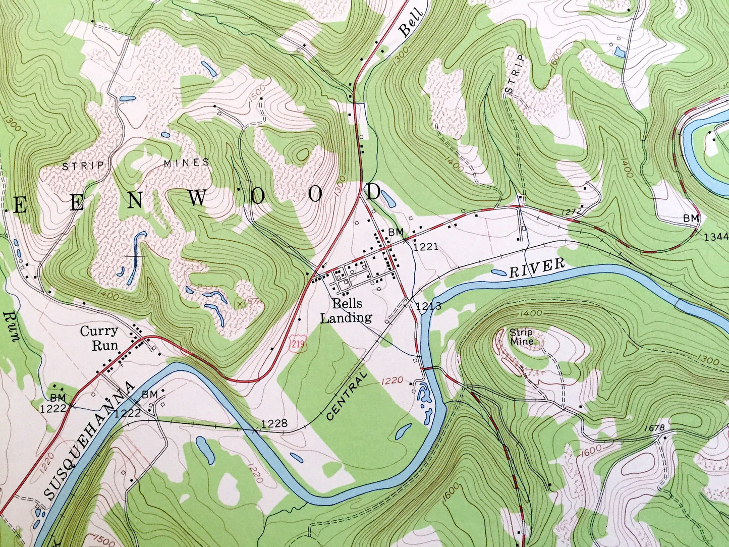
See what Pennsylvania looked like over 60 years ago. Lots of intricate details and geological contours. Map even has little squares for every house that existed at the time. The USGS cartographers were very thorough back then!
Perfect for the historian, map-lover, the curious or just as a conversation starter. Wonderful and rare. Vintage maps such as these make great gifts.
Edition of 1959, print 1960
Dimensions: 22" width x 27" height
----
Features
Cities & Towns: Brady, Bell, Penn, Greenwood, Ferguson, Bloom, Middleton, Bower, Cherry Corner, Curry Run, Bells Landing, Walltown, Irishtown.
Points of Interest: Camp Corbly, Camp Meeting Grounds, Fish Hatchery, strip mines, State Game Lands No. 87, Susquehanna River, Bell Run, and many more hills, streams, ponds, houses, schools, railroads, churches and roads.
Condition: Very Good Vintage condition, commensurate with age. This map is in great shape for being over 60 years old. Has light wear but will read as character when framed.
----
We will happily adjust shipping price for multiple purchases. Maps are rolled up and shipped in sturdy mailing tubes, never folded.
Couldn't load pickup availability
Share