My Store
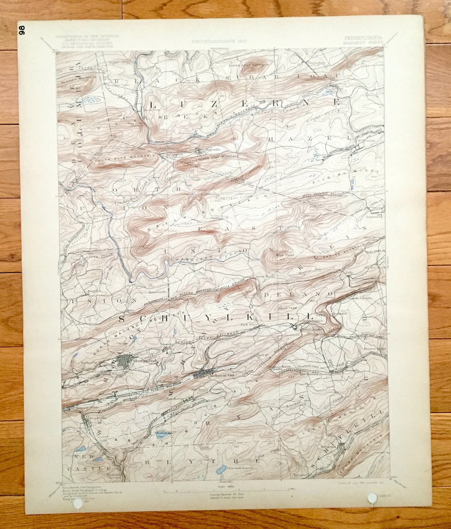
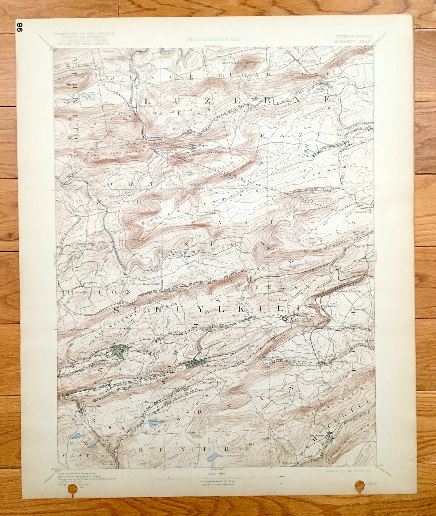
Antique Mahanoy, Pennsylvania 1893 US Geological Survey Topographic Map - Shenandoah, Hopeville, Frackville, Delano, Schuylkill County, PA
Antique Mahanoy, Pennsylvania 1893 US Geological Survey Topographic Map - Shenandoah, Hopeville, Frackville, Delano, Schuylkill County, PA
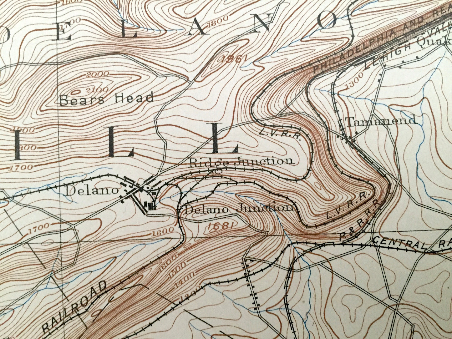
Beautiful, antique map of Mahanoy, Pennsylvania and surrounding Schuylkill, Columbia & Luzerne County areas. This is an authentic 1893 edition, 1921 print from the U.S. Geological Survey and NOT a computer reproduction.
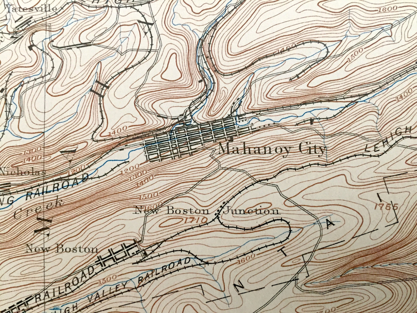
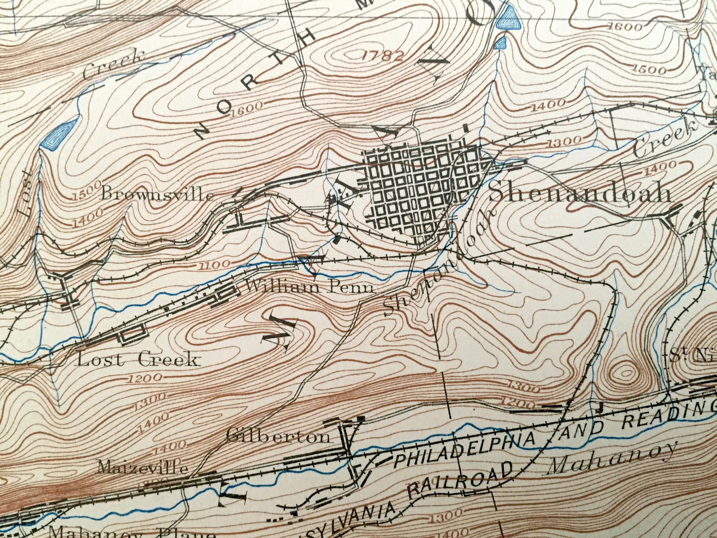
See what Pennsylvania looked like over 125 years ago. Lots of intricate details and geological contours. Map even has little squares for every house that existed at the time. The USGS cartographers were very thorough back then! On the back is a description of topographic symbols and map guide.
Perfect for the historian, map-lover, the curious or just as a conversation starter. Wonderful and rare. Vintage maps such as these make great gifts.
Edition of 1893, printed 1921
Dimensions: 16 1/2" width x 20" height
----
Features
Cities & Towns: Mahanoy, Beaver, Black, Sugar Loaf, North Union, Union, Klein, West Mahanoy, Delano, New Castle, Ryan, New Castle, Blythe, Schuylkill, Gowen, Derringer, Fern Glen, Hopeville, Tomhicken, Conyngham, Humboldt, Mt. Pleasant, Zions Grove, Ringtown, Krebs, Brandonville, Girard Manor, Park Place, Audenried, Old Silver Brook, Lofty, Tamanend, Brownsville, Shenandoah, Yatesville, Lost Creek, William Penn, Maizeville, Gilberton, st. Nicholas, Mahanoy Place, Frackville, Morea, Mahanoy City, New Boston, Barnesville, Tuscarora, Patterson.
Points of Interest: Schuylkill County, Columbia County, Luzerne County, Sugar Loaf Mountain, South Buck Mountain, Batawissa Creek, Pismire Ridge, Buck Mountain, Green Mountain, Spring Mountain, Blue Head, North Mahanoy Mountain, Bears Head, Broad Mountain, Black Creek, Locust Mountain, Sharp Mountain, Shenandoah Creek, Philadelphia & Reading Railroad, Lehigh Valley Railroad, Green Mountain Railroad and more roads, railroads, houses, ponds, hills, creeks, and lakes.
Condition: Good Vintage condition, commensurate with age. This map is in great shape for being over 100 years old. This map has punch holes towards the bottom. This is easily concealed by placing a similar piece of paper behind it as shown in the above photos. Also has light edge-wear and tears, but this will add to vintage character when framed.
----
We will happily adjust shipping price for multiple purchases. Maps are rolled up and shipped in sturdy mailing tubes, never folded.
Couldn't load pickup availability
Share