My Store
Antique Main Line, Pennsylvania 1894 US Geological Survey Map – Valley Forge, Merion, Norristown, Haverford, Radnor, Bryn Mawr, Villanova PA
Antique Main Line, Pennsylvania 1894 US Geological Survey Map – Valley Forge, Merion, Norristown, Haverford, Radnor, Bryn Mawr, Villanova PA
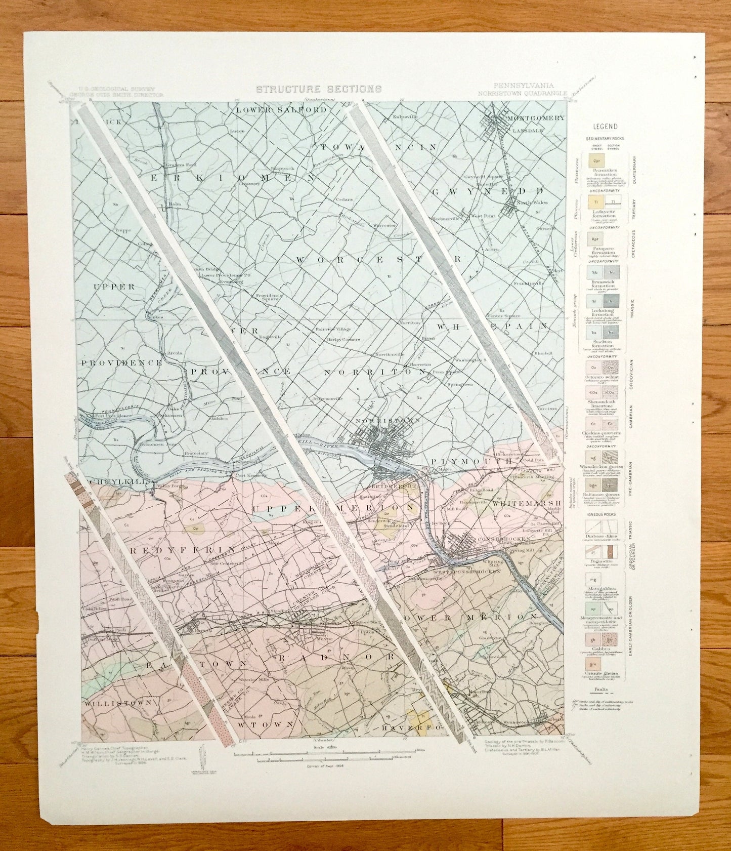
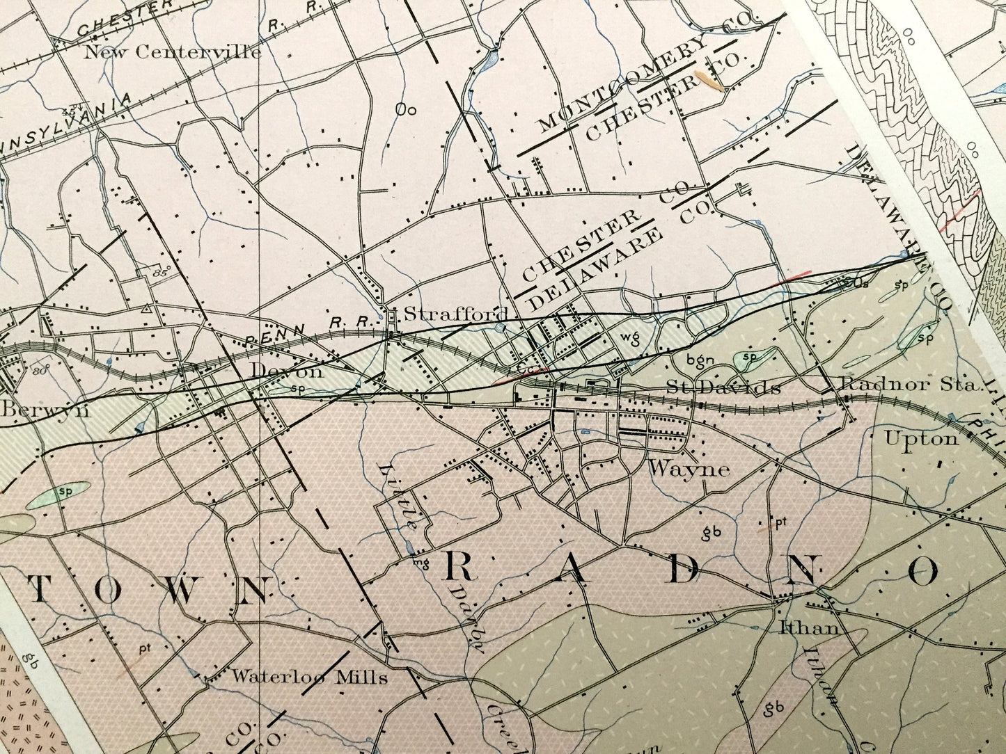
Beautiful, antique map of the sedimentary rock formations of the Main Line, just northwest of Philadelphia on the Schuylkill River. This is an authentic 1894 edition, 1908 print from a U.S. Geological Survey folio and NOT a computer reproduction.
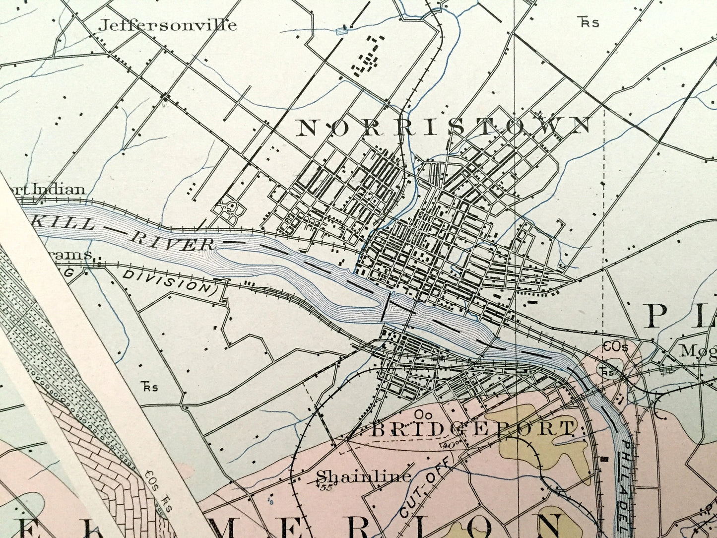
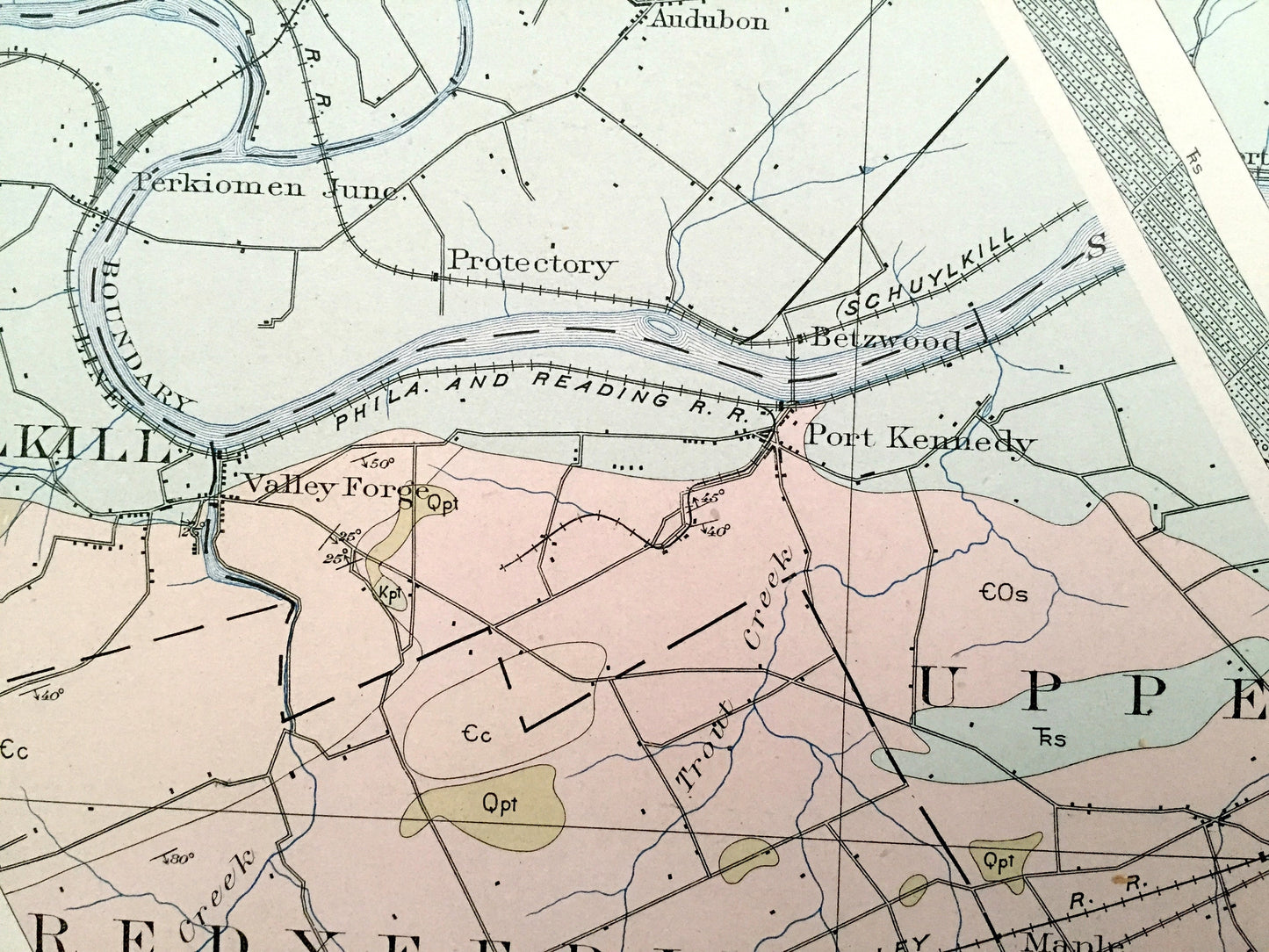
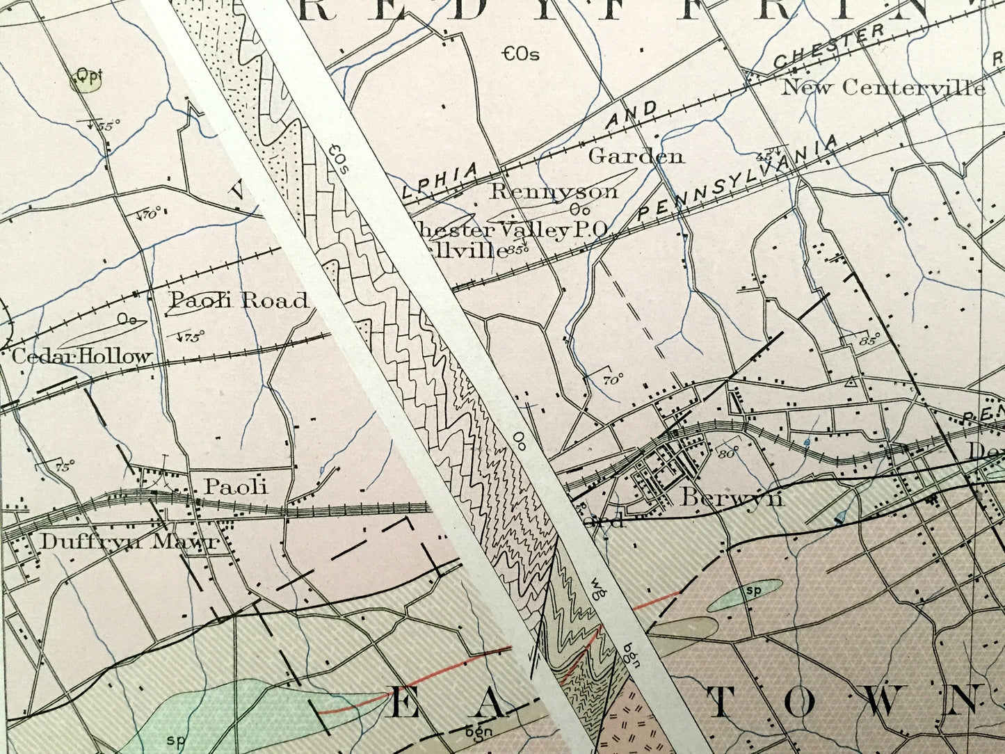
See what the historic Main Line looked like more than 120 years ago—Home of Valley Forge, Villanova and Bryn Mawr, including three striata diagrams. Map has lots of intricate details and geological contours—even little squares for every house that existed at the time. The USGS cartographers were very thorough back then! This is also one of the rare maps that has the map legend on the front.
Perfect for the historian, map-lover, the curious or just as a conversation starter. Wonderful and rare. Vintage maps such as this make great gifts.
Edition of 1894, printed 1908
Dimensions: 18 1/2" width x 21 3/4" height
----
Cities & Towns: Limerick, Lower Salford, Powamencin, Montgomery, Perkiomen, Gwynedd, Upper Providence, Lower Providence, Worcester, Whitpan, Norriton, Norristown, Plymouth, White Marsh, Schuylkill, Upper Merion, Lower Merion, Tredyffrin, Willistown, East Town, Radnor, Newtown, Haverford, Conshohocken, West Conschohocken, Chester County, Delaware County, Narberth, Wayne, Ardmore, Bridgeport, King of Prussia, Gladwyne.
Points of Interest: Chester County, Delaware County, Montgomery County, Valley Forge, Valley Forge National Historical Park, Schuylkill River, Philadelphia Main Line, Perkiomen Creek, Plymouth Creek, Stony Creek Railroad, Mill Creek, Bryn Mawr, Villanova and many more small towns, roads, train tracks, train stations, hills, islands and creeks.
Condition: Very Good condition, commensurate with age. This map is in incredible shape for being over 100 years old. Has has light edge-wear and folio staple marks on the right margin, but these are easily concealed with framing, as the right margin is wider than the left.
----
We will happily adjust shipping price for multiple purchases. Maps are rolled up and shipped in sturdy mailing tubes, never folded.
Couldn't load pickup availability
Share