My Store
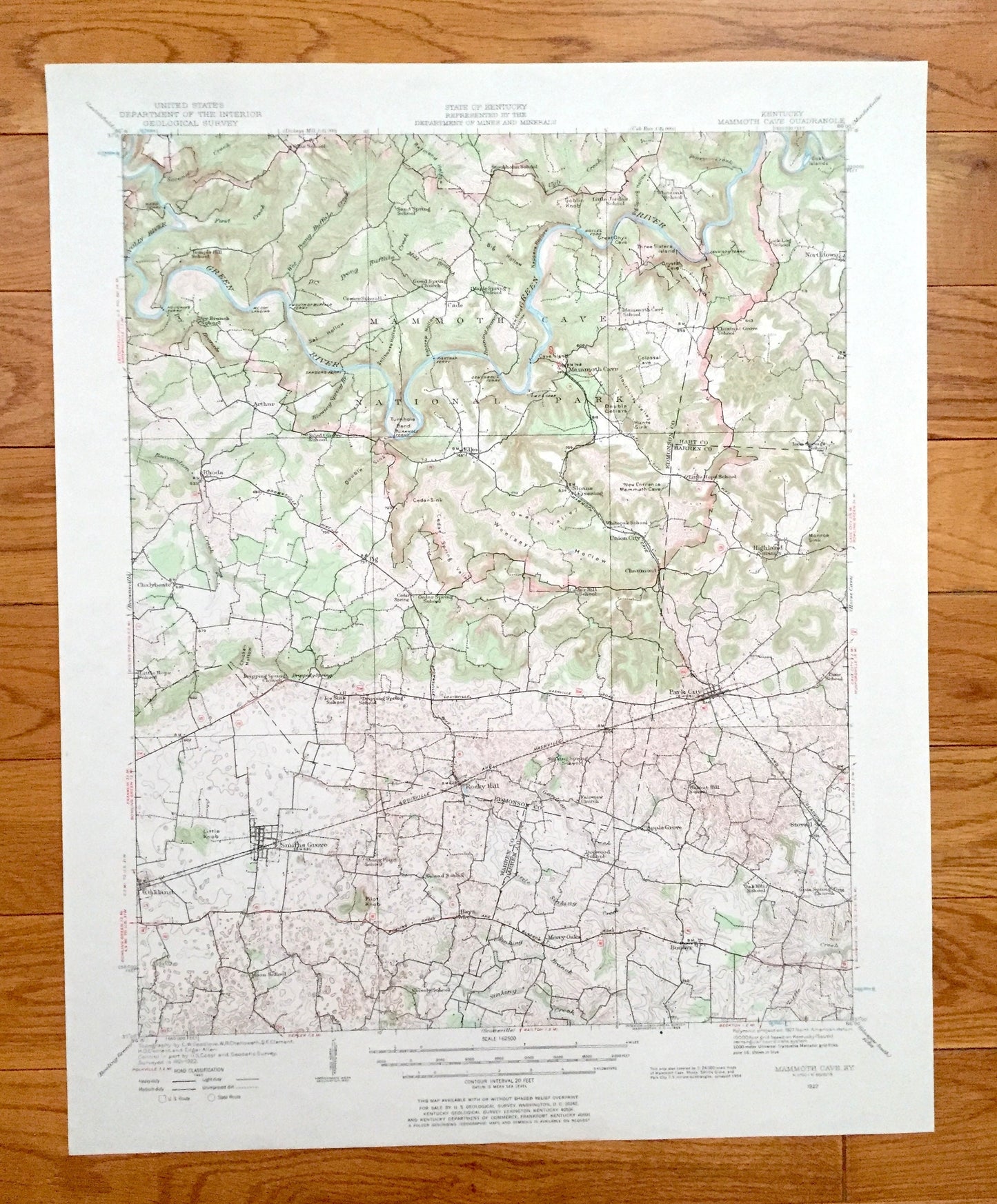
Antique Mammoth Cave, Kentucky 1922 US Geological Survey Topographic Map – National Park, Pig, Cedar Spring, Smiths Grove, Park City, KY
Antique Mammoth Cave, Kentucky 1922 US Geological Survey Topographic Map – National Park, Pig, Cedar Spring, Smiths Grove, Park City, KY
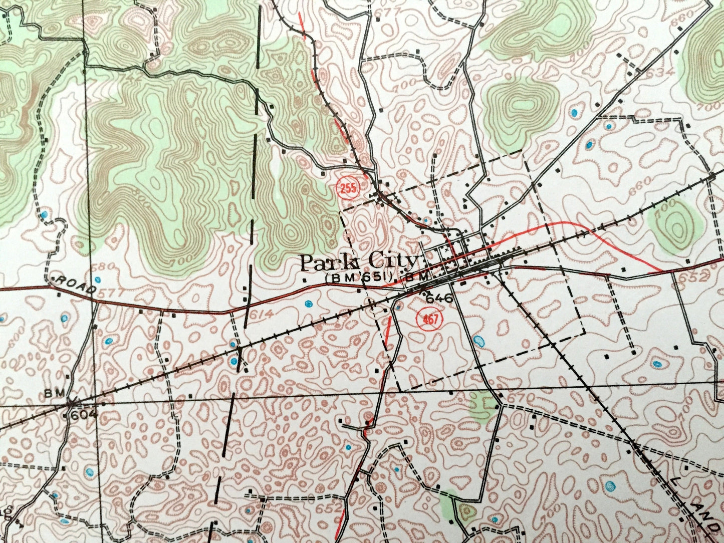
Beautiful, antique map of Mammoth Cave National Park, Kentucky and surrounding area on the Green River. This is an authentic 1922 edition, 1969 print from the U.S. Geological Survey and NOT a computer reproduction.
See what Kentucky looked like 100 years ago, including Edmonson, Warren, Barren & Hart County. Lots of intricate details and geological contours. Map even has little squares for every house that existed at the time. The USGS cartographers were very thorough back then!
Perfect for the historian, map-lover, the curious or just as a conversation starter. Wonderful and rare. Maps such as these make great gifts.
Edition of 1922, printed 1969
Dimensions: 17" width x 21" height
----
Features
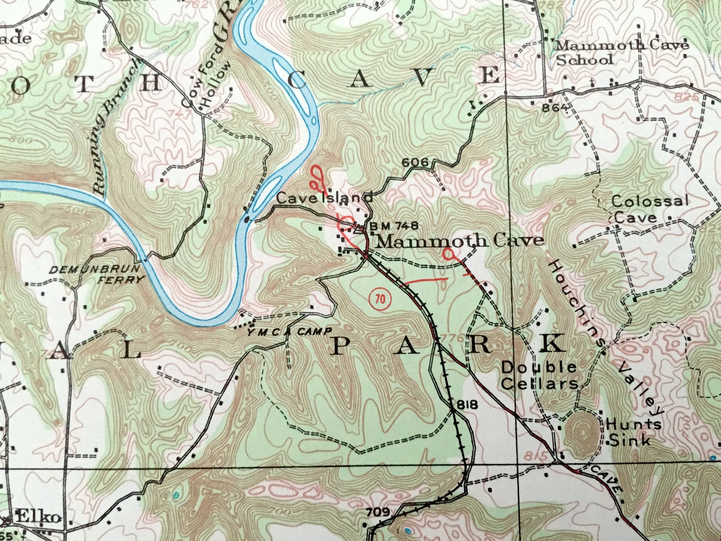
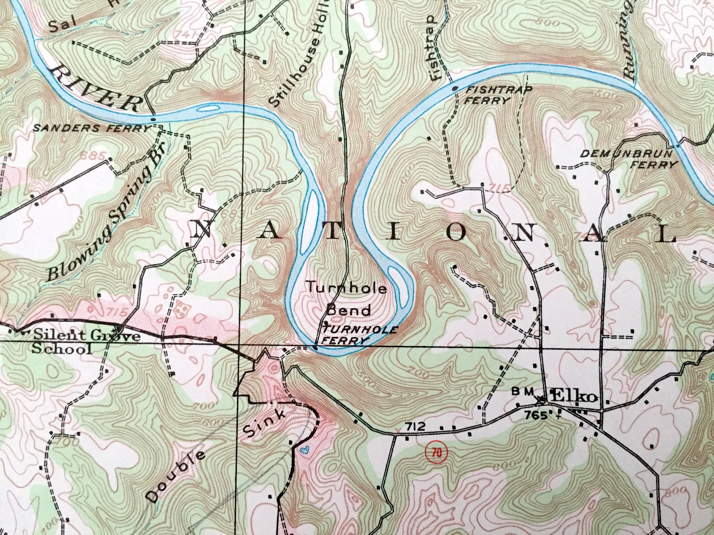
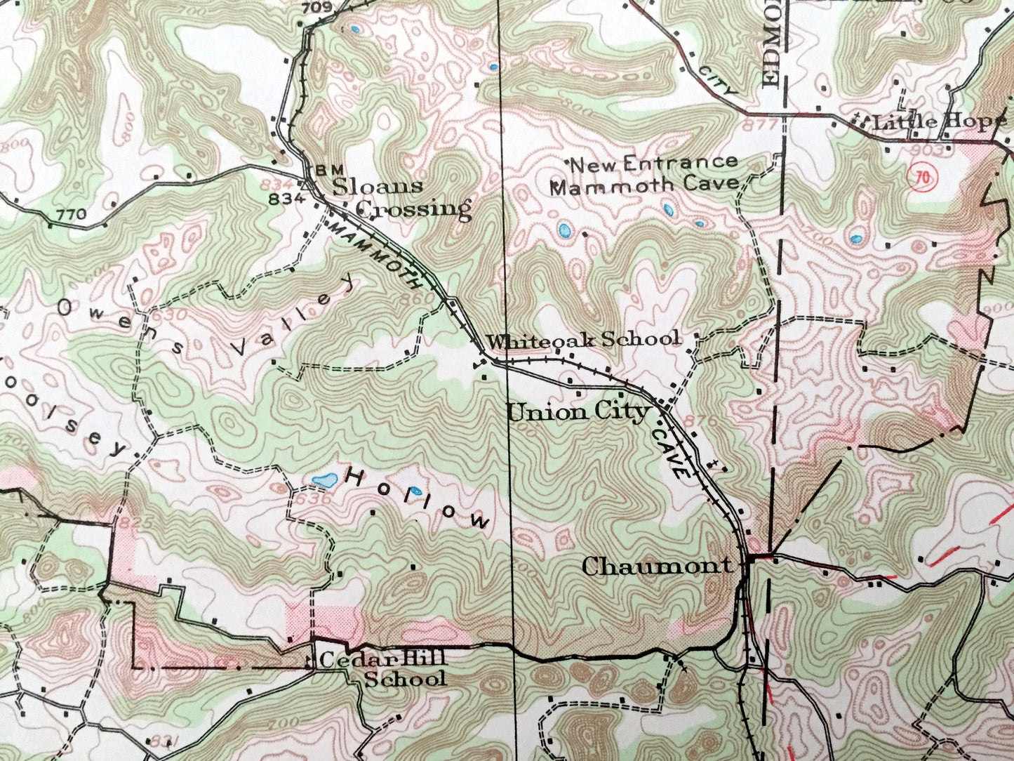
Cities & Towns: Arthur, Mammoth Cave, Cade, Northtown, Rhoda, Chalybeate, Pig, Elko, Sloans Crossing, Union City, Chaumont, Highland Springs, Park City, Oakland, Smiths Grove, Rocky Hill, Hays, Merry Oaks, Apple Grove, Bonayr.
Points of Interest: Green River, Mammoth Cave National Park, Nolin River, Wet Prong Buffalo Creek, Double Sink, Cedar Sink, Sinking Creek, Cedar Springs Valley, Woolsey Hollow, Owens Valley, Goblin Knob, Cave Island and lots more hills, creeks, hollows, valleys towns, schools, churches, roads and train tracks.
Condition: Very Good Vintage condition, commensurate with age. This map is in great shape for being over 50 years old. Light edge-wear but this will add to vintage character when framed.
----
We will happily adjust shipping price for multiple purchases. Maps are rolled up and shipped in sturdy mailing tubes, never folded.
Couldn't load pickup availability
Share