My Store
Antique Man, West Virginia 1963 US Geological Survey Topographic Map – Mingo, Logan County, Magnolia, Mountain View, Hampden, Tamcliff, WV
Antique Man, West Virginia 1963 US Geological Survey Topographic Map – Mingo, Logan County, Magnolia, Mountain View, Hampden, Tamcliff, WV
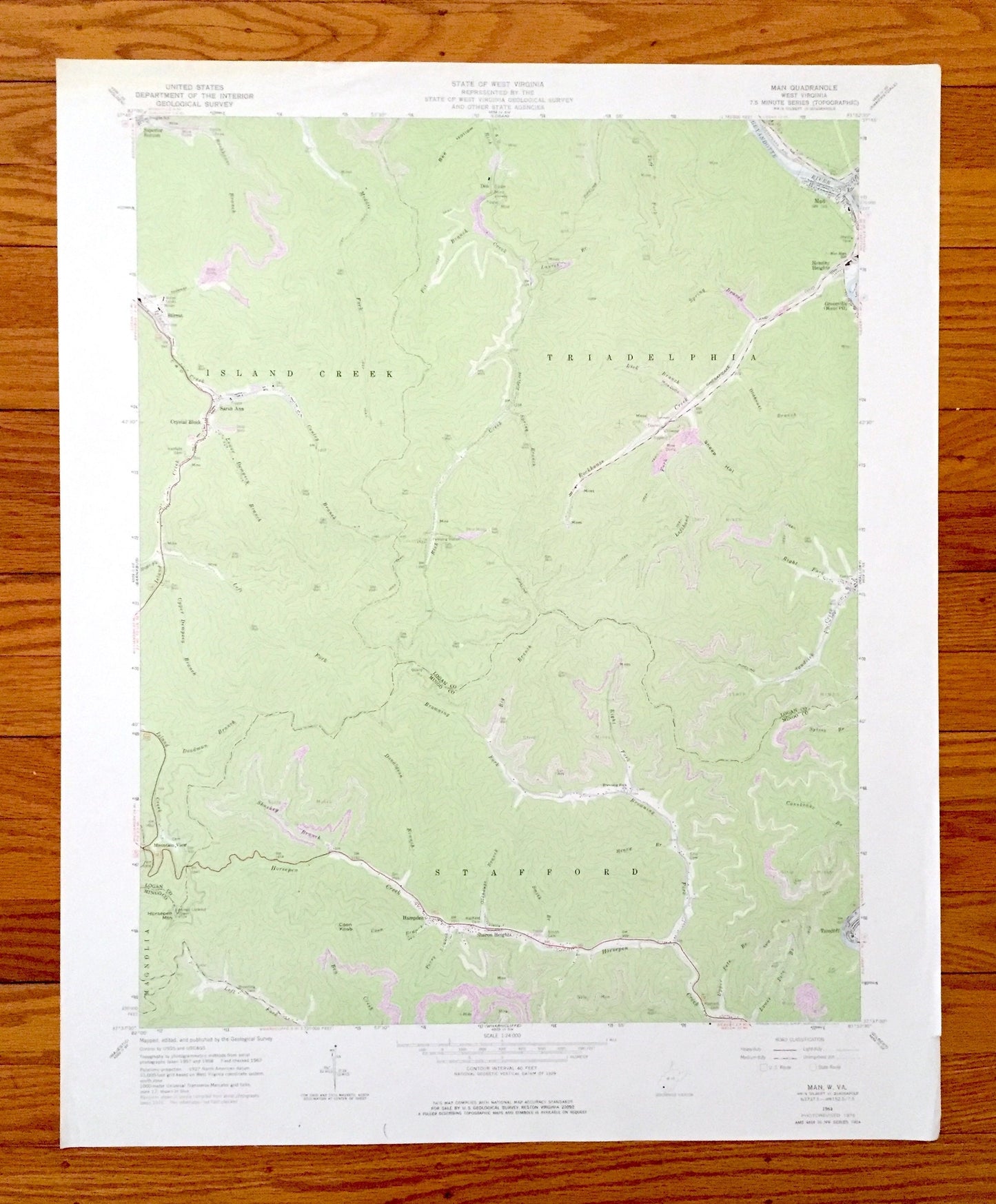
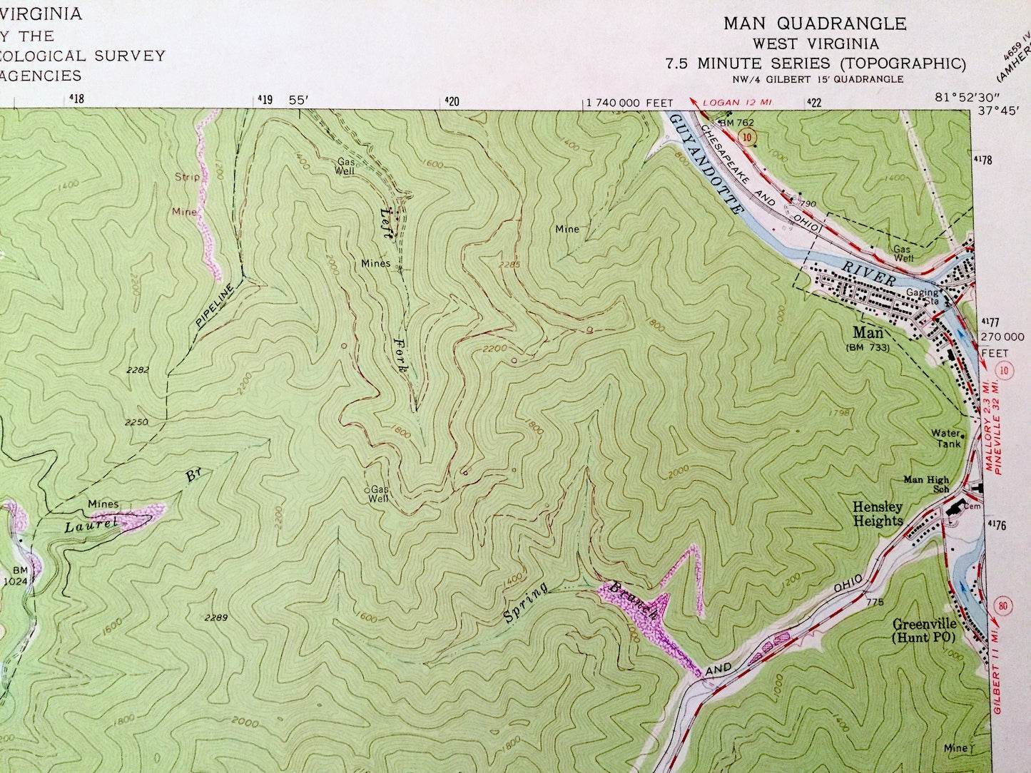
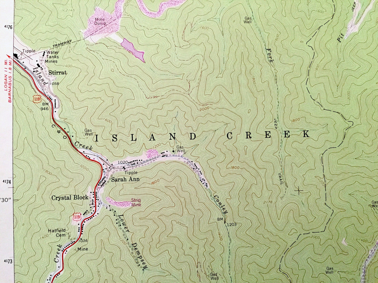
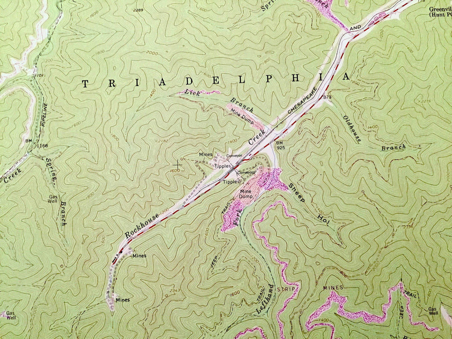
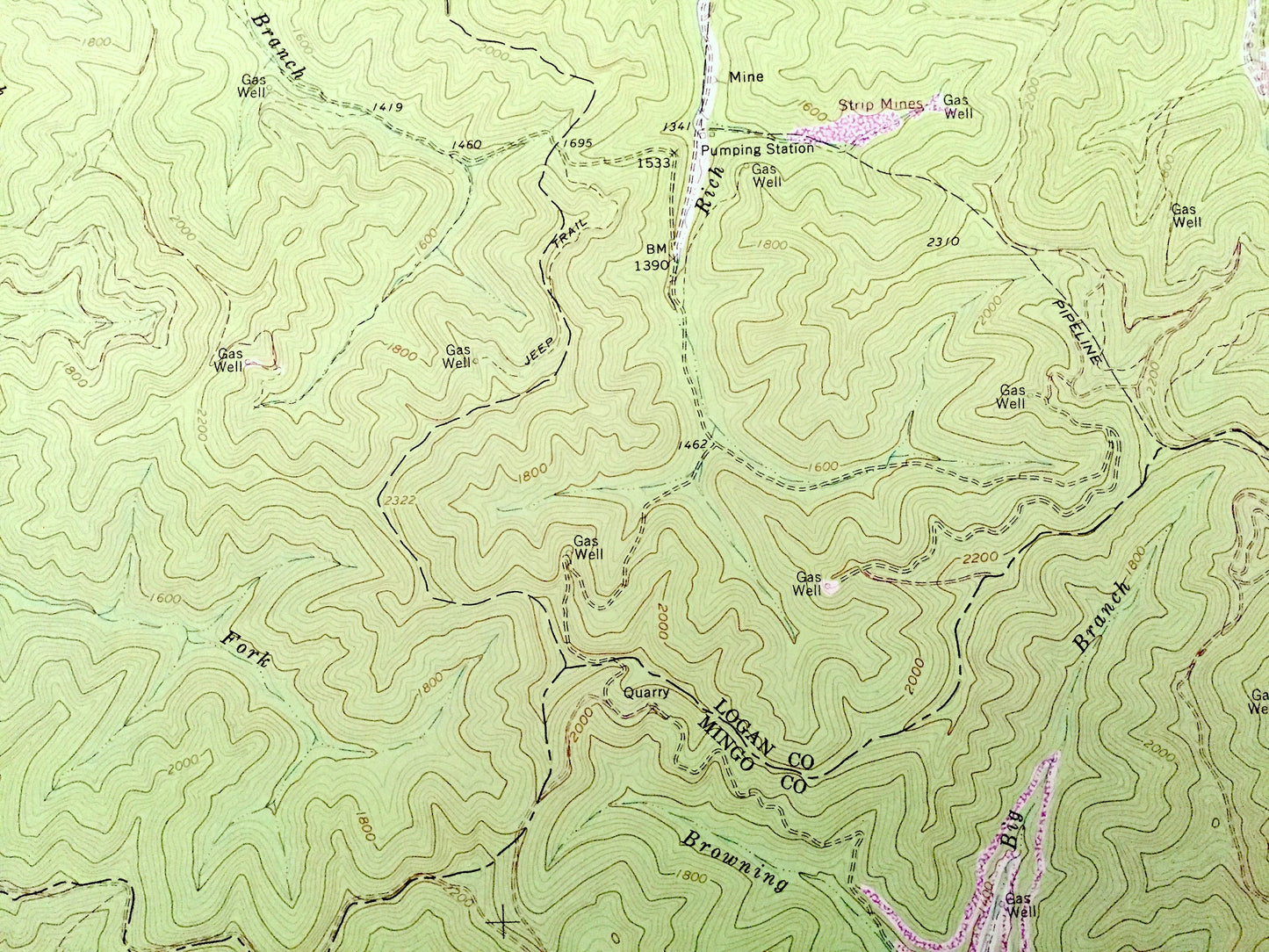
Beautiful, antique map of Man, West Virginia and surrounding Logan and Mingo County area. This is an authentic 1963 edition, 1977 print from the U.S. Geological Survey and NOT a computer reproduction.
See what West Virginia looked like almost 60 years ago. Lots of intricate details and geological contours. Map even has little squares for every house that existed at the time. The USGS cartographers were very thorough back then!
Perfect for the historian, map-lover, the curious or just as a conversation starter. Wonderful and rare. Vintage maps such as these make great gifts.
Edition of 1963, printed 1977
Dimensions: 22" width x 27" height
----
Features
Cities & Towns: Man, Magnolia, Mountain View, Hampden, Sharon Heights, Tamcliff, Crystal Block, Sarah Ann Strrat, Island Creek, Triadelphia, Stafford, Hensley Heights, Don, Superior Bottom.
Points of Interest: Mingo County, Logan County, Guyandotte River, Horsepen Creek, Island Creek, Rockhouse Creek, Rich Creek, Pit Branch Creek, and lots more hills, mountains, creeks, towns, roads and train tracks.
Condition: Very Good Vintage condition, commensurate with age. This map is in great shape for being over 40 years old. Has some tiny tears on the edge but these will be hidden when framed.
----
We will happily adjust shipping price for multiple purchases. Maps are rolled up and shipped in sturdy mailing tubes, never folded.
Couldn't load pickup availability
Share