My Store
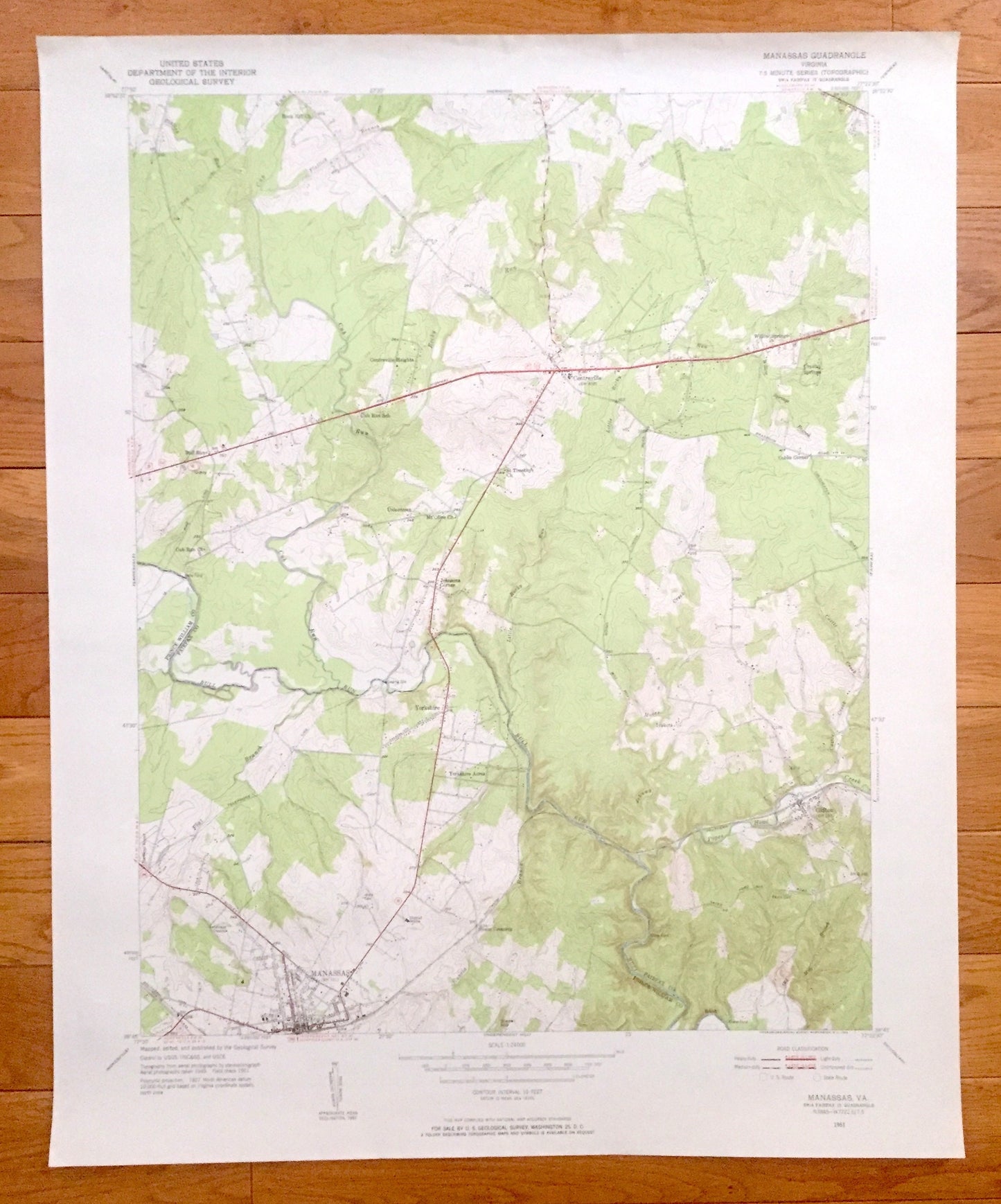
Antique Manassas, Virginia 1951 US Geological Survey Topographic Map – Prince William County, Fairfax, Clifton, Yorkshire, Park, Bull Run VA
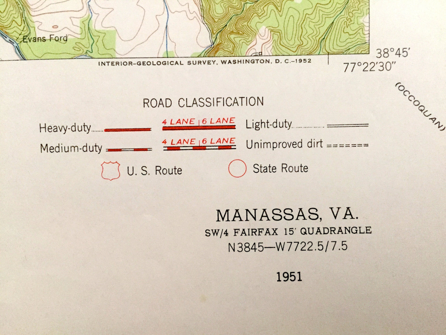
Antique Manassas, Virginia 1951 US Geological Survey Topographic Map – Prince William County, Fairfax, Clifton, Yorkshire, Park, Bull Run VA
Beautiful, antique map of Manassas, Virginia and surrounding Prince William & Fairfax County area. This is an authentic 1951 edition, 1952 print from the U.S. Geological Survey and NOT a computer reproduction.
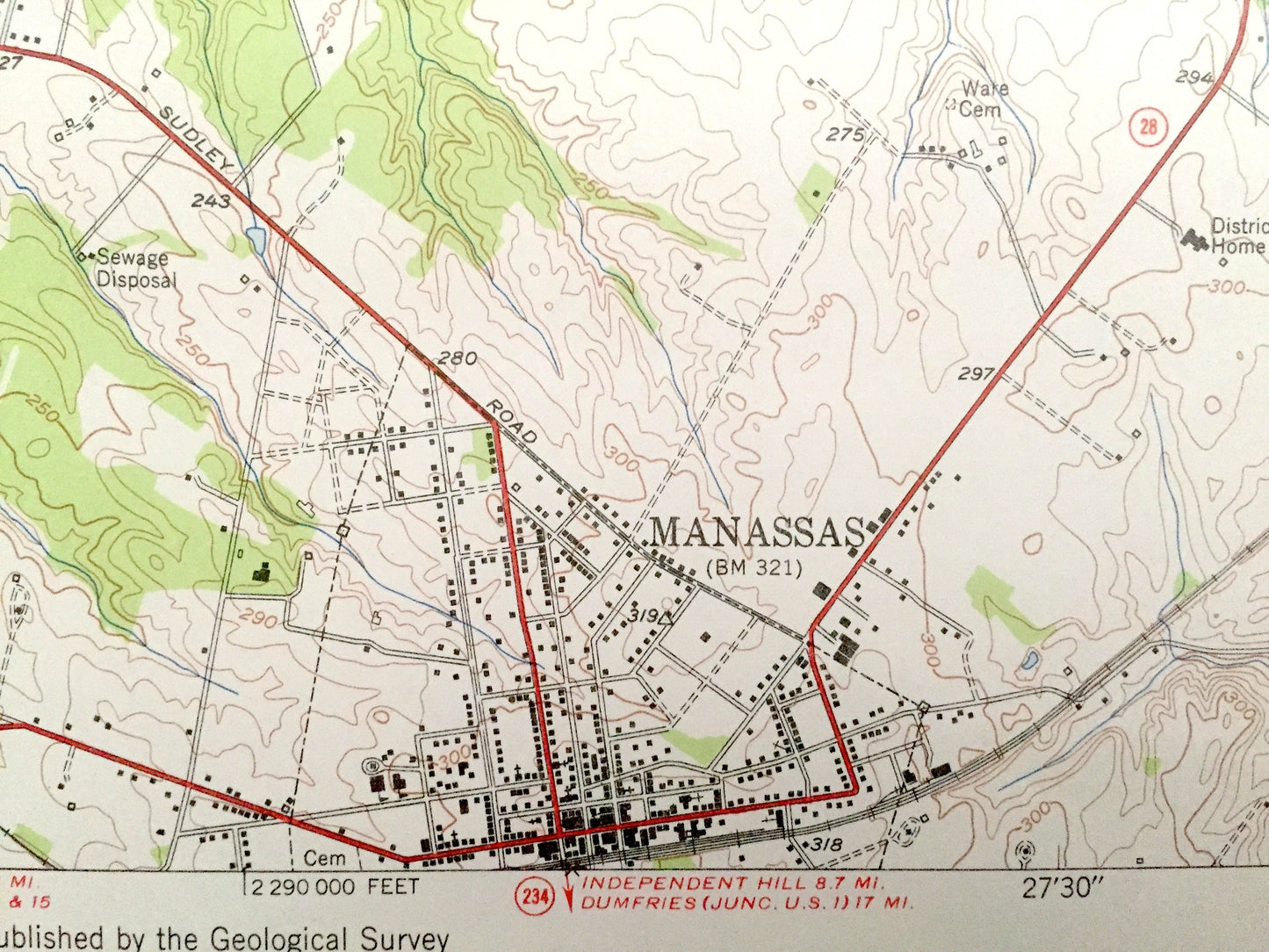
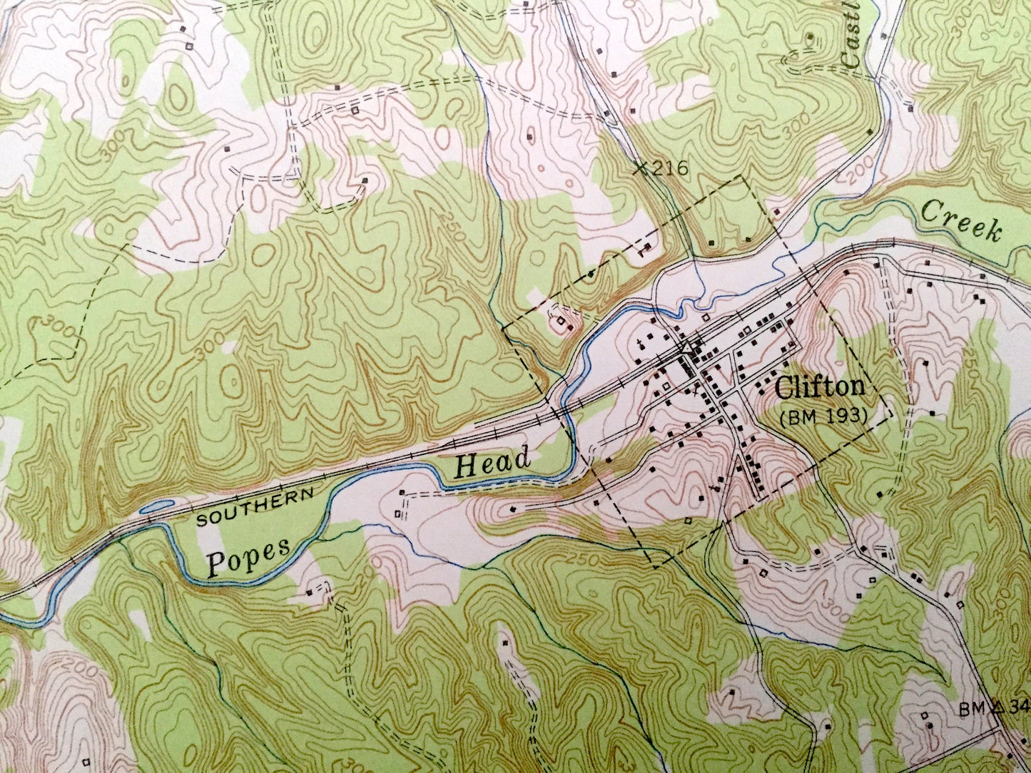
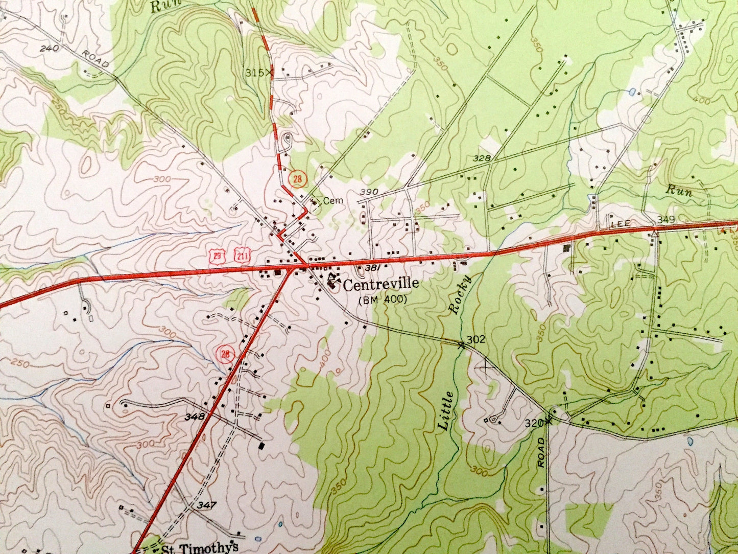
See what Virginia looked like over 70 years ago. Lots of intricate details and geological contours. Map even has little squares for every house that existed at the time. The USGS cartographers were very thorough back then!
Perfect for the historian, map-lover, the curious or just as a conversation starter. Wonderful and rare. Vintage maps such as these make great gifts.
Edition of 1951, printed 1952
Dimensions: 22" width x 27" height
----
Features
Cities & Towns: Manassas, Bloom Crossing, Clifton, Yorkshire Acres, Manassas Park, Yorkshire, Yorkshire Park, Bull Run Estates, Uniontown, Cedar Spring, Centre Heights, Bull Run, Centreville Farms, Marshall Farms, Willow Springs, Crystal Springs, Centreville, Cobbs Corner, Braddock Woods, Lewis Park, Vannoy Park, Johnsons Corner, Ivakota.
Points of Interest: Fairfax County, Prince Williams County, Cub Run, Bull Run, Popes Head Creek, Southern Railway, Manassas Airport, and many more hills, streams, ponds, houses, schools, churches and roads.
Condition: Good Vintage condition, commensurate with age. This map is in great shape for being 70 years old. Has light wear but this will add to vintage character when framed.
----
We will happily adjust shipping price for multiple purchases. Maps are rolled up and shipped in sturdy mailing tubes, never folded.
Couldn't load pickup availability
Share