My Store
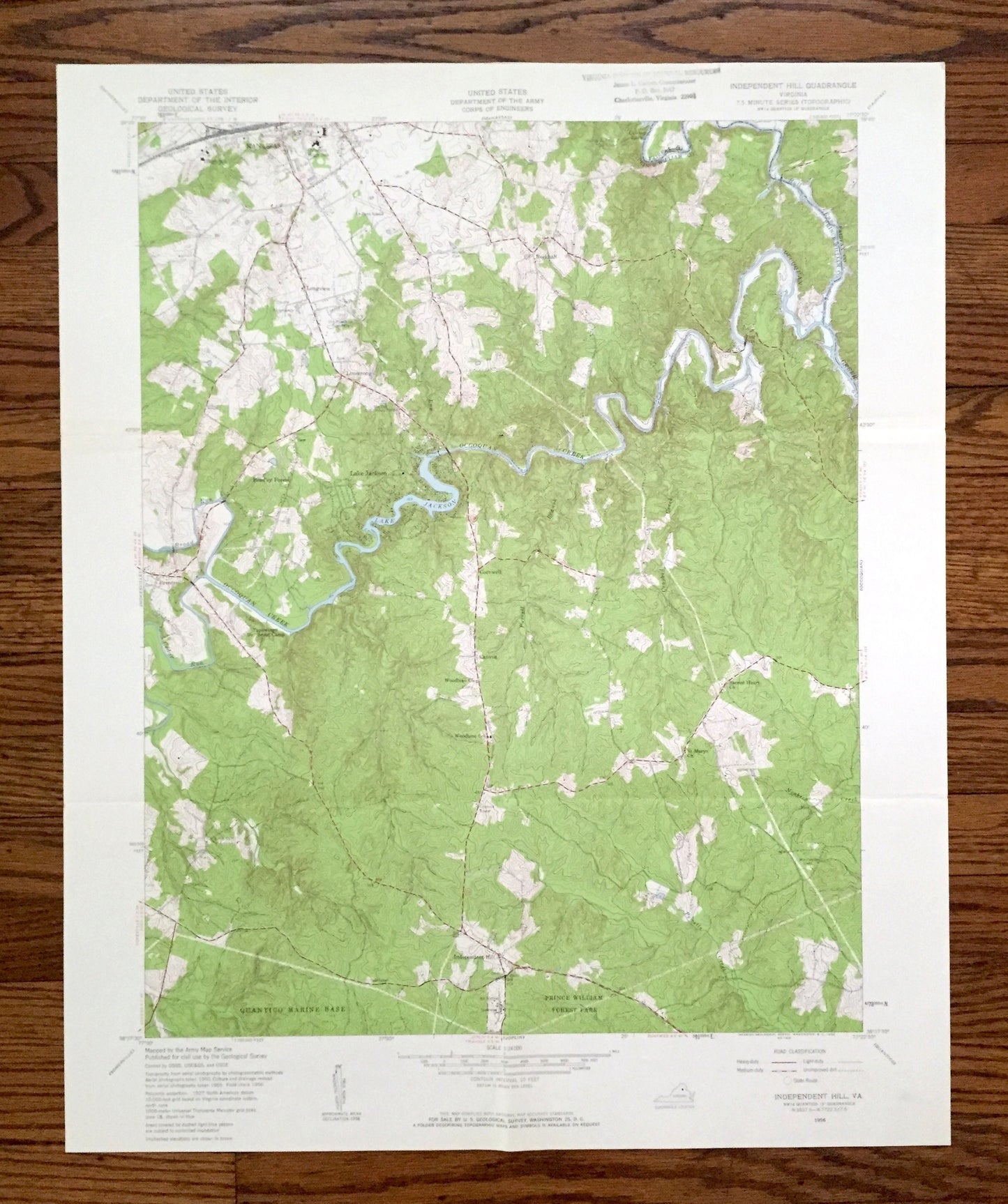
Antique Manassas, Virginia 1956 US Geological Survey Topographic Map – Prince William County, Independent Hill, Lake Jackson, Bull Run, VA
Antique Manassas, Virginia 1956 US Geological Survey Topographic Map – Prince William County, Independent Hill, Lake Jackson, Bull Run, VA
Beautiful, antique map of Independent Hill, Virginia and surrounding Prince William & Fairfax County area. This is an authentic 1956 edition, 1959 print from the U.S. Geological Survey and NOT a computer reproduction.
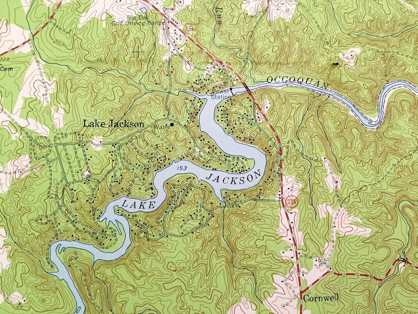
See what Virginia looked like over 65 years ago, before the Occoquan Reservoir was created. Lots of intricate details and geological contours. Map even has little squares for every house that existed at the time. The USGS cartographers were very thorough back then!
Perfect for the historian, map-lover, the curious or just as a conversation starter. Wonderful and rare. Vintage maps such as these make great gifts.
Edition of 1956, printed 1959
Dimensions: 22" width x 27" height
----
Features
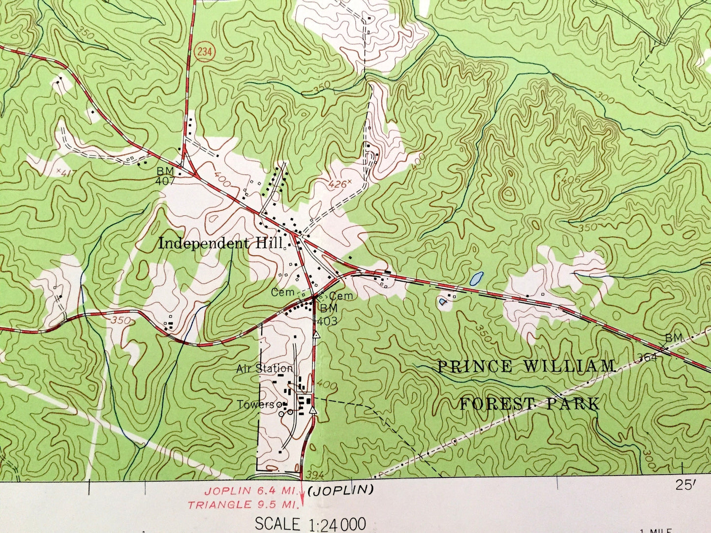
Cities & Towns: Independent Hill, Manassas, Longview, Hillcrest Estates, Buckhall, Lake Jackson, Bradley Forest, Brentsville, Cornwell, Canova.
Points of Interest: Prince William County, Fairfax County, Lake Jackson, Occoquan River, Broad Run, Bull Run Regional Park, Quantico Marine Corps Schools, Prince William Forest Park, and many more hills, streams, ponds, houses, schools, churches and roads.
Condition: Good Vintage condition, commensurate with age. This map is in great shape for being over 60 years old. Has light wear, stamp in upper margin and folds as-issued, but these will flatten easily and all will read as vintage character when framed.
----
We will happily adjust shipping price for multiple purchases. Maps are rolled up and shipped in sturdy mailing tubes, never folded.
Couldn't load pickup availability
Share