My Store
Antique Manchester, Maryland & West Manheim, Pennsylvania 1953 US Geological Survey Topographic Map – Bachman Mills, Melrose, Bandanna
Antique Manchester, Maryland & West Manheim, Pennsylvania 1953 US Geological Survey Topographic Map – Bachman Mills, Melrose, Bandanna
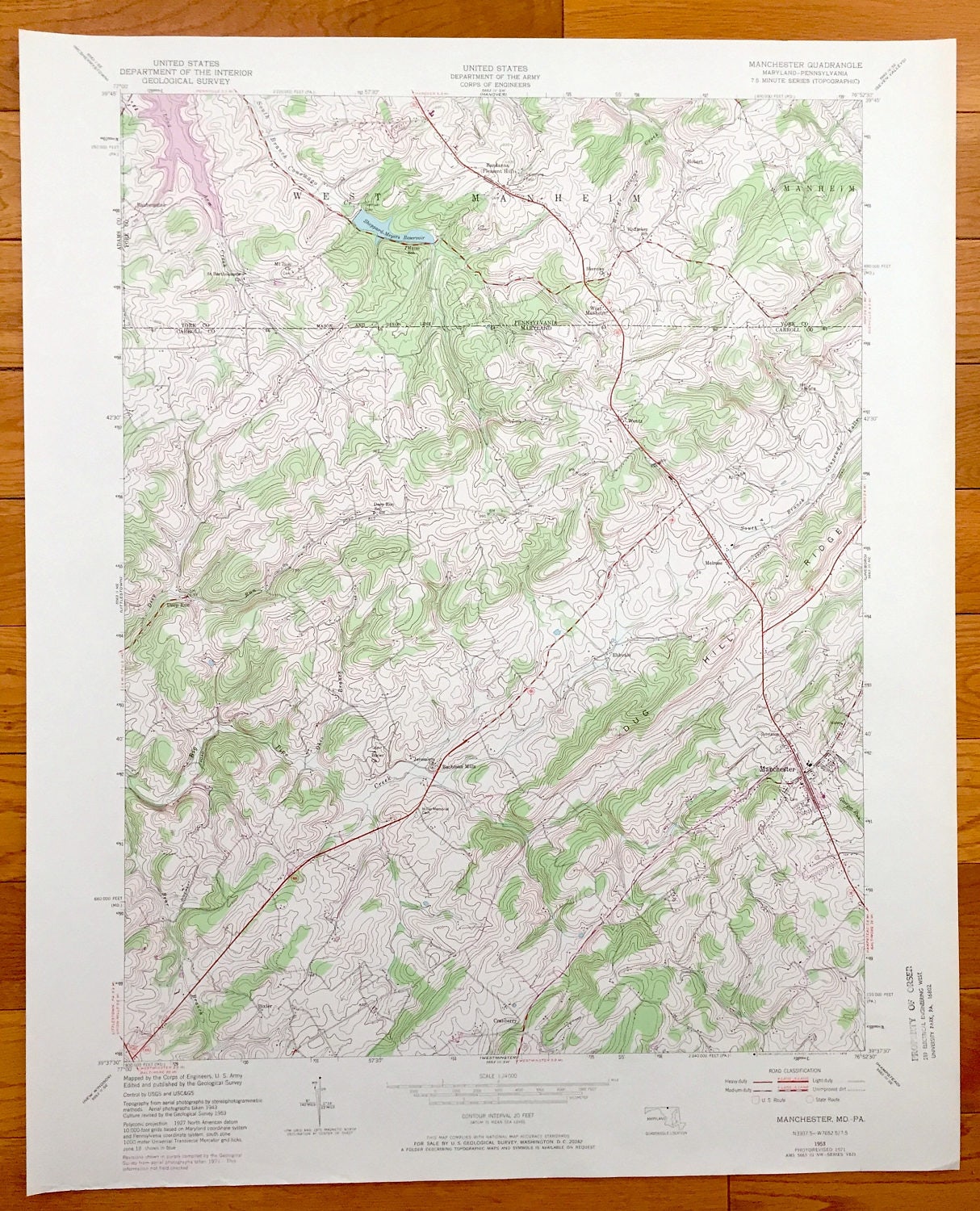
Beautiful, antique map of Manchester, Melrose, Wentz and Bachman Mills, Maryland including Pennsylvania towns of West Manheim and Bandanna, that are shown on the Mason-Dixon Line. This is an authentic 1971 print of 1953 survey data from the U.S. Geological Survey and NOT a computer reproduction.
See what Carroll County of Maryland and York County of Pennsylvania looked like almost 65 years years ago. Lots of intricate details and geological contours. Map even has little squares for every house that existed at the time. The USGS cartographers were very thorough back then!
Perfect for the historian, map-lover, the curious or just as a conversation starter. Wonderful and rare. Vintage maps such as these make great gifts.
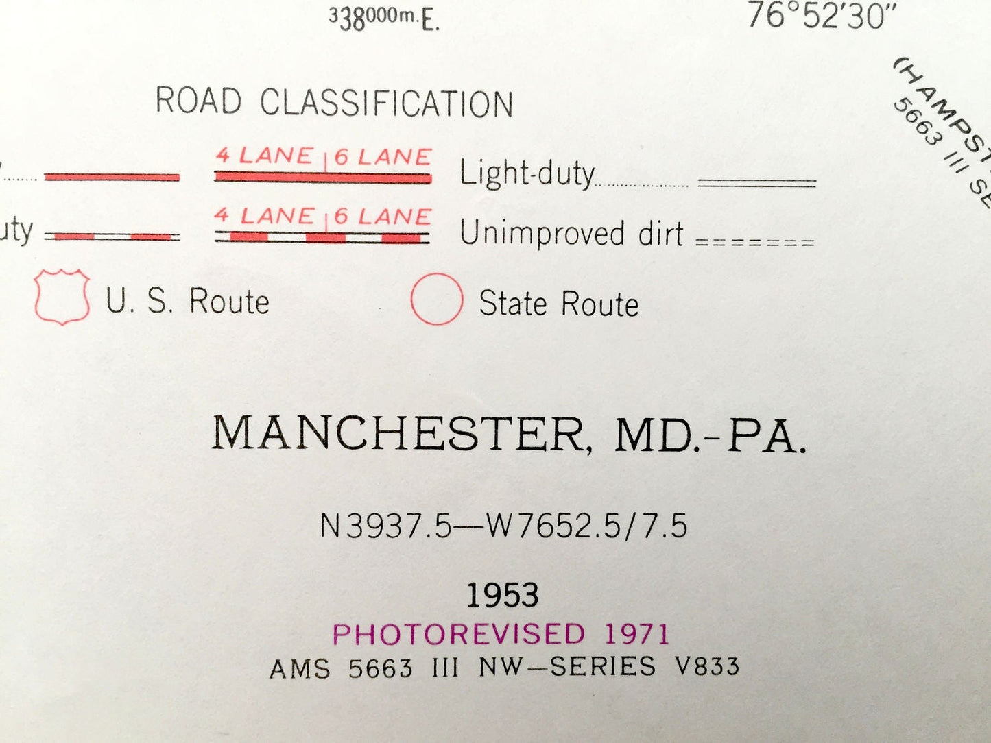
Edition of 1953, printed 1971
Dimensions: 22" width x 27" height
----
Features
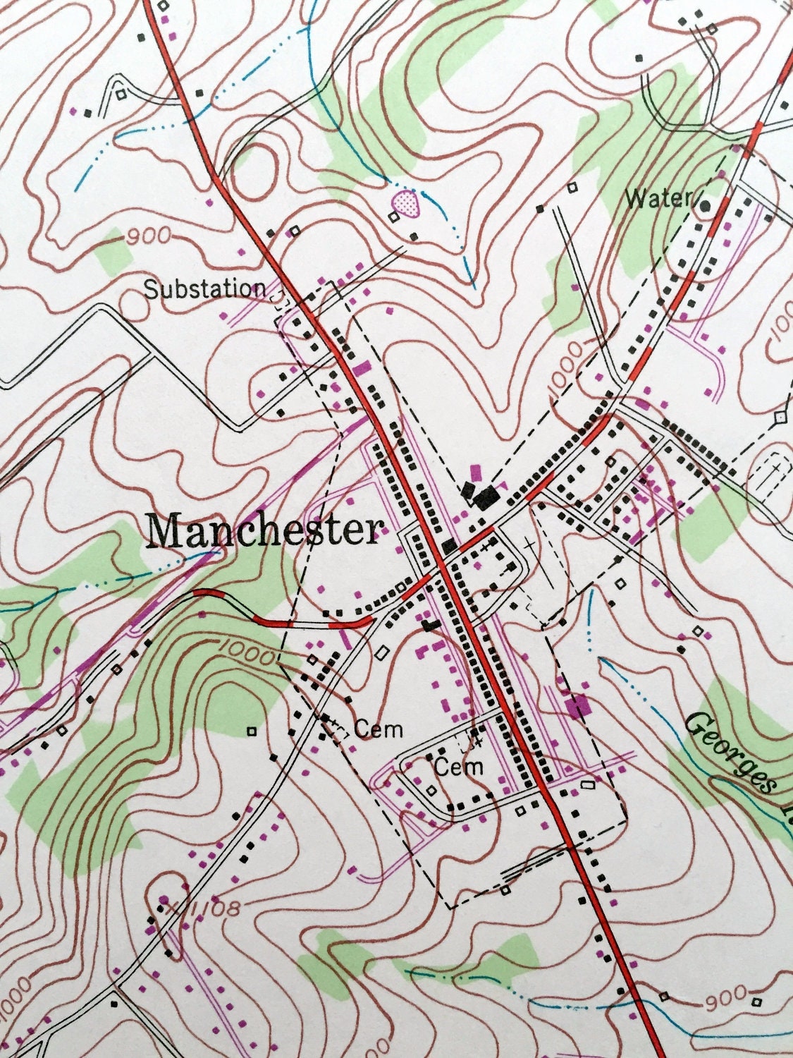
Cities & Towns: MARYLAND: Backman Mills, Deep Run, Wentz, Melrose, Manchester, Cranberry, Bixler, Ebbvale.
PENNSYLVANIA: Rubenstine, West Manheim, Manheim, Hobart, Bandanna.
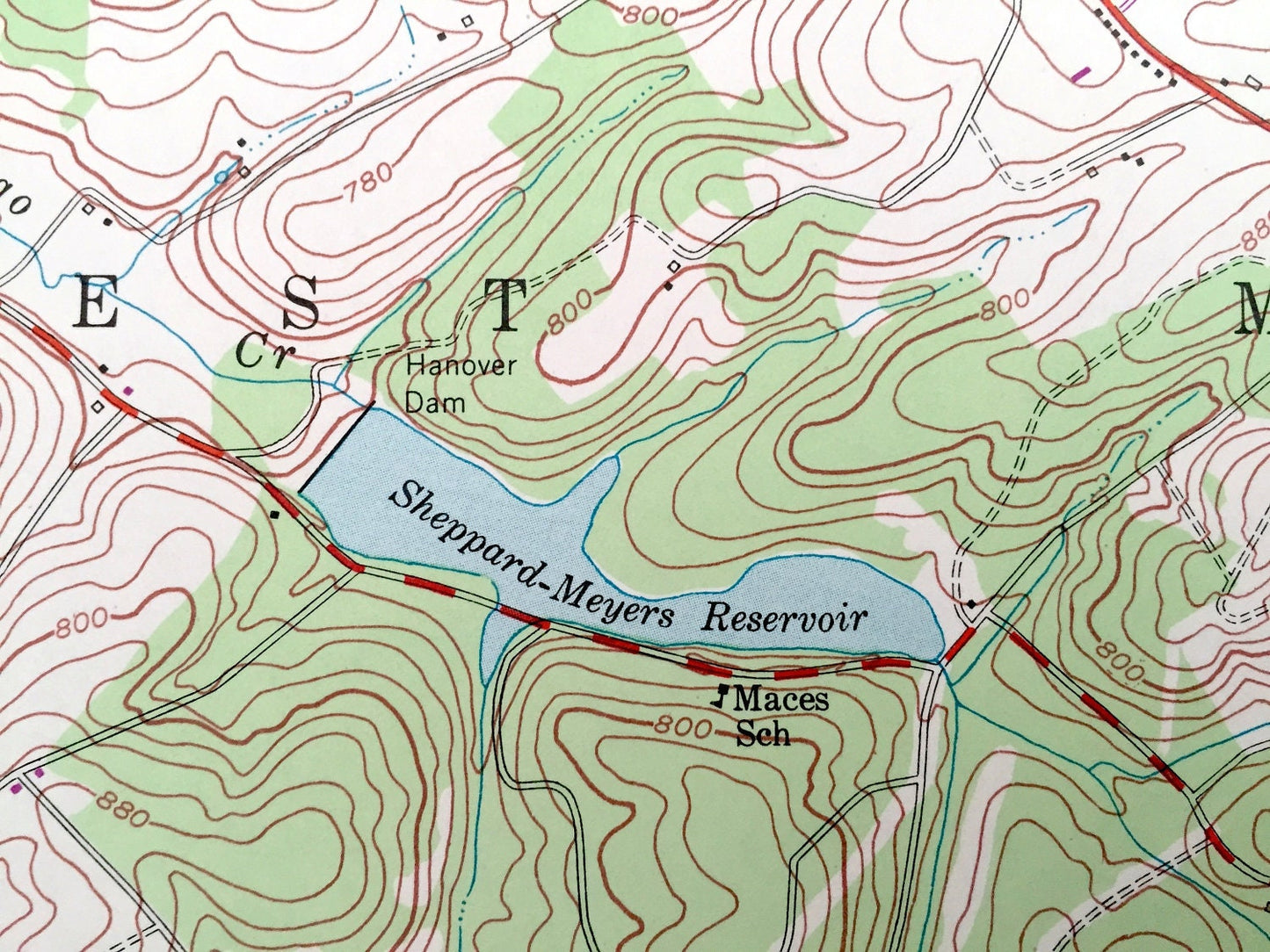
Points of Interest: Sheppard-Meyers Reservoir, South Branch Conewago River, St Bartholomew Church, Hoffakep School, Dug Hill Ridge, Deep Run School, and lots more hills, streams, ponds, houses, schools and roads.
Condition: Very Good condition, commensurate with age. This map is in incredible shape for being over 45 years old.
----
We will happily adjust shipping price for multiple purchases. Maps are rolled up and shipped in sturdy mailing tubes, never folded.
Couldn't load pickup availability
Share