My Store
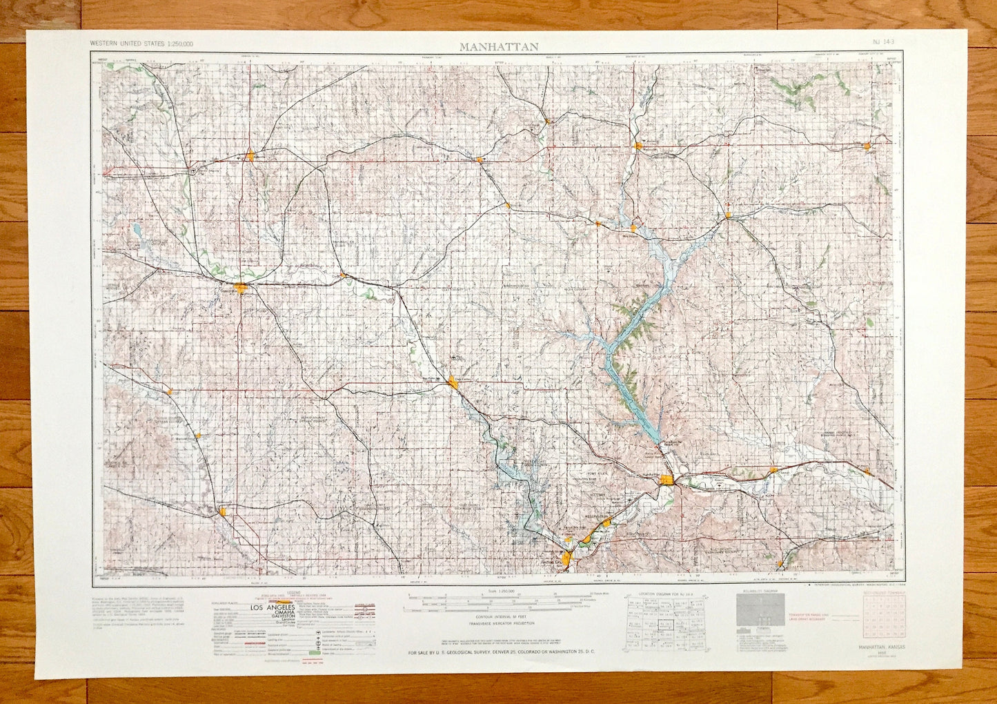
Antique Manhattan, Kansas 1955 US Geological Survey Topographic Map – Junction City, Clay Center, Minneapolis Concordia Belleville Wamego KS
Antique Manhattan, Kansas 1955 US Geological Survey Topographic Map – Junction City, Clay Center, Minneapolis Concordia Belleville Wamego KS
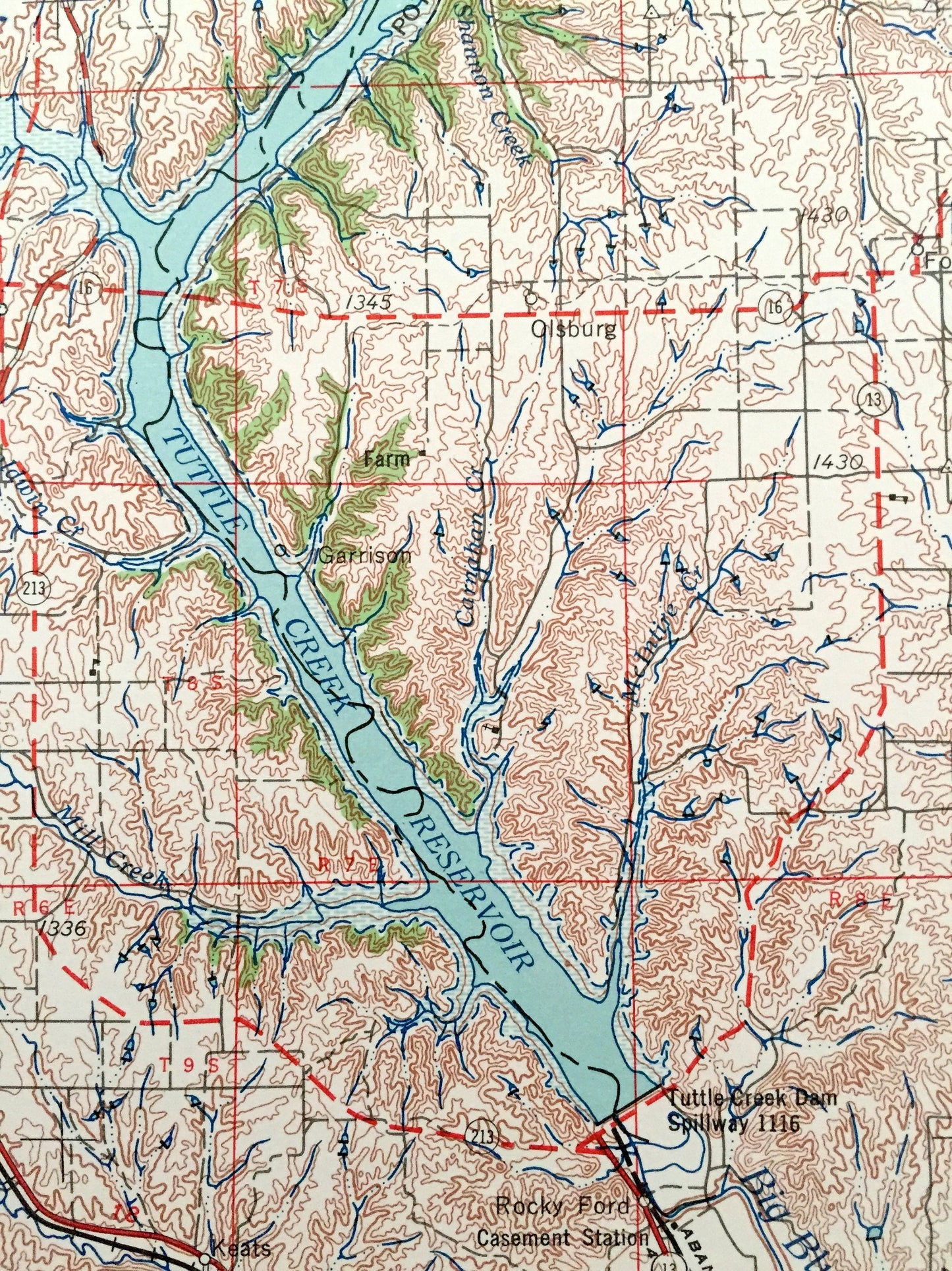
Beautiful, antique map of Manhattan, Kansas and surrounding area. This is an authentic 1955 edition, 1964 print from the U.S. Geological Survey and NOT a computer reproduction.
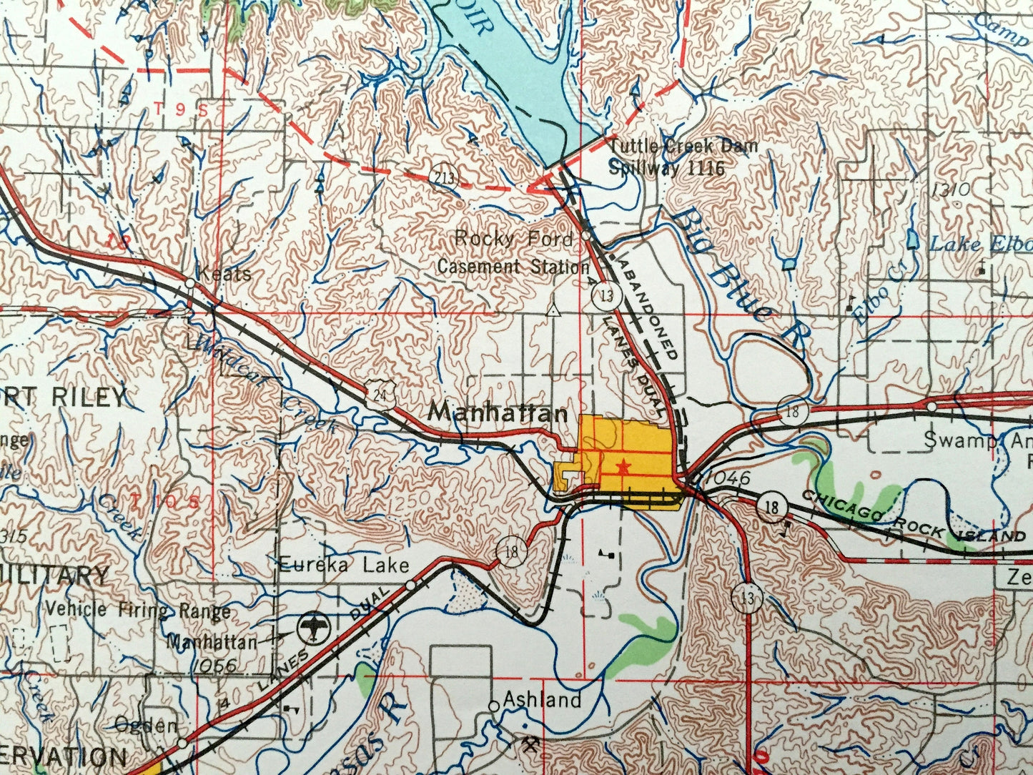
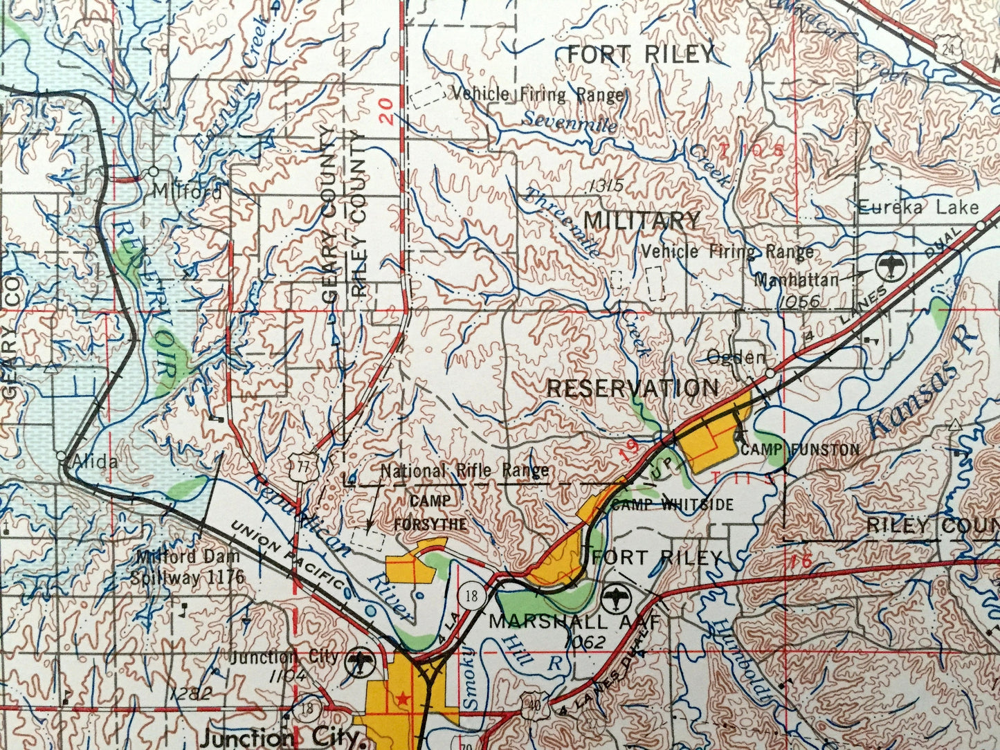
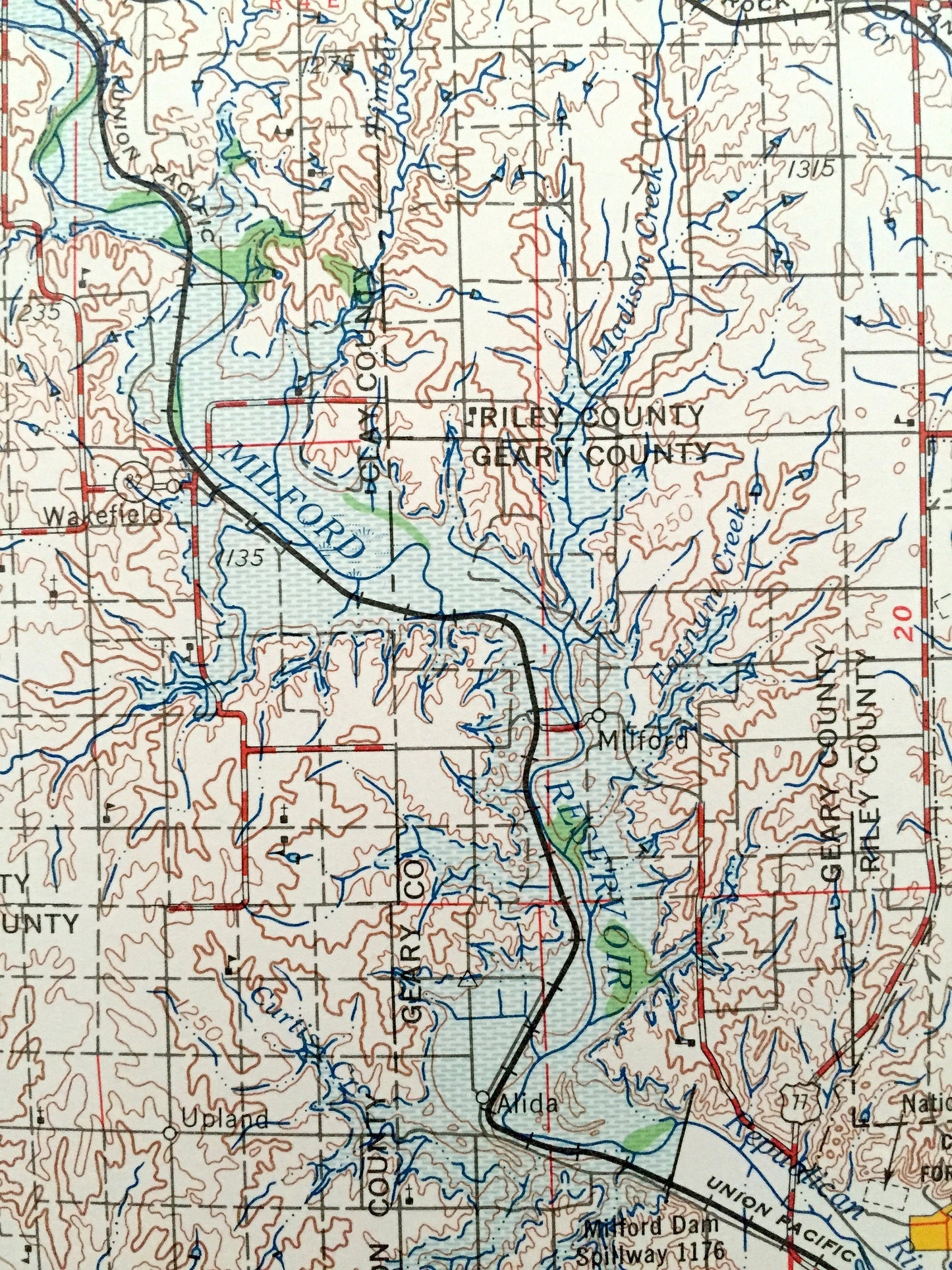
See what Kansas looked like over 65 years ago. Lots of intricate details and geological contours. Map is incredibly large and in the grand 1:250,000 scale. The USGS cartographers were very thorough back then!
Perfect for the historian, map-lover, the curious or just as a conversation starter. Wonderful and rare. Vintage maps such as these make great gifts.
Edition of 1955, printed 1964
Dimensions: 32" width x 22 1/2" height
----
Features
Cities & Towns: Manhattan, St. Marys, Frankfort, Seneca, Marysville, Hanover, Washington, Clyde, Glasco, Asherville, Delphos, Lindsey, Bennington, Fort Riley, Junction City, Clay Center, Minneapolis, Concordia, Belleville, Wamego.
Points of Interest: Big Blue River, Kansas River, Republican River, Turtle Creek Reservoir, Milford Reservoir, Fort Riley Military Reservation, Mill Creek, Millers Creek, Walnut Creek and lots more hills, mountains, lakes, rivers, creeks, roads, highways and railroads.
Condition: Very Good condition, commensurate with age. This map is in incredible shape for being over 55 years old. Has light edge-wear, all of which will read as vintage character when framed.
----
We will happily adjust shipping price for multiple purchases. Maps are rolled up and shipped in sturdy mailing tubes, never folded.
Couldn't load pickup availability
Share