My Store
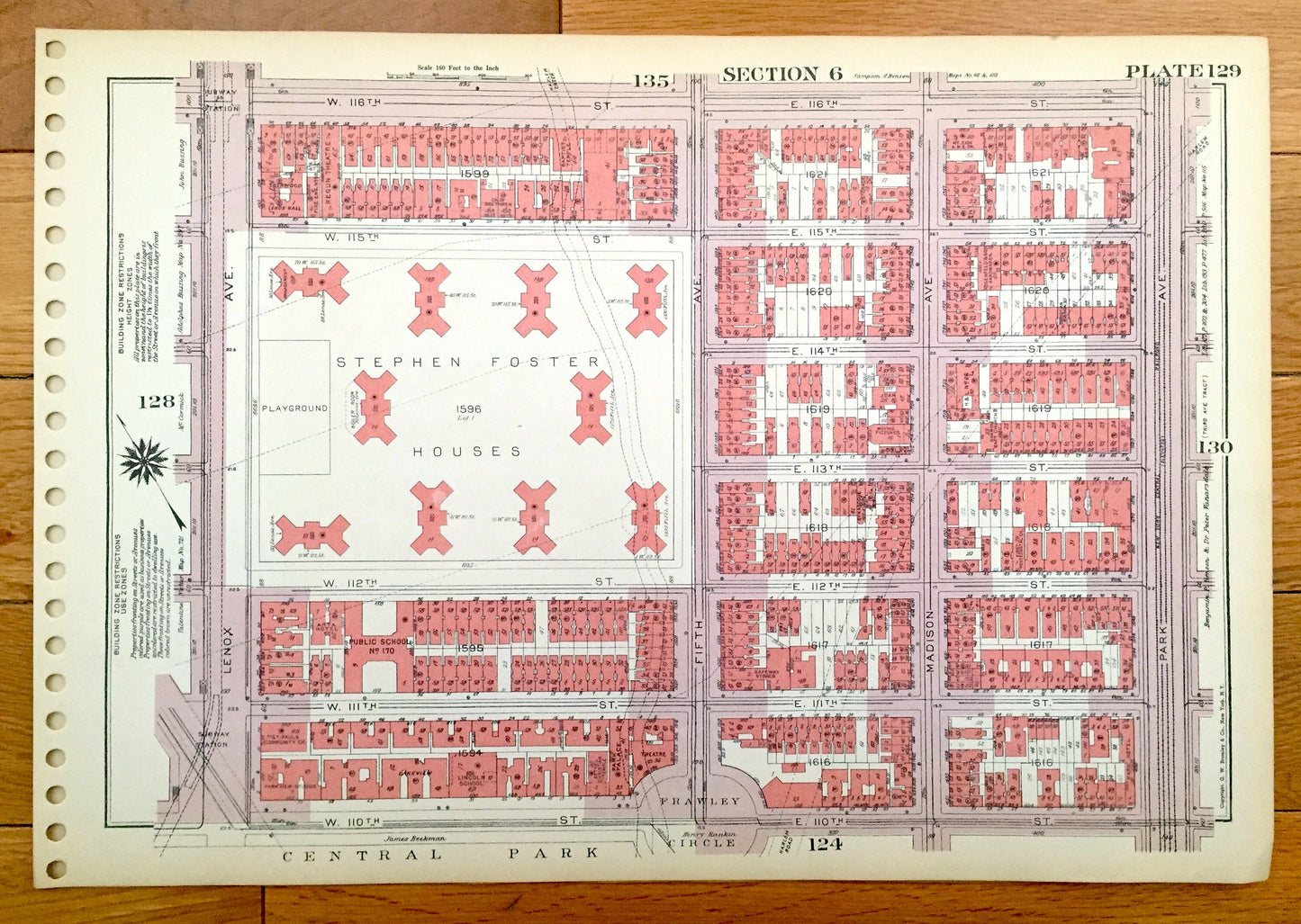
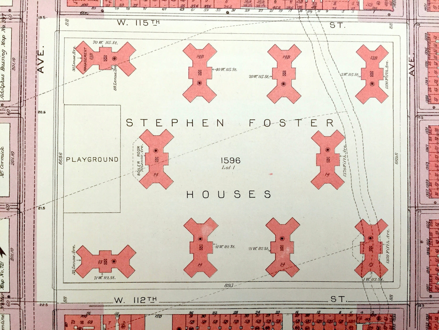
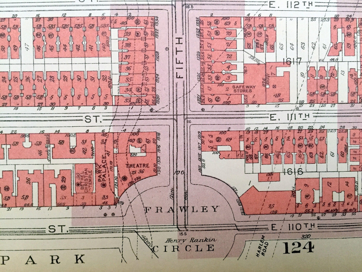
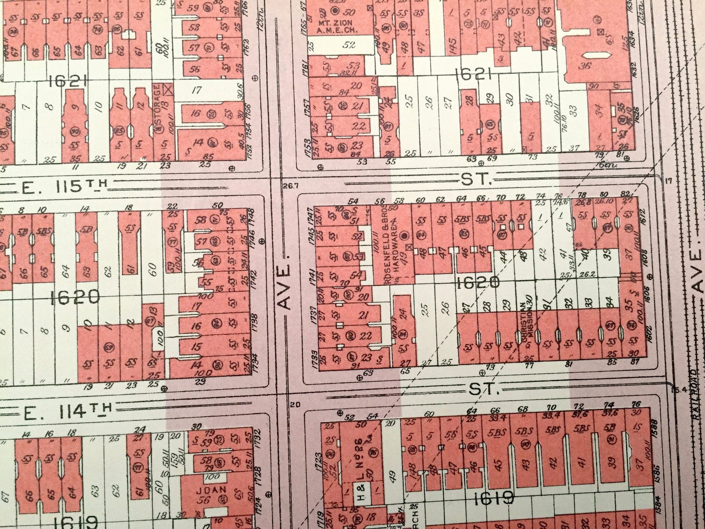
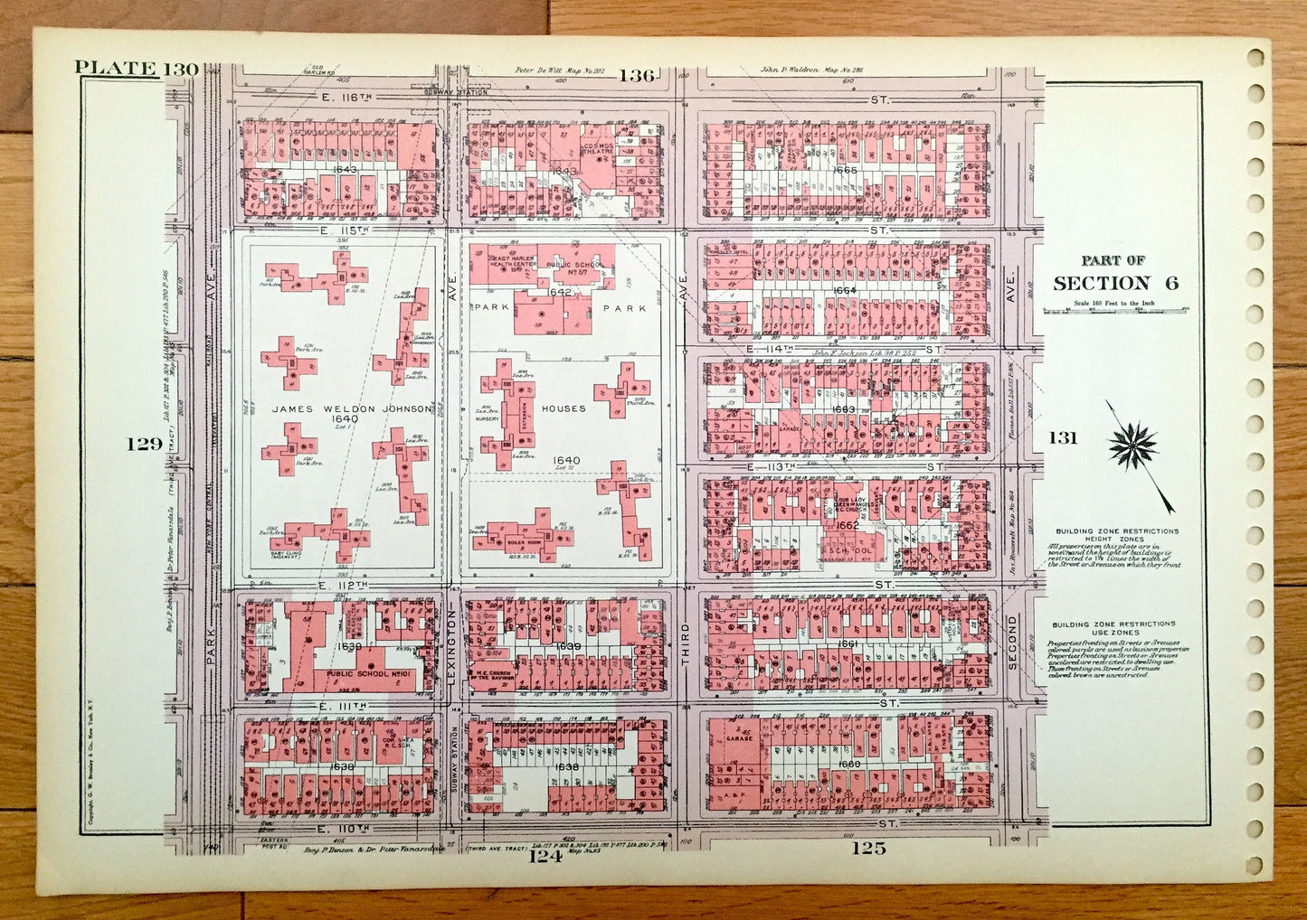
Antique Manhattan, New York City Map from Bromley's 1955 Manhattan Land Book – Harlem, Central Park, Stephen Foster Houses, Frawley NYC NY
Antique Manhattan, New York City Map from Bromley's 1955 Manhattan Land Book – Harlem, Central Park, Stephen Foster Houses, Frawley NYC NY
Beautiful, antique, double-sided map of Manhattan, taken from the rare "Manhattan Land Book of the City of New York" published in 1955 by G.W. Bromley & Company. This is an authentic print and NOT a computer reproduction. Includes Plates #129 and #130 from the atlas.
See what Manhattan looked like more than 65 years ago. Lots of charming, intricate details. All streets, important buildings and landmarks are named—a lot of which have changed in the past century. And all city blocks and houses are numbered.
Perfect for the historian, map-lover, the curious or just as a conversation starter. Wonderful and rare. Vintage maps such as these make great gifts.
Edition of 1955, printed 1955
Dimensions: 16 1/2" width x 11 1/2" height
----
Condition: Very Good Vintage condition, commensurate with age. This map is in great shape for being almost 70 years old. The atlas the map is from was spiral bound. These holes are easily concealed with framing and placing a similar-colored paper in the background as I have done in the photos, or can be cut with no loss to the image—the margins would still be even on both sides. I've left it up to the customer to decide how best to present it.
(Image of "Manhattan Land Book" title page for information only and not included.)
----
We will happily adjust shipping price for multiple purchases. Maps are rolled up and shipped in sturdy mailing tubes, never folded.
Couldn't load pickup availability
Share