My Store
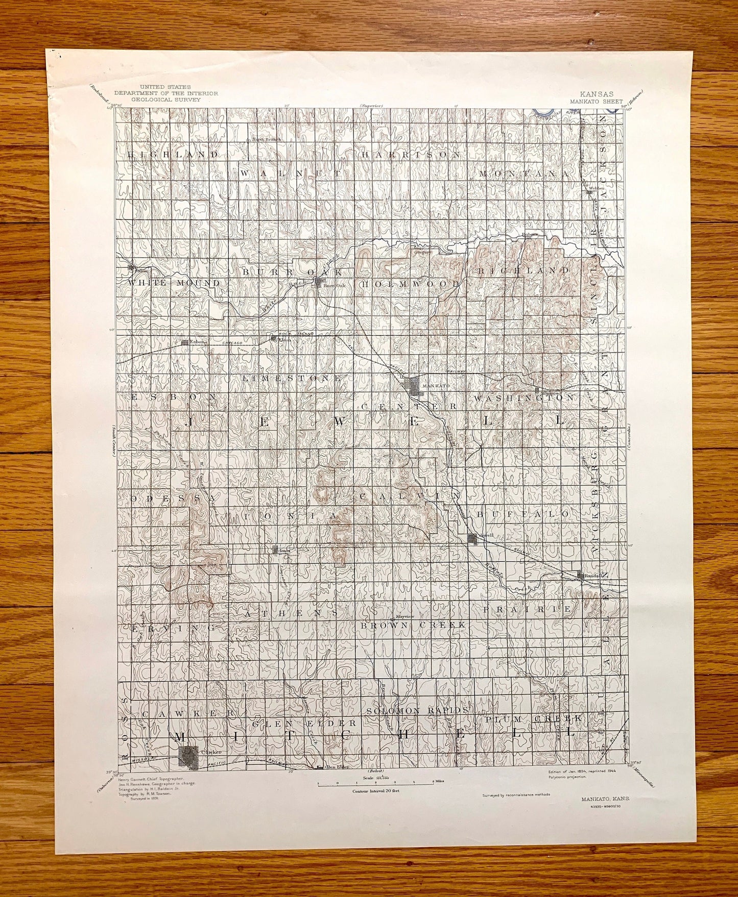
Antique Mankato, Kansas 1894 US Geological Survey Topographic Map – Jewell, Mitchell County, Cawker, Burr Oak, Randall, Webber, Ionia, KS
Antique Mankato, Kansas 1894 US Geological Survey Topographic Map – Jewell, Mitchell County, Cawker, Burr Oak, Randall, Webber, Ionia, KS
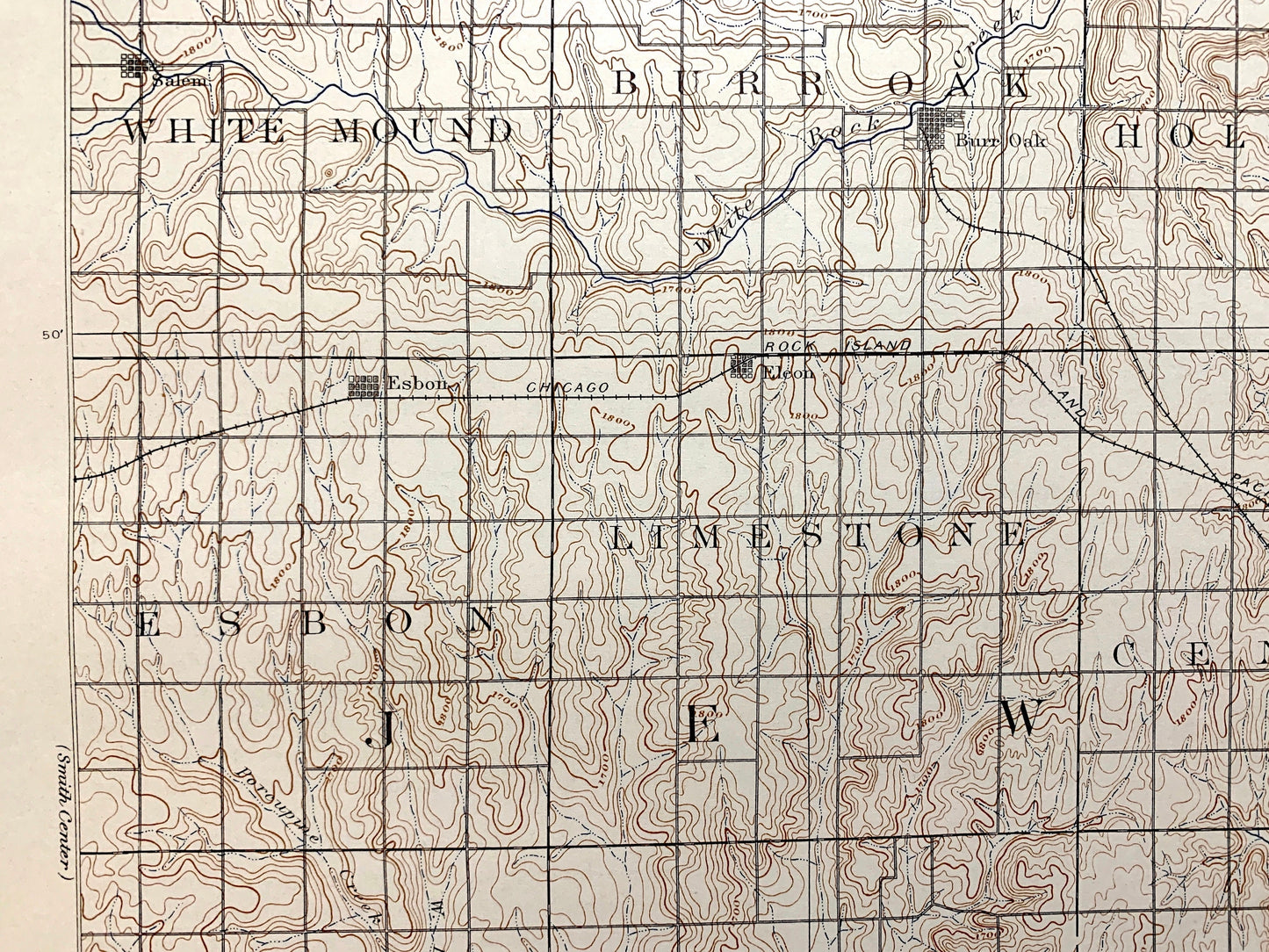
Beautiful, antique map of Mankato, Kansas and surrounding Jewell County & Mitchell County area. This is an authentic 1894 edition, 1944 print from the U.S. Geological Survey and NOT a computer reproduction.
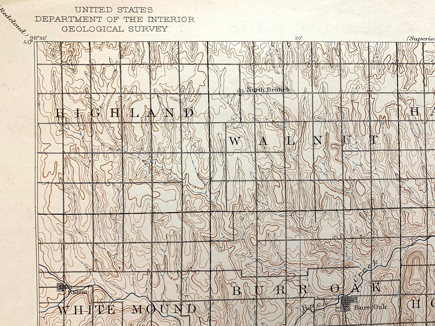
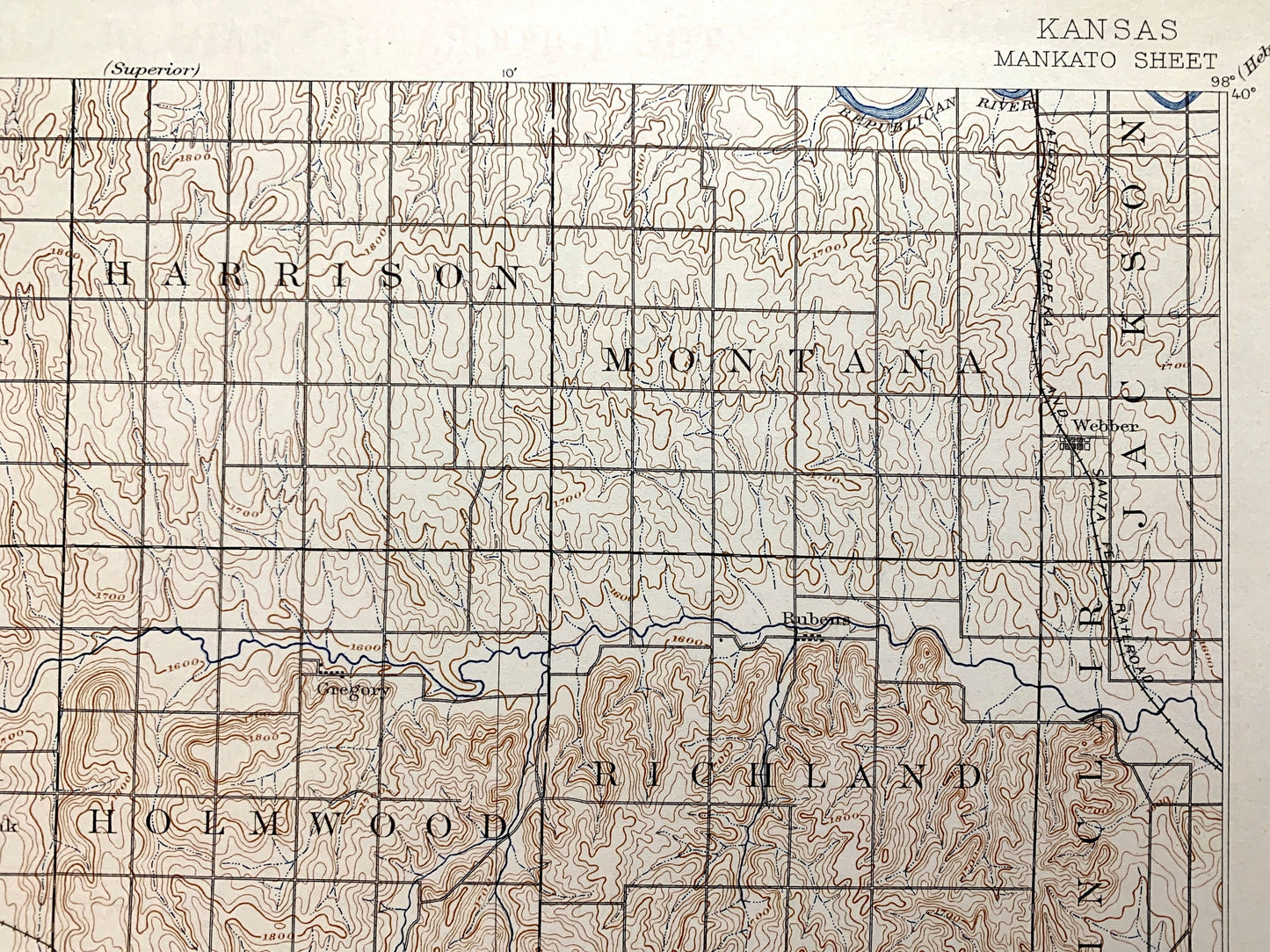
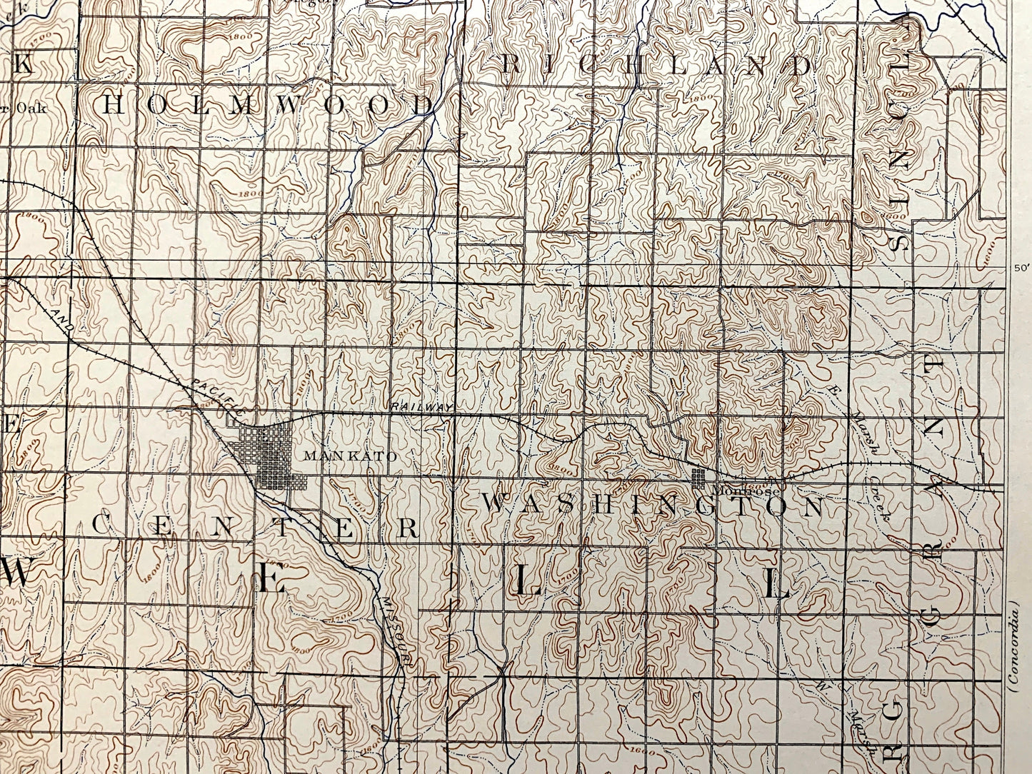
See what Kansas looked like 130 years ago. Lots of intricate details and geological contours. Map even has little squares for every street and block that existed at the time. The USGS cartographers were very thorough back then!
Perfect for the historian, map-lover, the curious or just as a conversation starter. Wonderful and rare. Vintage maps such as these make great gifts.
Edition of 1894, printed 1944
Dimensions: 17" width x 2/" height
----
Features
Cities & Towns: Mankato, Highland, Walnut, Harrison, Montana, Jackson, White Mound, Burr Oak, Holmwood, Richland, Sinclair, Esbon, Limestone, Center, Washington, Grant, Odessa, Ionia, Calvin, Buffalo, Vicksburg, Erving, Athens, Brown Creek, Prairie, Allen, Ross, Cawker, Glen Elder, Solomon Rapids, Plum Creek, North Branch, Salem, Gregory, Webber, Rubens, Eleon, Montrose, Randall, Mayview.
Points of Interest: Jewell County, Mitchell County, Buffalo Creek, White Creek, Lovewell Reservoir (future site), Waconda Lake (future site), and lots more hills, creeks, towns and rivers.
Condition: Very Good Vintage condition, commensurate with age. This map is in great shape for being about 80 years old. Has light wear and toning, but this will all add to vintage character when framed.
----
We will happily adjust shipping price for multiple purchases. Maps are rolled up and shipped in sturdy mailing tubes, never folded.
Couldn't load pickup availability
Share