My Store
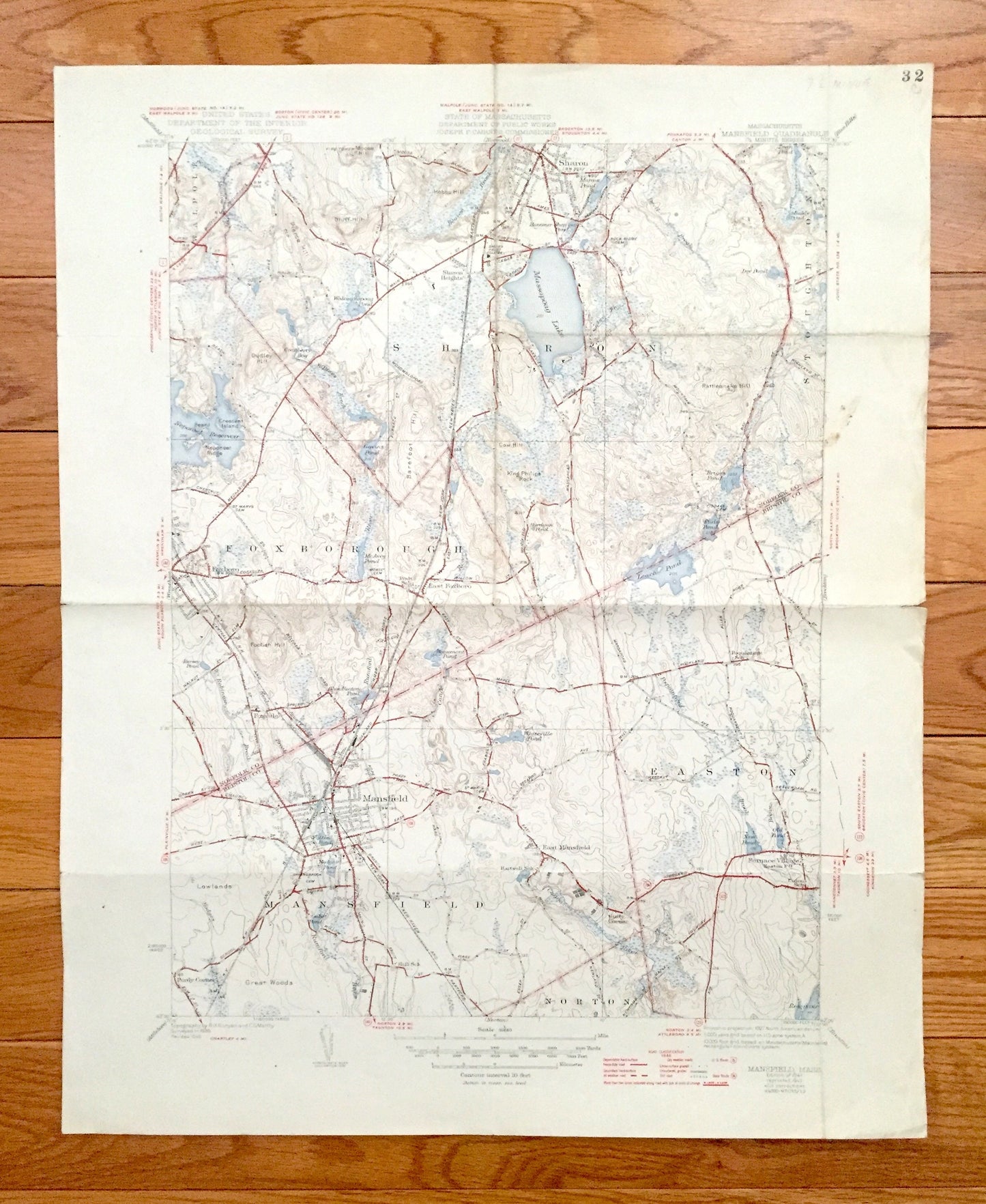
Antique Mansfield, Massachusetts 1941 US Geological Survey Topographic Map – Sharon, Foxborough, Norton, Easton, Furnace Village, Stoughton
Antique Mansfield, Massachusetts 1941 US Geological Survey Topographic Map – Sharon, Foxborough, Norton, Easton, Furnace Village, Stoughton
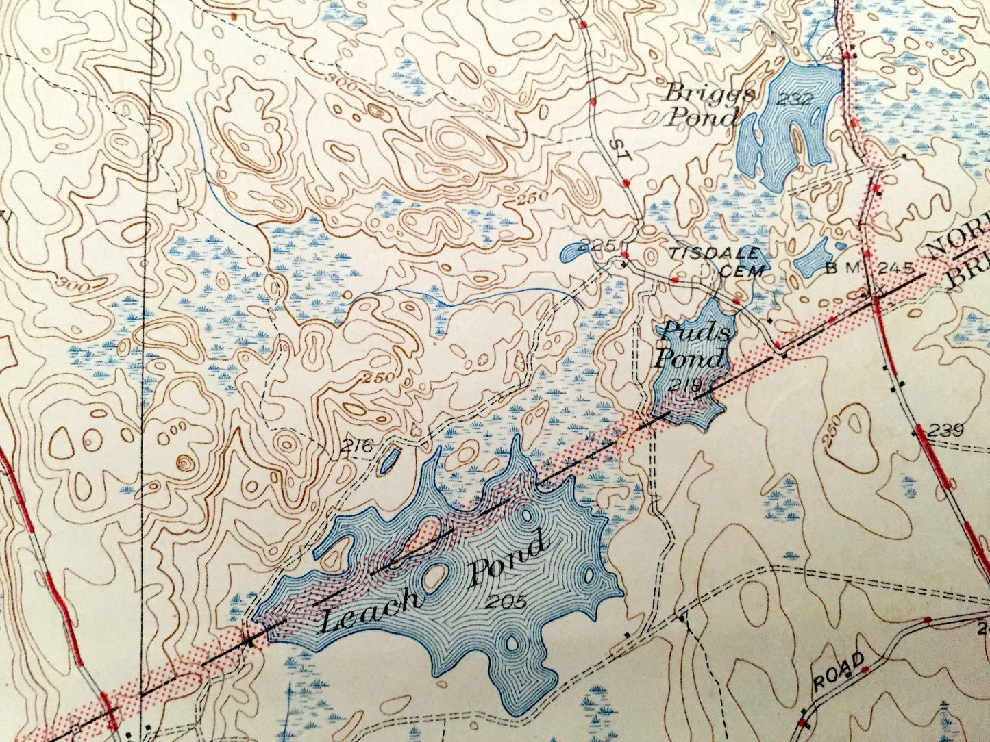
Beautiful, antique map of Mansfield, Easton, Foxborough, Sharon, Massachusetts. This is an authentic 1941 edition, 1947 print from the U.S. Geological Survey and NOT a computer reproduction.
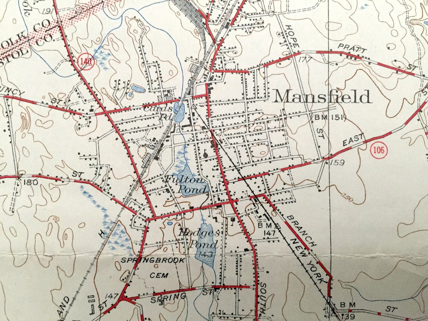
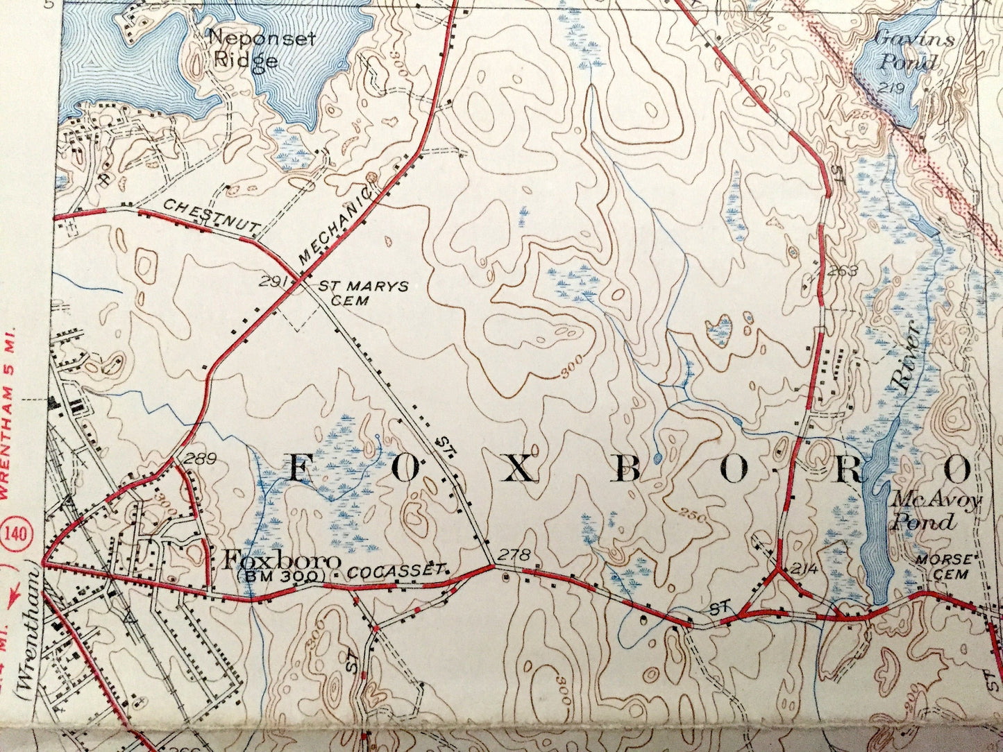
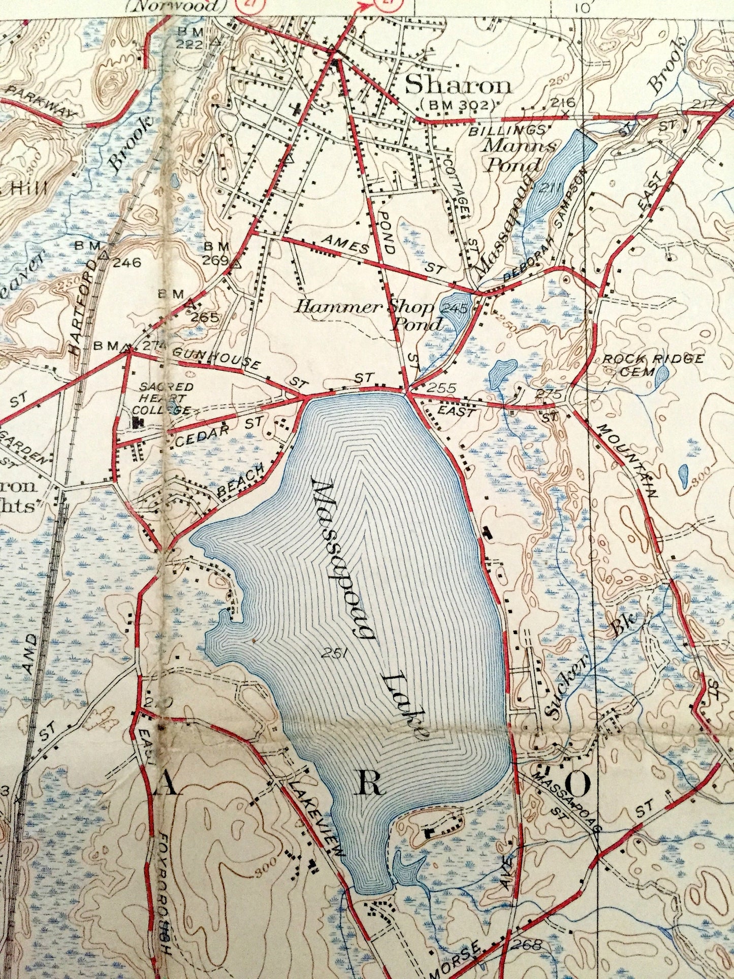
See what Norfolk and Bristol Counties looked like over 75 years ago. Lots of intricate details and geological contours. Map even has little squares for every house that existed at the time. The USGS cartographers were very thorough back then! On the back is a description of topographic symbols and map guide.
Perfect for the historian, map-lover, the curious or just as a conversation starter. Wonderful and rare. Vintage maps such as these make great gifts.
Edition of 1941, printed 1947
Dimensions: 17" width x 21" height
----
Features
Cities & Towns: Walpole, Sharon, Foxborough, Mansfield, Norton, Furnace Village, Easton, Stoughton, Sharon Heights, East Foxboro, Foxvale, Ginty Corner.
Points of Interest: Massapoag Lake, Leach Pond, Neponset Reservoir, Neponset Ridge, Cranberry Bog, Pratt School, New York New Haven and Hartford Railroad, Hartwell School, Easton Post Office, Union School, Poquanticut School, and lots more hills, mountains, streams, ponds, houses, schools and roads.
Condition: Good Vintage condition, commensurate with age. This map is in great shape for being over 70 years old. Has some wear, stamp in upper right corner and folds as-issued, but these will flatten easily and all will add to vintage character when framed.
----
We will happily adjust shipping price for multiple purchases. Maps are rolled up and shipped in sturdy mailing tubes, never folded.
Couldn't load pickup availability
Share