My Store
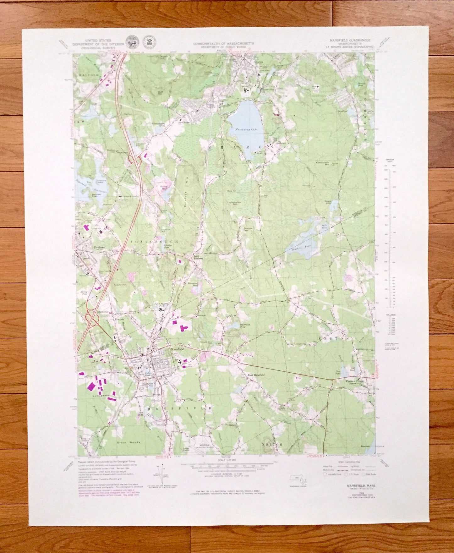
Antique Mansfield, Massachusetts 1964 US Geological Survey Topographic Map – Norfolk, Bristol County, Foxborough, Stoughton, Walpole, MA
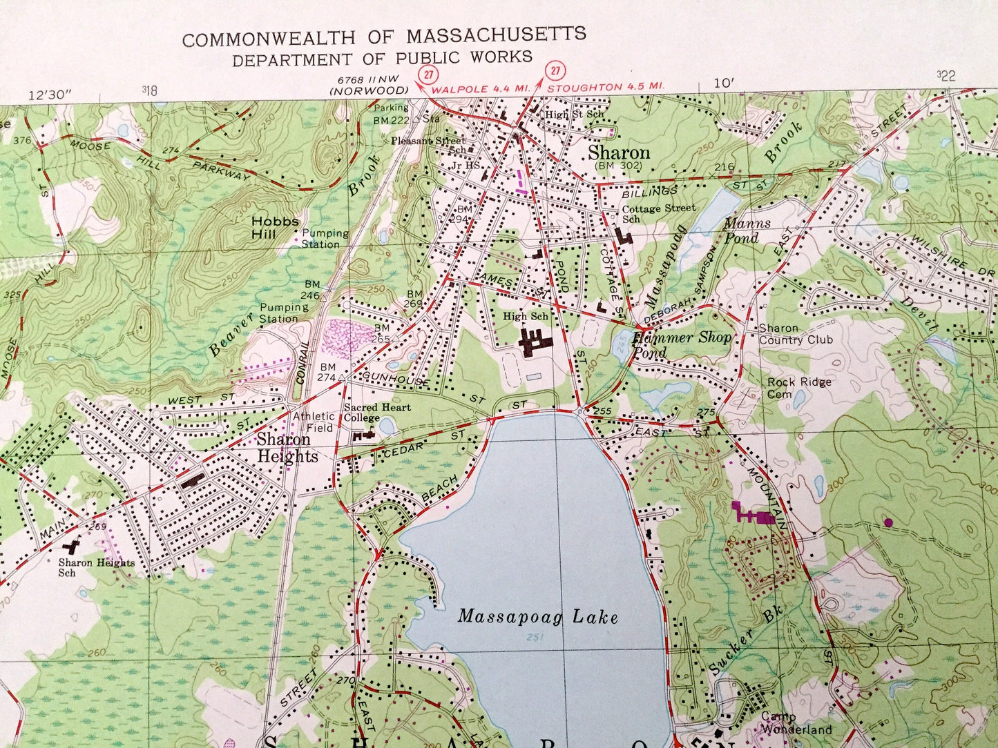
Antique Mansfield, Massachusetts 1964 US Geological Survey Topographic Map – Norfolk, Bristol County, Foxborough, Stoughton, Walpole, MA
Beautiful, antique map of Mansfield, Massachusetts and surrounding Norfolk & Bristol County areas. This is an authentic 1964 edition, 1979 print from the U.S. Geological Survey and NOT a computer reproduction.
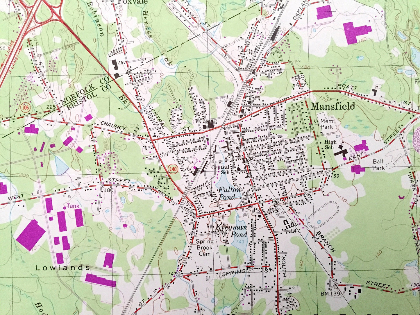
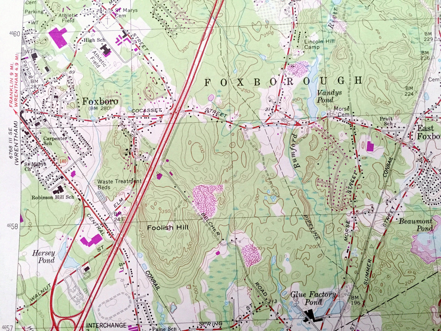
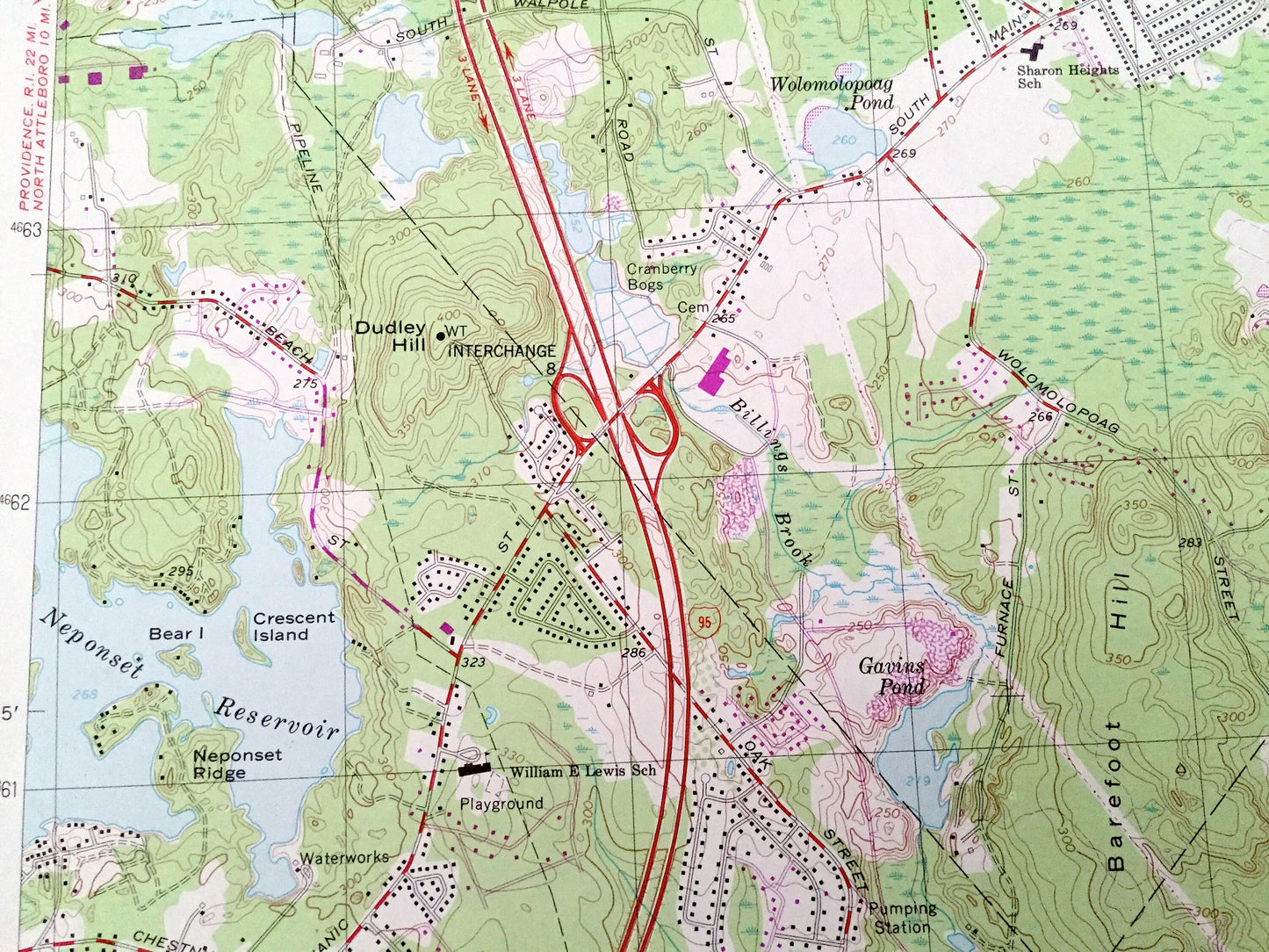
See what Massachusetts looked like over 55 years ago. Lots of intricate details and geological contours. Map even has little squares for every house that existed at the time. The USGS cartographers were very thorough back then!
Perfect for the historian, map-lover, the curious or just as a conversation starter. Wonderful and rare. Vintage maps such as these make great gifts.
Edition of 1964, printed 1979
Dimensions: 22" width x 27" height
----
Features
Cities & Towns: Sharon, Easton, Sharon Heights, Foxboro, East Foxboro, Foxvale, Purdy Corner, Norton, East Mansfield, Furnace Village, Ginty Corner.
Points of Interest: Sacred Heart College, Mansfield Municipal Airport, Lincoln Hill Camp, Bluff Hill, Hobbs Hill, Dudley Hill, Cow Hill, Rattlesnake Hill, Great Woods, Massapoag Lake, Neponset Reservoir, Leach Pond, Fulton Pond, Kingman Pond, Puds Pond, Rumford River, Canoe River, Beaver Brook, Poquanticut Brook, Hodges Brook, and many more hills, streams, ponds, houses, schools, railroads, churches and roads.
Condition: Very Good Vintage condition, commensurate with age. This map is in great shape for being over 40 years old. Has subtle edge-wear but will read as character when framed.
----
We will happily adjust shipping price for multiple purchases. Maps are rolled up and shipped in sturdy mailing tubes, never folded.
Couldn't load pickup availability
Share