My Store
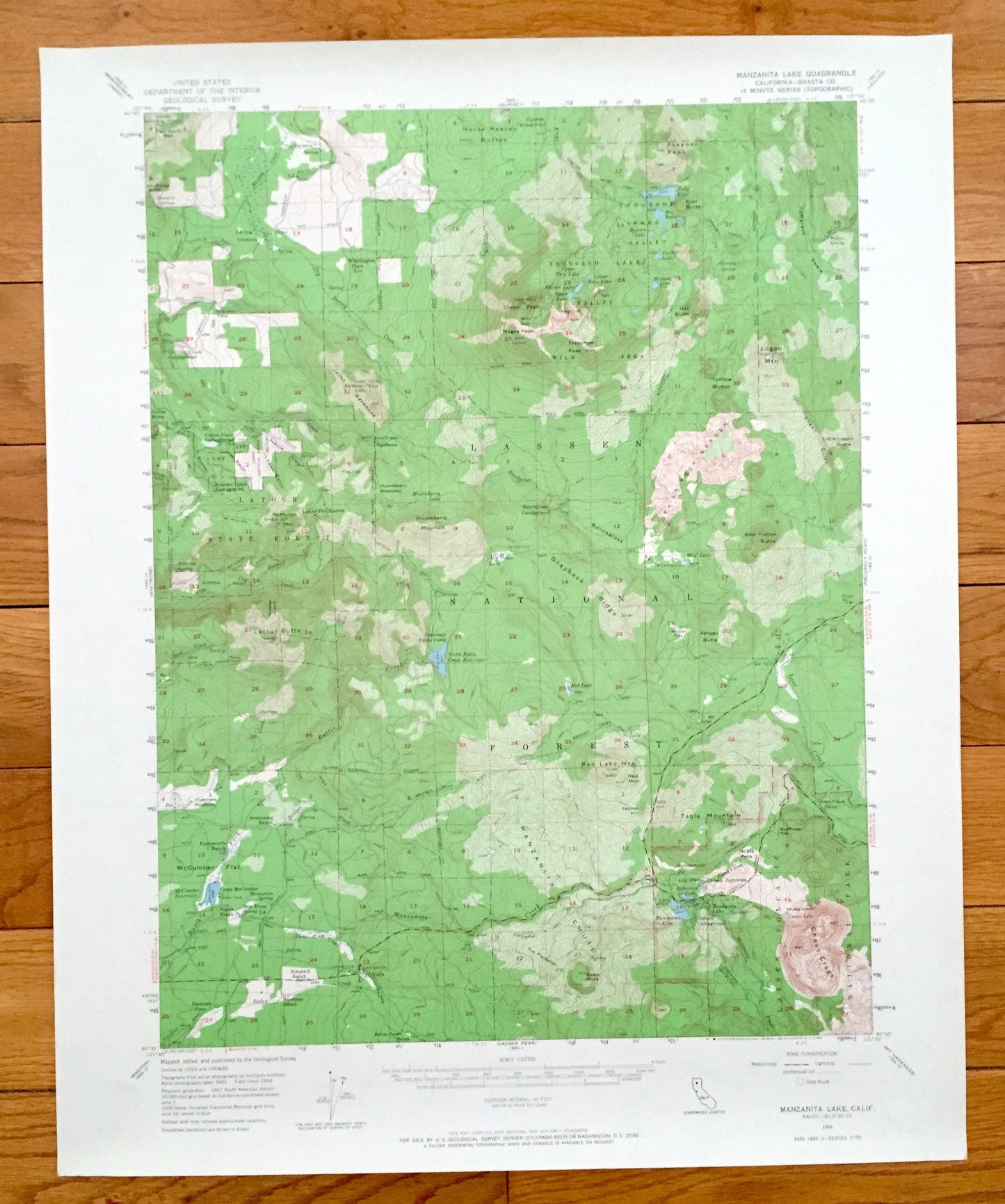
Antique Manzanita Lake, California 1956 US Geological Survey Topographic Map – Shasta County, Lassen Forest, Latour, Thousand Valley Lake CA
Antique Manzanita Lake, California 1956 US Geological Survey Topographic Map – Shasta County, Lassen Forest, Latour, Thousand Valley Lake CA
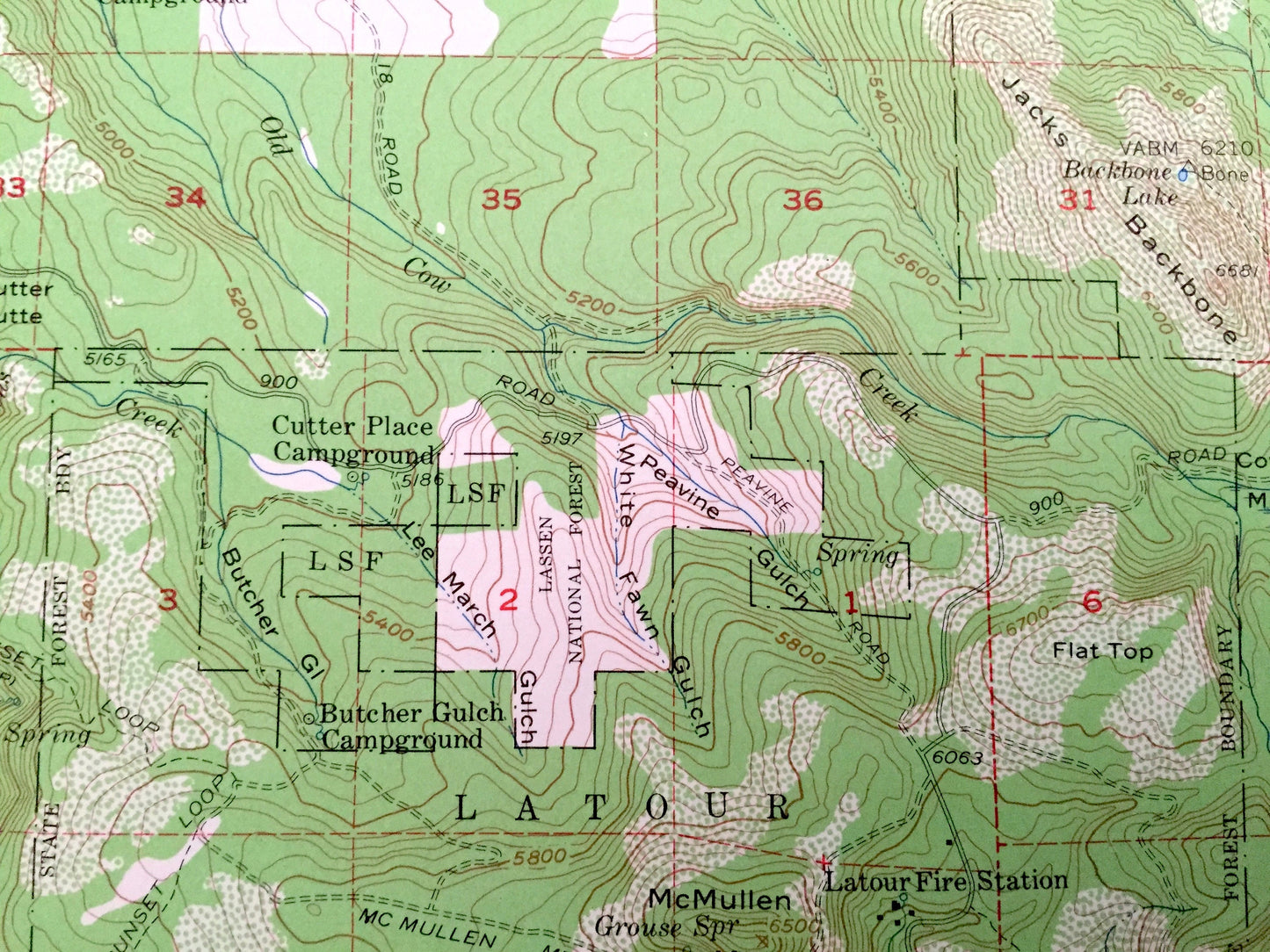
Beautiful, antique map of Manzanita Lake, California and surrounding Shasta County area of Lassen National Forest. This is an authentic 1956 edition, 1965 print from the U.S. Geological Survey and NOT a computer reproduction.
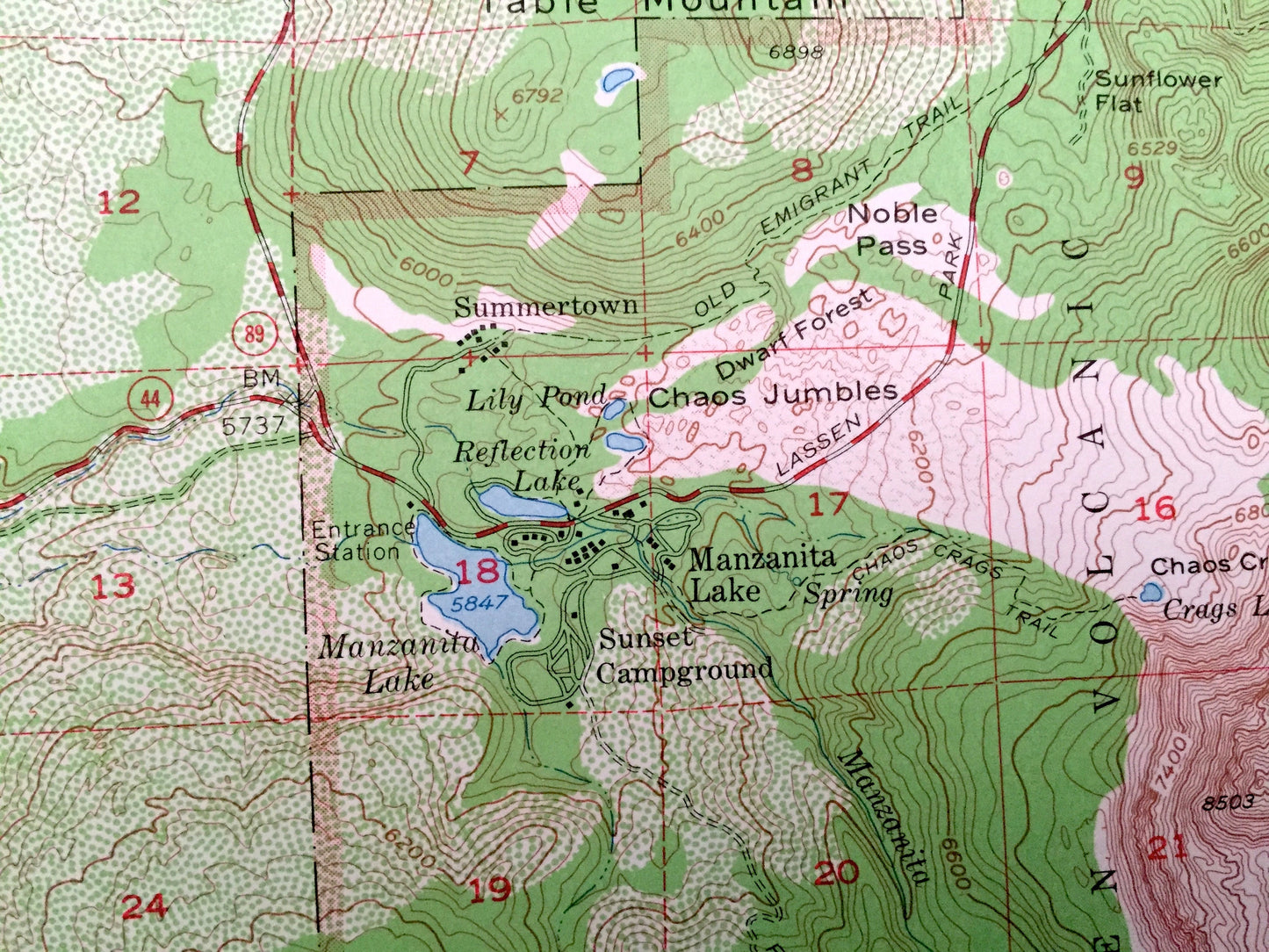
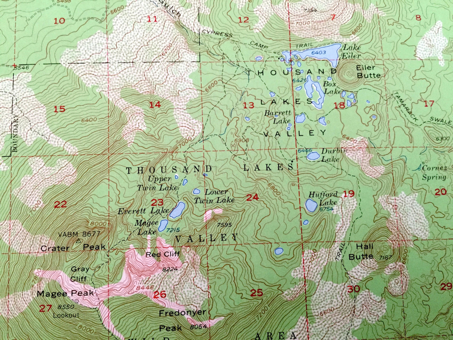
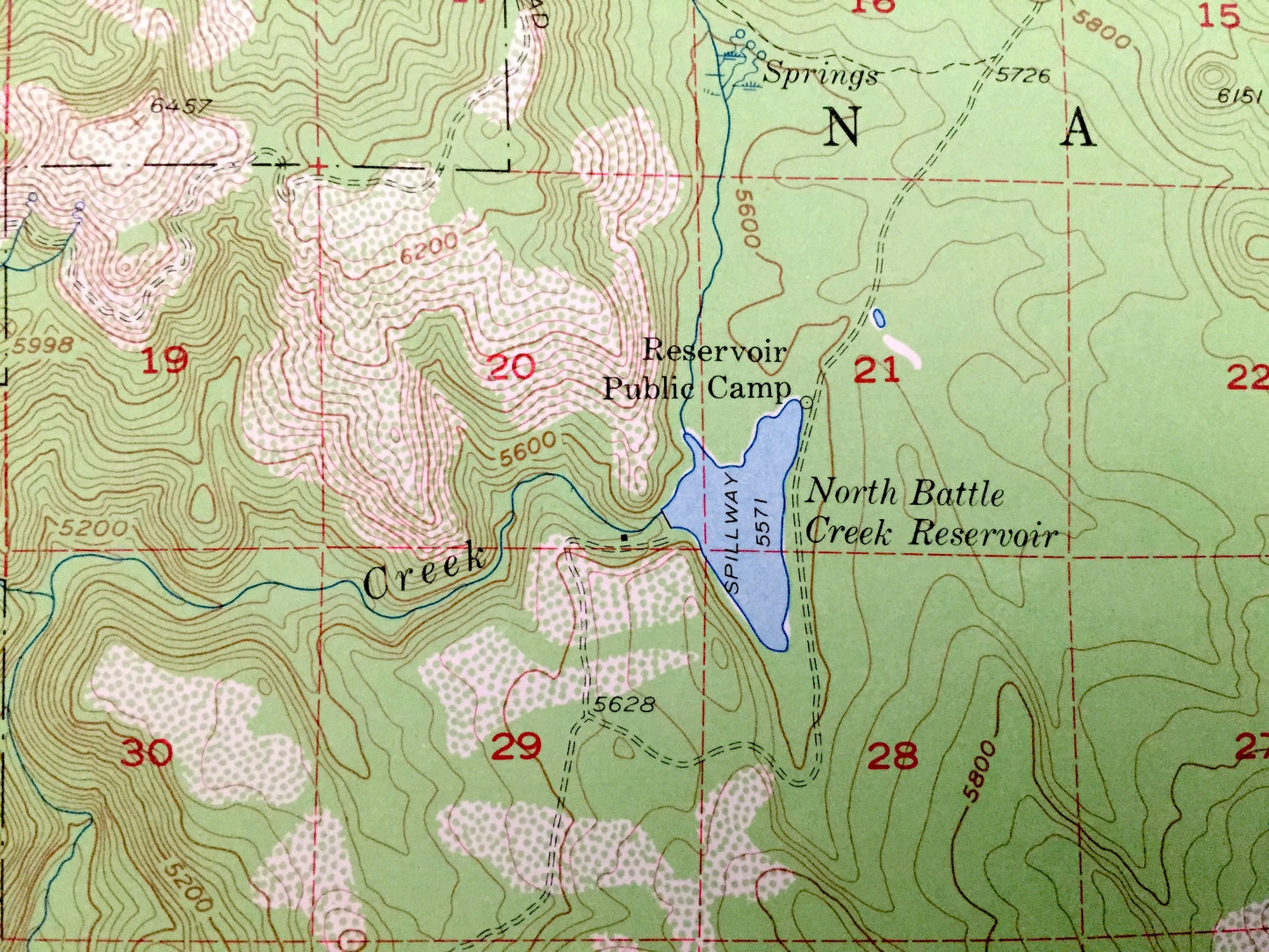
See what California looked like over 60 years ago. Lots of intricate details and geological contours. Map even has little squares for every house that existed at the time. The USGS cartographers were very thorough back then!
Perfect for the historian, map-lover, the curious or just as a conversation starter. Wonderful and rare. Vintage maps such as these make great gifts.
Edition of 1956, printed 1965
Dimensions: 17" width x 21" height
----
Features
Cities & Towns: Washington Place, Viola, Manzanita Lake, Summertown.
Points of Interest: Shasta County, Manzanita Lake, North Battle Creek Reservoir, McCumber Reservoir, Lassen National Forest, Lassen Volcanic National Park, Chaos Crags, Tamarack Swale, Latour State Forest, Thousand Valley Lakes, Thousand Valley Wild Area, Manzanita Chute, Grayback Ridge, Bunchgrass Valley, Fredonyer Peak, Jacks Backbone, Latour Butte, Bear Walle Butte, Table Mountain, and lots more hills, mountains, canyons, creeks, houses, roads, ranches and camps.
Condition: Very Good condition, commensurate with age. This map is in incredible shape for being over 50 years old.
----
We will happily adjust shipping price for multiple purchases. Maps are rolled up and shipped in sturdy mailing tubes, never folded.
Couldn't load pickup availability
Share