My Store
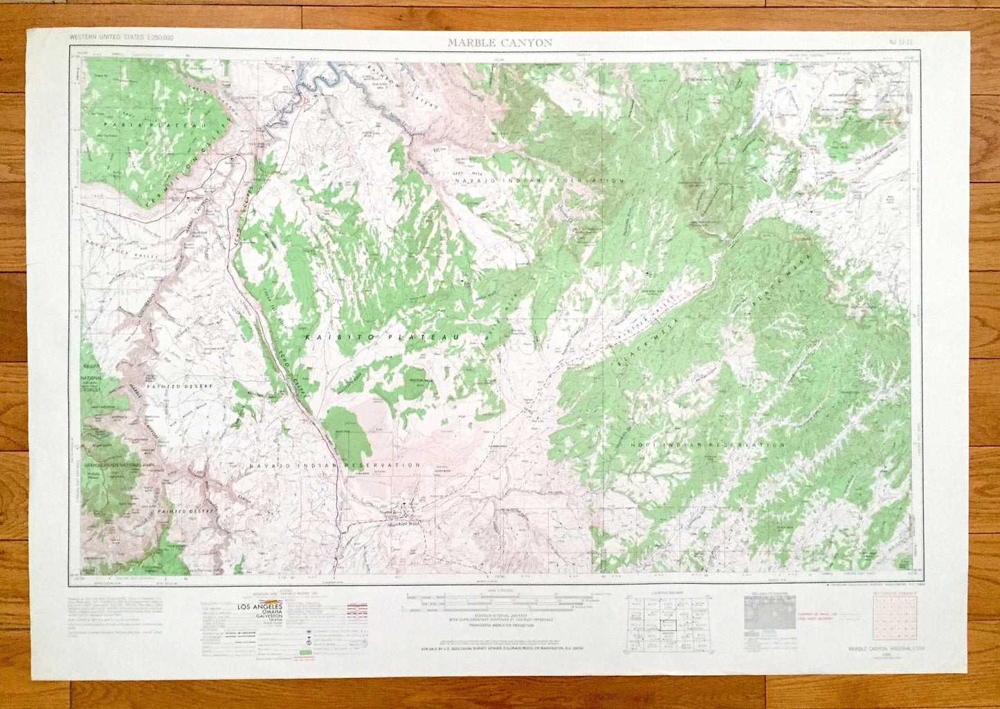
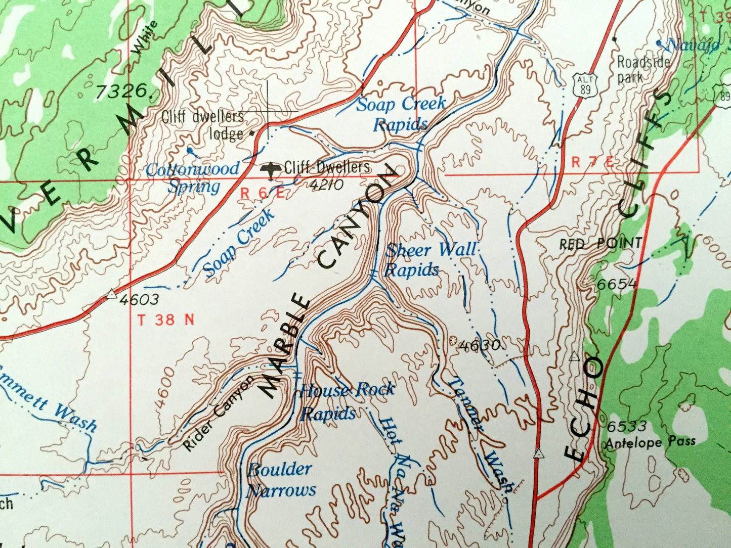
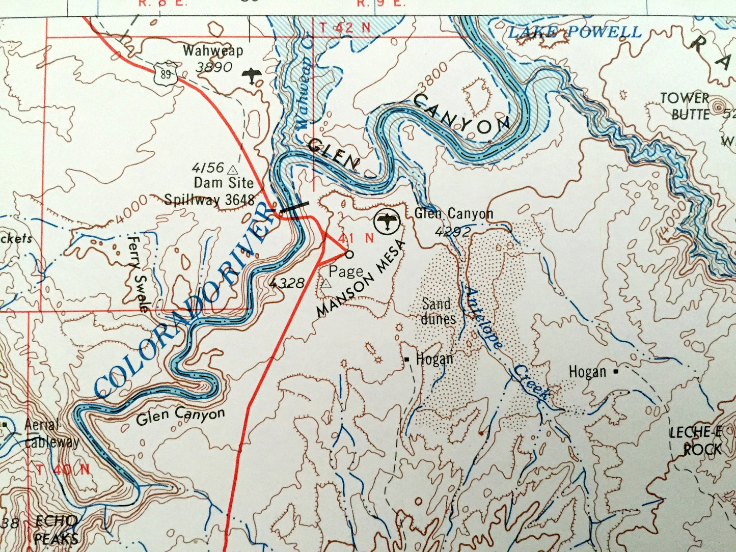
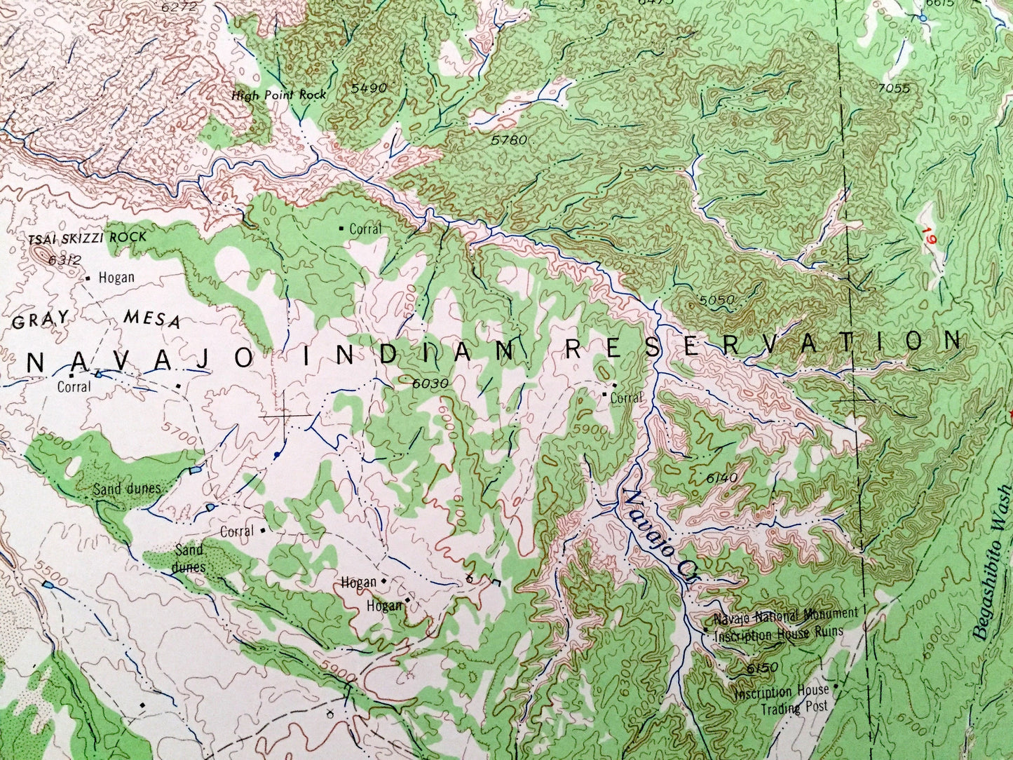
Antique Marble Canyon, Arizona 1956 US Geological Survey Topographic Map – Tuba City, Moenkopi, Page, Kaibito, Shonto, Colorado River, Utah
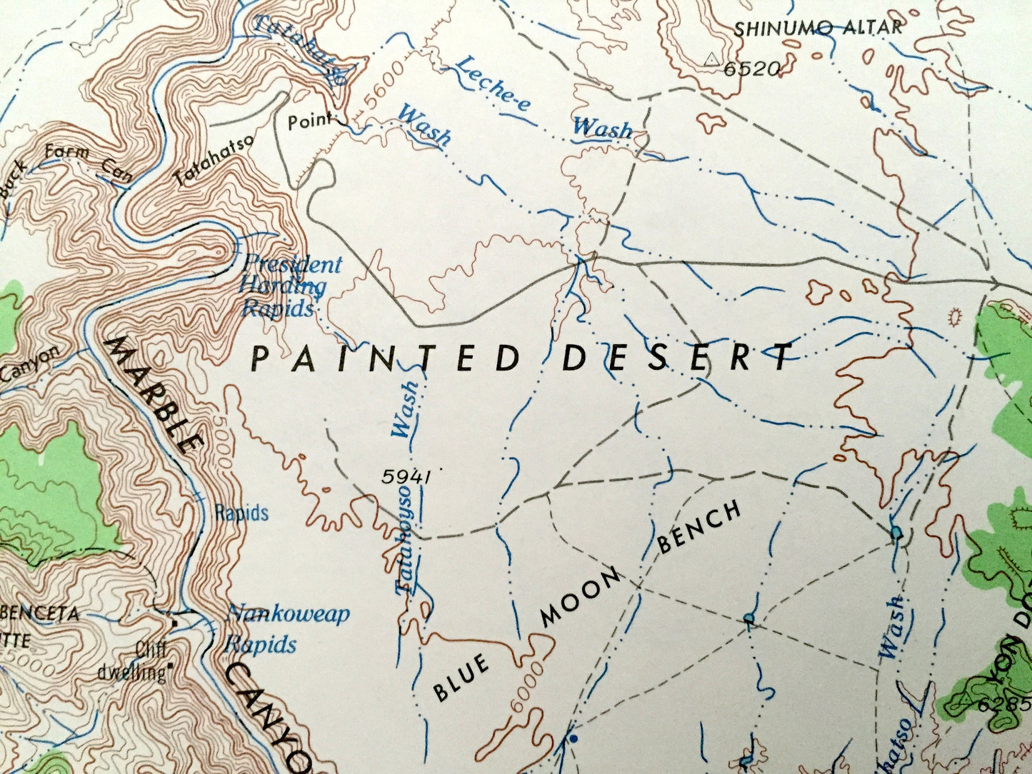
Antique Marble Canyon, Arizona 1956 US Geological Survey Topographic Map – Tuba City, Moenkopi, Page, Kaibito, Shonto, Colorado River, Utah
Beautiful, antique map of Marble Canyon, Arizona and surrounding Utah areas. This is an authentic 1956 edition, 1968 print from the U.S. Geological Survey and NOT a computer reproduction.
See what Arizona and Utah looked like over 65 years ago. Lots of intricate details and geological contours. Map is incredibly large and in the grand 1:250,000 scale. The USGS cartographers were very thorough back then!
Perfect for the historian, map-lover, the curious or just as a conversation starter. Wonderful and rare. Vintage maps such as these make great gifts.
Edition of 1956, printed 1968
Dimensions: 32" width x 22 1/2" height
----
Features
Cities & Towns: Marble Canyon, Tuba City, Moenkopi, Page, Kaibito, Shonto.
Points of Interest: Grand Canyon National Park, Haibab National Forest, Kaibito Plateau, Paria Plateau, Rainbow Plateau, Navajo Indian Reservation, Hopi Indian Reservation, Echo Cliffs, Vermilion Cliffs, House Rock Valley, Klethla Valley, Black Mesa, Gray Mesa, Moenkopi Wash, Hamblin Wash and San Juan County, Utah and lots more hills, mountains, lakes, rivers, creeks, islands, roads, highways and railroads.
Condition: Very Good Vintage condition, commensurate with age. This map is in great shape for being over 50 years old. Has light edge-wear, all of which will read as vintage character when framed.
----
We will happily adjust shipping price for multiple purchases. Maps are rolled up and shipped in sturdy mailing tubes, never folded.
Couldn't load pickup availability
Share