My Store
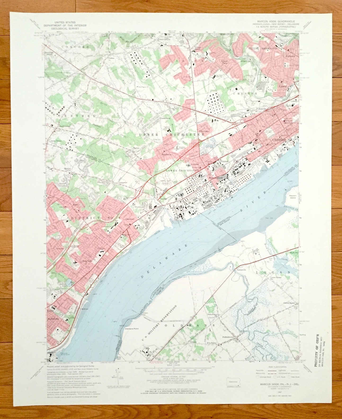
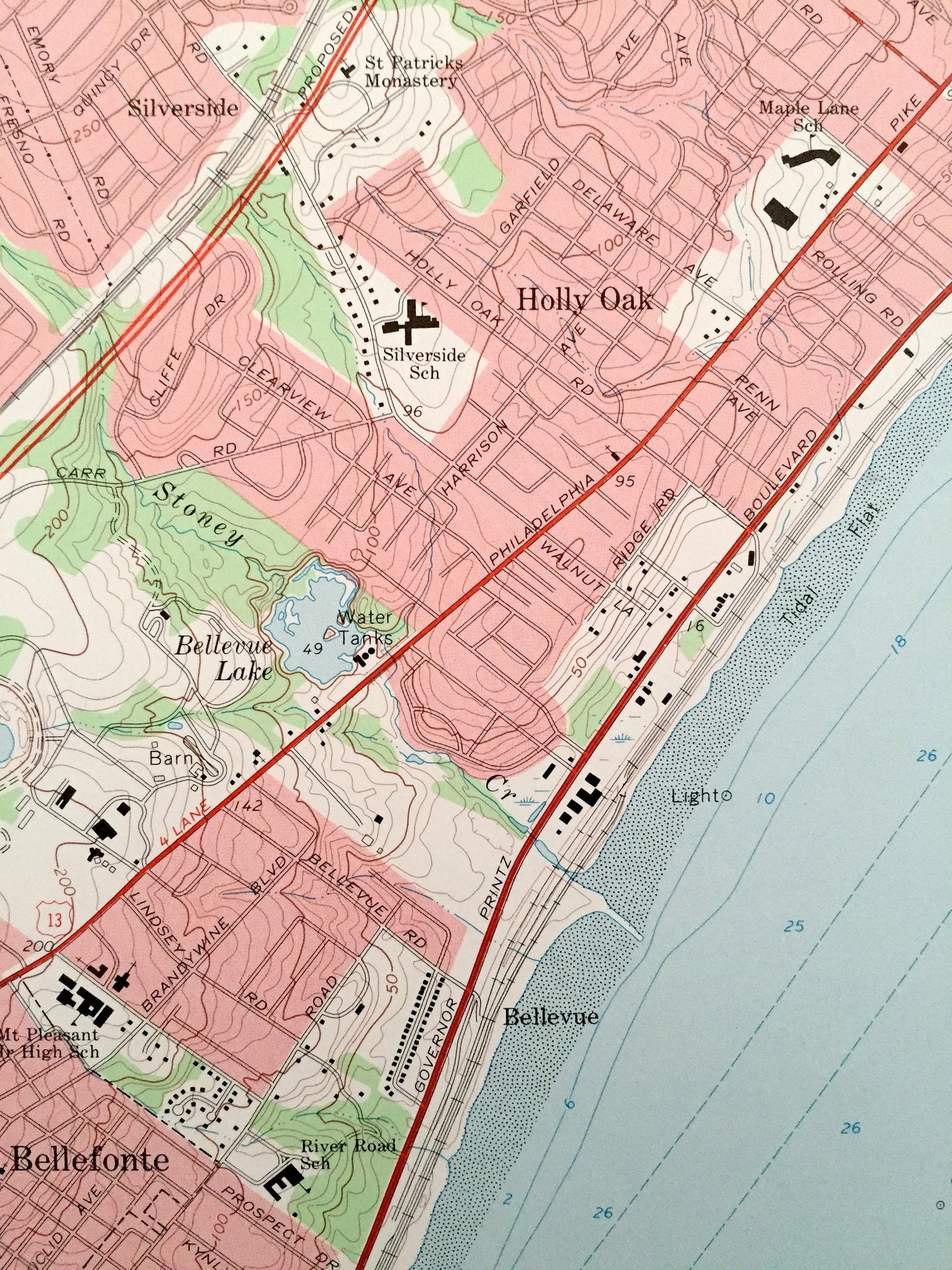
Antique Marcus Hook, Pennsylvania 1967 US Geological Survey Topographic Map – Chichester, Bethel, Oldmans, New Jersey & Holly Oak, Delaware
Antique Marcus Hook, Pennsylvania 1967 US Geological Survey Topographic Map – Chichester, Bethel, Oldmans, New Jersey & Holly Oak, Delaware
Beautiful, antique map of Concord, Aston, Chester, and Marcus Hook, Pennsylvania including District No 6 of Delaware and Oldmans and Logan, New Jersey. This is an authentic 1967 print from the U.S. Geological Survey and NOT a computer reproduction.
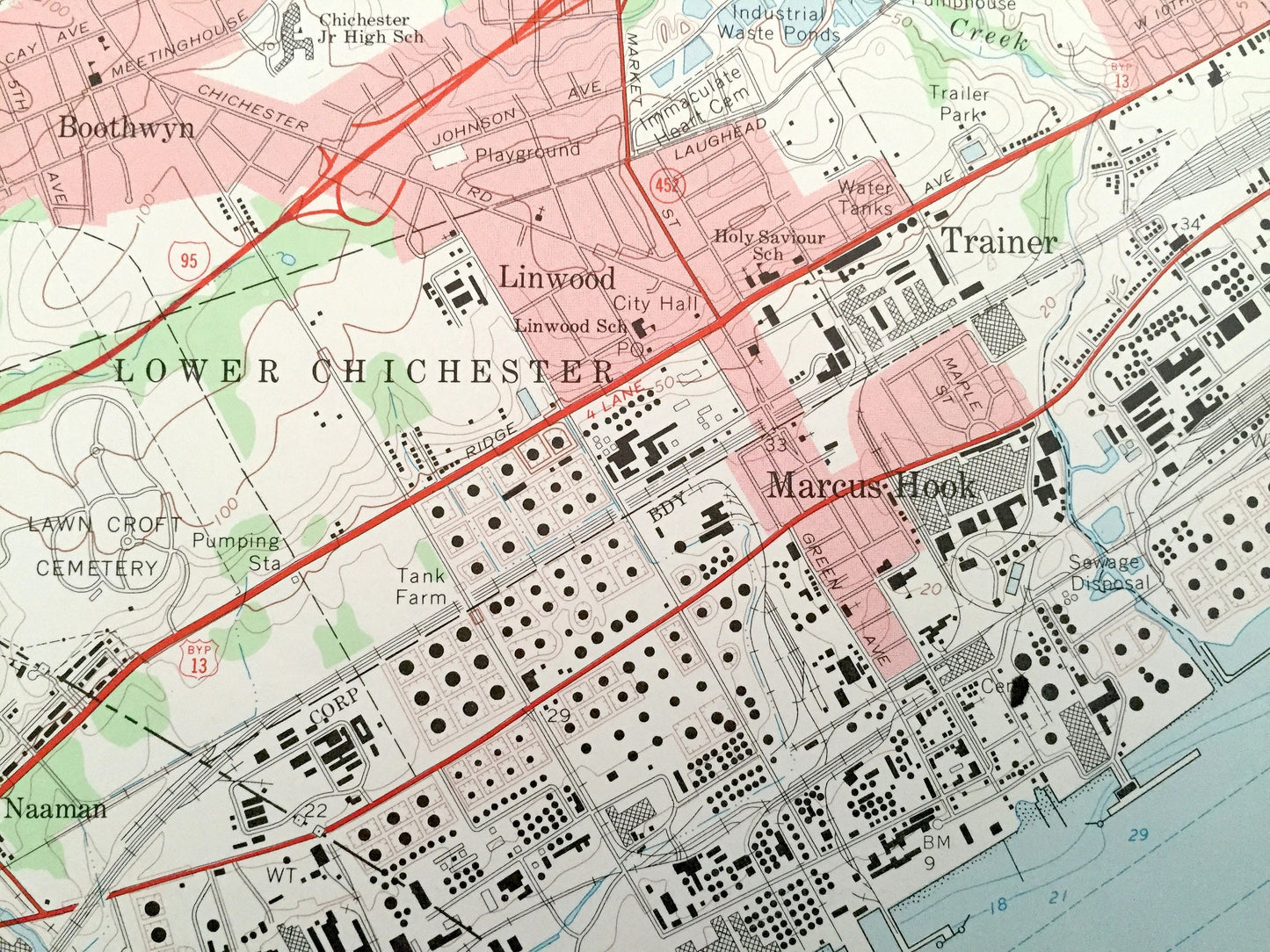
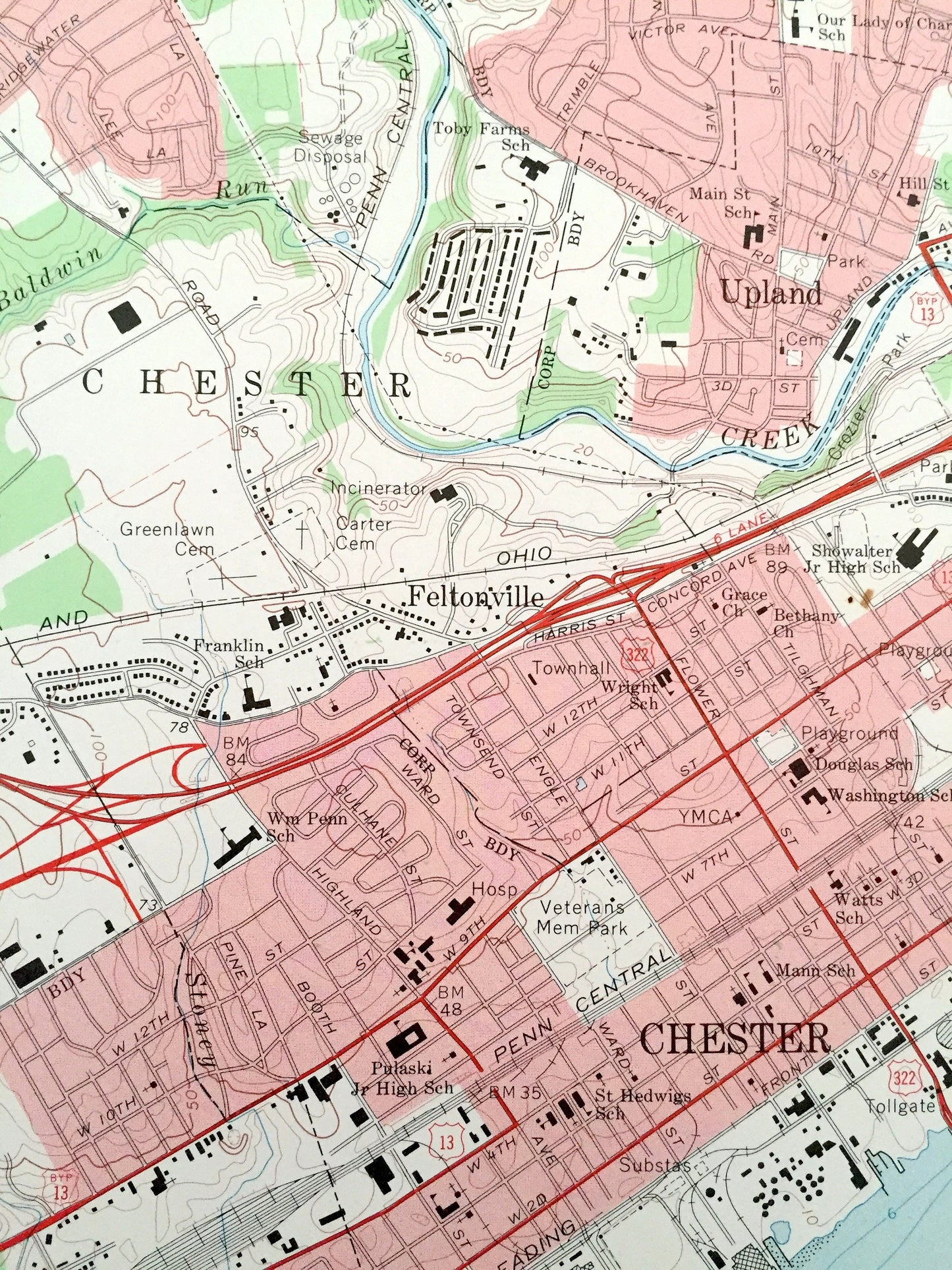
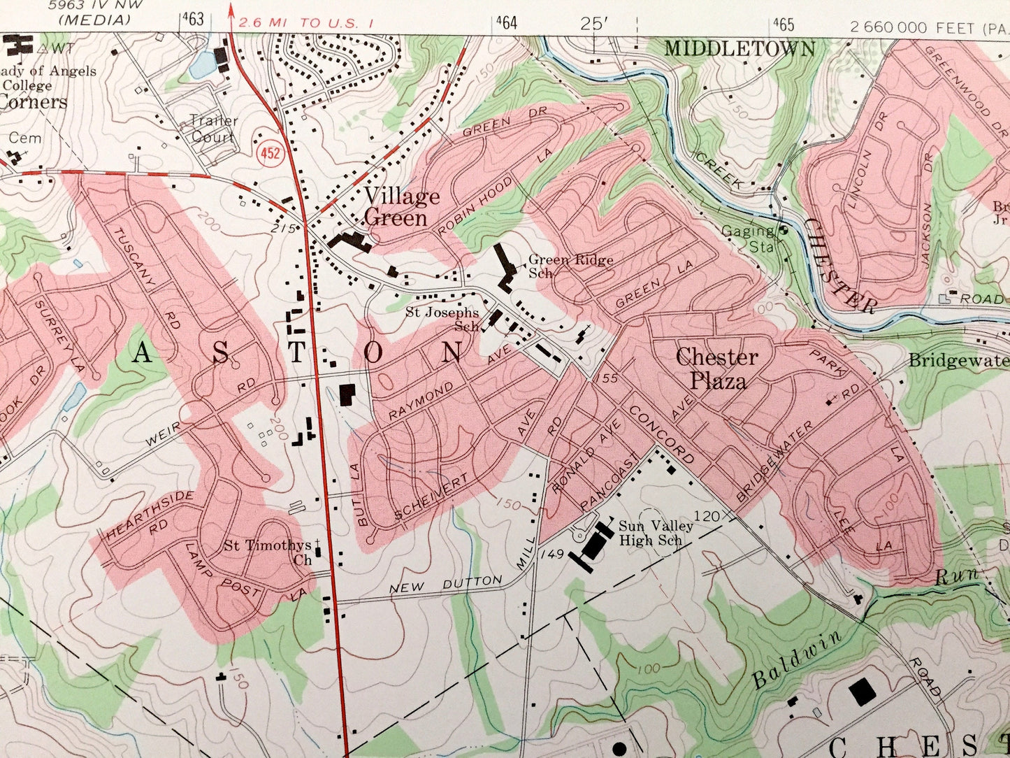
See what Delaware County of Pennsylvania, New Castle County of Delaware, and Salem & Gloucester County of New Jersey looked like over 50 years ago. Lots of intricate details and geological contours. Map even has little squares for every house that existed at the time. The USGS cartographers were very thorough back then!
Perfect for the historian, map-lover, the curious or just as a conversation starter. Wonderful and rare. Vintage maps such as these make great gifts.
Edition of 1967, printed 1967
Dimensions: 22" width x 27" height
----
Features
Cities & Towns: Pennsylvania: Concord, Bethel, Upper Chichester, Lower Chichester, Linwood, Boothwyn, Ogden, Gardendale, Booth Corner, Zebly Corner ,Twin Oaks, Chester, Trainer, Marcus Hook, Parkside, Upland, Chester Plaza, Brookhaven.
Delaware: District No 6, Claymont, Worthland, Naaman, Carpenter, Arden, Silverside, Holly Oak, Bellefonte, Edgemoor, Bellevue, Hambys Corner.
New Jersey: Logan, Center Square, Oldmans, Pedricktown, Five Points, Nortonville, Jumbo.
Points of Interest: Delaware River, Pennsylvania-Reading Seashore Lines, Oldmans Creek, Raccoon Island, Maple Swamp, Oldmans Point, US Military Reservation, Tidal Flats, Penn Central Railroad, Bellevue Lake, St. Patrick's Monastery, Lighthouse, Baltimore and Ohio Railroad, Chester Creek, Clayton Park, and lots more hills, streams, ponds, schools, churches, houses, and roads.
Condition: Very Good Vintage condition, commensurate with age. This map is in great shape for being over 50 years old. This map was used in the field and has some light edge-wear, which will add vintage character when framed.
----
We will happily adjust shipping price for multiple purchases. Maps are rolled up and shipped in sturdy mailing tubes, never folded.
Couldn't load pickup availability
Share