My Store
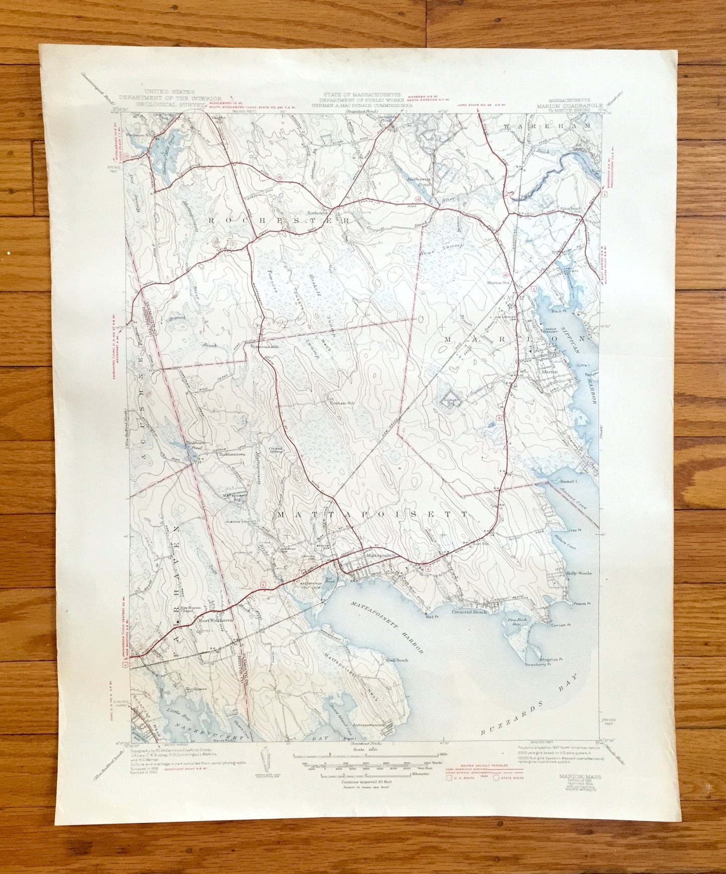
Antique Marion, Massachusetts 1941 US Geological Survey Topographic Map – Plymouth, Bristol County, Fairhaven, Rochester, Mattapoisett, MA
Antique Marion, Massachusetts 1941 US Geological Survey Topographic Map – Plymouth, Bristol County, Fairhaven, Rochester, Mattapoisett, MA
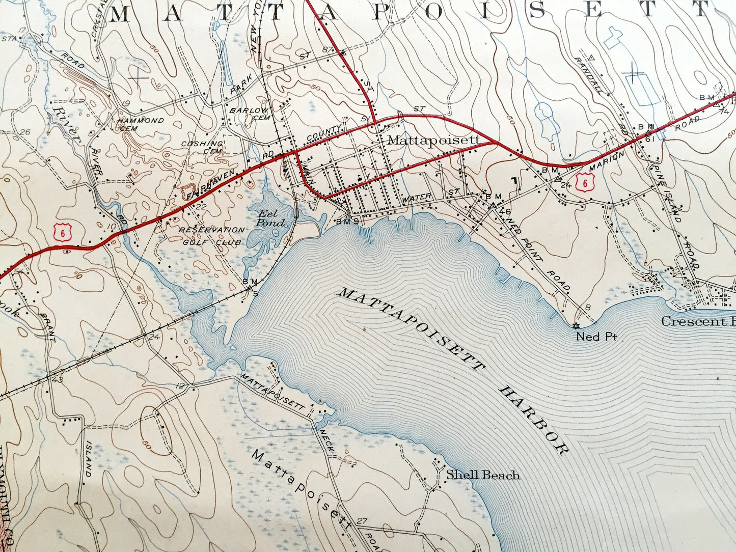
Beautiful, antique map of Marion, Massachusetts and surrounding Bristol & Plymouth County area. This is an authentic edition of 1941 edition, 1944 print from the U.S. Geological Survey and is NOT a computer reproduction.
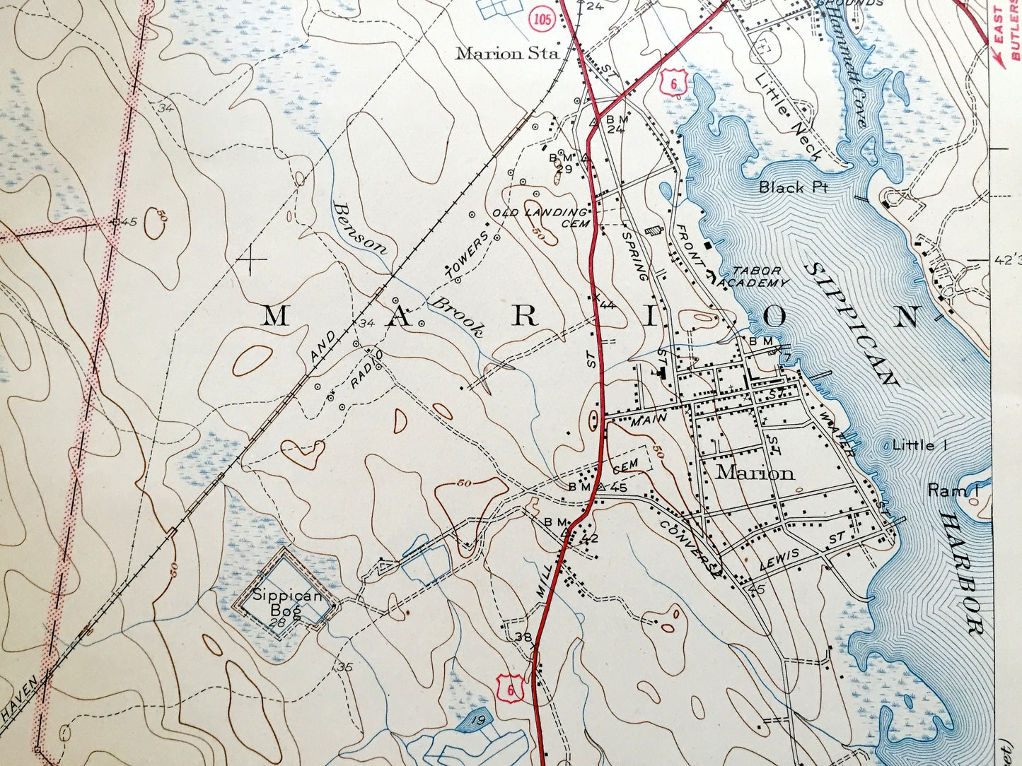
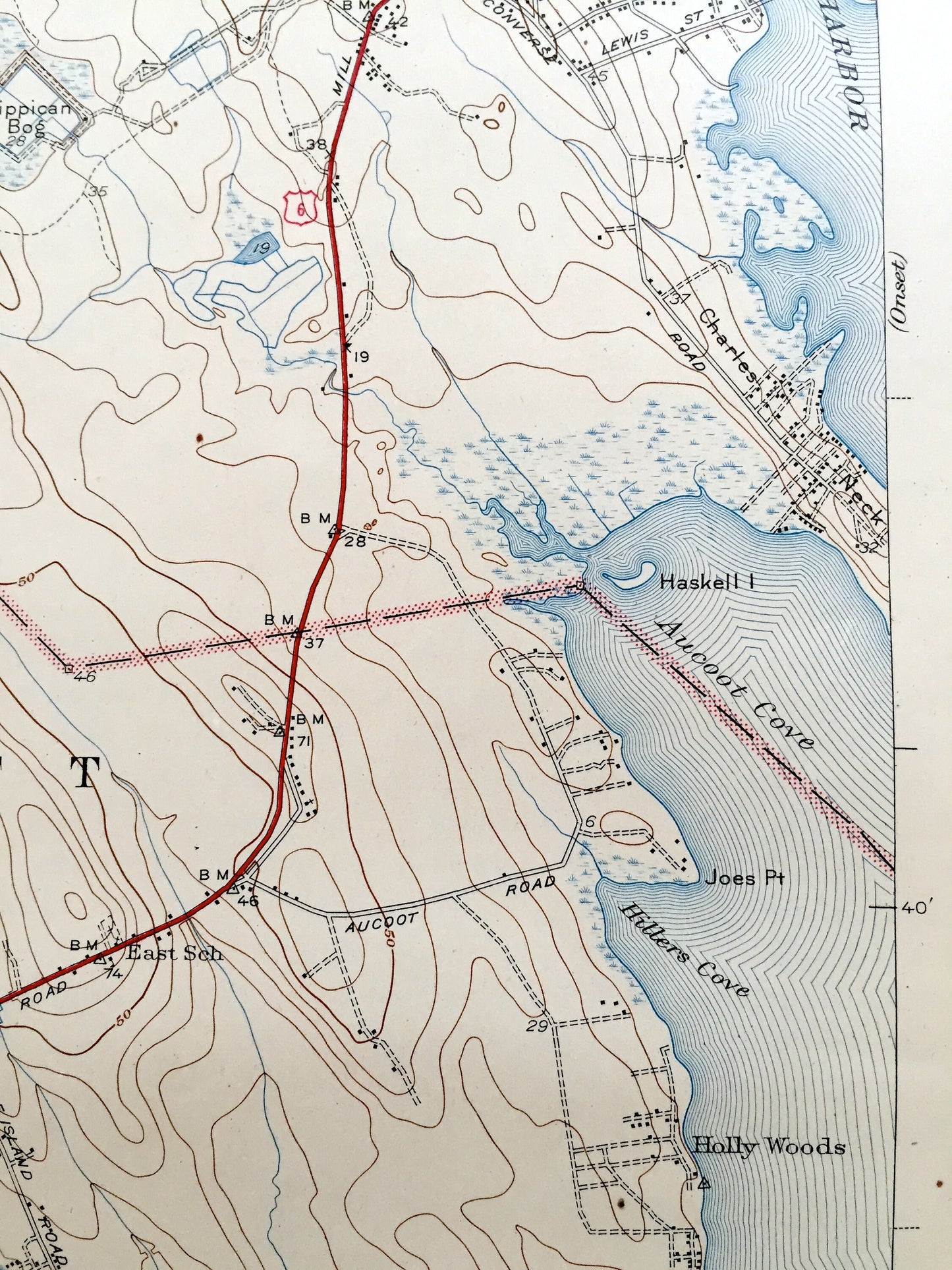
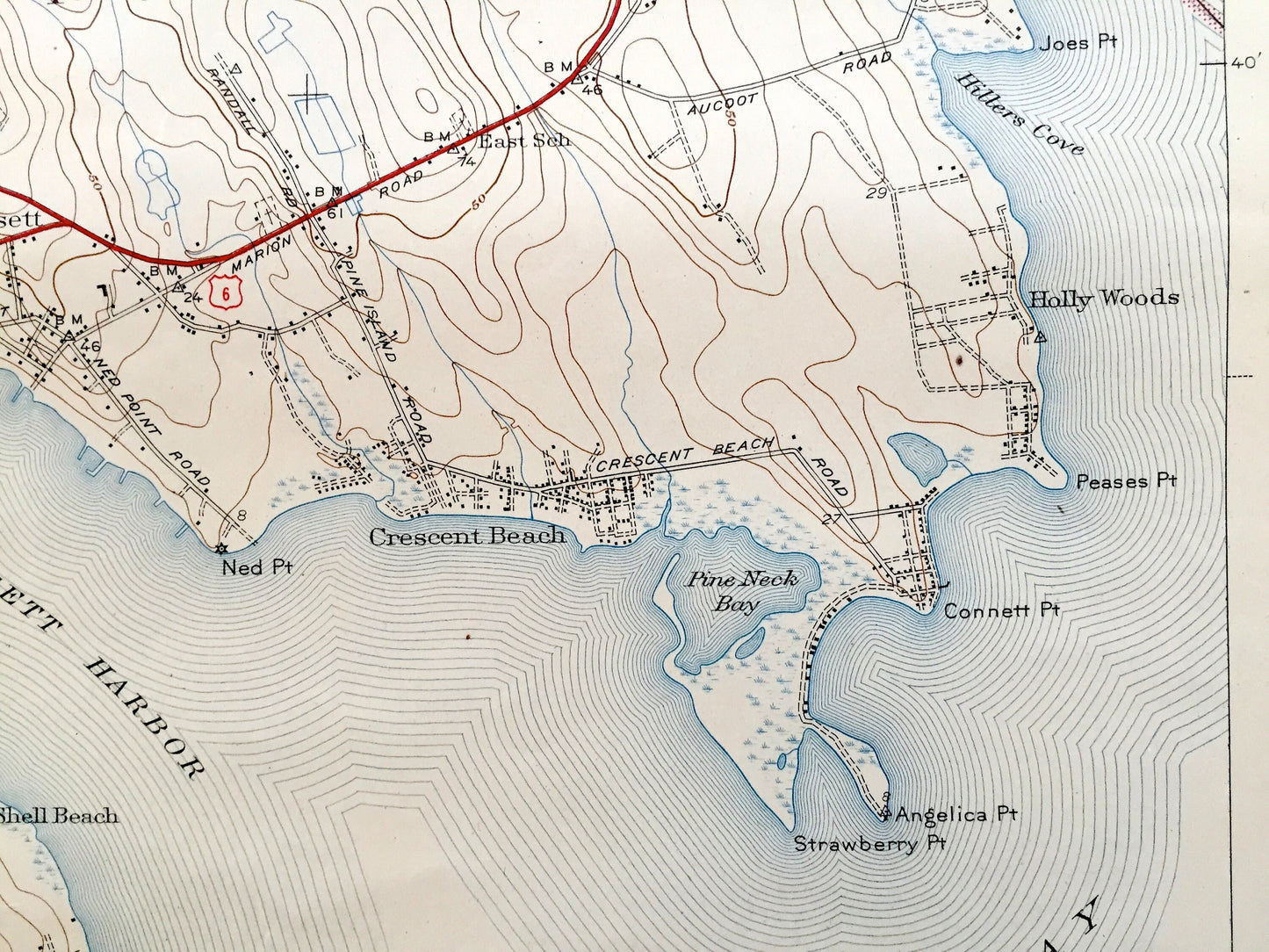
See what Massachusetts looked like over 80 years ago. Lots of intricate details and geological contours. Map even has little squares for every house that existed at the time. The USGS cartographers were very thorough back then! On the back is a description of topographic symbols and map guide.
Perfect for the historian, map-lover, the curious or just as a conversation starter. Wonderful and rare. Vintage maps such as these make great gifts.
Edition of 1941, printed 1944
Dimensions: 16 1/2" width x 20" height
----
Features
Cities & Towns: Marion, Rochester, Mattapoisett, Tinkhamtown, Acushnet, Farihaven, East Fairfaven, Wareham, Crescent Beach, Antassawamock, Knollmere.
Points of Interest: Bristol County, Plymouth County, Buzzards Bay, Nasketucket Bay, New York New Haven and Hartford Railroad, Marion Station, Sippican Bog, Sippican Harbor, Crescent Beach, Reservation Golf Club, Hathaway Pond, Aucoot Cove, New Boston Chapel, Mattapoisett Neck, Mattapoisett Harbor, Marion Camp Grounds, and many more roads, houses, reservoirs, ponds, and hills.
Condition: Good Vintage condition, commensurate with age. This map is in great shape for being about about 80 years old. Has some wear, foxing and toning, but this will all add to vintage character when framed.
----
We will happily adjust shipping price for multiple purchases
Couldn't load pickup availability
Share