My Store
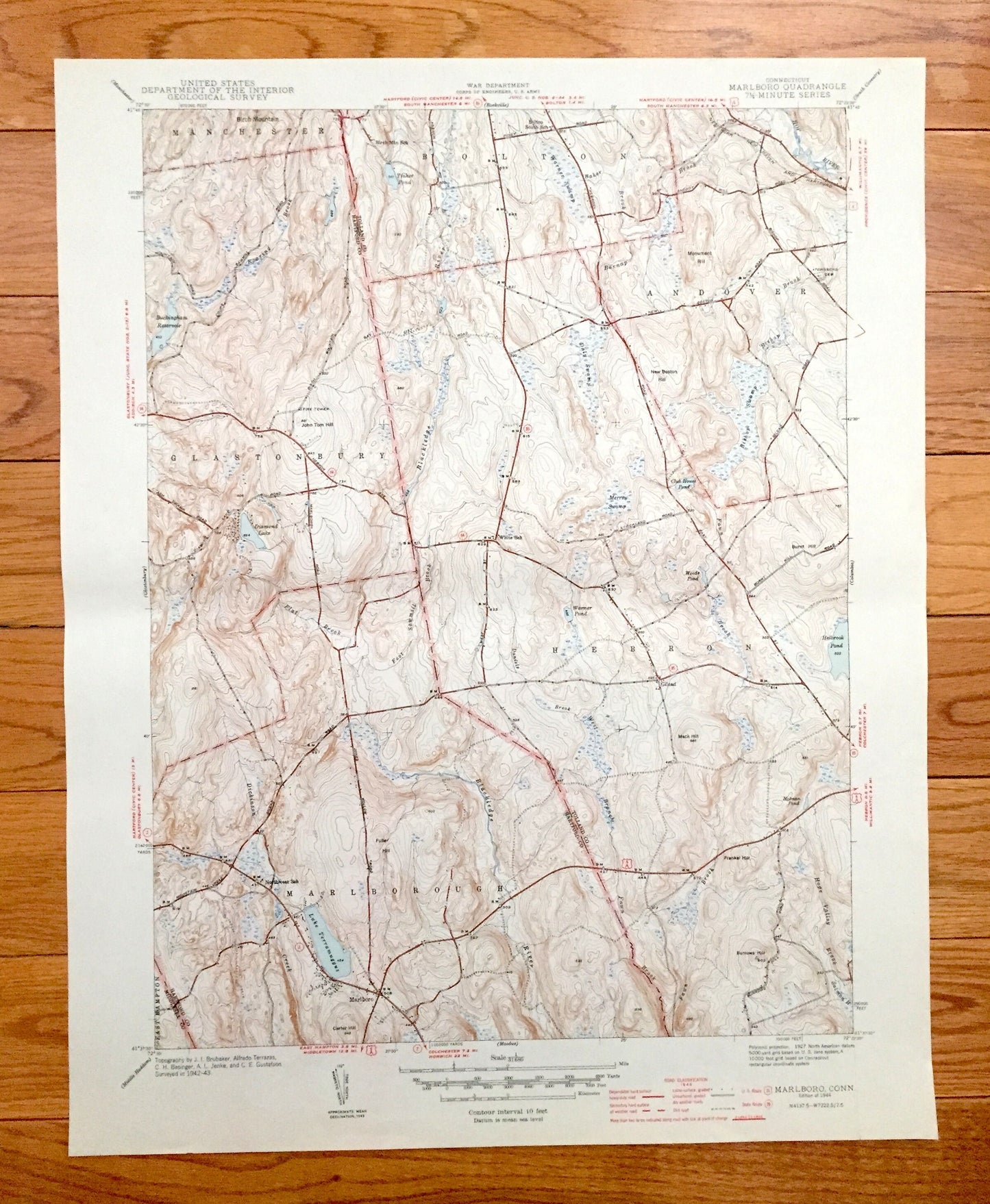
Antique Marlborough, Connecticut 1944 US Geological Survey Topographic Map – Glastonbury, Andover, Hebron, Bolton, Marlboro, Manchester, CT
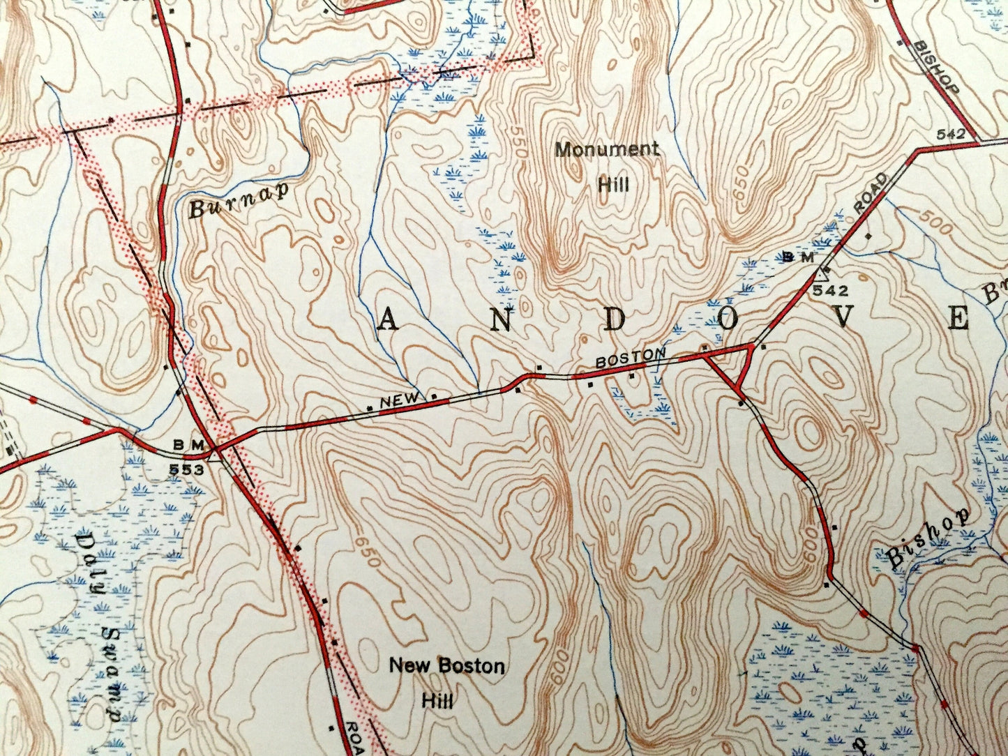
Antique Marlborough, Connecticut 1944 US Geological Survey Topographic Map – Glastonbury, Andover, Hebron, Bolton, Marlboro, Manchester, CT
Beautiful, antique map of Marlborough, Connecticut and surrounding Hartford & Tolland County area. This is an authentic 1945 print from the U.S. Geological Survey and NOT a computer reproduction.
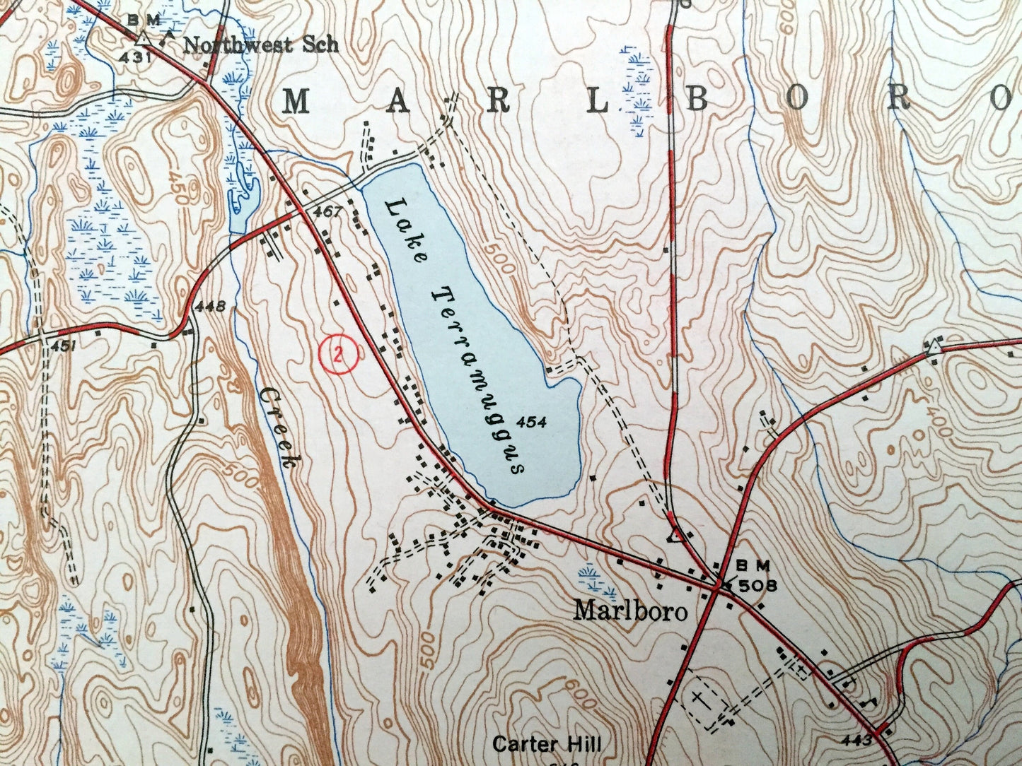
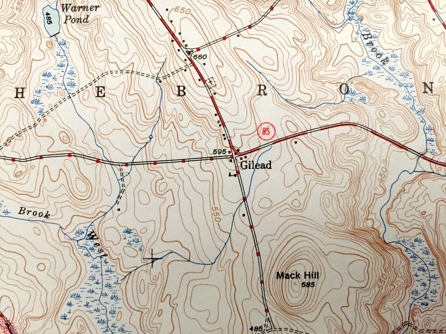
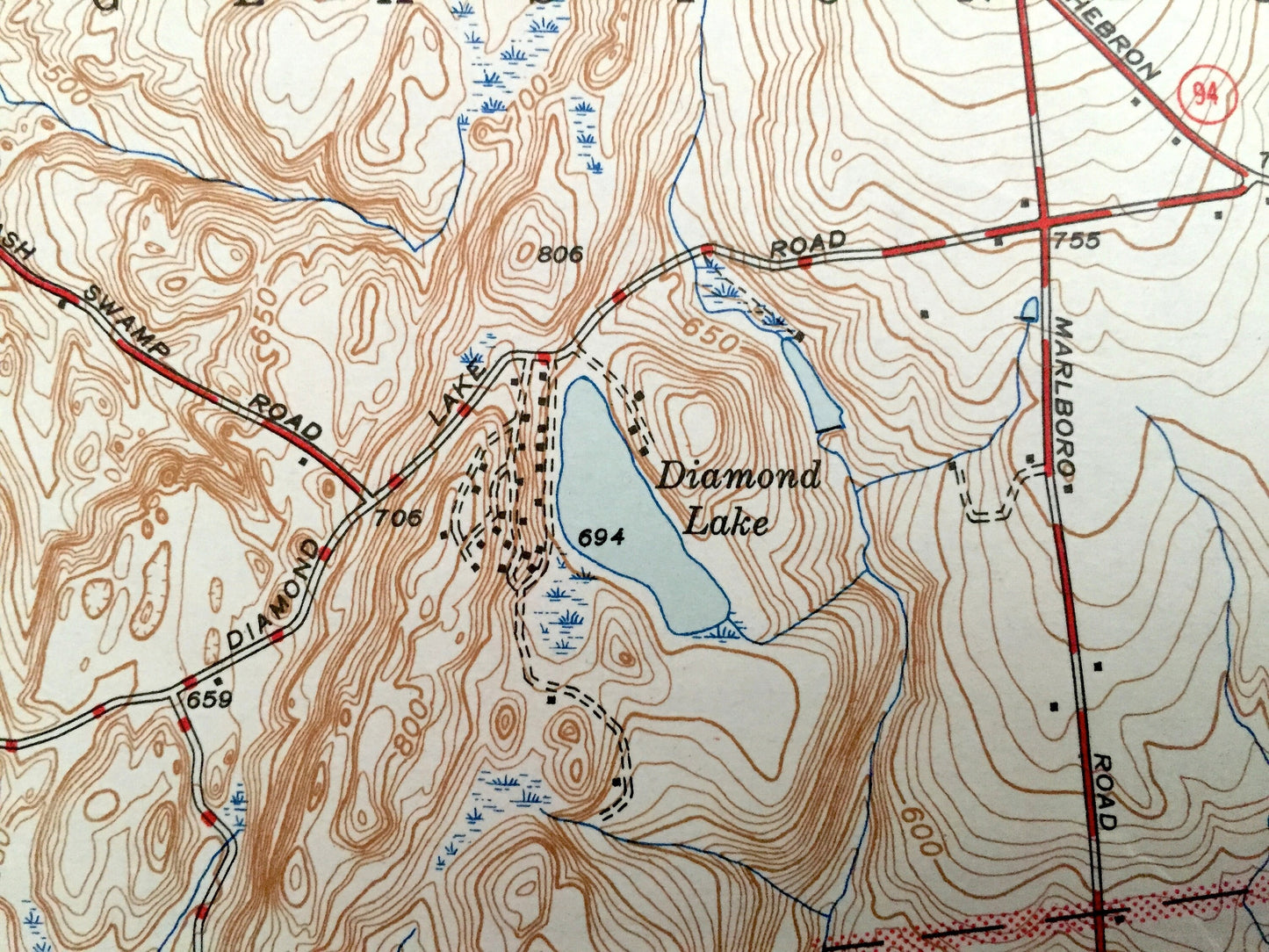
See what Connecticut looked like over 75 years ago. Lots of intricate details and geological contours. Map even has little squares for every house that existed at the time. The USGS cartographers were very thorough back then! On the back is a description of topographic symbols and map guide.
Perfect for the historian, map-lover, the curious or just as a conversation starter. Wonderful and rare. Vintage maps such as these make great gifts.
Edition of 1944, printed 1944
Dimensions: 16" width x 20" height
----
Features
Cities & Towns: Manchester, Bolton, Andover, Glastonbury, Hebron, Marlborough, Marlboro, East Hampton.
Points of Interest: Hop River, Birch Mountain, Birch Mountain School, Tinker Pond, Bolton South School, Monument Hill, John Tom Hill, Buckingham Reservoir, Diamond Lake, Lake Terramuggus, Northwest School and lots more hills, mountains, creeks, towns, schools, and roads.
Condition: Very Good Vintage condition, commensurate with age. This map is in great shape for being over 75 years old. Has some wear but this will add to vintage character when framed.
----
We will happily adjust shipping price for multiple purchases. Maps are rolled up and shipped in sturdy mailing tubes, never folded.
Couldn't load pickup availability
Share