My Store
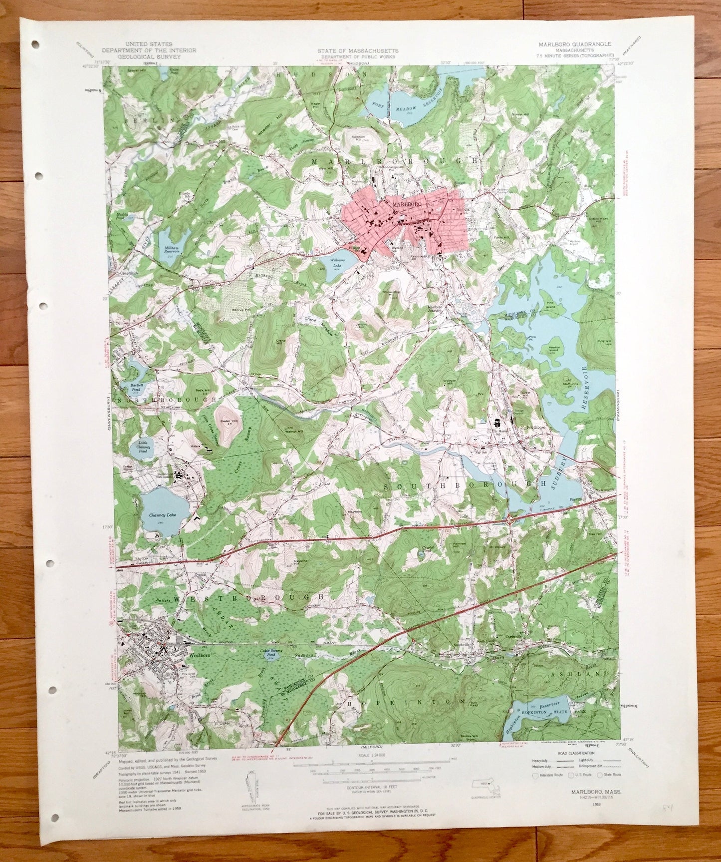
Antique Marlborough, Massachusetts 1953 US Geological Survey Topographic Map - Westborough, Northborough, Hopkinton, Ashland, Marlboro, MA
Antique Marlborough, Massachusetts 1953 US Geological Survey Topographic Map - Westborough, Northborough, Hopkinton, Ashland, Marlboro, MA
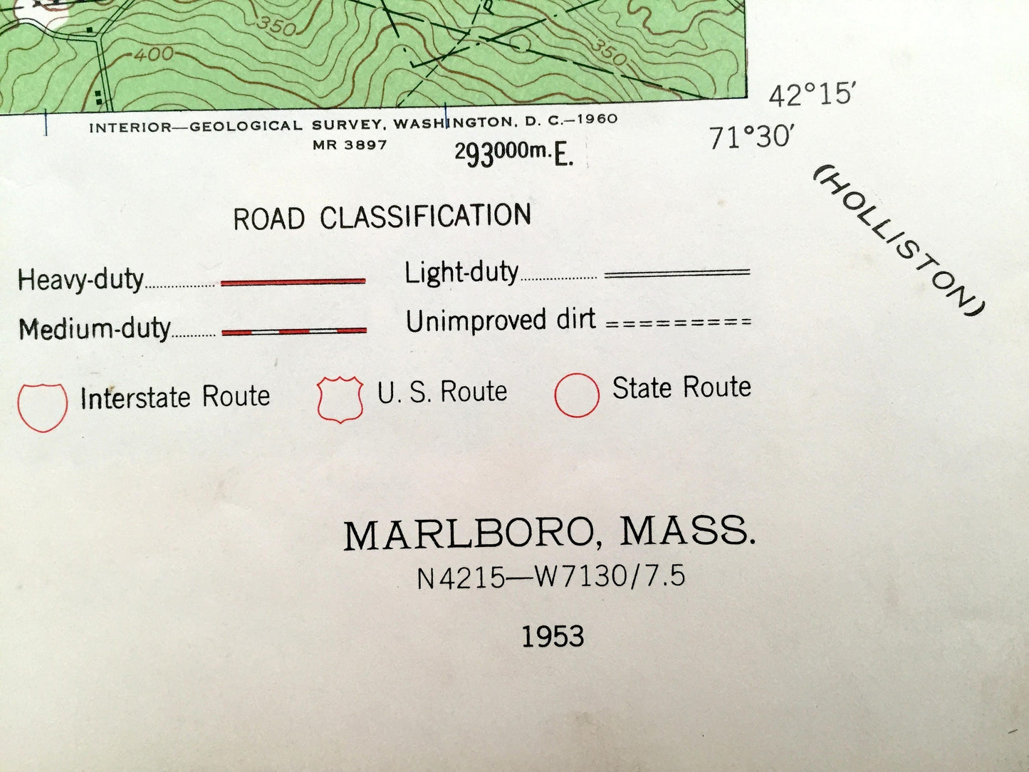
Beautiful, antique map of Marlborough, Massachusetts (spelled Marlboro here) and surrounding Middlesex County and Worcester County area. This is an authentic 1953 print from the U.S. Geological Survey and NOT a computer reproduction.
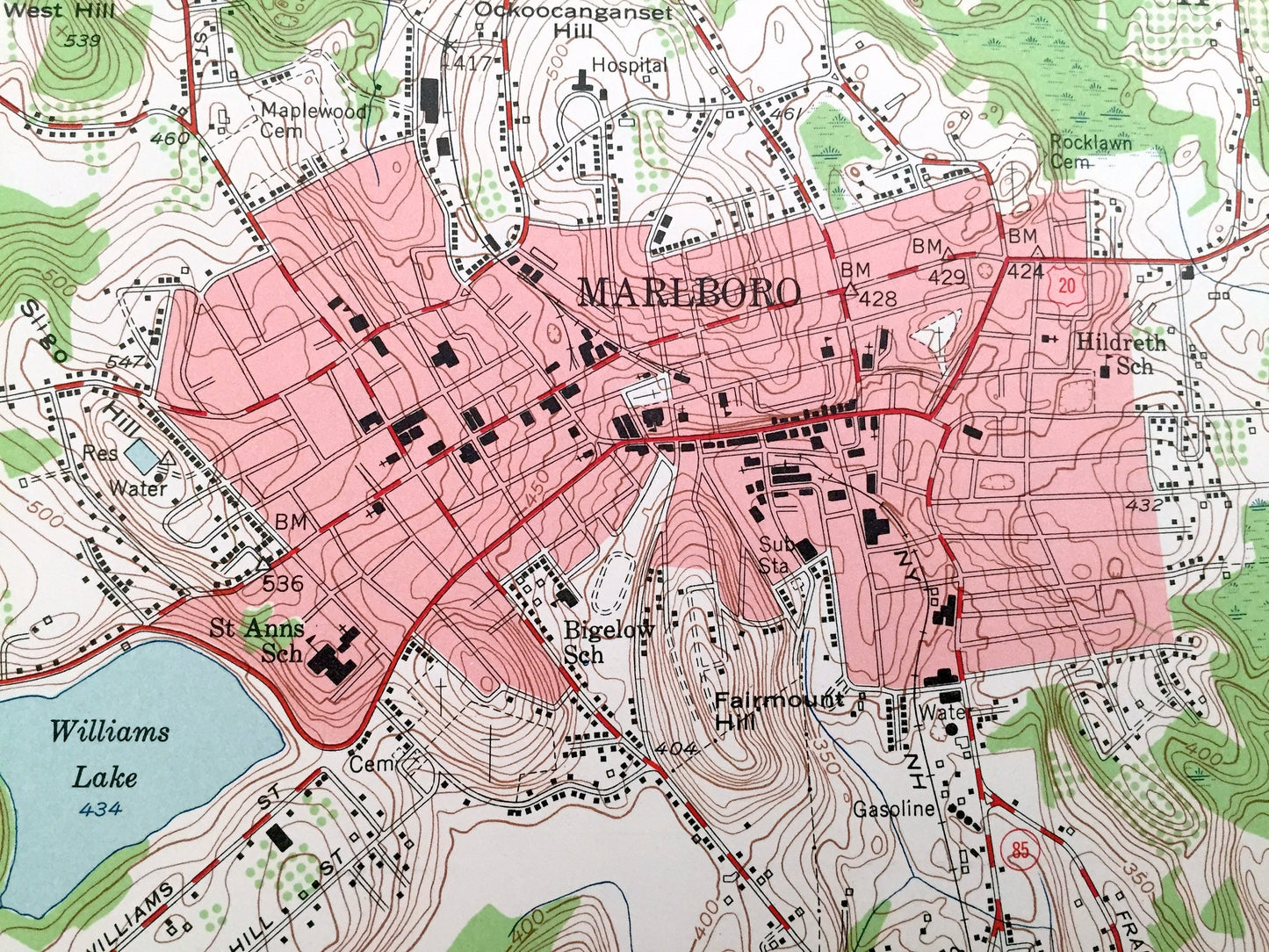
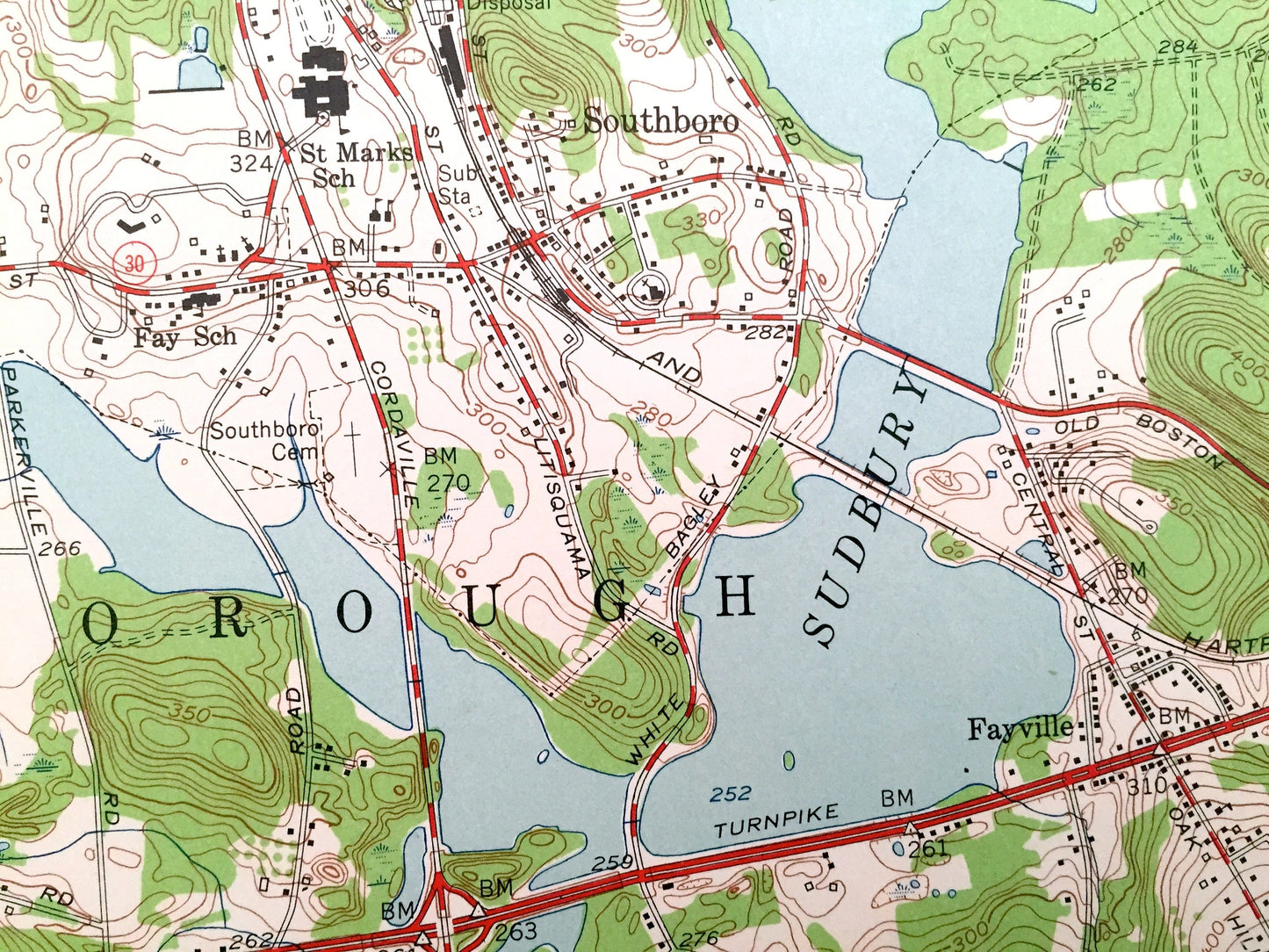
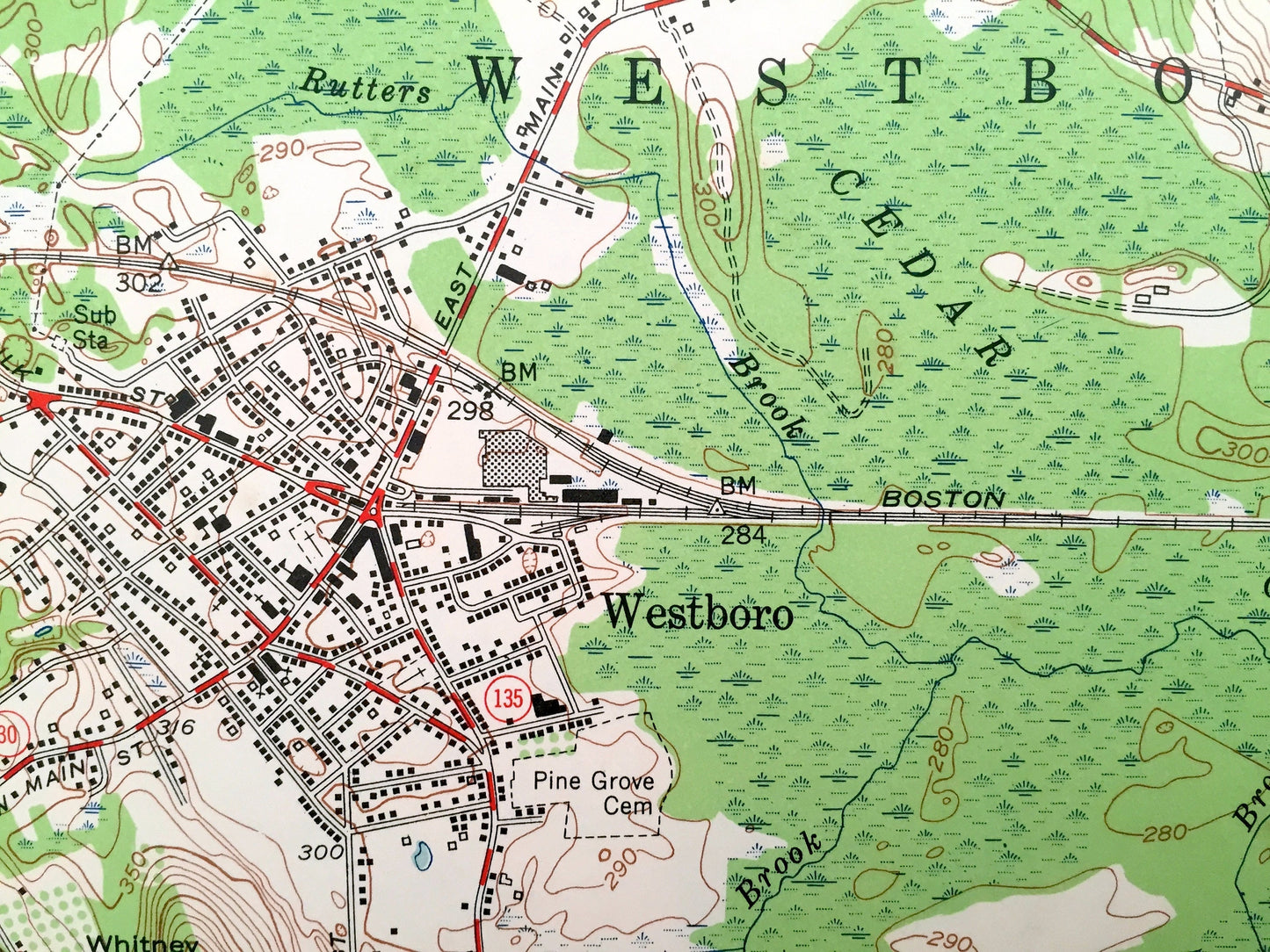
See what Middlesex County and Worcester County looked like 60 years ago. Lots of intricate details and geological contours. Map even has little squares for every house that existed at the time. The USGS cartographers were very thorough back then!
Perfect for the historian, map-lover, the curious or just as a conversation starter. Wonderful and rare. Maps such as these make great gifts.
Edition of 1953, printed 1953
Dimensions: 22" width x 27" height
----
Features
Cities & Towns: Westborough, Marlboro, Marlborough, Northborough, Berlin, Hopkinton, Ashland, Southborough, Southboro, Hudson, Westboro, Fayville, Chapinville, Marlboro Junction, Robin Hill.
Points of Interest: Middlesex County, Worcester County, Chauncy Lake, Bartlett Pond, Little Chauncy Pond, Williams Lake, Sudbury Reservoir, Fort Meadow Reservoir, Hopkinton State Park, Hopkinton Reservoir, Cedar Swamp, Assaret River, and lots more hills, mountains, creeks, and roads.
Condition: Good Vintage condition, commensurate with age. This map is in incredible shape for being 60 years old. Map has punch holes but these are easily concealed with framing or placing a similar-colored paper behind the map, as can be seen in the photos.
----
We will happily adjust shipping price for multiple purchases. Maps are rolled up and shipped in sturdy mailing tubes, never folded.
Couldn't load pickup availability
Share