My Store
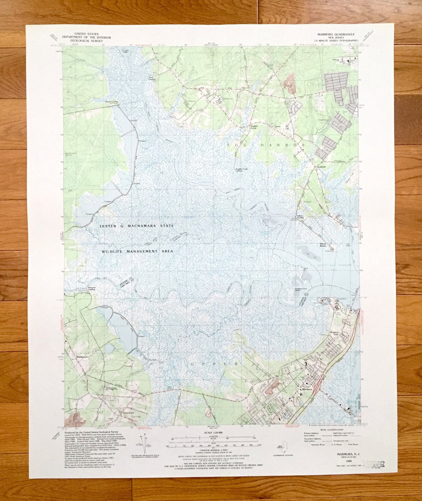
Antique Marmora, New Jersey 1989 US Geological Survey Topographic Map – Atlantic, Cape May County, Egg Harbor, Upper, Middletown, NJ
Antique Marmora, New Jersey 1989 US Geological Survey Topographic Map – Atlantic, Cape May County, Egg Harbor, Upper, Middletown, NJ
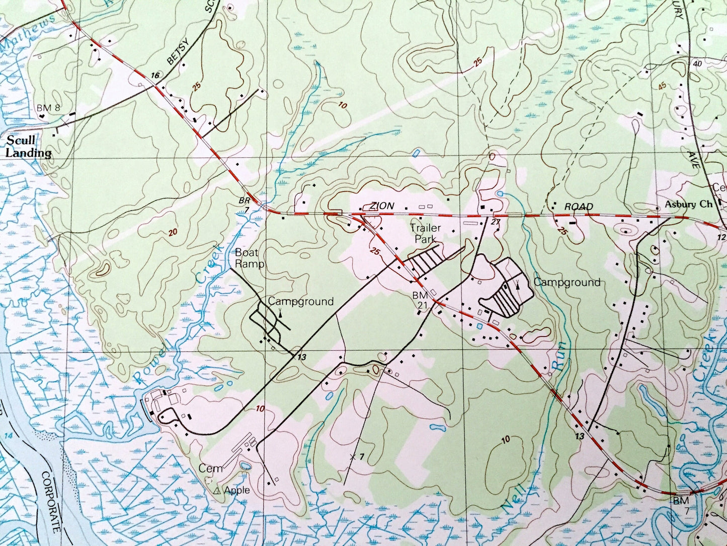
Beautiful, antique map of Marmora, New Jersey and surrounding Atlantic County and Cape May County areas. This is an authentic 1989 edition, 1989 print from the U.S. Geological Survey and NOT a computer reproduction.
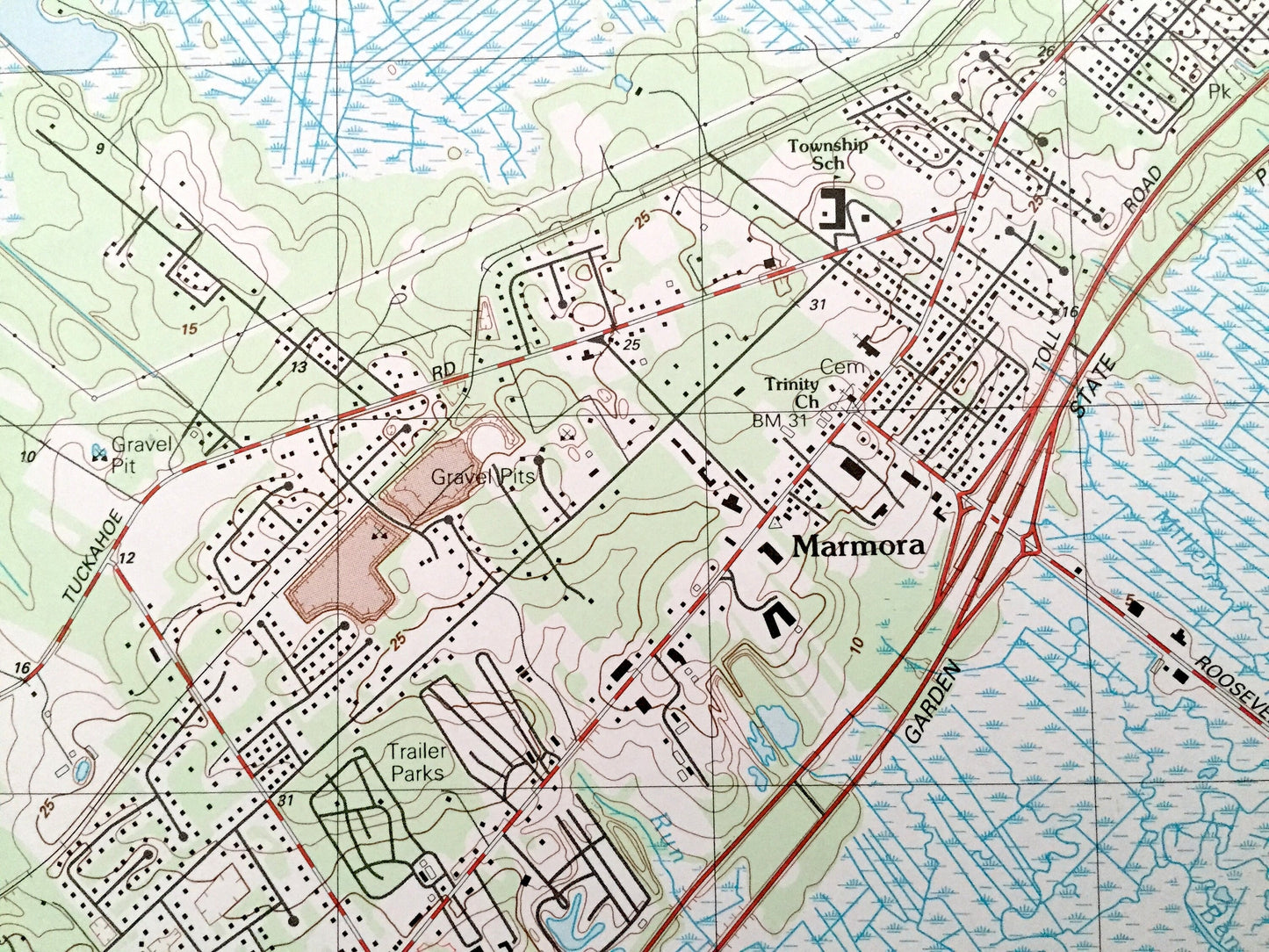
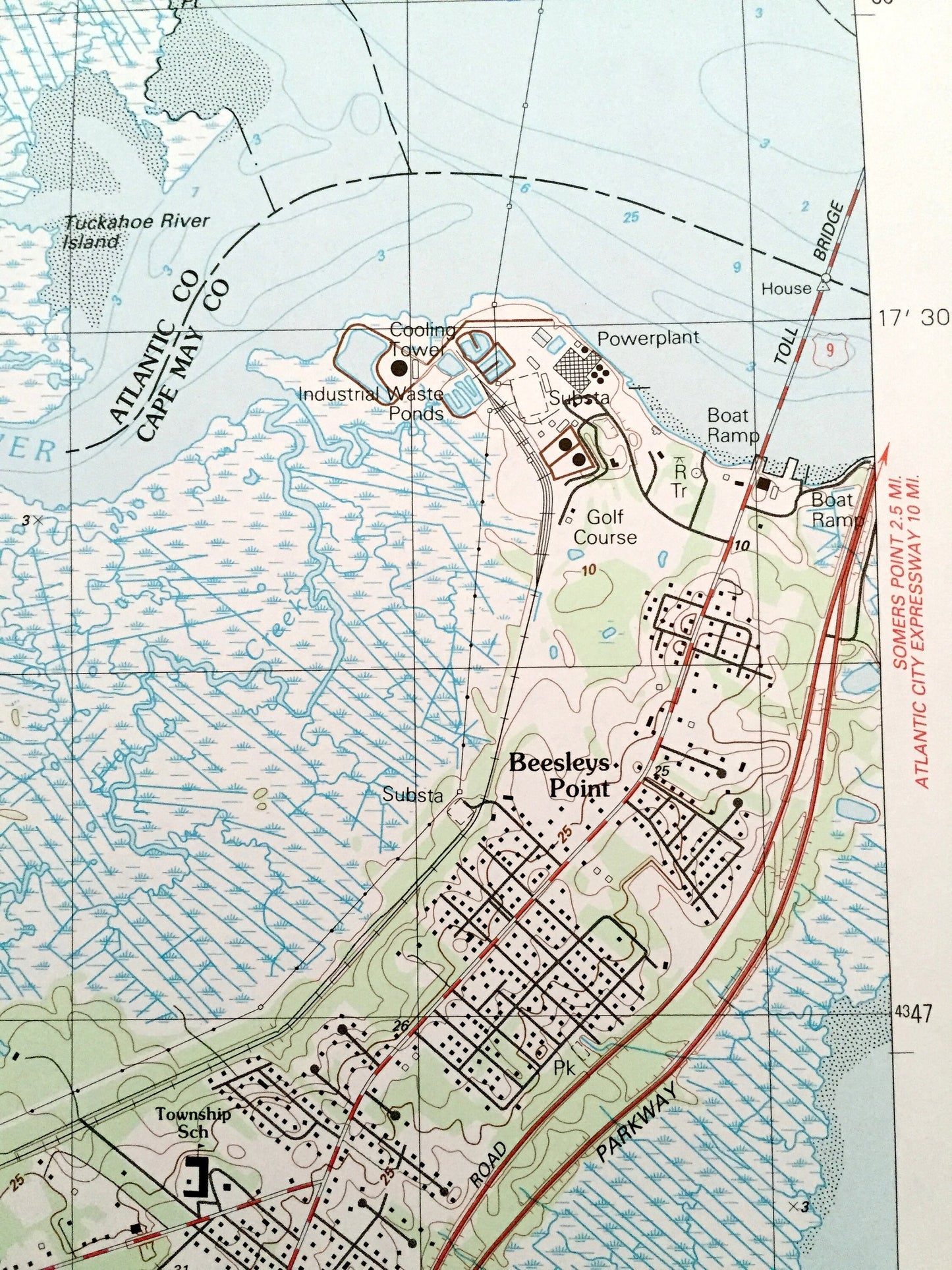
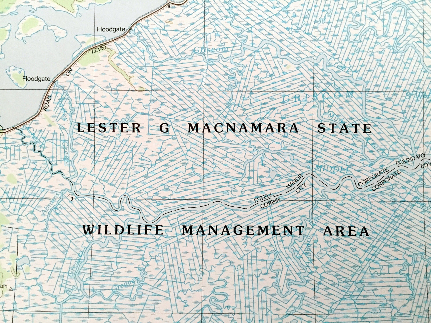
See what New Jersey looked like over 30 years ago. Lots of intricate details and geological contours. Map even has little squares for every house that existed at the time. The USGS cartographers were very thorough back then!
Perfect for the historian, map-lover, the curious or just as a conversation starter. Wonderful and rare. Vintage maps such as these make great gifts.
Edition of 1989, printed 1989
Dimensions: 22" width x 27" height
----
Features
Cities & Towns: Petersburg, Ocean City, Beesleys Point, Scullville, English Creek.
Points of Interest: Lester G Macnamara State Wildlife Management Area, Gibson Landing, Mosquito Landing, Jeffers Landing, English Creek Landing, Scull Landing, Morris Beach, Great Egg Harbor River, Tuckahoe Lake, Peck Bay, Great Egg Harbor Bay, Jackson Creek, Gibson Creek, Hawkins Creek, Peters Creek, Mirey Run, Swamp Creek, Jacobs Creek, English Creek, Powell Creek, Mathews Run, township schools, gravel pits, campgrounds, and many more hills, streams, ponds, houses, schools, railroads, churches, roads, beaches, islands, rivers, and creeks.
Condition: Very Good Vintage condition, commensurate with age. This map is in great shape for being over 30 years old.
----
We will happily adjust shipping price for multiple purchases. Maps are rolled up and shipped in sturdy mailing tubes, never folded.
Couldn't load pickup availability
Share