My Store
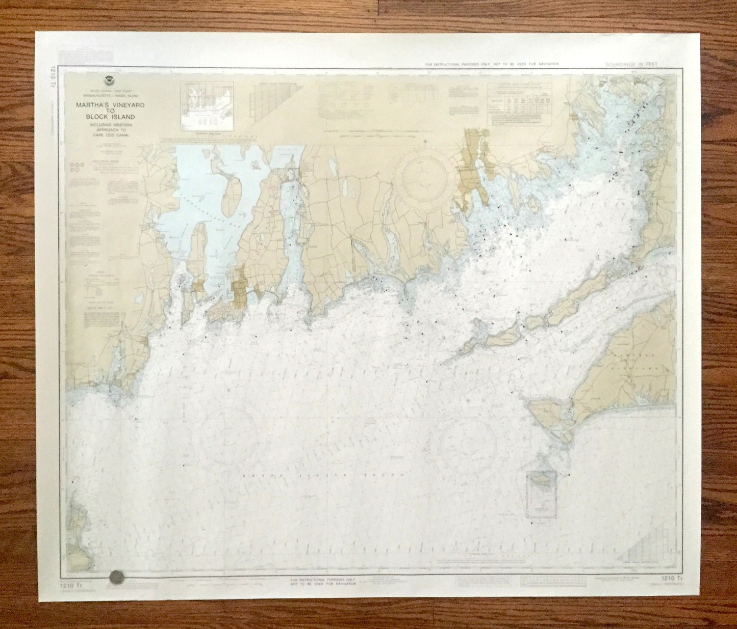
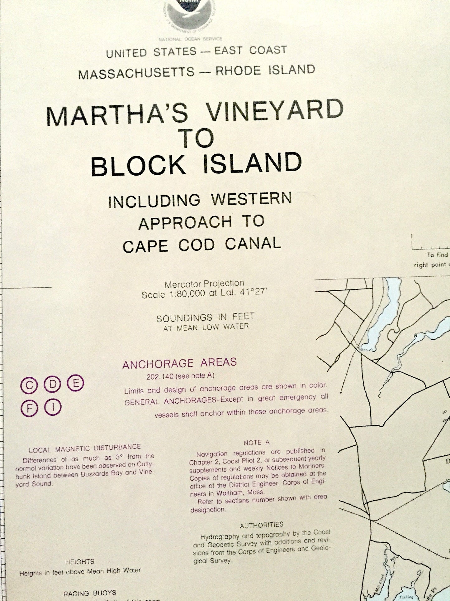
Antique Marthas Vineyard to Block Island 1962 US Coast Guard Nautical Map – Massachusetts, Rhode Island, Cape Cod, Woods Hole, Newport RI MA
Antique Marthas Vineyard to Block Island 1962 US Coast Guard Nautical Map – Massachusetts, Rhode Island, Cape Cod, Woods Hole, Newport RI MA
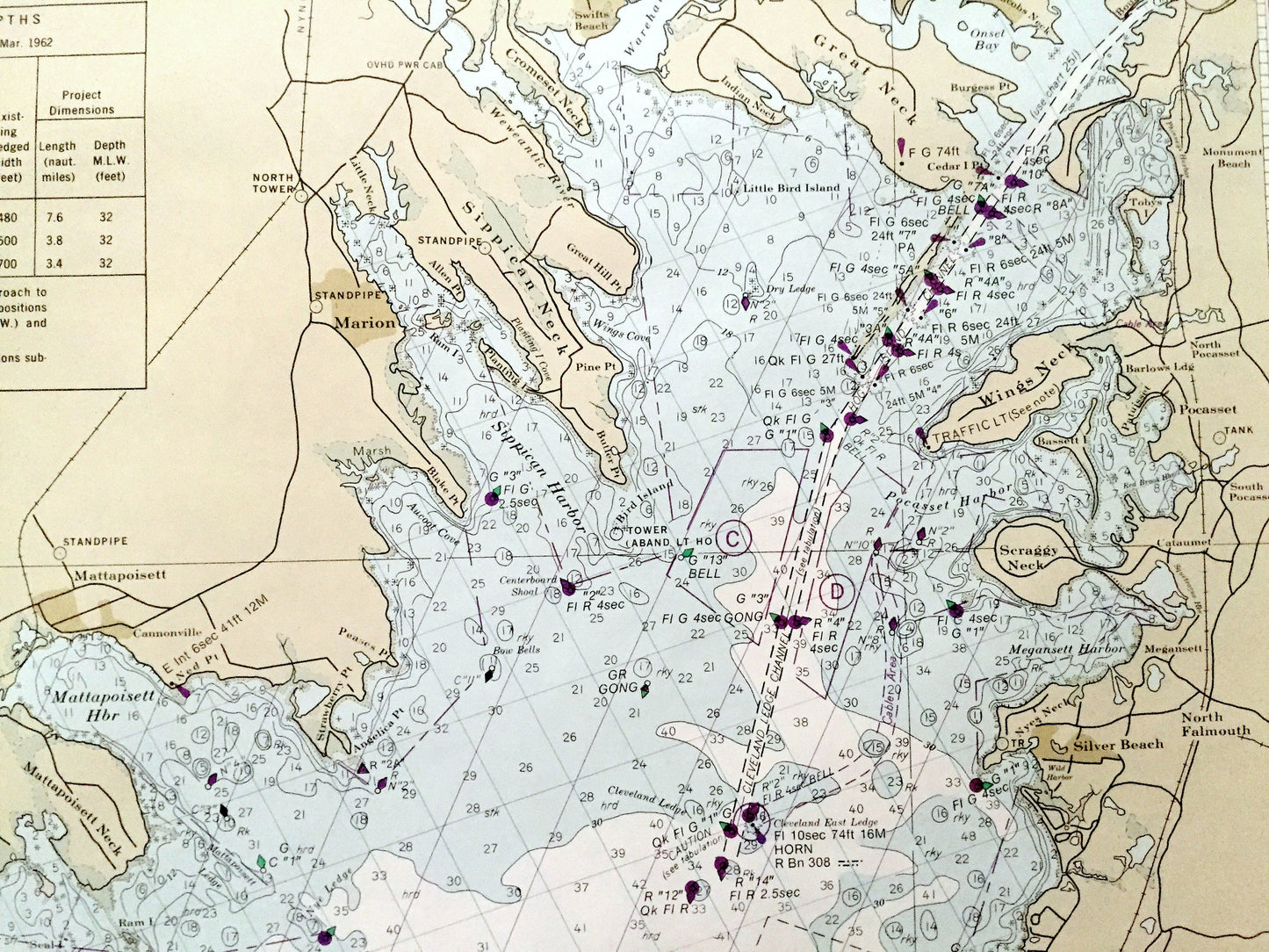
Beautiful, antique nautical chart of Martha's Vineyard to Block Island, including the southern coasts of Massachusetts and Rhode Island. This is an authentic original map from the United States Coast Guard & Geodetic Survey, edition of 1962, published in 1990, and is NOT a computer reproduction.
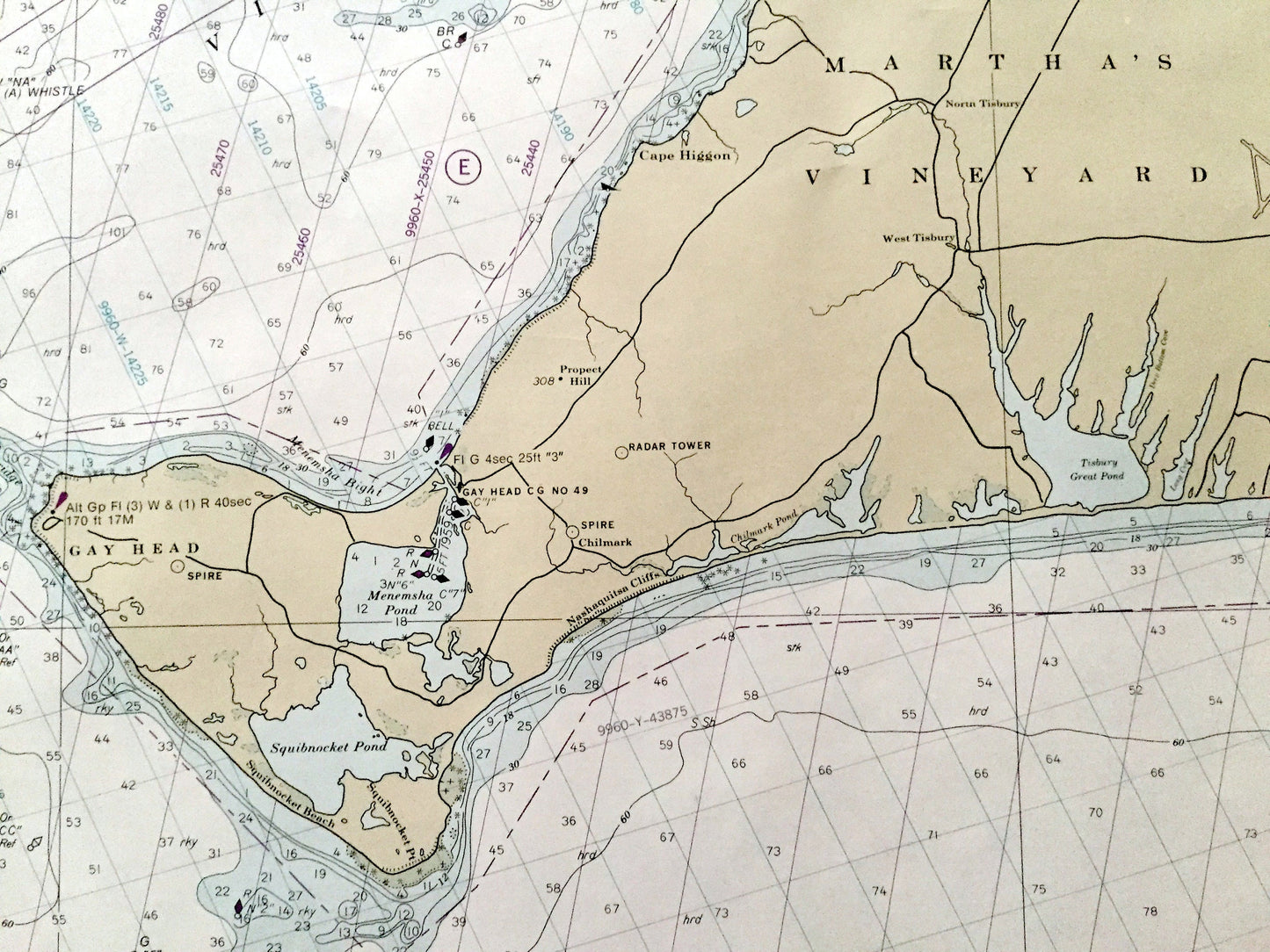
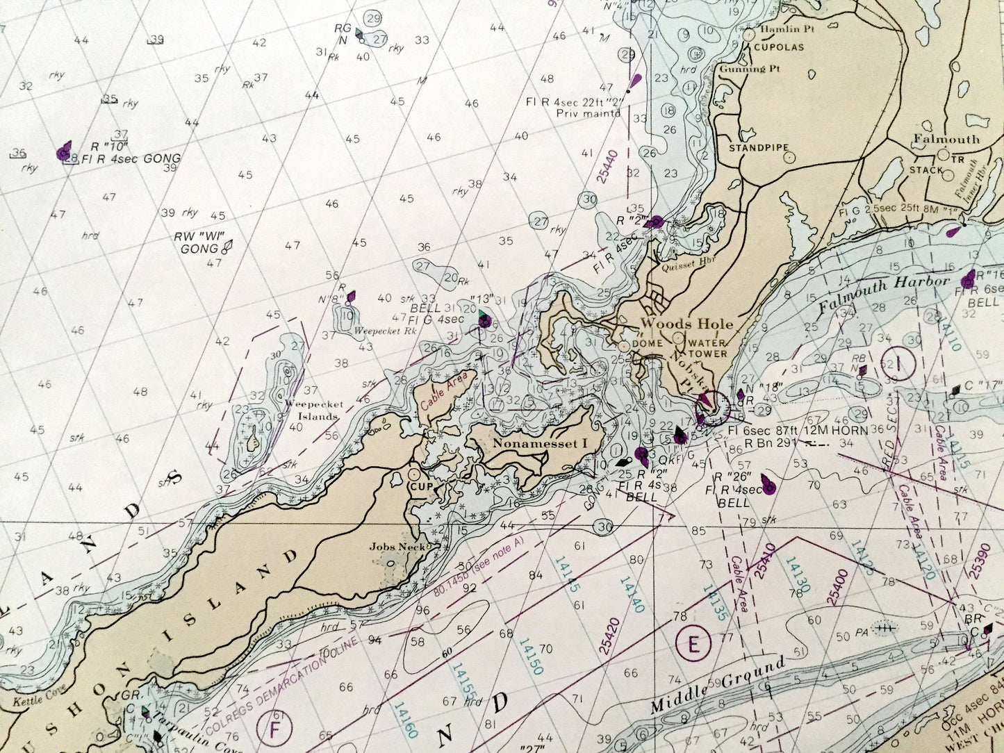
See what the New England Coast and Islands looked like over 60 years ago. Lots of charming, intricate details and contours, including depth soundings, cities, streets, rivers, anchorages, magnetic anomaly areas and other points of nautical interest. Map is very large and would be the focal point in whatever room it is hung. (See quarter in bottom left corner of map for idea of scale.) Verso has a map guide.
Perfect for the historian, seaman, map-lover, the curious or just as a conversation starter. Wonderful and rare. Vintage maps such as these make great gifts.
Edition of 1962, printed 1990
Dimensions: 44" width x 37 1/2" height
----
Condition: Very Good Vintage condition, commensurate with age. This map is in great shape for being over 30 years old. Has very light wear but this will add to vintage character when framed.
----
We will happily adjust shipping price for multiple purchases. Maps are rolled up and shipped in sturdy mailing tubes, never folded.
Couldn't load pickup availability
Share