My Store
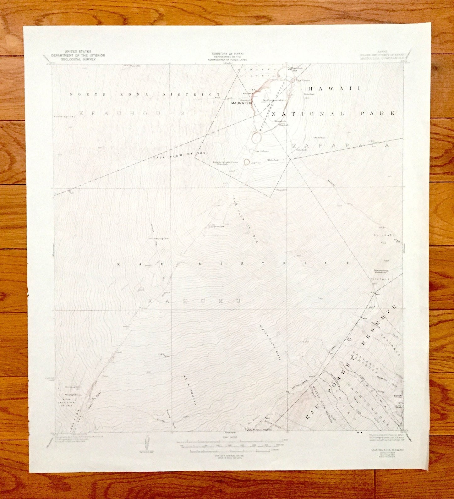
Antique Mauna Loa, Hawaii 1928 US Geological Survey Topographic Map – North Kona, Hamakua, Kau, National Forest, Kau Forest Reserve, HI
Antique Mauna Loa, Hawaii 1928 US Geological Survey Topographic Map – North Kona, Hamakua, Kau, National Forest, Kau Forest Reserve, HI
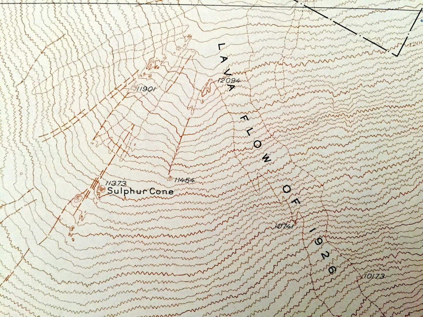
Beautiful, antique map of the largest volcano on Earth, Mauna Loa, Hawaii—and surrounding area on the Island of Hawaii. This is an authentic 1928 edition, 1964 print from the U.S. Geological Survey and NOT a computer reproduction.
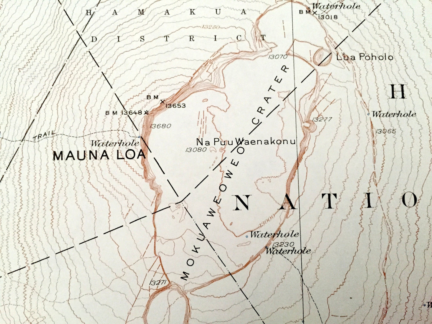
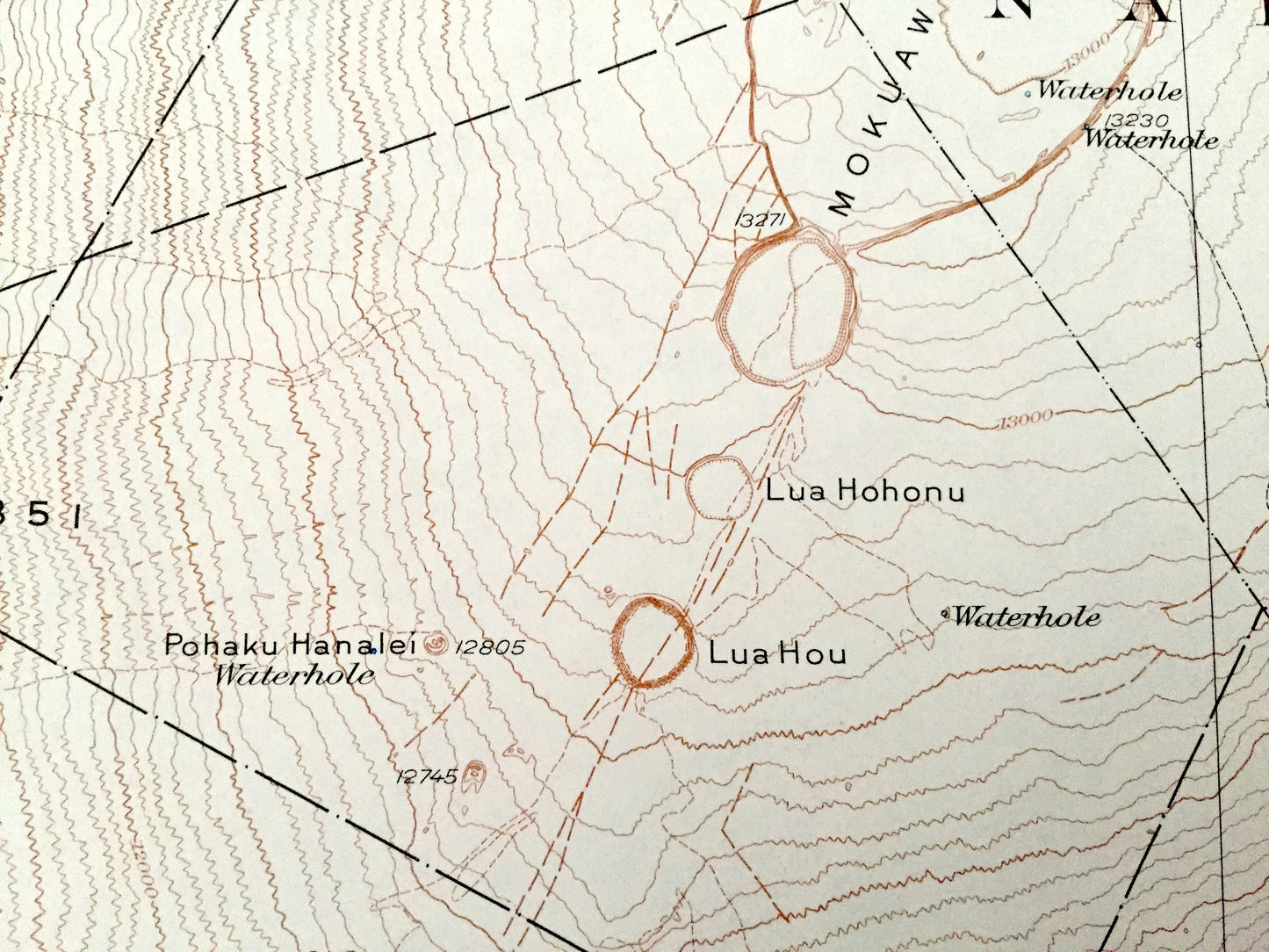
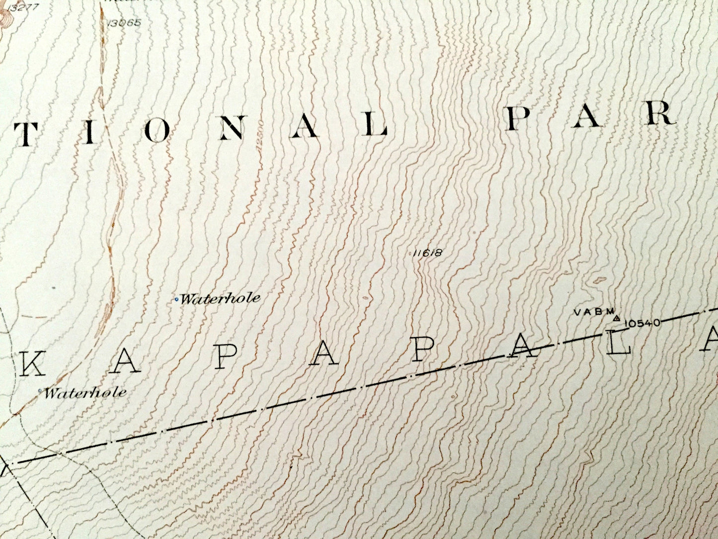
See what the Kau & North Kona Districts of Hawaii looked like over 90 years ago. Lots of intricate details and geological contours. Map even has little squares for every house that existed at the time. The USGS cartographers were very thorough back then!
Perfect for the historian, map-lover, the curious or just as a conversation starter. Wonderful and rare. Vintage maps such as these make great gifts.
Edition of 1928, printed 1964
Dimensions: 19" width x 21" height
----
Features
Cities, Towns & Districts: Kau District, North Kona District, Hamakua District.
Points of Interest: Hawaii National Park, Kau Forest Reserve, Muana Loa, Mokuaweoweo Crater, Kohalapilau, Lava Flow of 1851, Keauhou 2, Kapapala, Lua Hohonu, Lua Hou, Na Puu Waenakonu, Lua Pholo, Lava Flow of 1926, Kahuku, Ke a Pohina, Kipuka Aiaka Alala and many more roads, houses, valleys, gulches, lava flows, mountains and streams.
Condition: Good Vintage condition, commensurate with age. This map is in great shape for being over 55 years old. Has some edge-wear but this will add to vintage character when framed.
----
We will happily adjust shipping price for multiple purchases. Maps are rolled up and shipped in sturdy mailing tubes, never folded.
Couldn't load pickup availability
Share