My Store
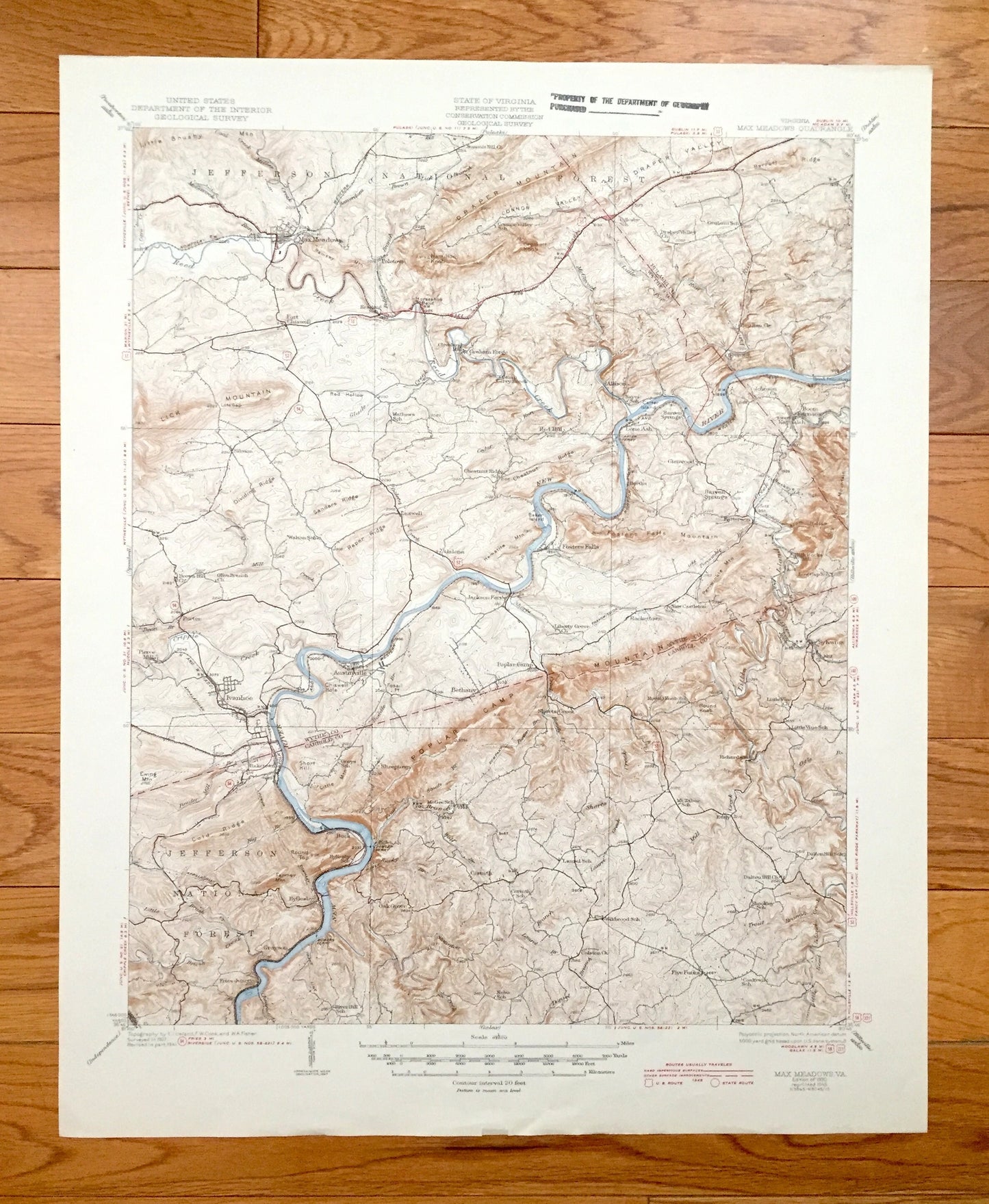
Antique Max Meadows, Virginia 1930 US Geological Survey Topographic Map – Fosters Falls, Ivanhoe, Bethany, Oak Grove, Sheeptown, Byllesby VA
Antique Max Meadows, Virginia 1930 US Geological Survey Topographic Map – Fosters Falls, Ivanhoe, Bethany, Oak Grove, Sheeptown, Byllesby VA
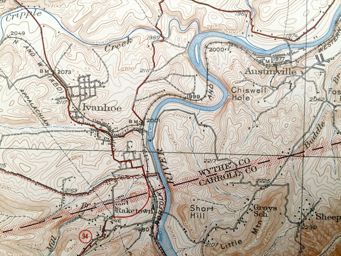
Beautiful, antique map of Max Meadows, Virginia and surrounding Wythe, Carroll & Pulaski County area. This is an authentic 1930 edition, 1945 print from the U.S. Geological Survey and NOT a computer reproduction.
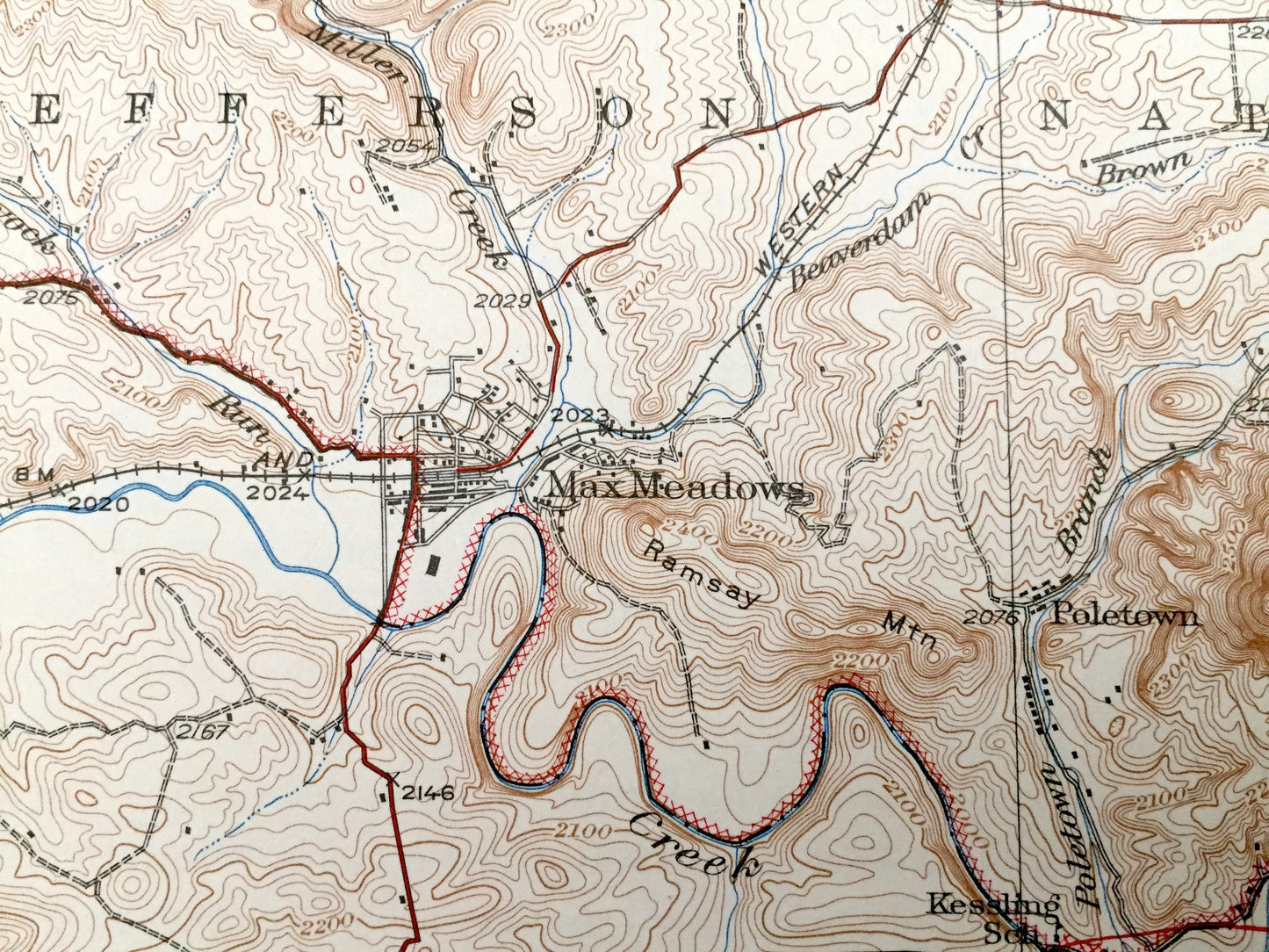
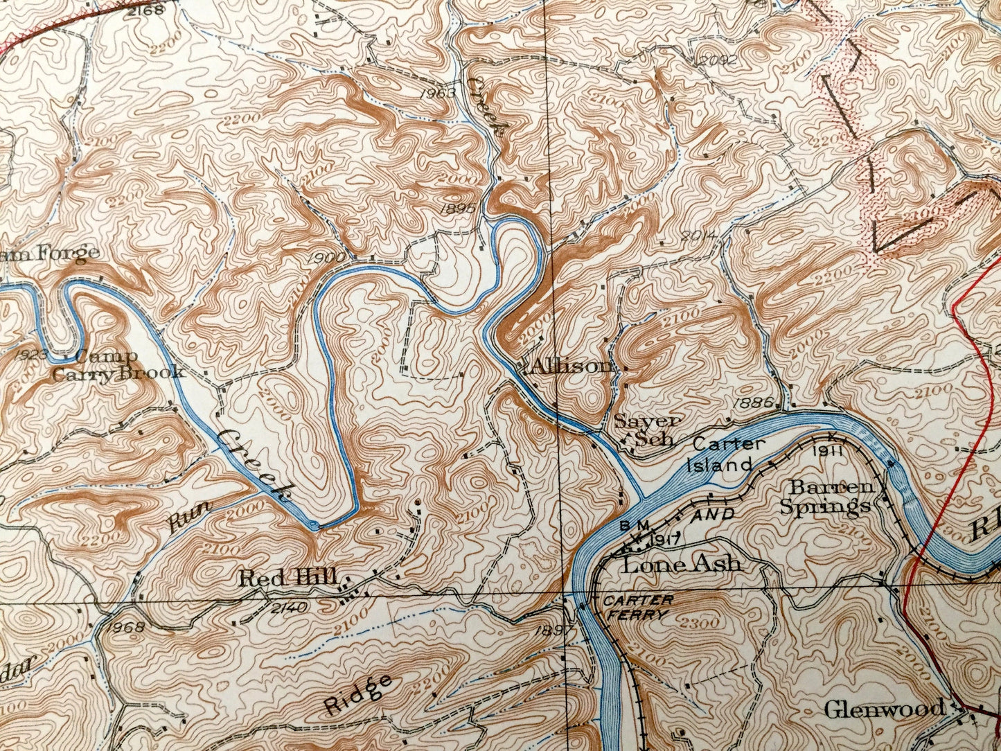
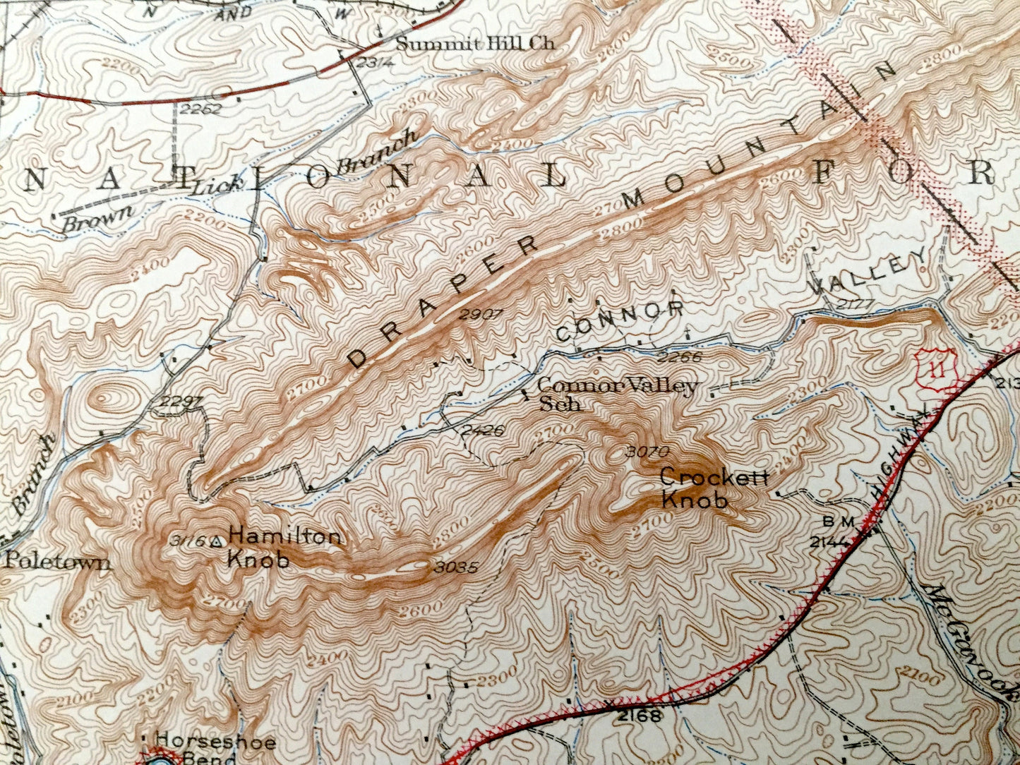
See what Virginia looked like over 90 years ago. Lots of intricate details and geological contours. Map even has little squares for every house that existed at the time. The USGS cartographers were very thorough back then! On the back is a description of topographic symbols and map guide.
Perfect for the historian, map-lover, the curious or just as a conversation starter. Wonderful and rare. Vintage maps such as these make great gifts.
Edition of 1930, printed 1945
Dimensions: 17" width x 21" height
----
Features
Cities & Towns: Max Meadow, Sylvatus, Patterson, Barren Springs, Siloam, Red Hill, Kayonlah, Fosters Falls, Ivanhoe, Bethany, Oak Grove, Sheeptown, Byllesby.
Points of Interest: Wythe County, Carroll County, Pulaski County, Unaka National Forest, Poplar Camp Mountain, Draper Mountain, Lick Mountain, Little Brush Mountain, Fosters Falls Mountain, New River, Sanders Ridge, Dividing Ridge, Connor Valley, Draper Valley, Reed Creek and lots more hills, mountains, rivers, streams, ponds, lakes, houses, churches, schools and roads.
Condition: Good Vintage condition, commensurate with age. This map is in great shape for being over 75 years old. Light wear and ex-libris stamp in upper margin but this will add to vintage character when framed.
----
We will happily adjust shipping price for multiple purchases. Maps are rolled up and shipped in sturdy mailing tubes, never folded.
Couldn't load pickup availability
Share