My Store
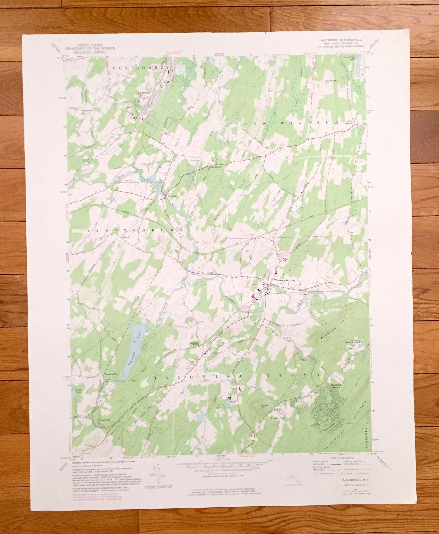
Antique Maybrook, New York 1957 US Geological Survey Topographic Map – Orange County, Montgomery, New Windsor, Blooming Grove, Neelytown, NY
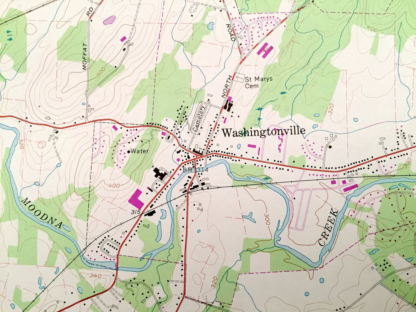
Antique Maybrook, New York 1957 US Geological Survey Topographic Map – Orange County, Montgomery, New Windsor, Blooming Grove, Neelytown, NY
Beautiful, antique map of Maybrook, New York and surrounding Orange County. This is an authentic 1957 edition, 1981 print from the U.S. Geological Survey and NOT a computer reproduction.
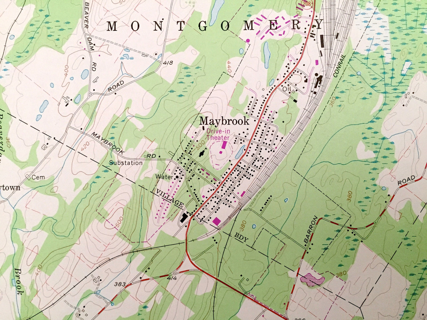
See what New York looked like over 60 years ago. Lots of intricate details and geological contours. Map even has little squares for every house that existed at the time. The USGS cartographers were very thorough back then!
Perfect for the historian, map-lover, the curious or just as a conversation starter. Wonderful and rare. Vintage maps such as these make great gifts.
Edition of 1957, printed 1981
Dimensions: 22" width x 27" height
----
Features
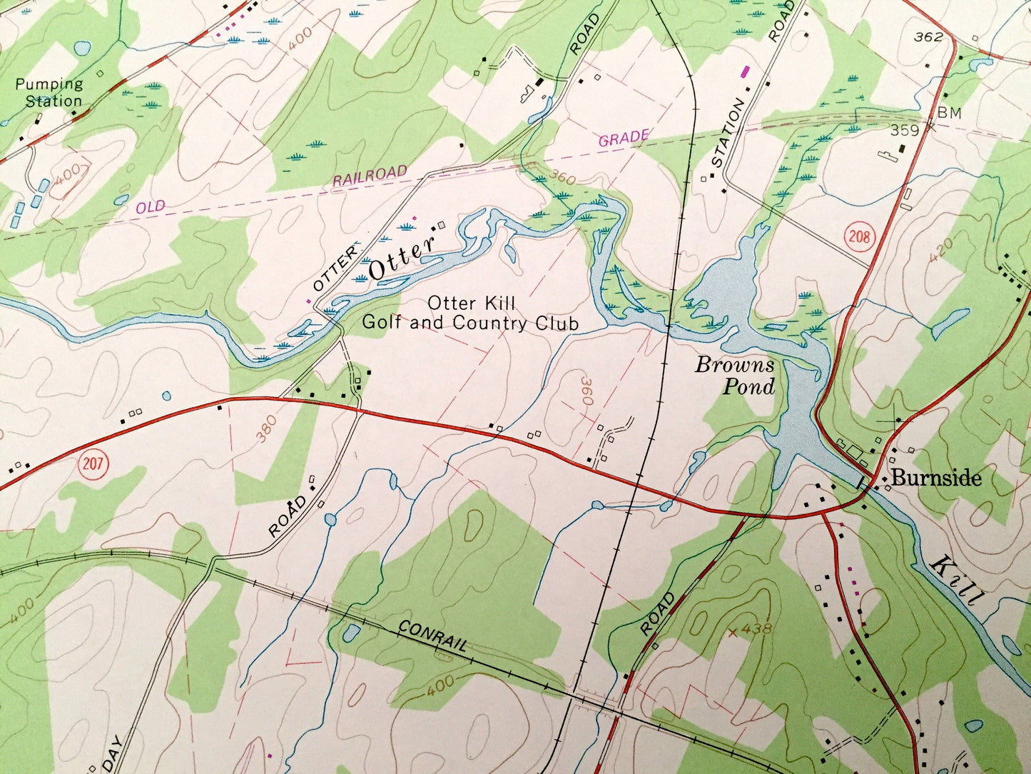
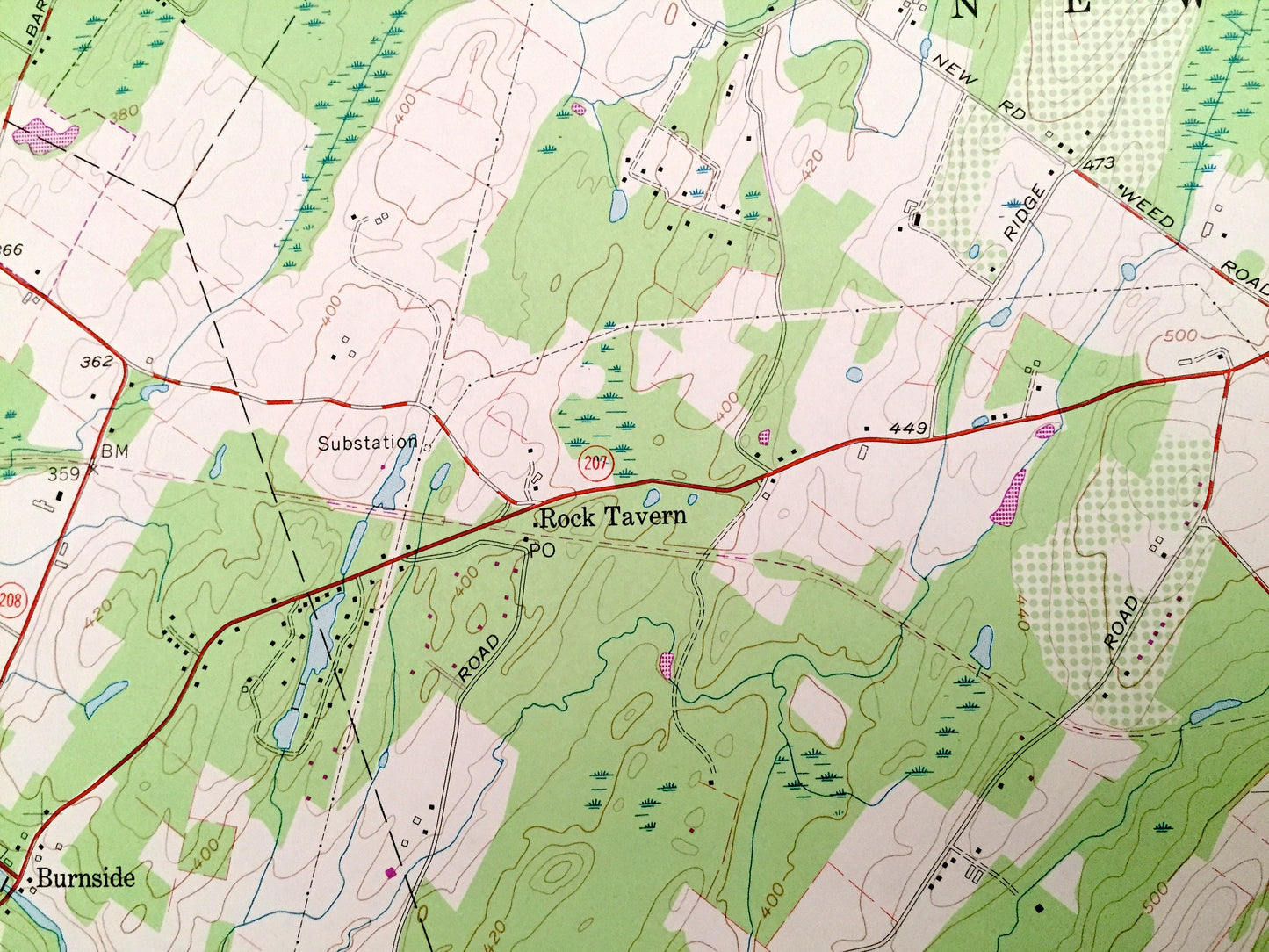
Cities & Towns: Hamptonburgh, Woodbury, Burnside, Rock Tavern, Little Britain, Washingtonville, Girarde, Farmingdale, Craigville, Mountain Lodge, Chester.
Points of Interest: Camp Lenni-Len-A-Pe, Schunemunk Mountain, Blaggs Clove, Round Hill, Woodcock Hill, Buchanan Hill, Browns Pond, Tomahawk Lake, Crest View Lake, Korby Lake, Otter Kill, Moodna Creek, Beaverdam Brook, Cromline Creek, Perry Creek, and many more hills, streams, ponds, houses, schools, railroads, churches and roads.
Condition: Very Good Vintage condition, commensurate with age. This map is in great shape for being over 40 years old. Has subtle edge-wear but will read as character when framed.
----
We will happily adjust shipping price for multiple purchases. Maps are rolled up and shipped in sturdy mailing tubes, never folded.
Couldn't load pickup availability
Share