My Store
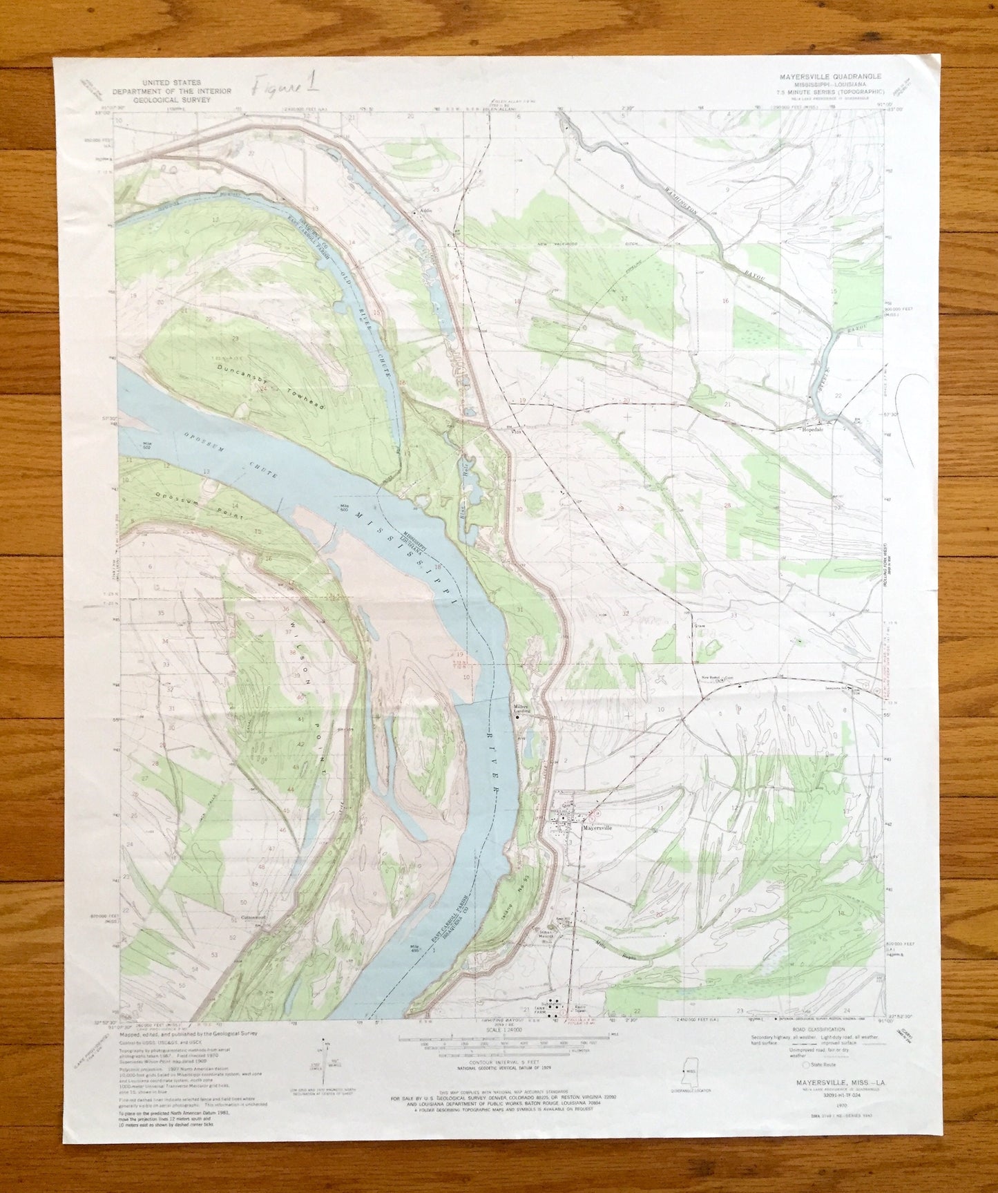
Antique Mayersville, Mississippi 1970 US Geological Survey Topographic Map — Issaquena County, Cottonwood, MS, East Carroll Parish, Addie LA
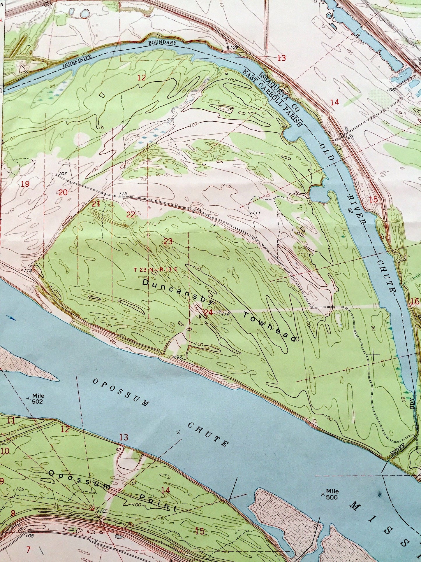
Antique Mayersville, Mississippi 1970 US Geological Survey Topographic Map — Issaquena County, Cottonwood, MS, East Carroll Parish, Addie LA
Beautiful, antique map of Mayersville, Mississippi and surrounding Issaquena County areas, including Louisiana’s East Carroll Parish. This is an authentic 1970 edition, 1986 print from the U.S. Geological Survey and is NOT a computer reproduction.
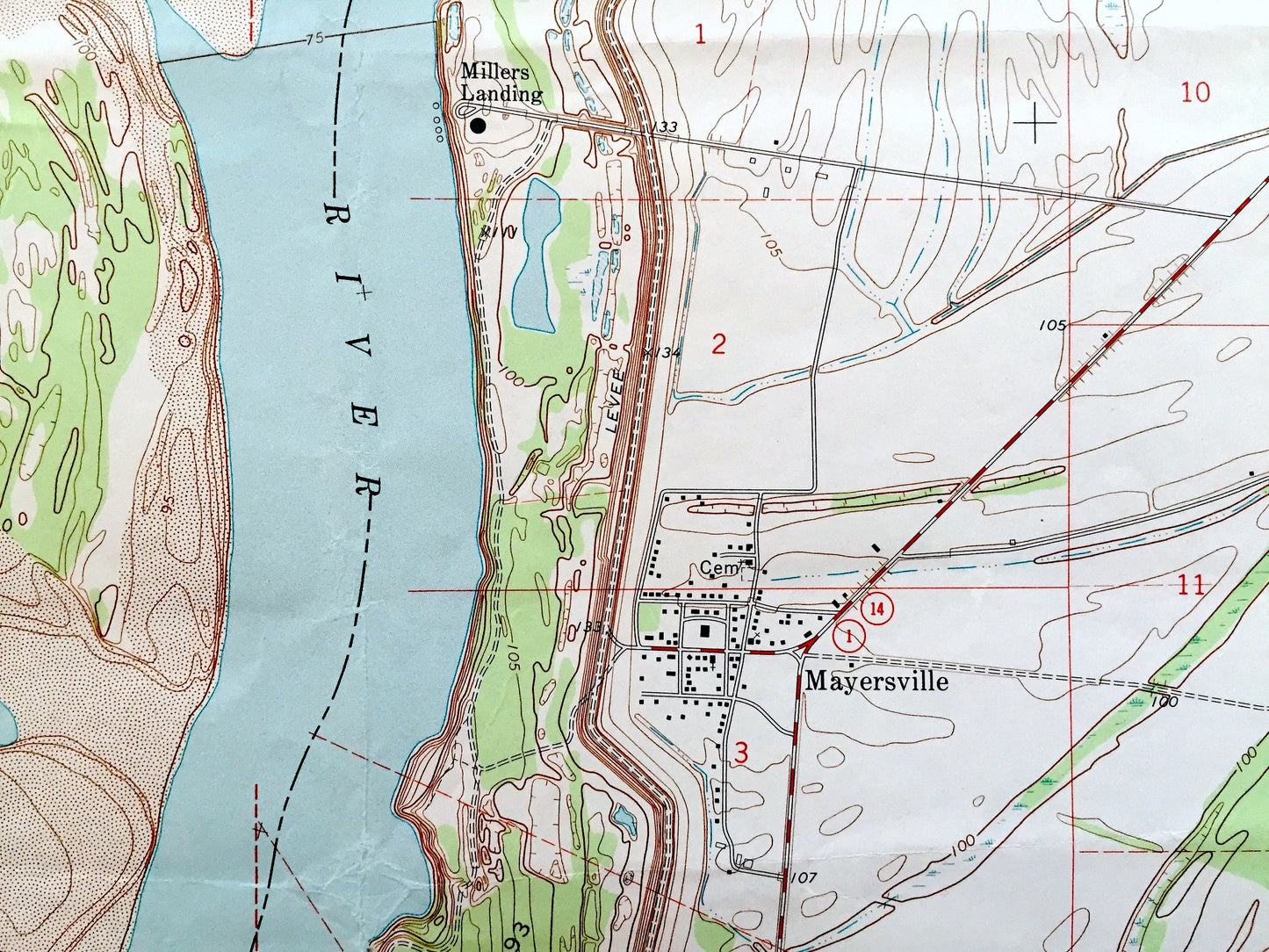
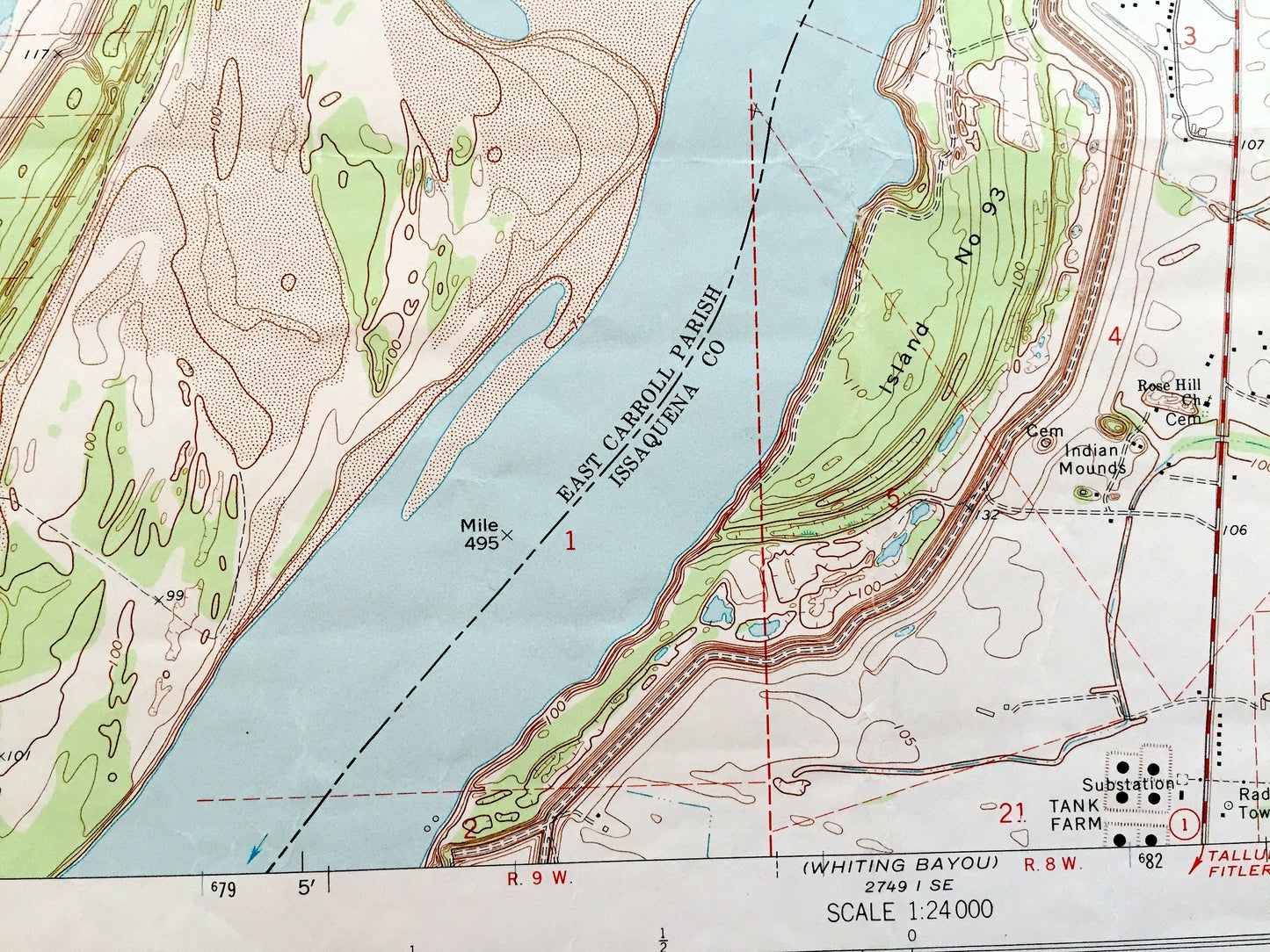
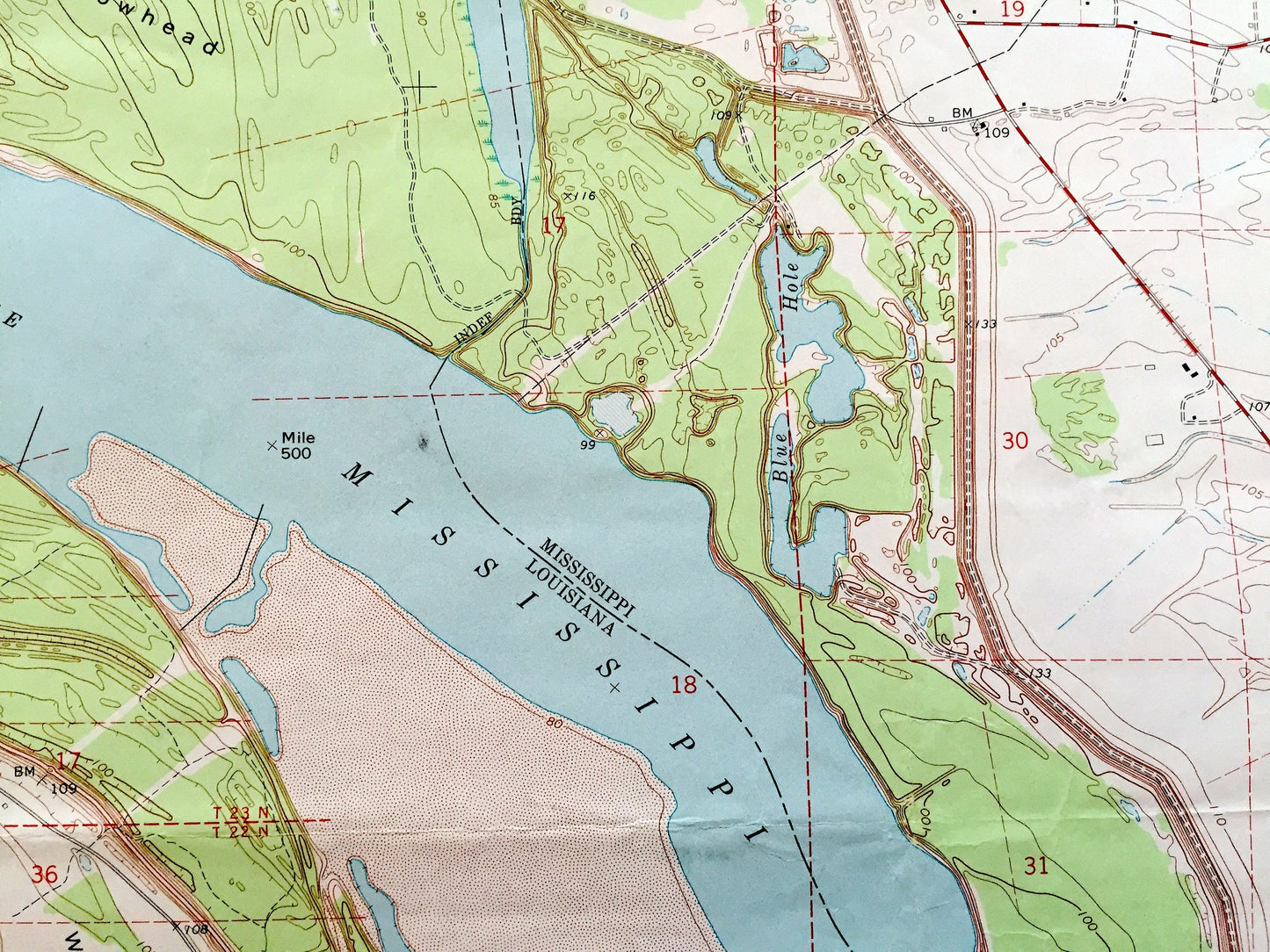
See what Mississippi and Louisiana looked like over 50 years ago. Lots of intricate details and geological contours. Map even has little squares for every house that existed at the time. The USGS cartographers were very thorough back then!
Perfect for the historian, map-lover, the curious or just as a conversation starter. Wonderful and rare. Maps such as these make great gifts.
Edition of 1970, printed 1986
Dimensions: 22" width x 27" height
----
Features
Cities & Towns:
MISSISSIPPI: Addie, Hopedale, Millers Landing.
LOUISIANA: Cottonwood.
Points of Interest: Duncansby Towhead, Opossum Point, Wilson Point, Opossum Chute, Old River Chute, Mississippi River, Washington Bayou, Steele Bayou, Blue Hole, Mills Bayou, and many more hills, streams, ponds, houses, schools, railroads, churches and roads.
Condition: Good Vintage condition, commensurate with age. This map is in great shape for being almost 40 years old. Has some edge-wear, fold creases and few pen and pencil markings. All of which will read as character when framed.
----
We will happily adjust shipping price for multiple purchases. Maps are rolled up and shipped in sturdy mailing tubes, never folded.
Couldn't load pickup availability
Share