My Store
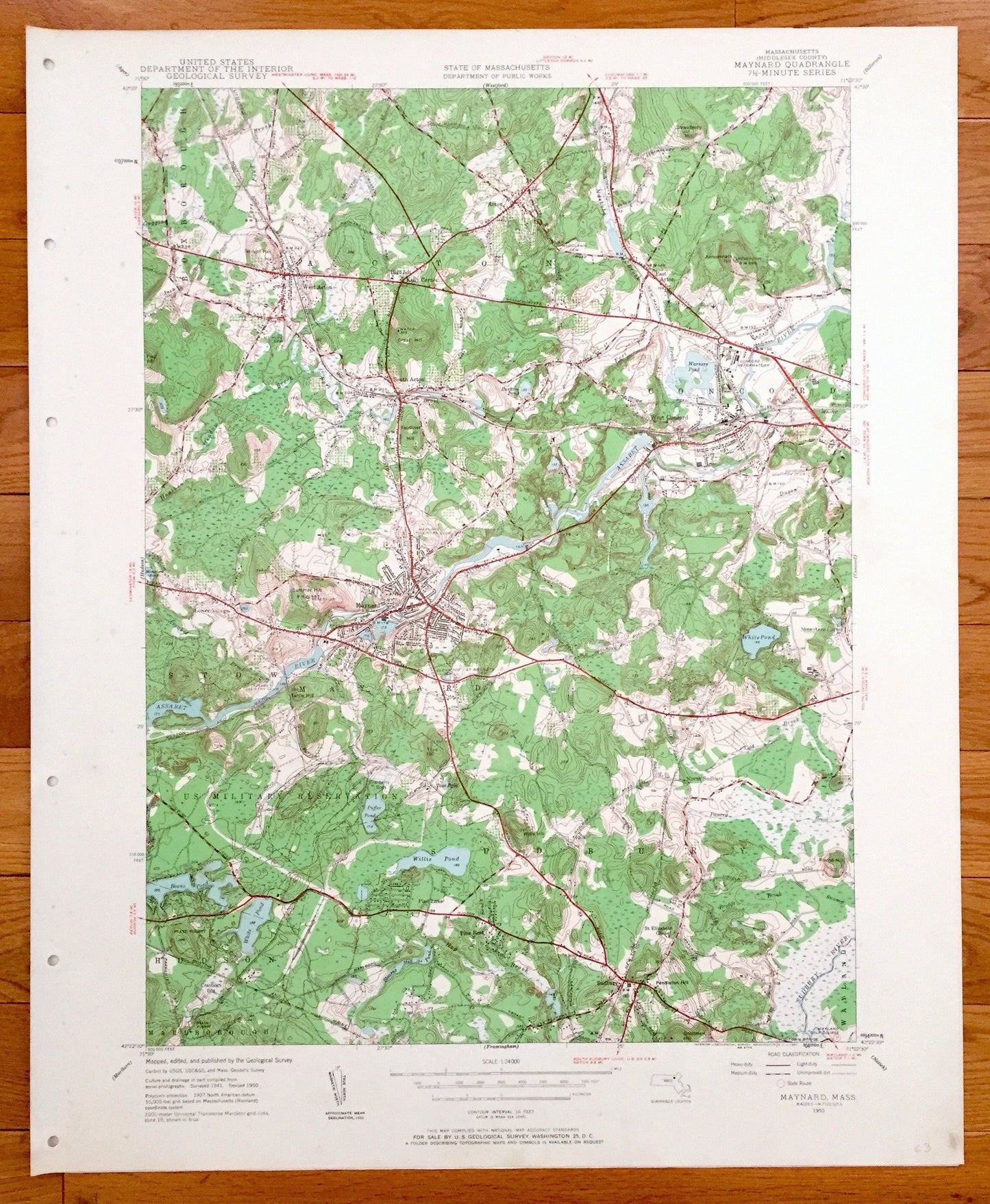
Antique Maynard, Massachusetts 1950 US Geological Survey Topographic Map – Concord, Sudbury, Acton, Hudson, Stow, Assabet Valley, MA
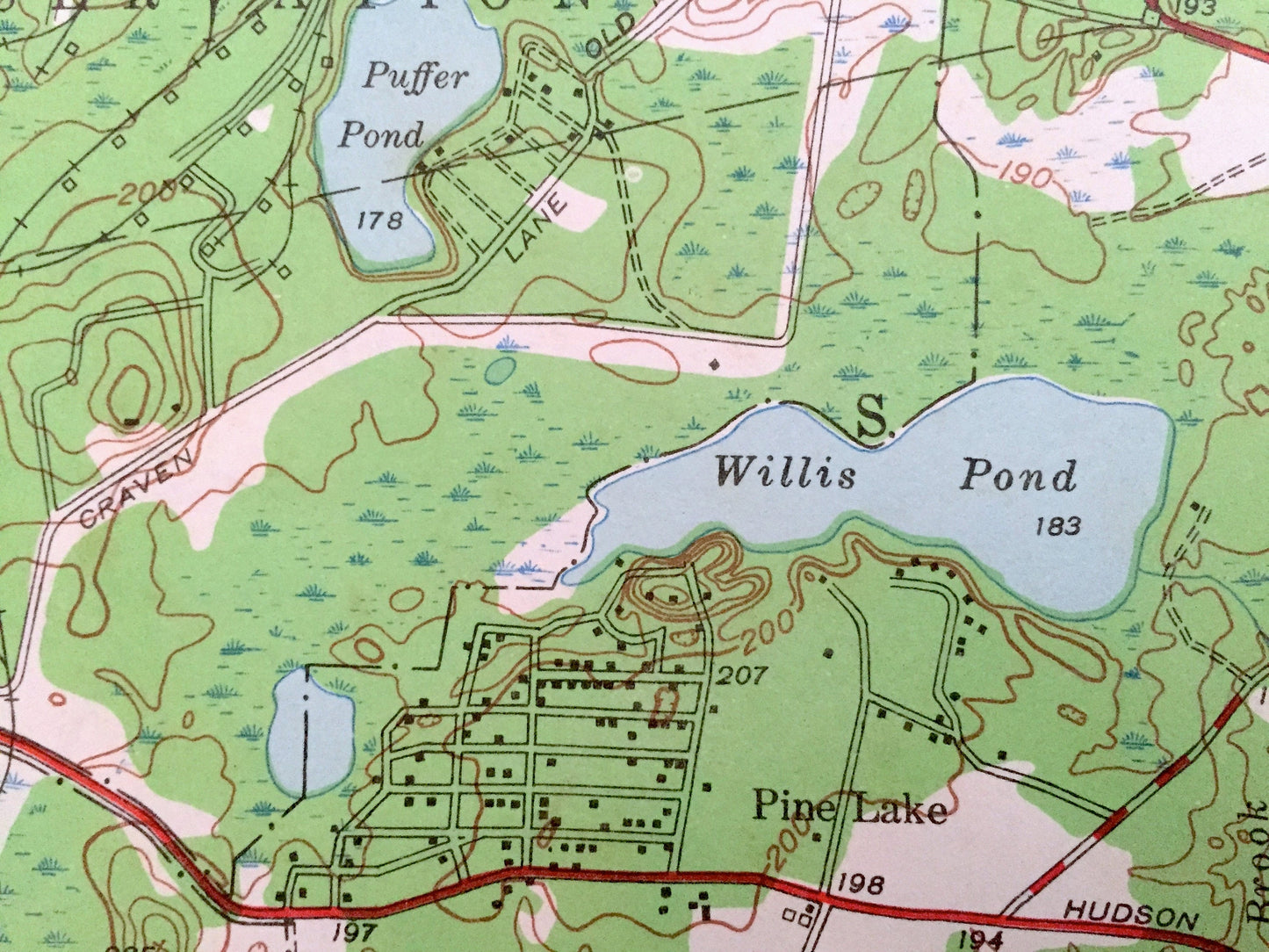
Antique Maynard, Massachusetts 1950 US Geological Survey Topographic Map – Concord, Sudbury, Acton, Hudson, Stow, Assabet Valley, MA
Beautiful, antique map of Maynard, Acton, Sudbury and Concord, Massachusetts. This is an authentic edition of 1950 print from the U.S. Geological Survey and NOT a computer reproduction.
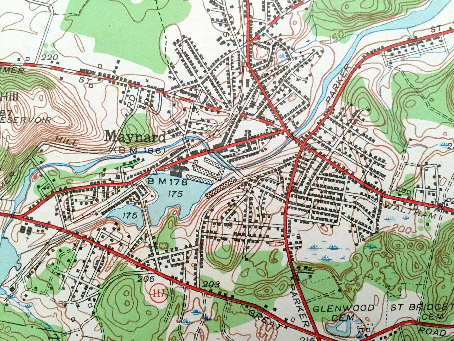
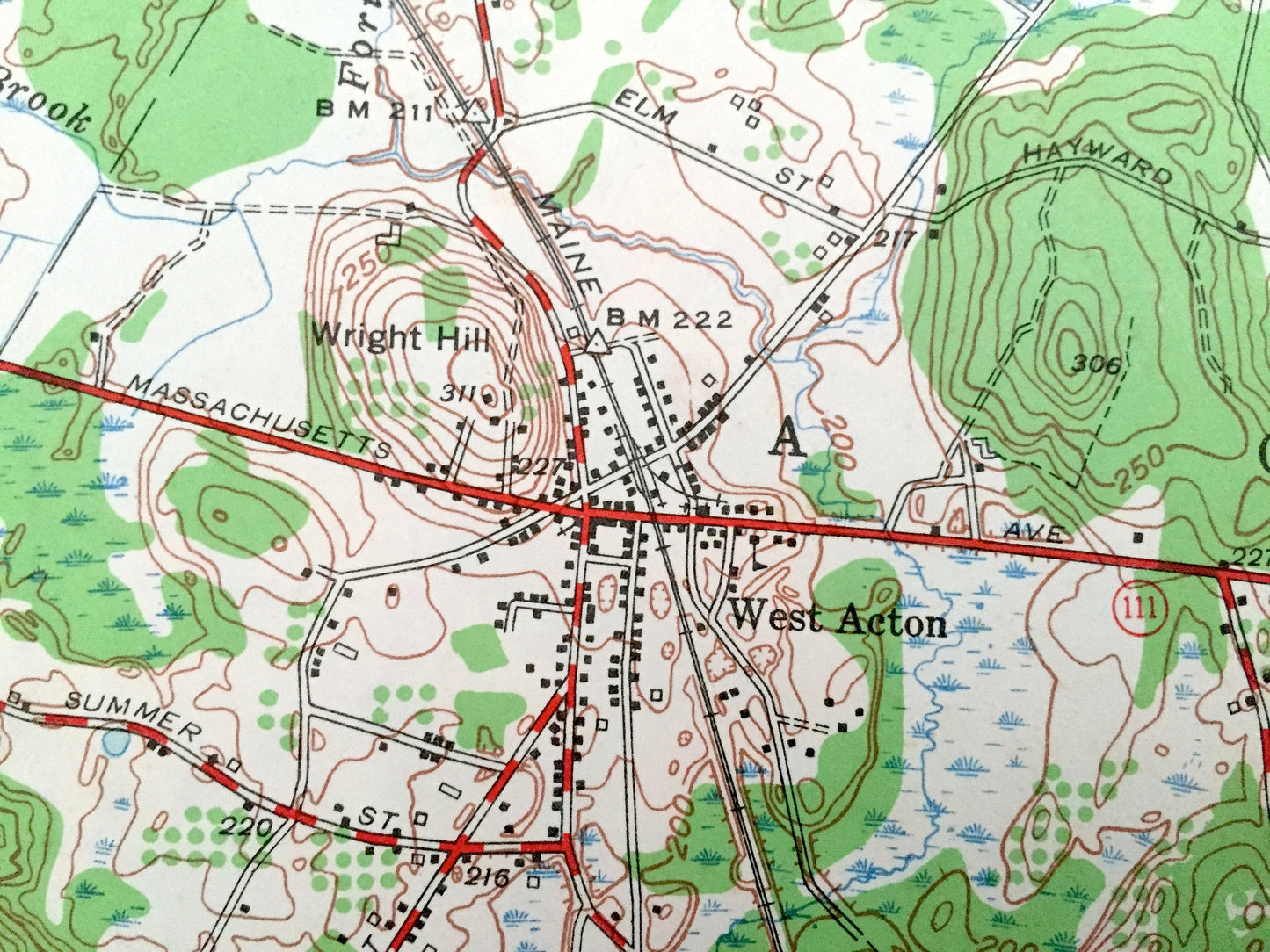
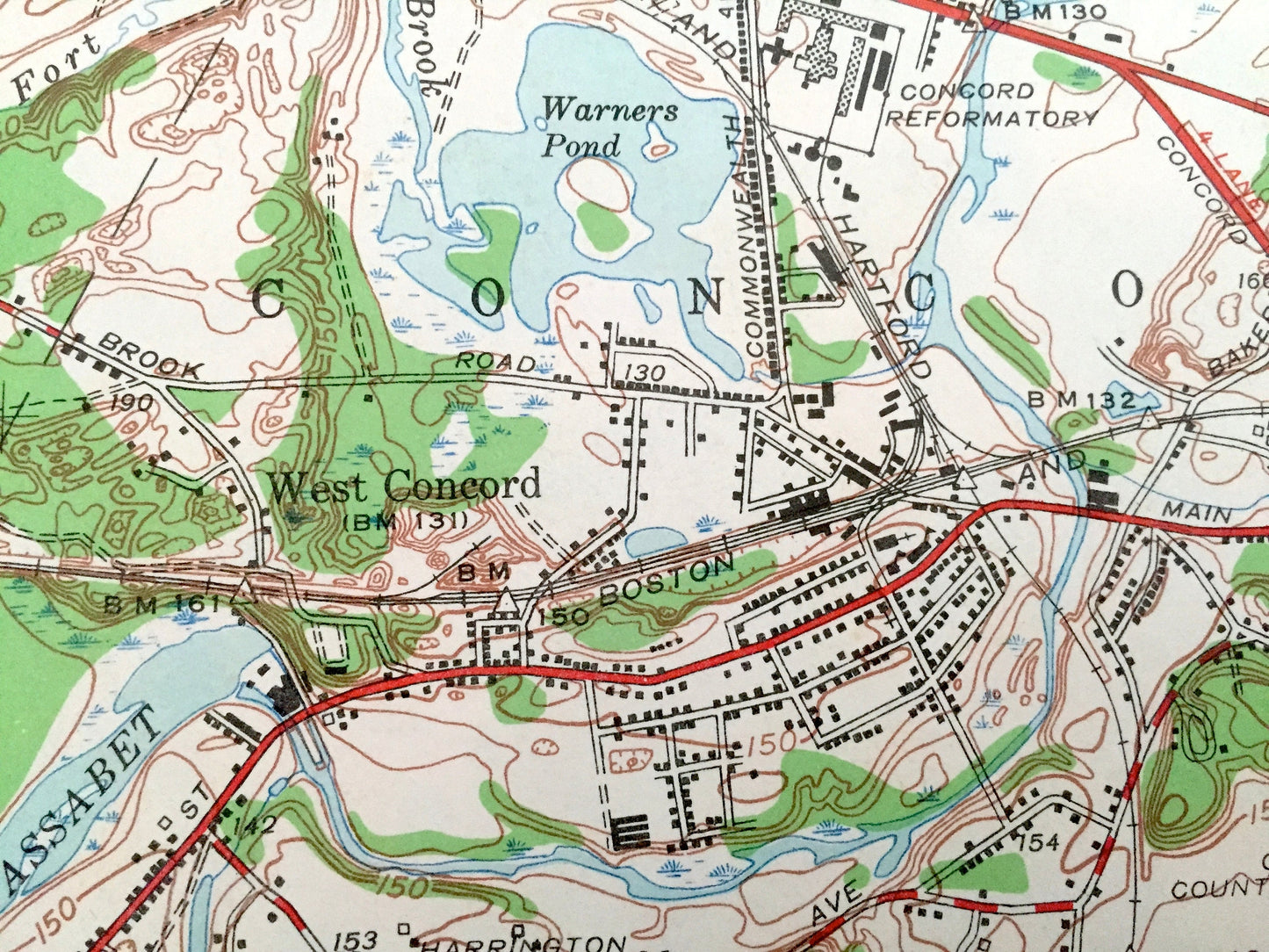
See what Middlesex County of Massachusetts looked like over 70 years ago. Lots of intricate details and geological contours. Map even has little squares for every house that existed at the time. The USGS cartographers were very thorough back then!
Perfect for the historian, map-lover, the curious or just as a conversation starter. Wonderful and rare. Vintage maps such as these make great gifts.
Edition of 1950, printed 1950
Dimensions: 22" width x 27" height
----
Features
Cities & Towns: Acton, Concord, Maynard, Sudbury, Hudson, Stow, South Acton, West Acton, West Concord.
Points of Interest: U.S. Military Reservation, Assabet River, Boston and Maine Railroad, Warners Pond, Concord Country Club, St. Elizabeths Chapel, Boons Pond, State Forest, Maynard Country Club, Assabet Country Club and more roads, houses, reservoirs, ponds, and hills.
Condition: Very Good Vintage condition, commensurate with age. This map is in great shape for being over 70 years old. Map has punch holes but these are easily concealed with framing or placing a similar-colored paper behind the map, as can be seen in the photos.
----
We will happily adjust shipping price for multiple purchases. Maps are rolled up and shipped in sturdy mailing tubes, never folded.
Couldn't load pickup availability
Share