My Store
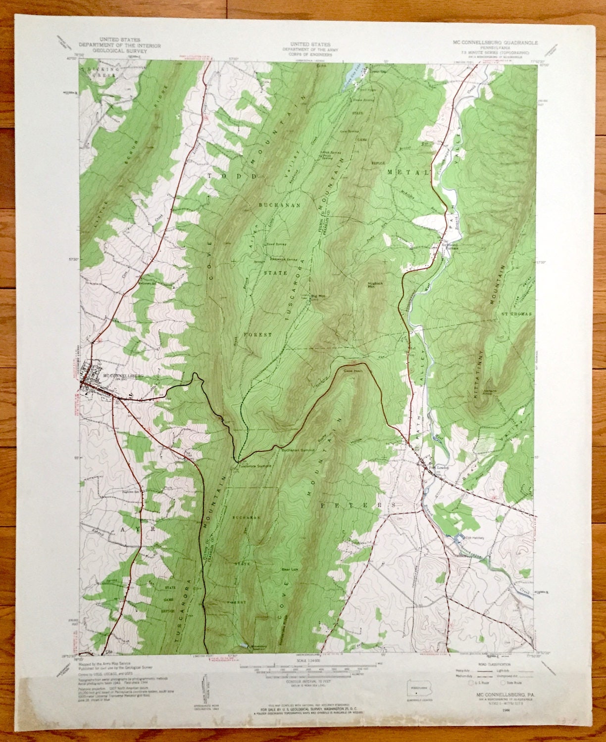
Antique McConnellsburg, Pennsylvania 1944 US Geological Survey Topographic Map – Peters Todd Buchanan State Forest Franklin Fulton County PA
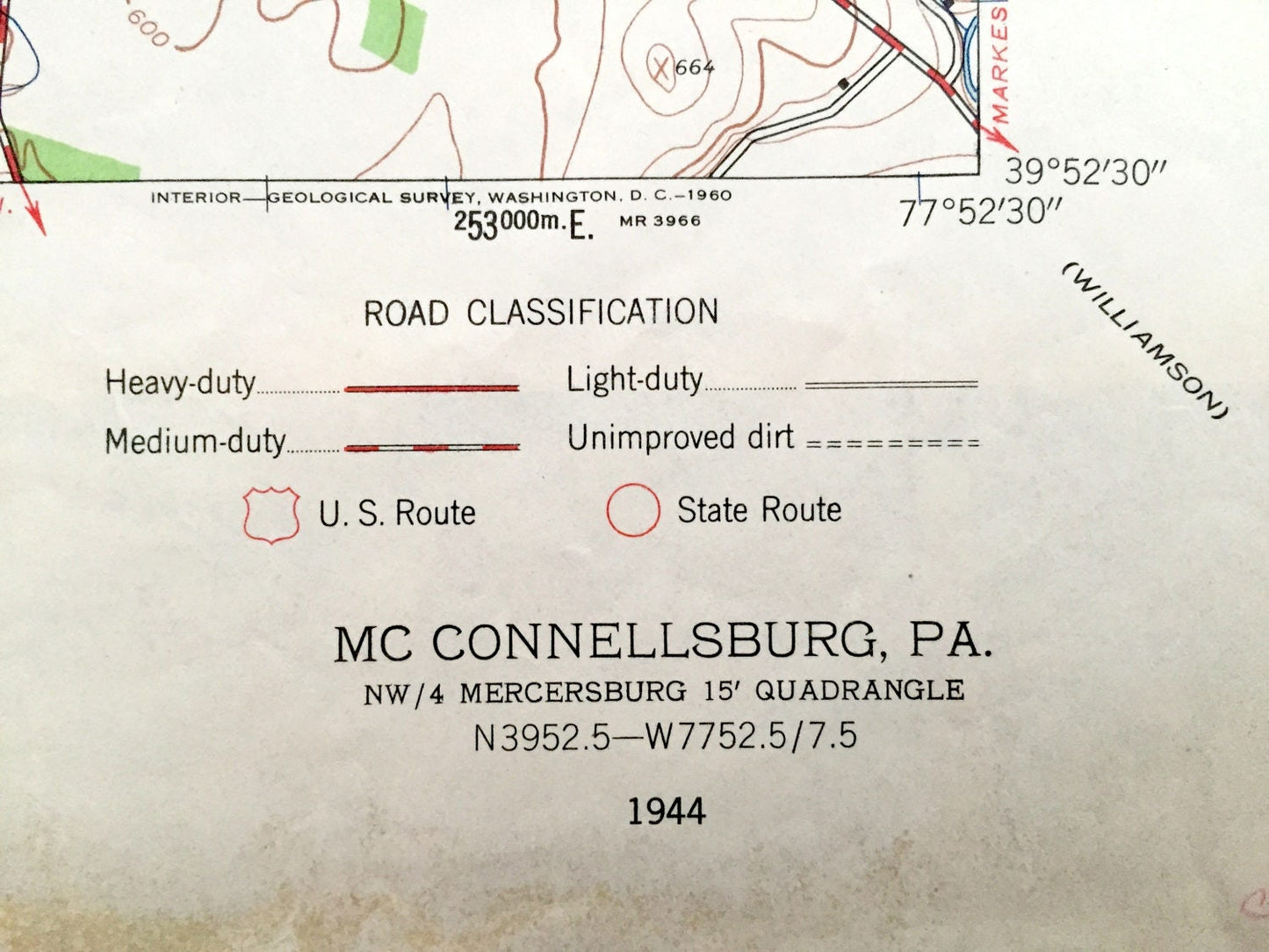
Antique McConnellsburg, Pennsylvania 1944 US Geological Survey Topographic Map – Peters Todd Buchanan State Forest Franklin Fulton County PA
Beautiful, antique map of McConnellsburg, Peters, Metal, Todd, Fort Loudon and Richmond Furnace, Pennsylvania. This is an authentic 1944 print from the U.S. Geological Survey and NOT a computer reproduction.
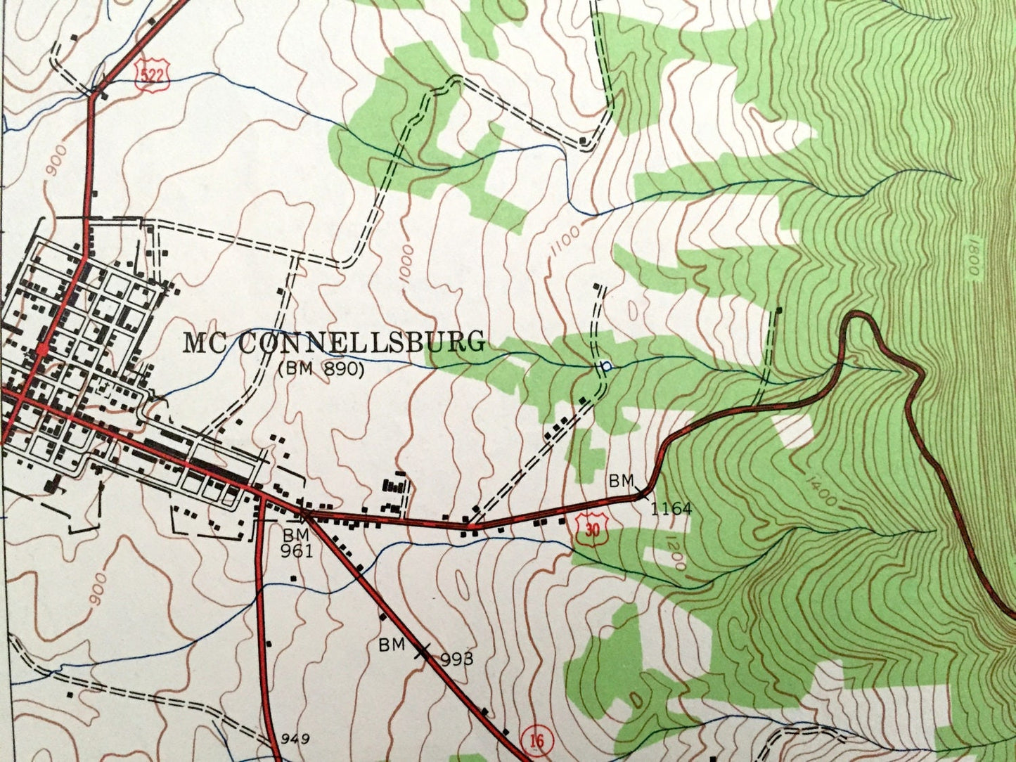
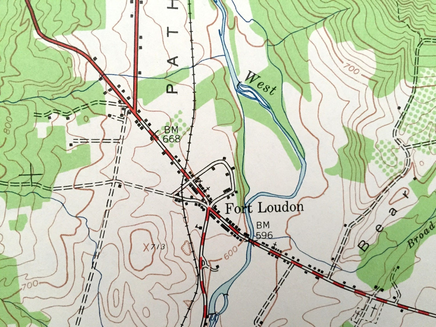
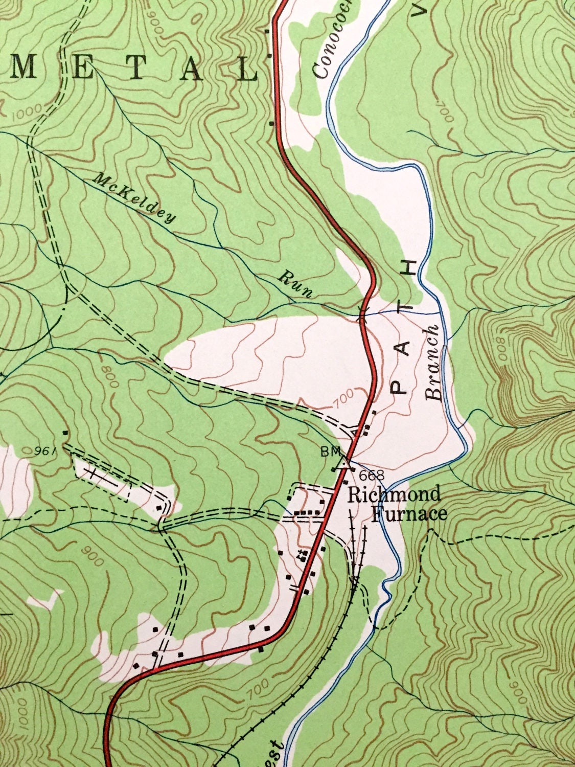
See what Franklin and Fulton County area of Pennsylvania looked like over 75 years ago. Lots of intricate details and geological contours. Map even has little squares for every house that existed at the time. The USGS cartographers were very thorough back then!
Perfect for the historian, map-lover, the curious or just as a conversation starter. Wonderful and rare. Vintage maps such as these make great gifts.
Edition of 1944, printed 1944
Dimensions: 22" width x 27" height
----
Features
Cities & Towns: Todd, McConnellsburg, Ayr, Fort Loudon, Peters, Richmond Furnace, St. Thomas, Metal, Todd, Cowan Gap, Dutchtown.
Points of Interest: Little Scrub Ridge, McGovern School, Buchanan State Forest, Cover Mountain, State Game Refuge, Cowan Gap Lake, House Spring, Kittatinny Mountain, Bear Valley, Fish Hatchery, Cove Mountain, Buchanan State Forest, Tuscarora Mountain, Jugtown School, and lots more hills, streams, ponds, schools, houses, and roads.
Condition: Very Good Vintage condition, commensurate with age. This map is in great shape for being over 75 years old. Has some edge-wear, which will read as character when framed.
----
We will happily adjust shipping price for multiple purchases. Maps are rolled up and shipped in sturdy mailing tubes, never folded.
Couldn't load pickup availability
Share