My Store
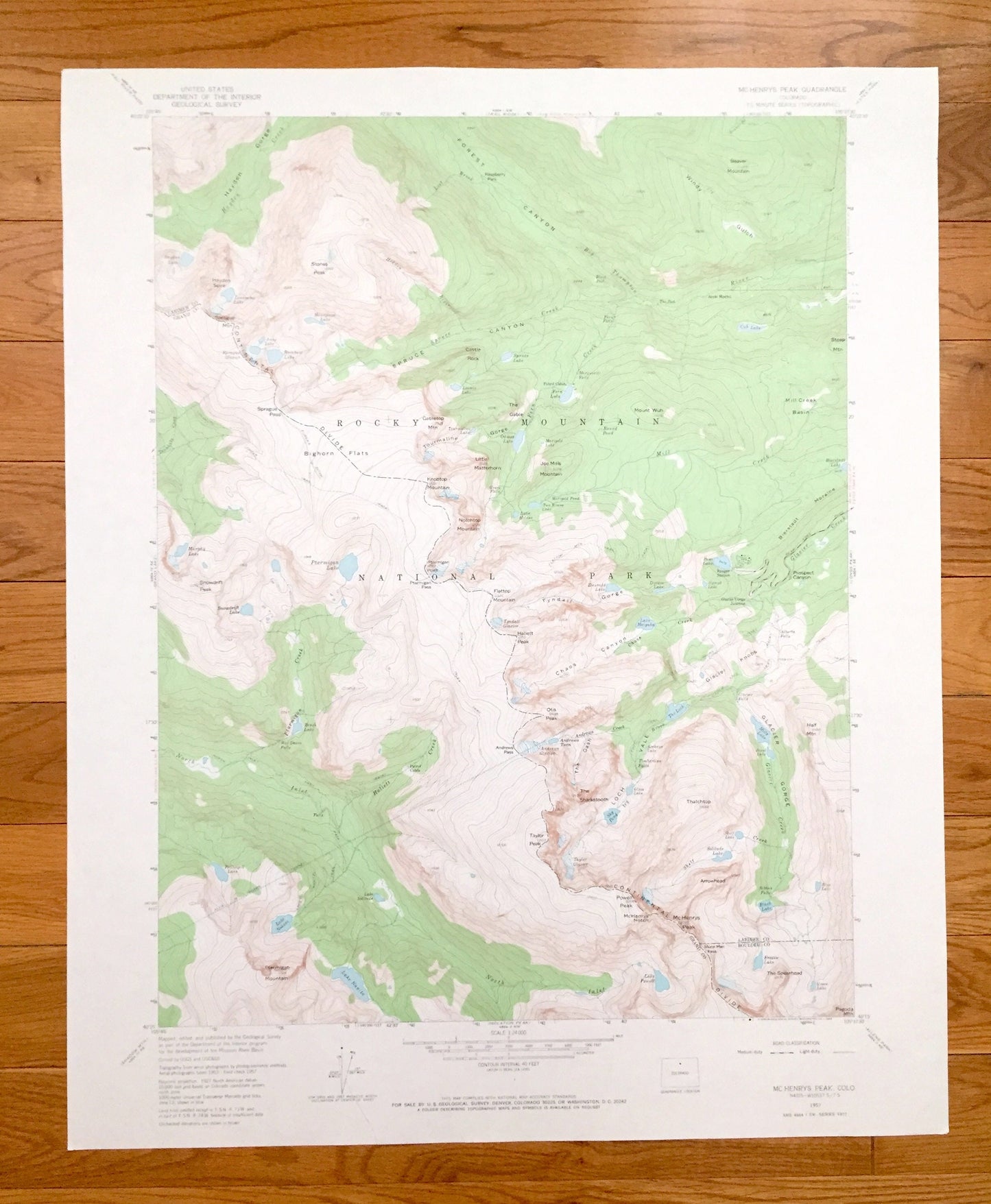
Antique McHenrys Peak, Colorado 1957 US Geological Survey Topographic Map – Larimer, Boulder, Grand County, CO
Antique McHenrys Peak, Colorado 1957 US Geological Survey Topographic Map – Larimer, Boulder, Grand County, CO
Beautiful, antique map of McHenrys Peak, Colorado and surrounding Larimer, Boulder & Grand County areas. This is an authentic 1957 edition, 1968 print from the U.S. Geological Survey and not a computer reprint.
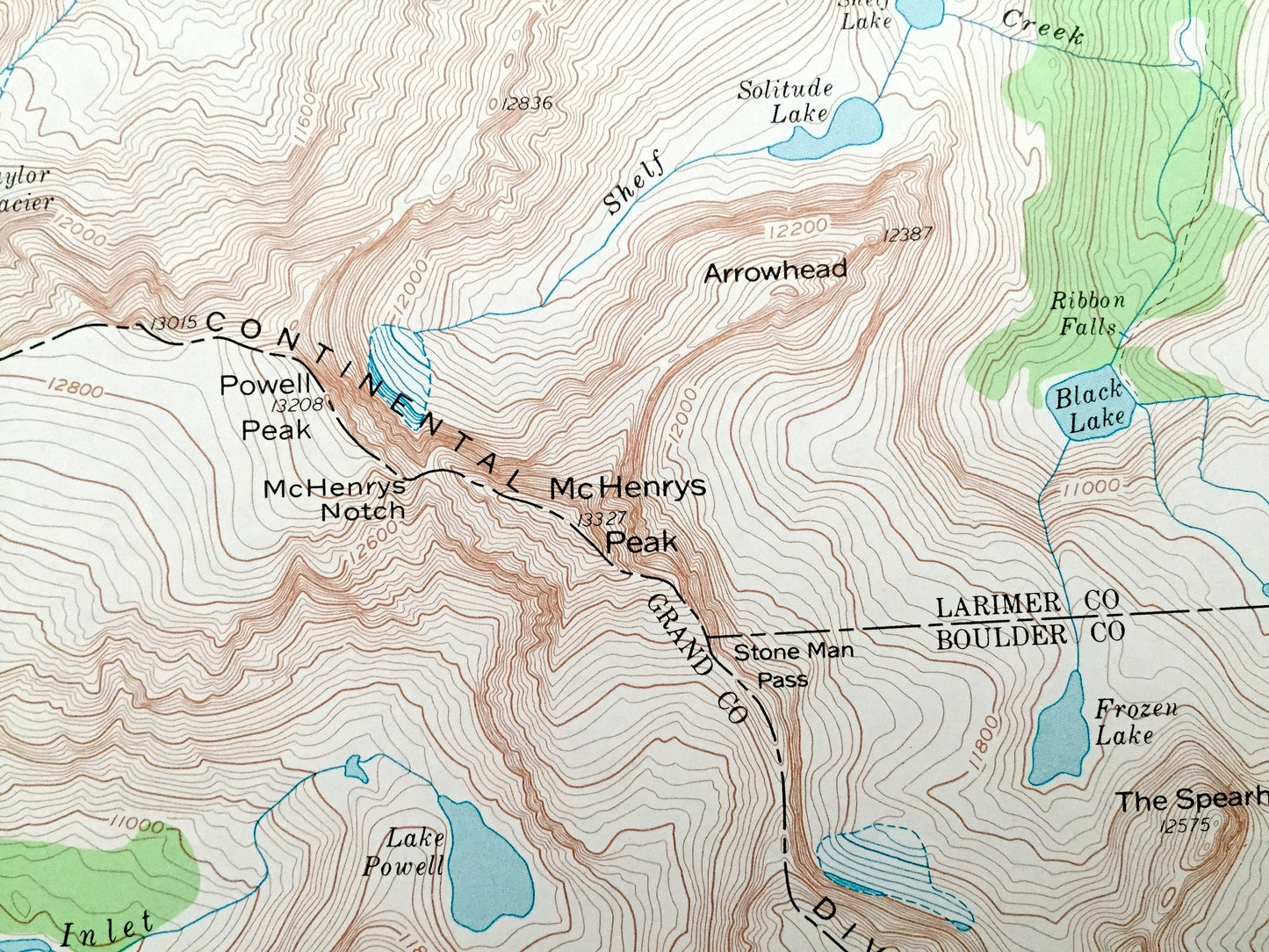
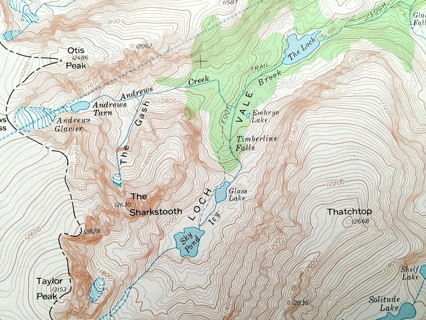
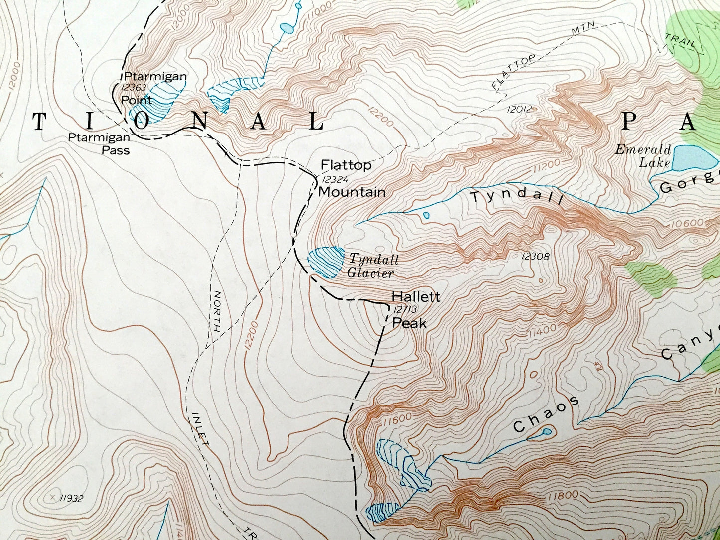
See what Colorado looked like over 60 years ago. Lots of intricate details and geological contours. Map even has little squares for every house that existed. The USGS cartographers were very thorough back then!
Perfect for the historian, map-lover, the curious or just as a conversation starter. Wonderful and rare. Vintage maps such as these make great gifts.
Edition of 1957, printed 1968
Dimensions: 22" width x 27" height
----
Features
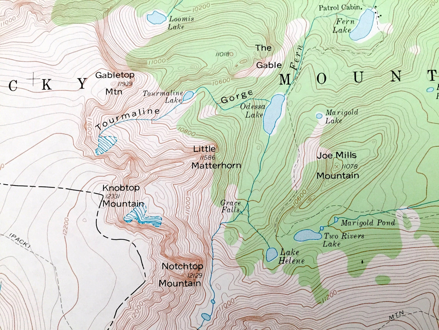
Points of Interest: Alva B Adams Tunnel, Rocky Mountain National Park, Chaos Canyon, Beaver Mountain, Forest Canyon, Spruce Canyon, Hayden Gorge, Ptarmigan Mountain, Snowdrift Peak, Knobtop Mountain, Notchtop Mountain, Glacier Knobs, McHenrys Peak, McHenrys Notch, Bierstadt Moraine, Mill Creek Basin, Glacier Gorge Junction, Lonesome Lake, Snowdrift Lake, Pettingell Lake, Lake Nokoni, Lake Nanita, Hallett Creek, Hayden Creek, Thompson River, Shelf Creek, and many more hills, streams, ponds, houses, schools, railroads, churches and roads.
Condition: Very Good Vintage condition, commensurate with age. This map is in great shape for being over 50 years old. Has some wear and folds as-issued, but these will flatten easily and all will add to vintage character when framed.
----
We will happily adjust shipping price for multiple purchases. Maps are rolled up and shipped in sturdy mailing tubes, never folded.
Couldn't load pickup availability
Share