My Store
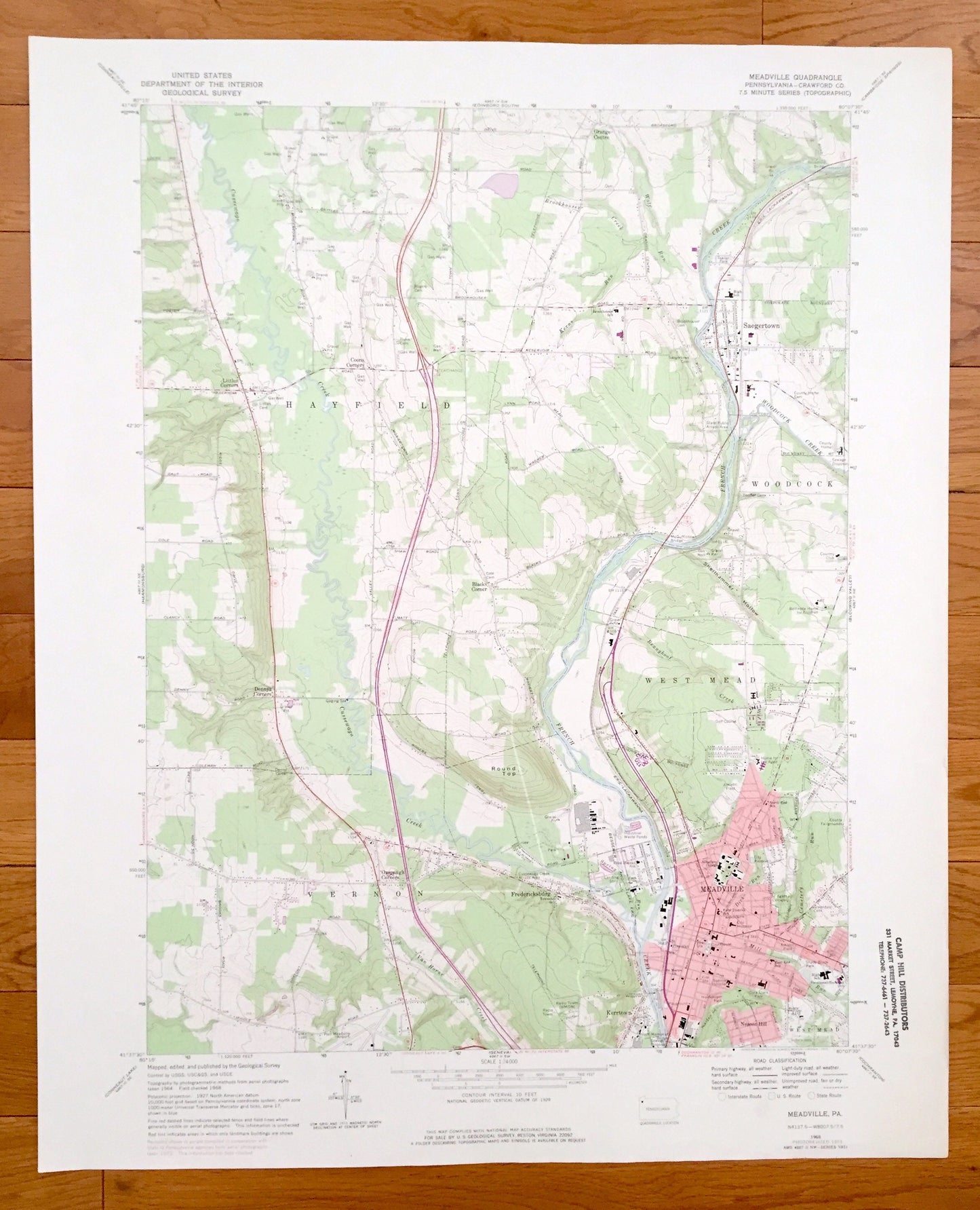
Antique Meadville, Pennsylvania 1968 US Geological Survey Topographic Map – Crawford County, Fredericksburg, Kerrtown Saegertown Hayfield PA
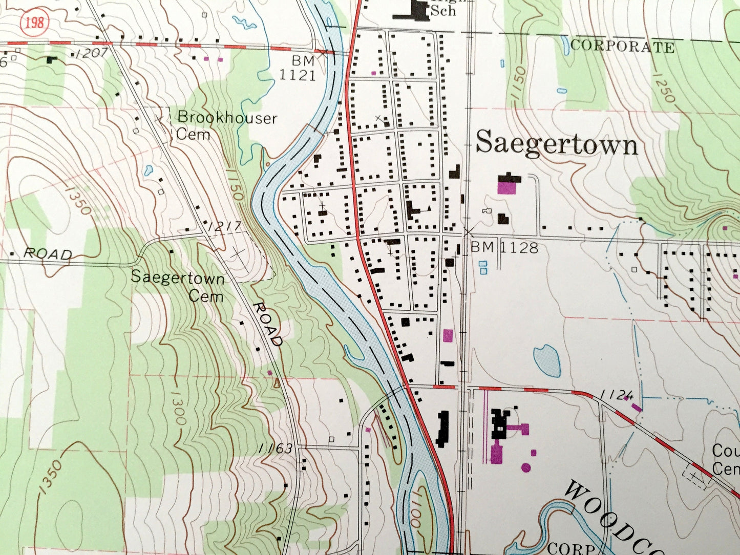
Antique Meadville, Pennsylvania 1968 US Geological Survey Topographic Map – Crawford County, Fredericksburg, Kerrtown Saegertown Hayfield PA
Beautiful, antique map of Meadville, Pennsylvania and surrounding Crawford County area. This is an authentic 1968 edition, 1975 print from the U.S. Geological Survey and NOT a computer reproduction.
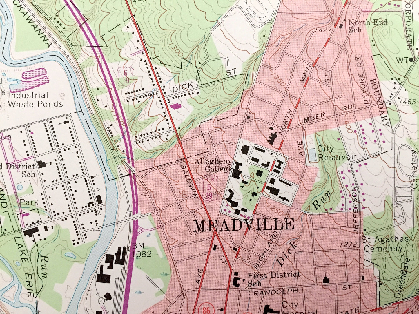
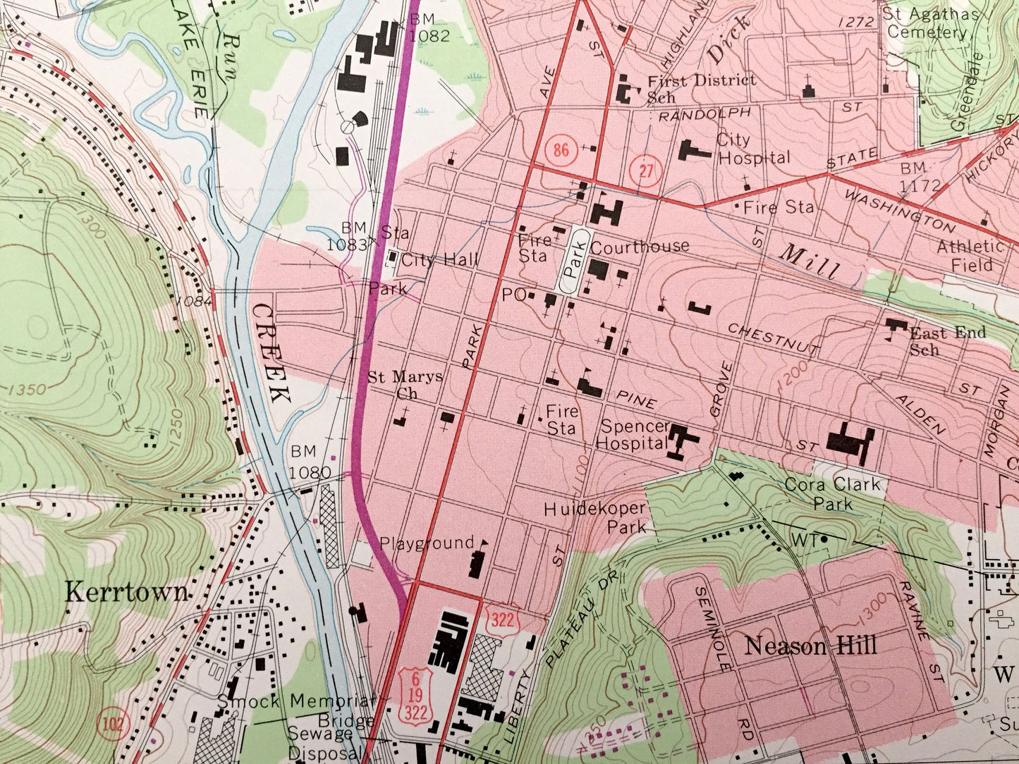
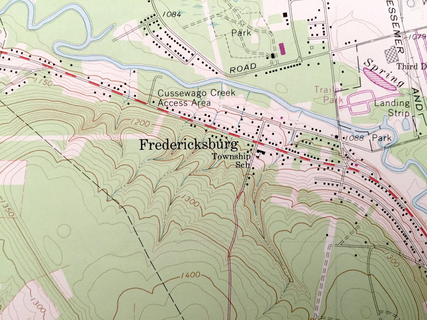
See what Pennsylvania looked like 50 years ago. Lots of intricate details and geological contours. Map even has little squares for every house that existed at the time. The USGS cartographers were very thorough back then!
Perfect for the historian, map-lover, the curious or just as a conversation starter. Wonderful and rare. Vintage maps such as these make great gifts.
Edition of 1968, printed 1975
Dimensions: 22" width x 27" height
----
Features
Cities & Towns: Meadville, Neason Hill, Saegertown, Blacks Corner, Fredericksburg, Kerrtown, Onspaugh Corners, Dennys Corners, Coons Corners, Little Corners, Vernon, Hayfield, Woodcock, West Mead.
Points of Interest: Round Top, Radio Towers, County Fairgrounds, Erie-Lackawanna Railroad, French Creek, Woodcock Creek, Shellhammer Hollow, Shady Brook Park, Cora Clark Park, Hudekoper Park, Cussewago Creek, Port Meadville Airport, and many more hills, streams, ponds, houses, schools, churches and roads.
Condition: Very Good condition, commensurate with age. This map is in incredible shape for being 50 years old. This map was most likely used in the field. Has light-edge wear, but this will read as vintage character when framed.
----
We will happily adjust shipping price for multiple purchases. Maps are rolled up and shipped in sturdy mailing tubes, never folded.
Couldn't load pickup availability
Share