My Store
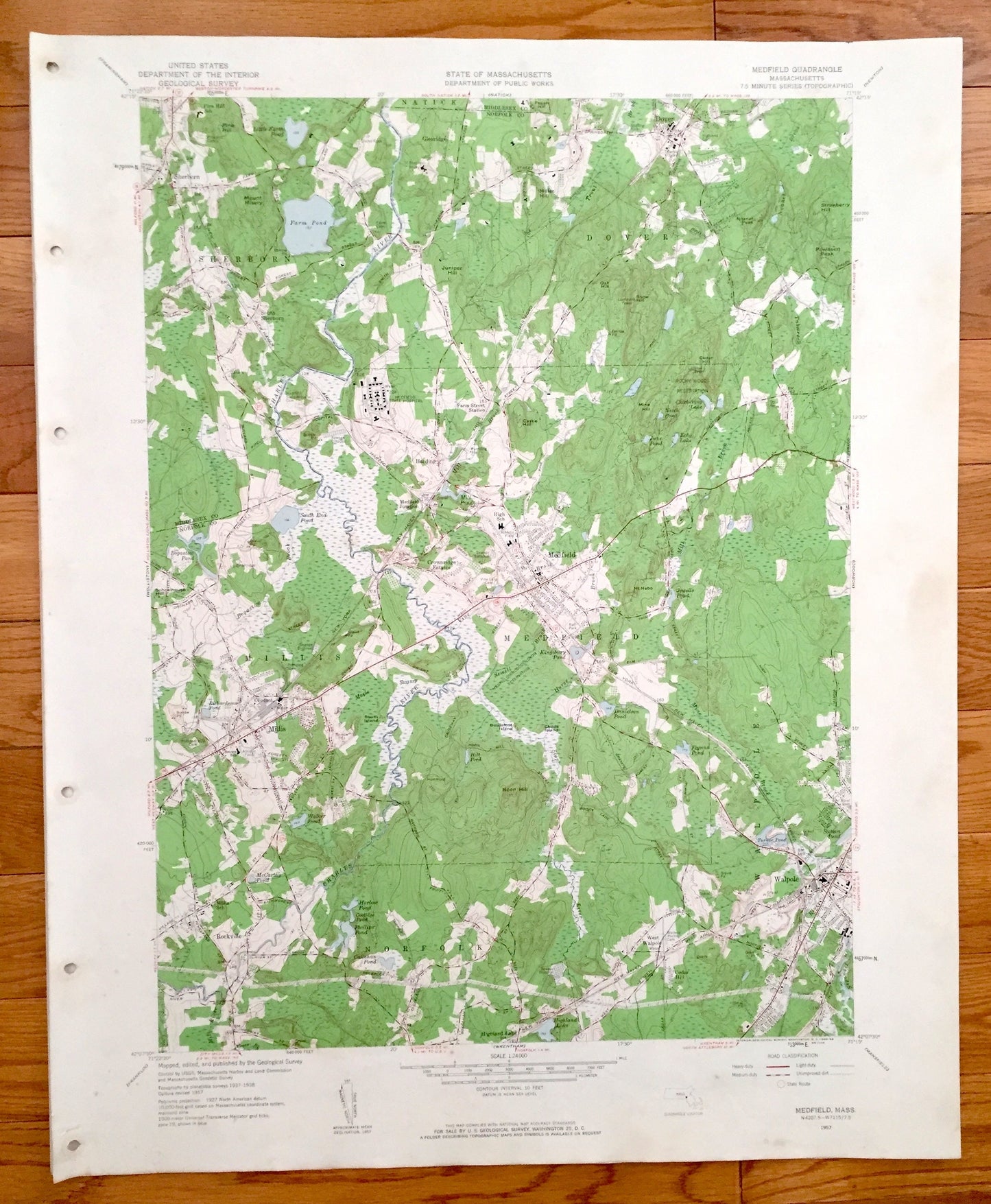
Antique Medfield, Massachusetts 1957 US Geological Survey Topographic Map – Millis, Sherborne, Walpole, Norfolk County, Walpole, Dover, MA
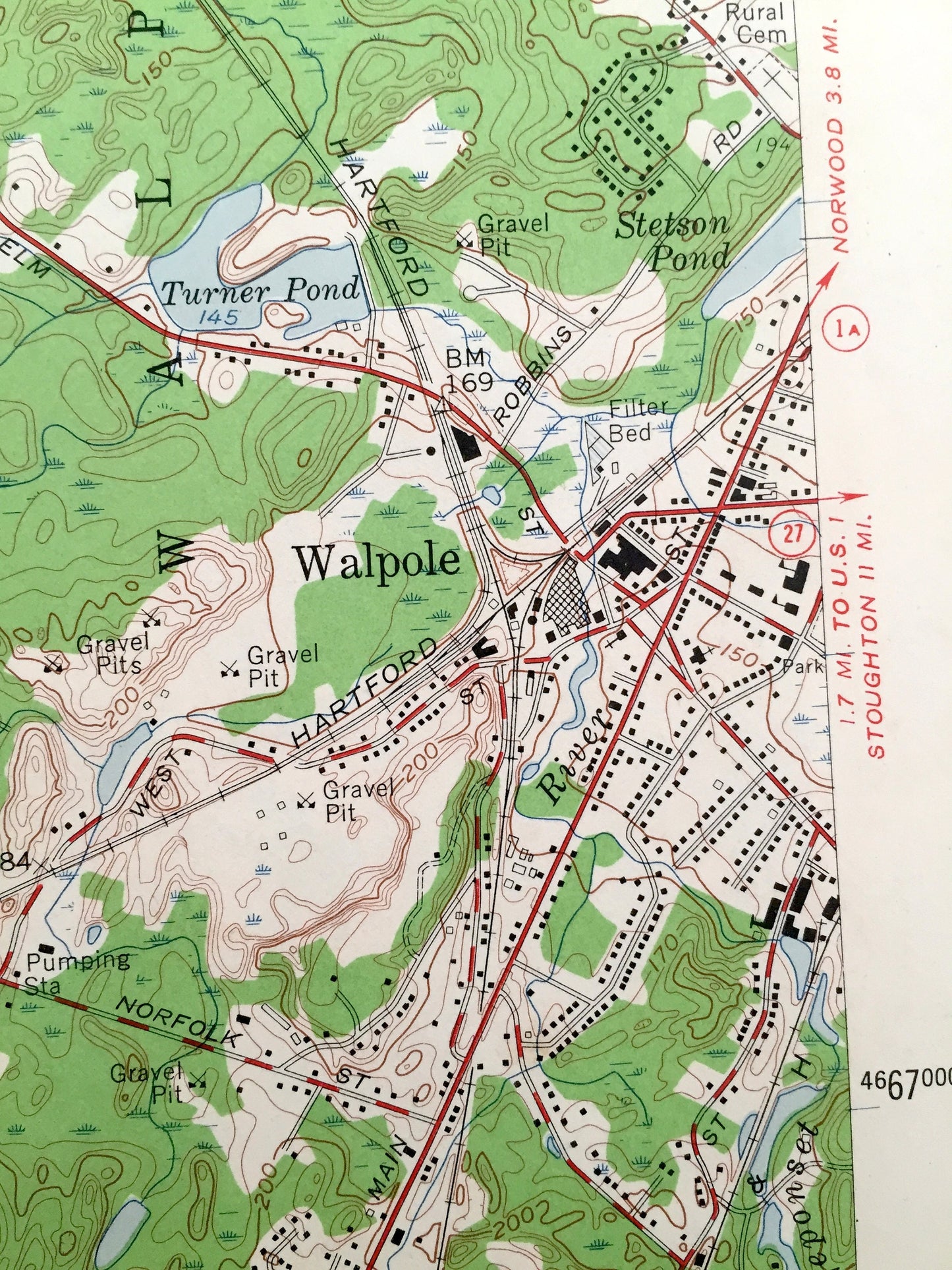
Antique Medfield, Massachusetts 1957 US Geological Survey Topographic Map – Millis, Sherborne, Walpole, Norfolk County, Walpole, Dover, MA
Beautiful, antique map of Medfield, Sherborne, Dover, Walpole, Norfolk and Millis, Massachusetts. This is an authentic 1957 print from the U.S. Geological Survey and NOT a computer reproduction.
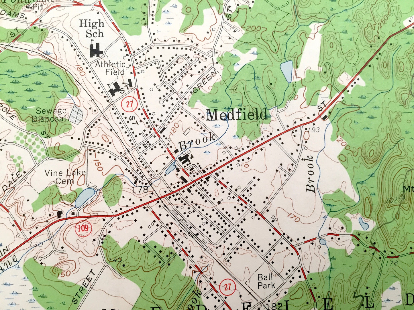
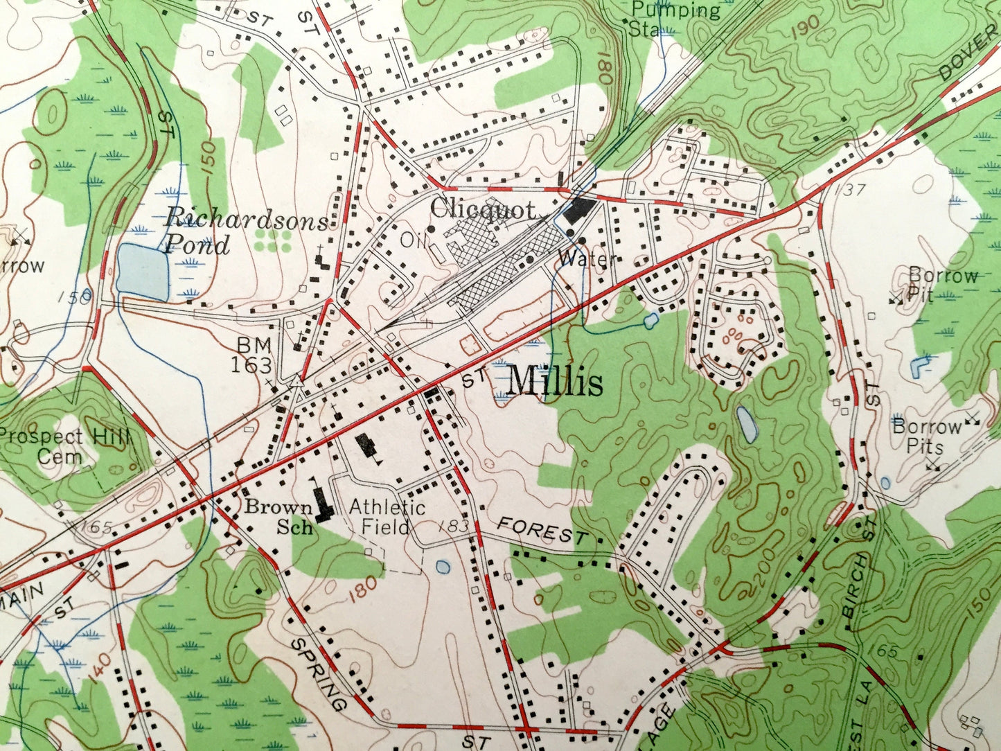
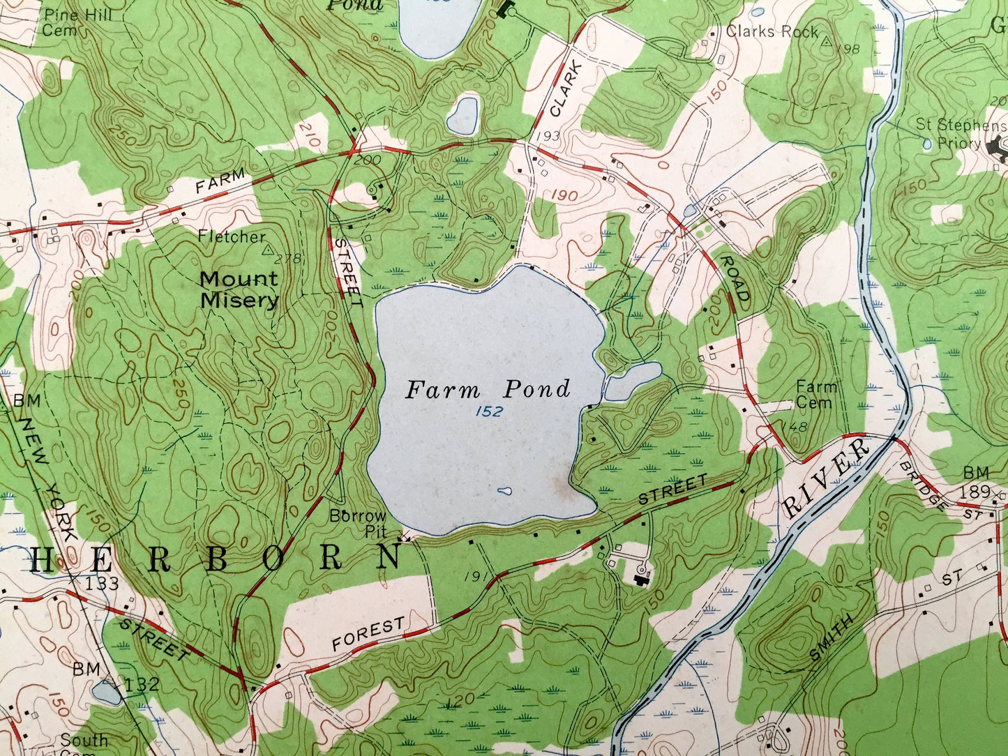
See what the Norfolk County looked like 60 years ago. Lots of intricate details and geological contours. Map even has little squares for every house that existed at the time. The USGS cartographers were very thorough back then!
Perfect for the historian, map-lover, the curious or just as a conversation starter. Wonderful and rare. Vintage maps such as these make great gifts.
Edition of 1957, printed 1957
Dimensions: 22" width x 27" height
----
Features
Cities & Towns: Sherborne, South Sherborne, Dover, Harding, Millis, Medfield, West Walpole, Walpole, Norfolk, Highland Lake, Rockville.
Points of Interest: Farm Pond, Norfolk Hunt Club, Mt. Nero, Turner Pond, Midfield Junction, Powisset Peak, Echo Lake, Charles River, Farm Street Station, Noon Hill, South End Pond, Bogastow Pond,New York New Haven and Hartford Railroad, and lots more hills, mountains, streams, ponds, houses, and roads.
Condition: Very Good condition, commensurate with age. This map is in incredible shape for being 60 years old.Map has punch holes but these are easily concealed with framing or placing a similar-colored paper behind the map, as can be seen in the photos.
----
We will happily adjust shipping price for multiple purchases. Maps are rolled up and shipped in sturdy mailing tubes, never folded.
Couldn't load pickup availability
Share