My Store
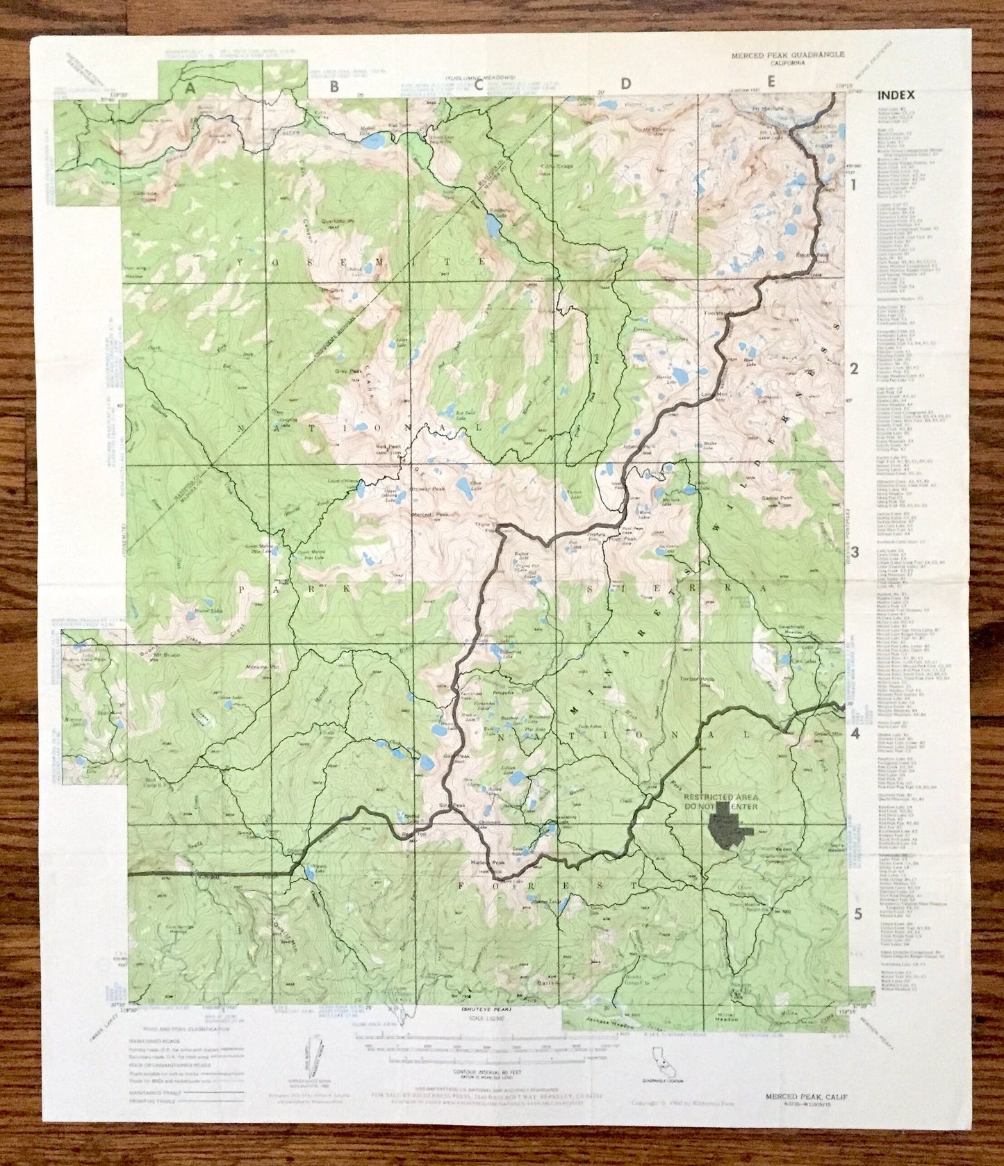
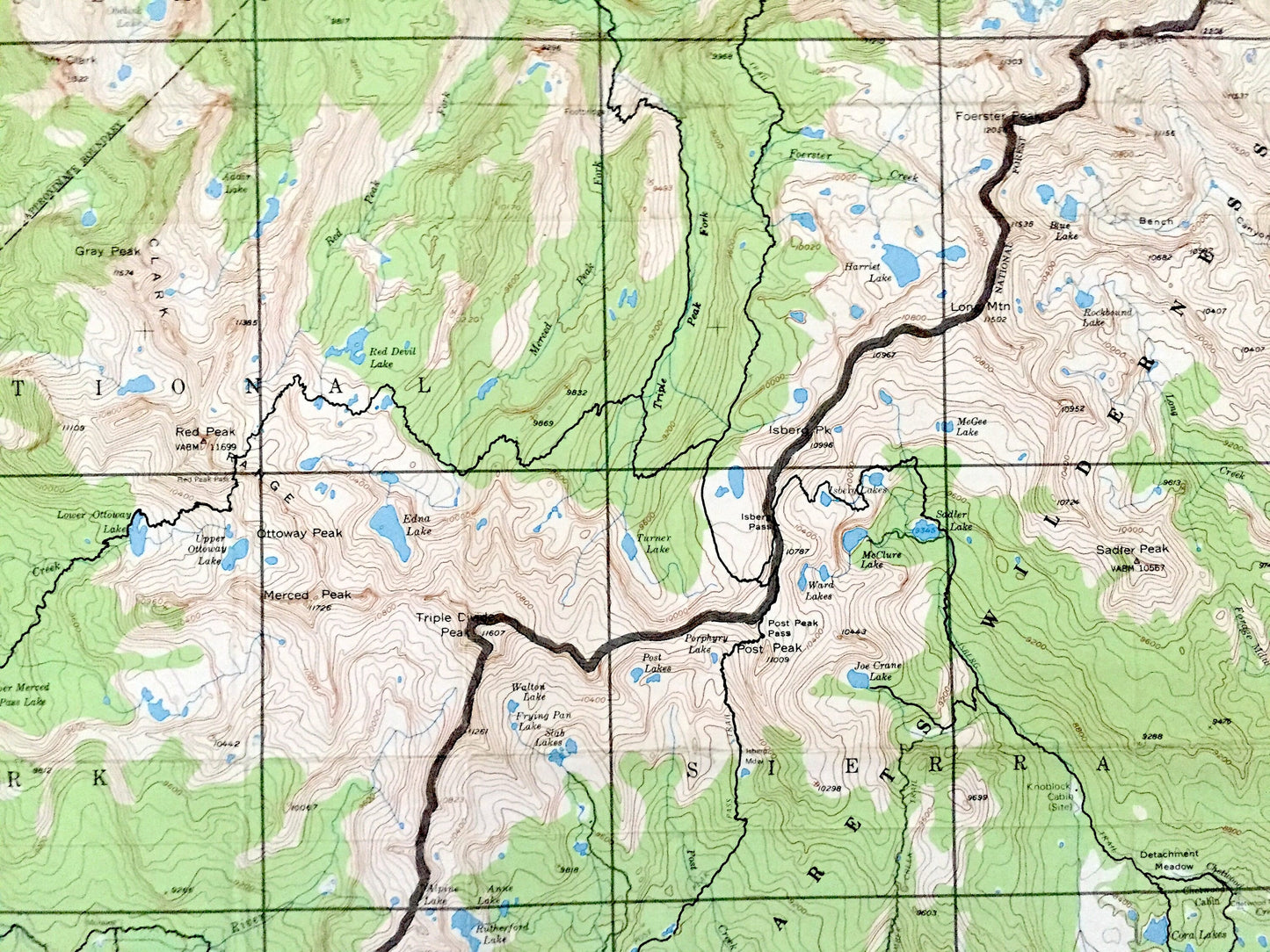
Antique Merced Peak, California 1976 US Geological Survey Topographic Map – Yosemite National Park, Sierra Forest, Inyo, Mariposa, Madera CA
Antique Merced Peak, California 1976 US Geological Survey Topographic Map – Yosemite National Park, Sierra Forest, Inyo, Mariposa, Madera CA
Beautiful, antique map of Merced Peak, California and surrounding Yosemite National Forest & Sierra National Forest area. This is an authentic 1976 edition, 1980 print from the U.S. Geological Survey/Wilderness Press and NOT a computer reproduction.
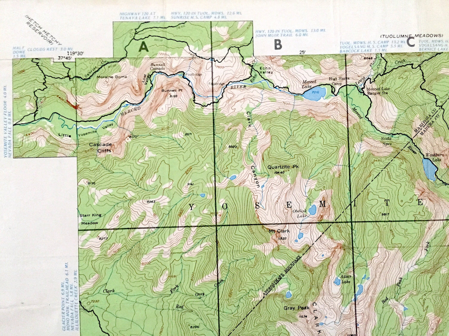
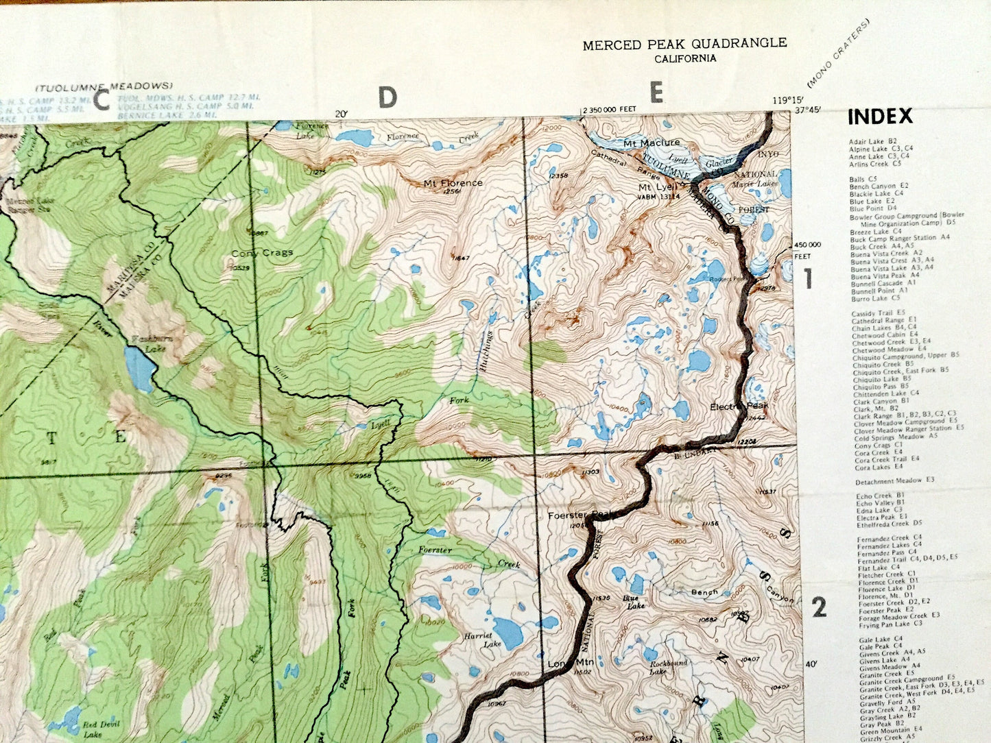
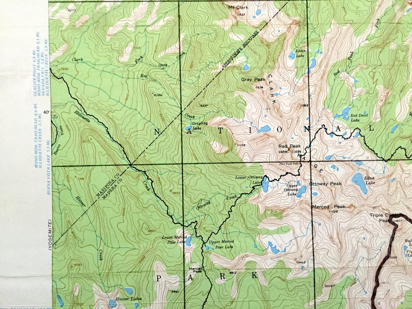
See what California looked like over 45 years ago. Lots of intricate details and geological contours. Map even has little squares for every house that existed at the time. The USGS cartographers were very thorough back then!
Perfect for the historian, map-lover, the curious or just as a conversation starter. Wonderful and rare. Vintage maps such as these make great gifts.
Edition of 1976, printed 1980
Dimensions: 18" width x 21" height
----
Features
Points of Interest: Mono County, Tuolumne County, Madera County, Mariposa County, Yosemite National Park, Sierra National Forest, Clark Rangel, Triple Divide Peak, Buena Vista Crest, Starr King Meadow, Ottoway Peak, Merced River, Sadler Peak, Electra Peak, Mt Machure, Inyo National Forest, and many more hills, mountains, canyons, creeks, houses, roads, ranches and camps.
Condition: Good Vintage condition, commensurate with age. This map is in great shape for being over 40 years old. Has some wear and folds as-issued but these will flatten easily and all will read as vintage character when framed.
----
We will happily adjust shipping price for multiple purchases. Maps are rolled up and shipped in sturdy mailing tubes, never folded.
Couldn't load pickup availability
Share