My Store
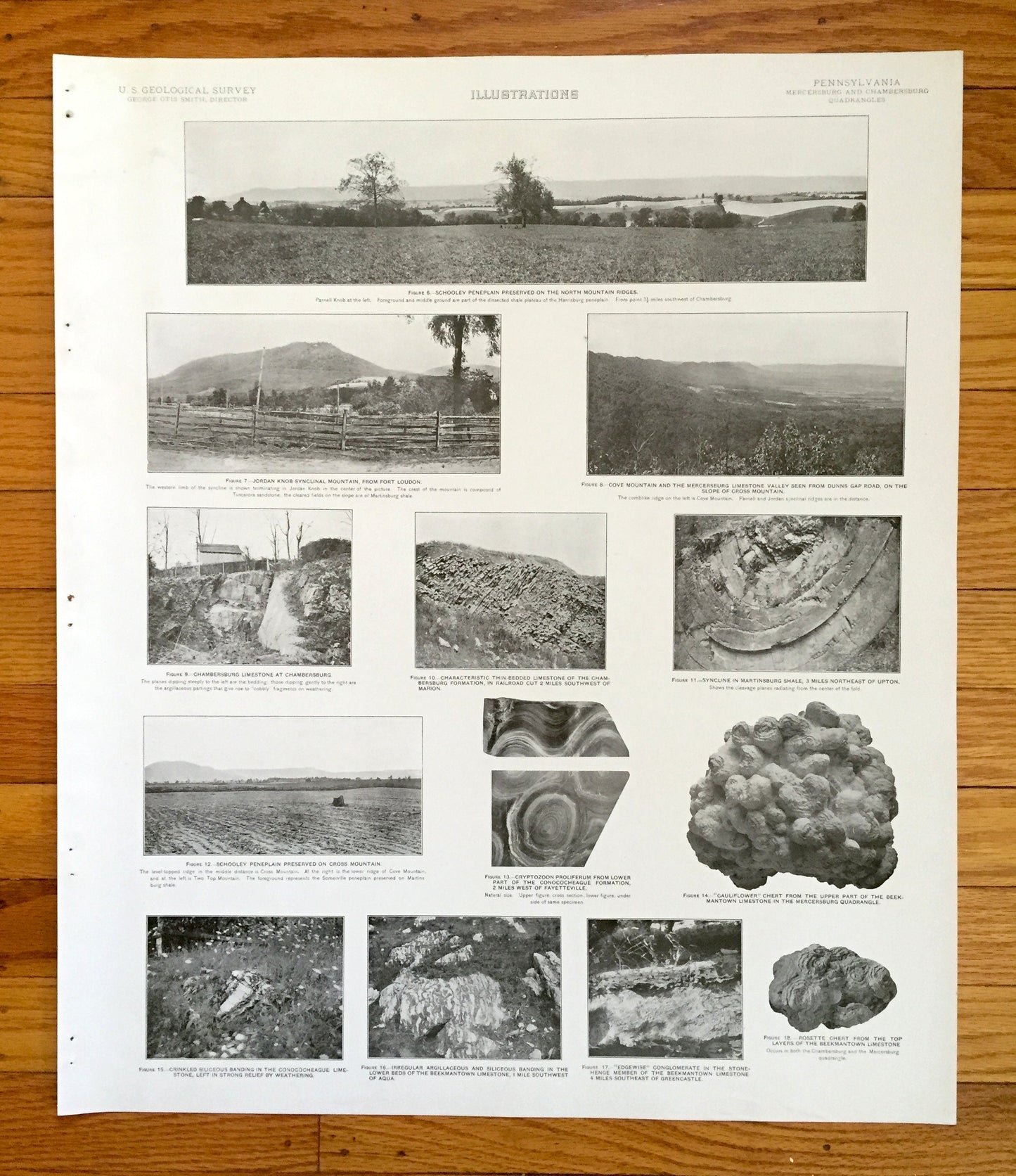
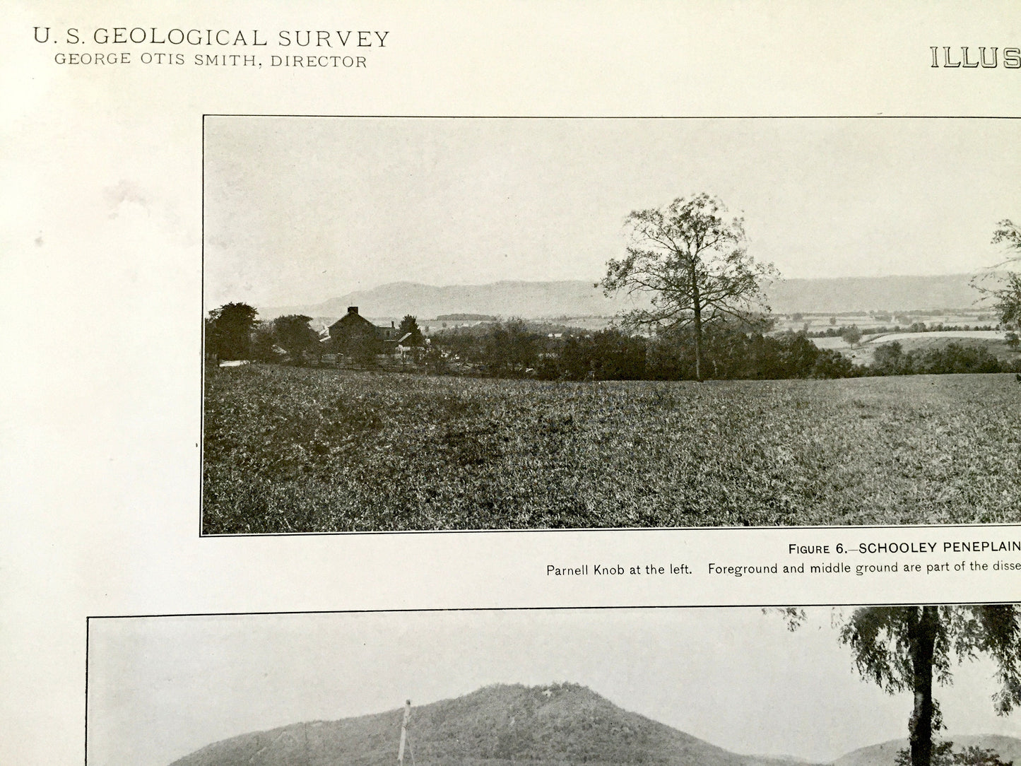
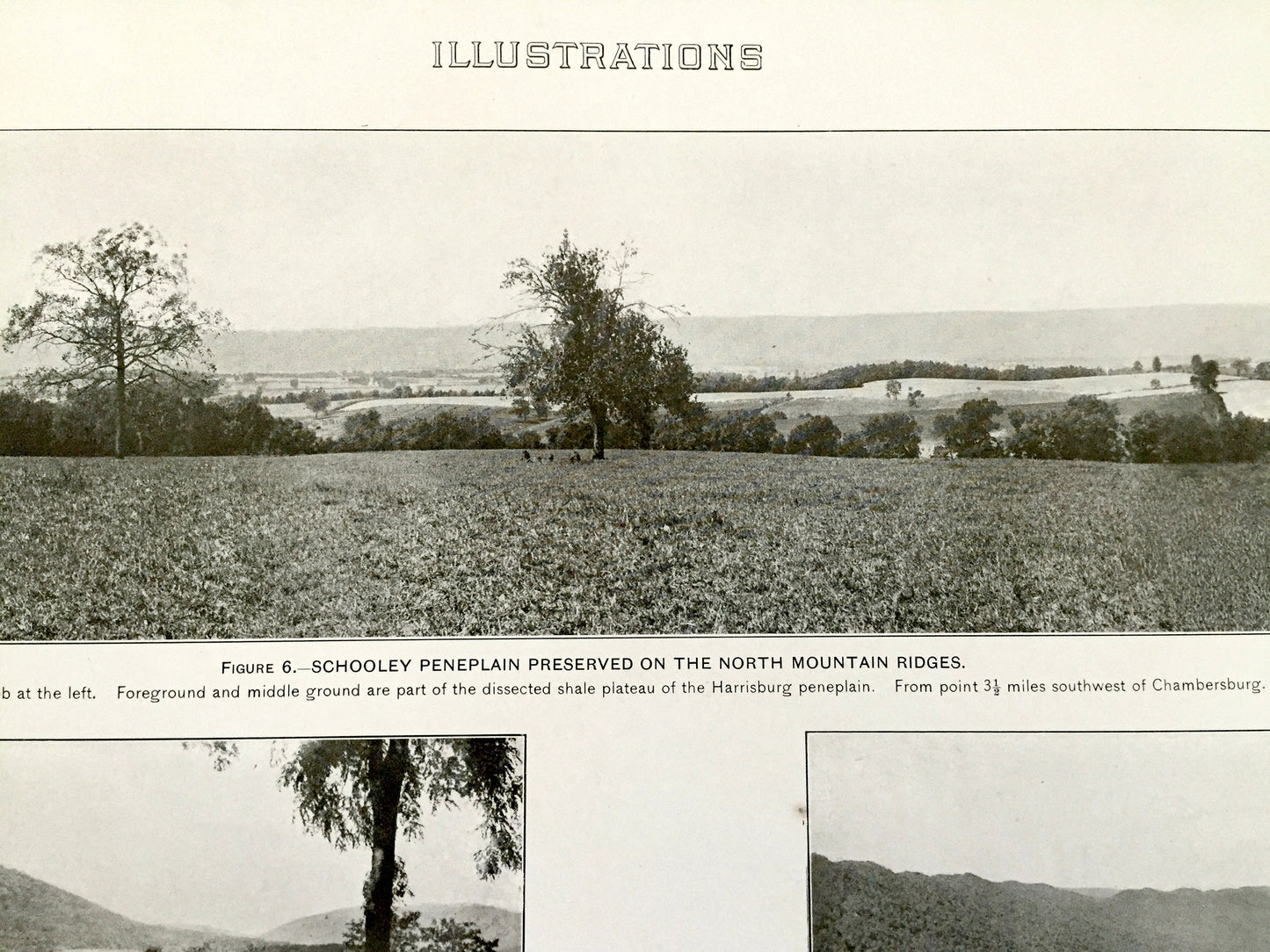
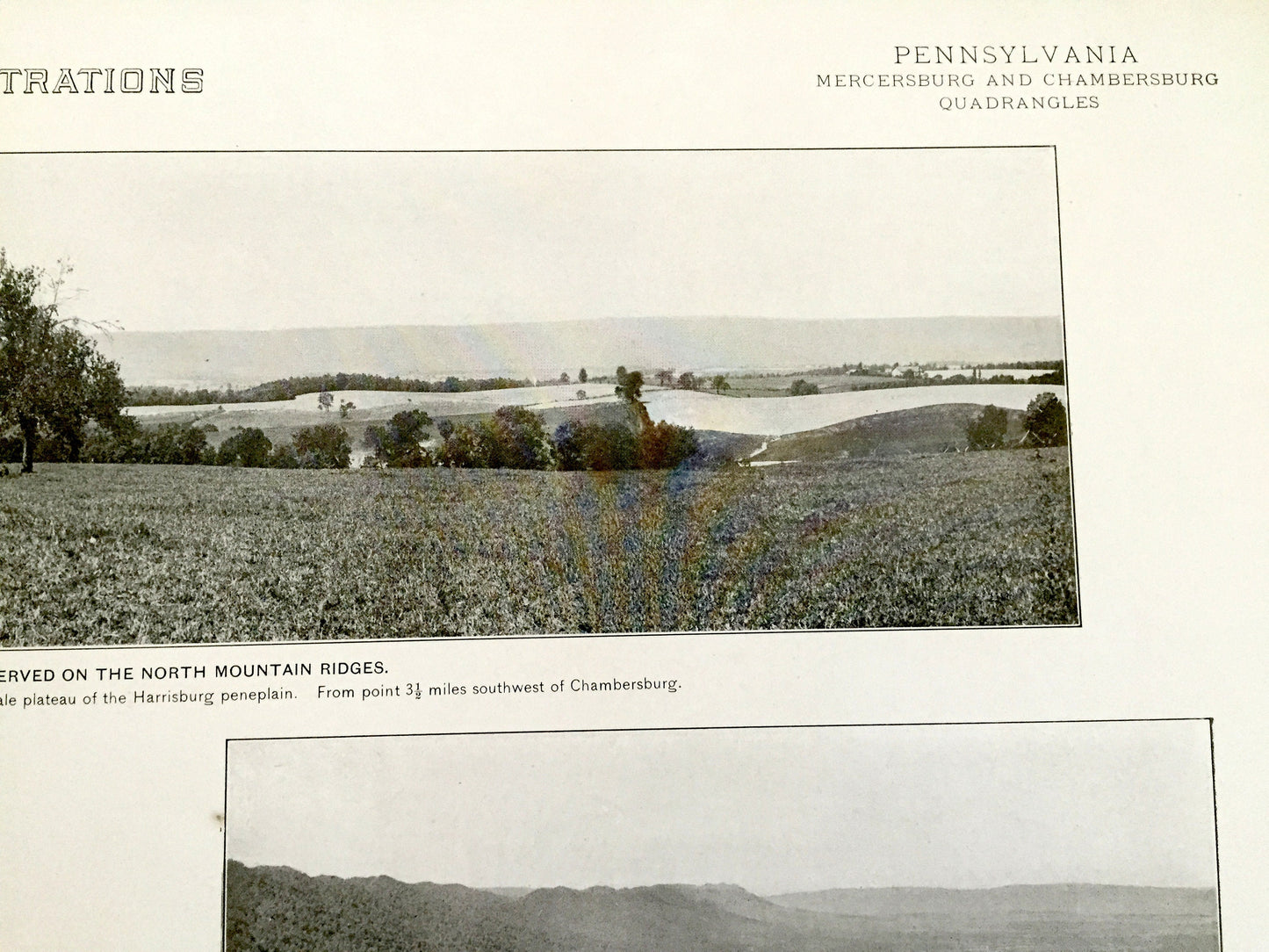
Antique Mercersburg-Chambersburg, Pennsylvania 1909 US Geological Survey Topographic Photographs – Fulton, Franklin County, Schooley Plain
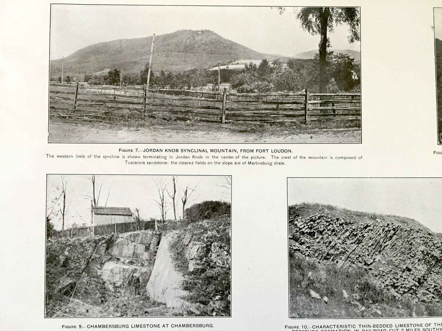
Antique Mercersburg-Chambersburg, Pennsylvania 1909 US Geological Survey Topographic Photographs – Fulton, Franklin County, Schooley Plain
Beautiful, antique plate of photographs of the Mercersburg-Chambersburg region of Pennsylvania. This is an authentic 1909 print from a U.S. Geological Survey folio and NOT a computer reproduction.
See what Pennsylvania looked like over 110 years ago. Perfect for the historian, nature-lover, the curious or just as a conversation starter. Very rare. Vintage prints such as these make great gifts.
Edition of 1909, printed 1909
Dimensions: 18 1/2" width x 21 3/4" height
----
Features
Cities & Towns: Mercersburg, Licking Creek, Todd, Metal, Letterkenny, Hamilton, St. Thomas, Peters, Ayr, Warren, Montgomery, Antrim, McConnellsburg, Edenville, Upton, Chambersburg, Letterkenny, St Thoma, Hamilton, Greene, Southampton, Guilford, Amtrim, Quincy, Washington, Rocky Springs, Green Village, Scotland, Stonehenge, Stoufferstown, Beautiful, Red Bridge, Smoketown, Woodstock, Conocheague Island, West Fayetteville, Sunbeam, Turkeyfoot, Marion, Housum, Kauffman, Guilford Springs, Falling Spring, Aula, New Franklin, Guilford Siding, Fayetteville, Black Gap, Mt Union, Duffield, Pond Bank, Ledy, Greencastle, Shady Grove, Clay Hill, Elbrook, Five Forks, Greendale, Zullinger, Waynecastle, Waynesboro, Knepper, Mont Alto, Slabtown, Montalto Park, Tartown, Tomstown, Biesecker Gap, Roadside.
Points of Interest: Fulton County, Franklin County, Tuscarora Mountain, Scrub Ridge, Cove Mountain, Claylick Mountain, Bear Valley, North Mountain, Path Valley, Cumberland Valley Railroad, Horse Valley, South Mountain, Conocheague Creek, Sandy Ridge, Quincy Mountain, Pleasant Peak, Antietam Creek, and many more small towns, roads, schools, hills, creeks and rivers.
Condition: Good Vintage condition, commensurate with age. This map is in great shape for being over 100 years old. Has staple-holes in margin from folio, foxing, toning and edge-wear but this will all add to vintage character when framed.
----
We will happily adjust shipping price for multiple purchases. Maps are rolled up and shipped in sturdy mailing tubes, never folded.
Couldn't load pickup availability
Share