My Store
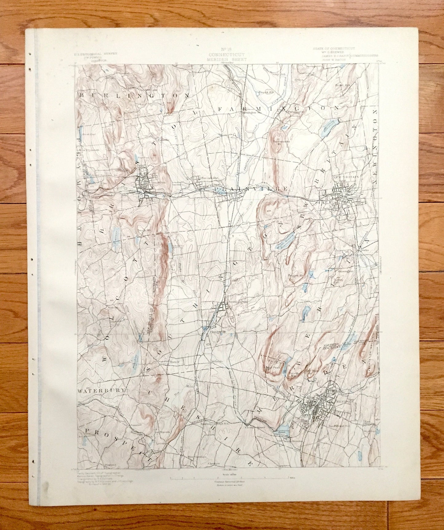
Antique Meriden, Connecticut 1893 US Geological Survey Topographic Map – Burlington, Farmington, Southington, Bristol New Britain Wolcott CT
Antique Meriden, Connecticut 1893 US Geological Survey Topographic Map – Burlington, Farmington, Southington, Bristol New Britain Wolcott CT
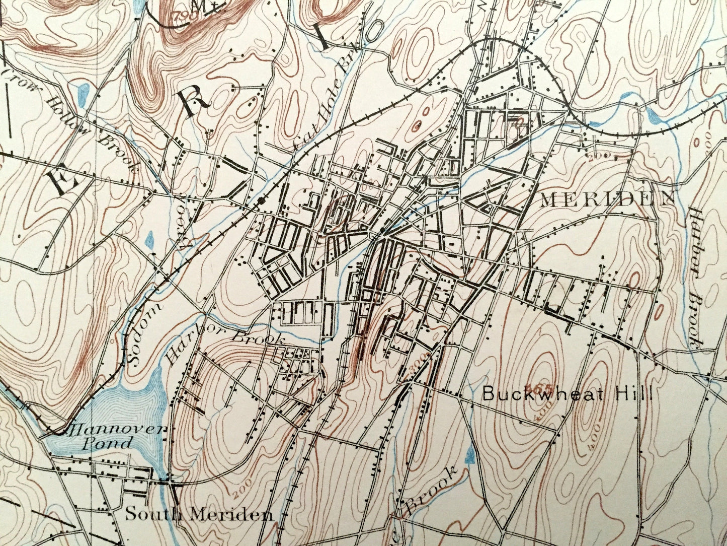
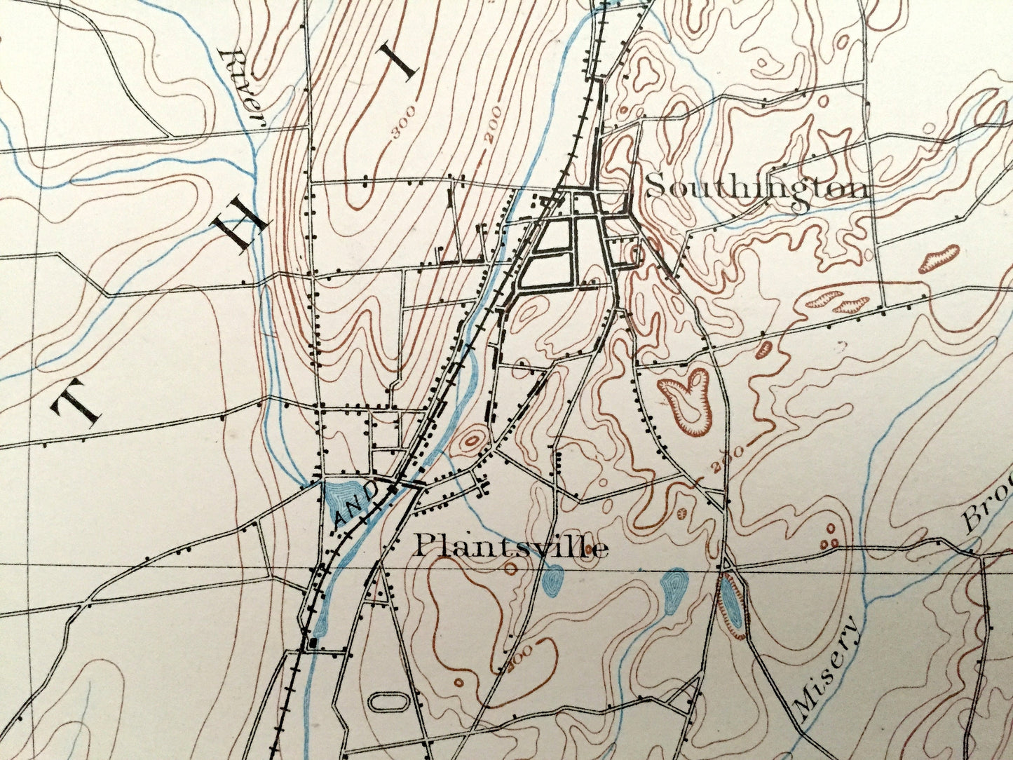
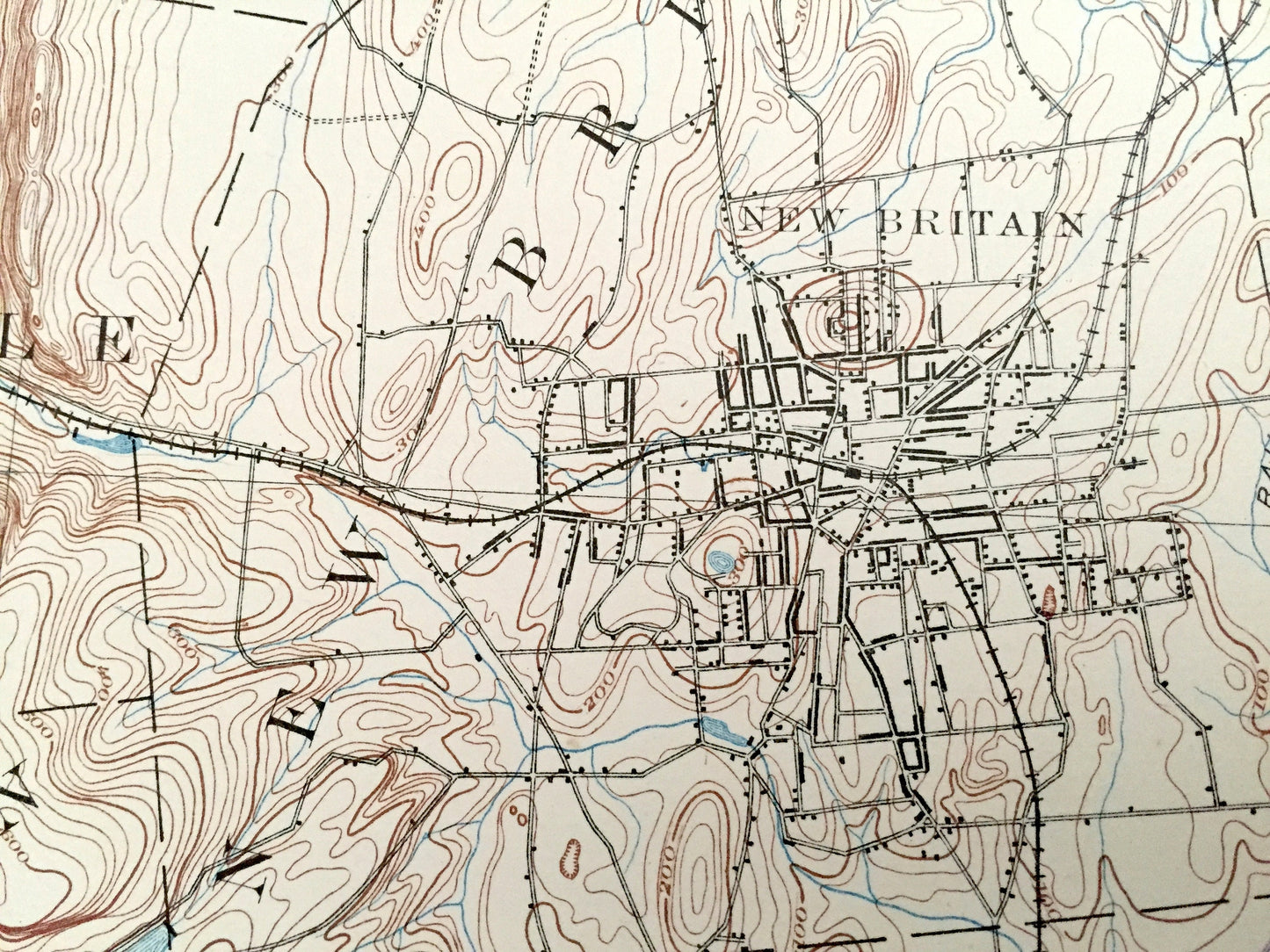
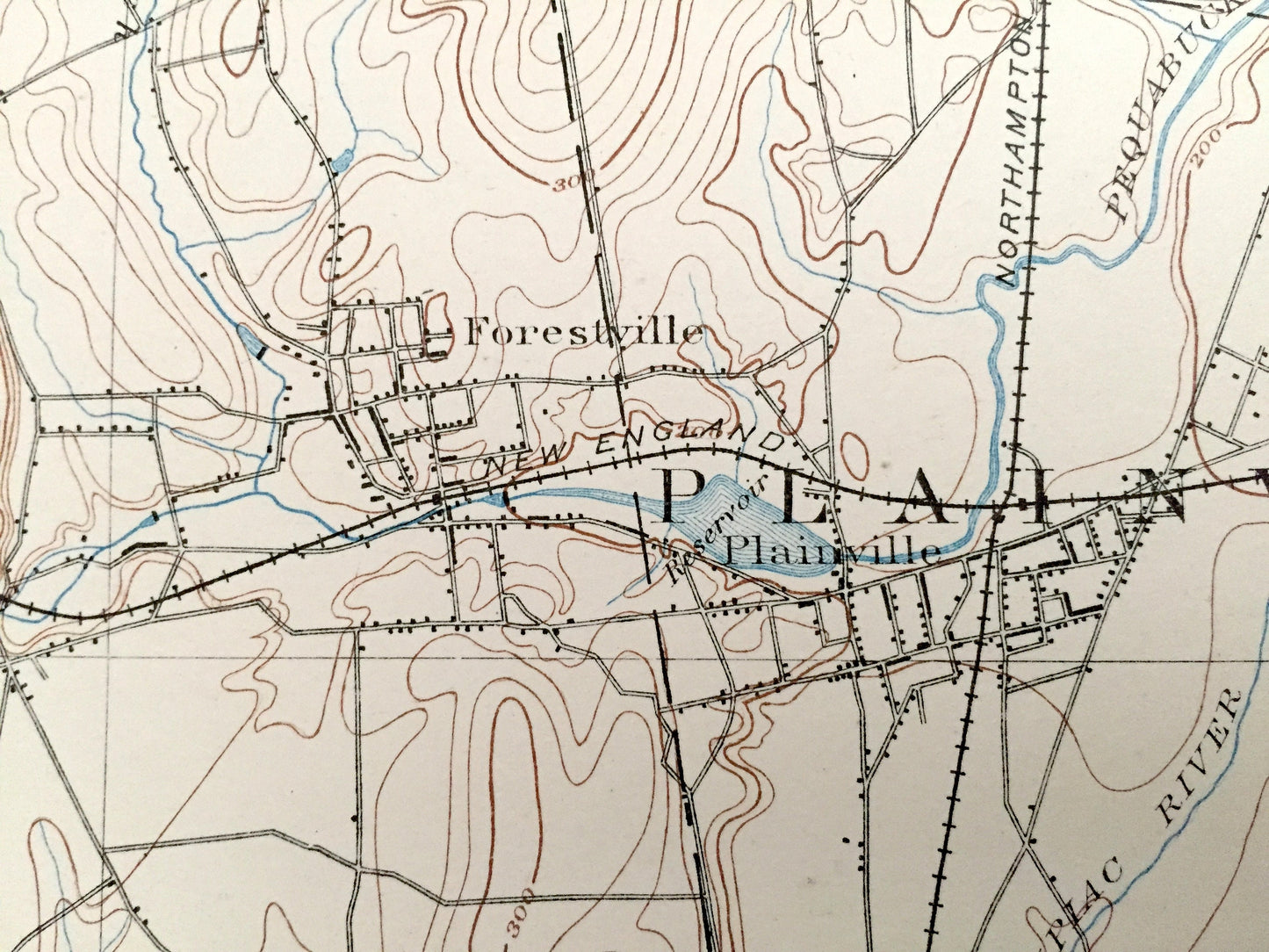
Beautiful, antique map of Meriden, Farmington, Bristol and New Britain, Connecticut and surrounding area. This is an authentic 1893 print taken from the "Topographical Atlas of the State of Connecticut" by the U.S. Geological Survey and is NOT a computer reproduction. (Plate No. 18.)
See what Hartford, Litchfield & New Haven County looked like over 125 years ago. Lots of intricate details and geological contours. Map even has little squares for every house that existed at the time. The USGS cartographers were very thorough back then! On the back is a description of topographic symbols and map guide.
Perfect for the historian, map-lover, the curious or just as a conversation starter. Wonderful and rare. Vintage maps such as these make great gifts.
Edition of 1893, printed 1893
Dimensions: 17" width x 20 1/2" height
----
Features
Cities & Towns: Burlington, Bristol, Farmington, West Hartford, Newington, New Britain, Southington, Wolcott, Waterbury, Cheshire, Meriden, Prospect, Mixville, Plantsville, Kensington, Berlin, Forestville, Whigville, East Plymouth, Terryville, Tracy.
Points of Interest: Farmington River, Pequabuck River, Quinnipiac River, Shuttle Meadow Reservoir, Hartford Reservoir, Southington Road Station, Hanover Pond, West Peak, Hanging Hills, Cathole Mountain, Lamentation Mountain, Rattlesnake Mountain, Waterbury Railroad, New York New Haven and Hartford Railroad, and lots more hills, mountains, creeks, towns, roads and train tracks.
Condition: Good Vintage condition, commensurate with age. This map is in great shape for being over 125 years old. Some edge-wear, spotting, toning and warble from atlas, but this will add to vintage character when framed. I have kept the thin margin of paper on the left where the map was attached to the atlas—this piece can be removed or folded behind the print.
(Picture of atlas cover and front matter shown for informational purposes and not included.)
----
We will happily adjust shipping price for multiple purchases. Maps are rolled up and shipped in sturdy mailing tubes, never folded.
Couldn't load pickup availability
Share