My Store
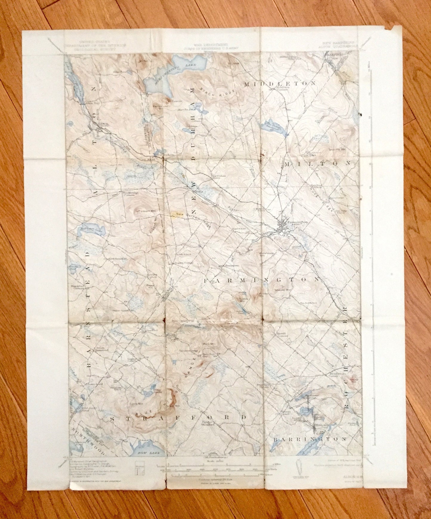
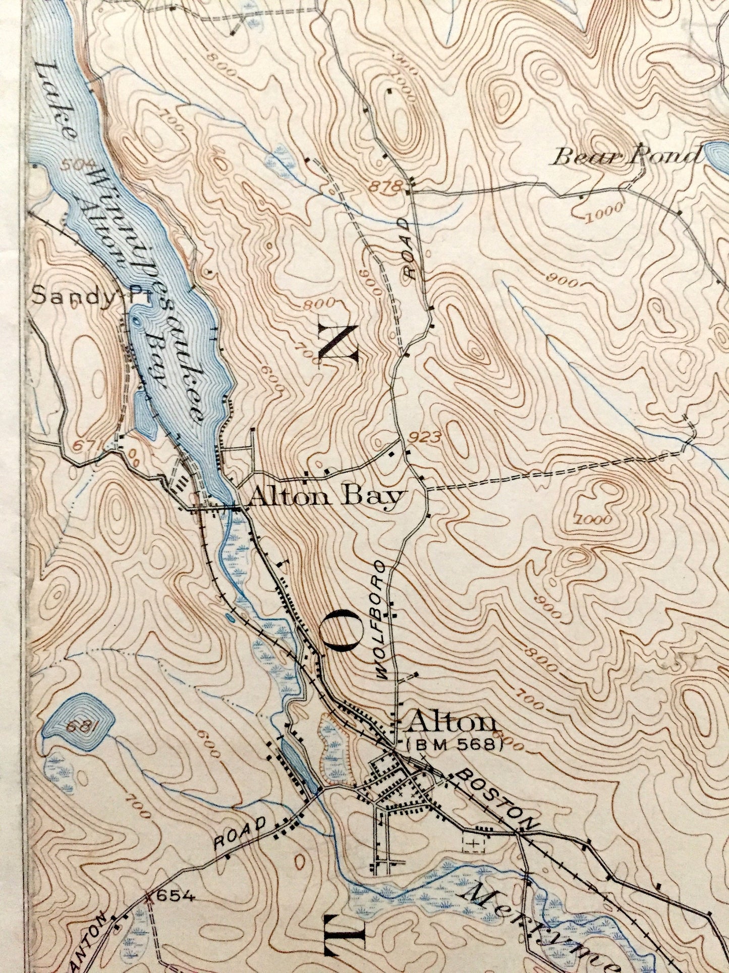
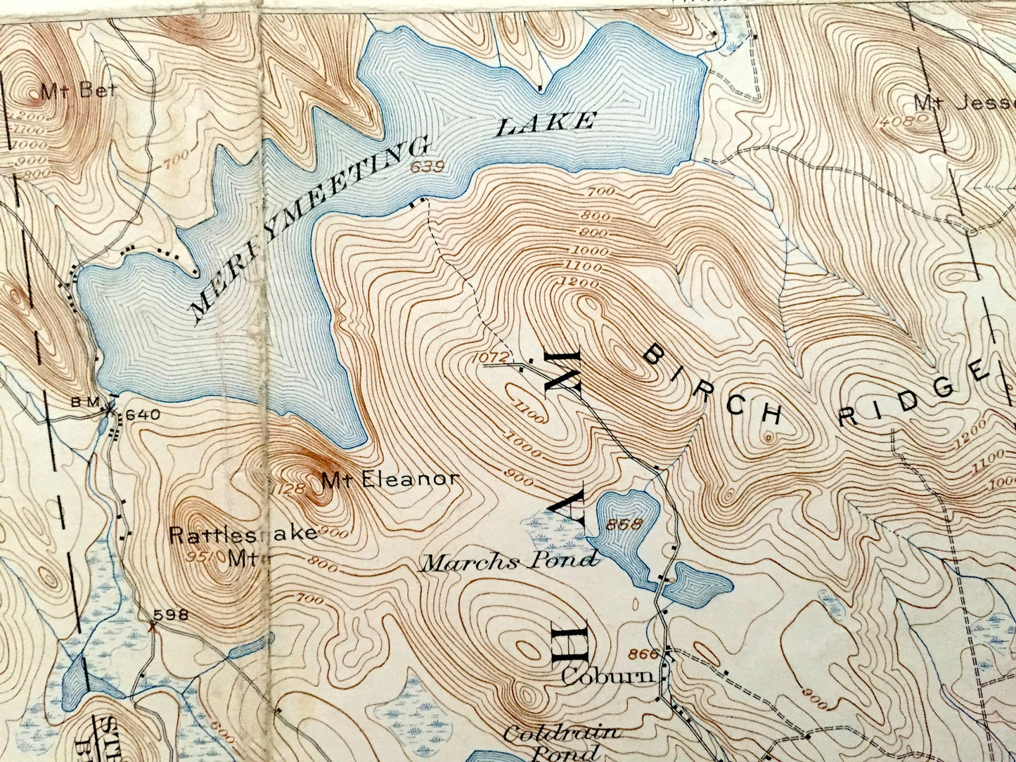
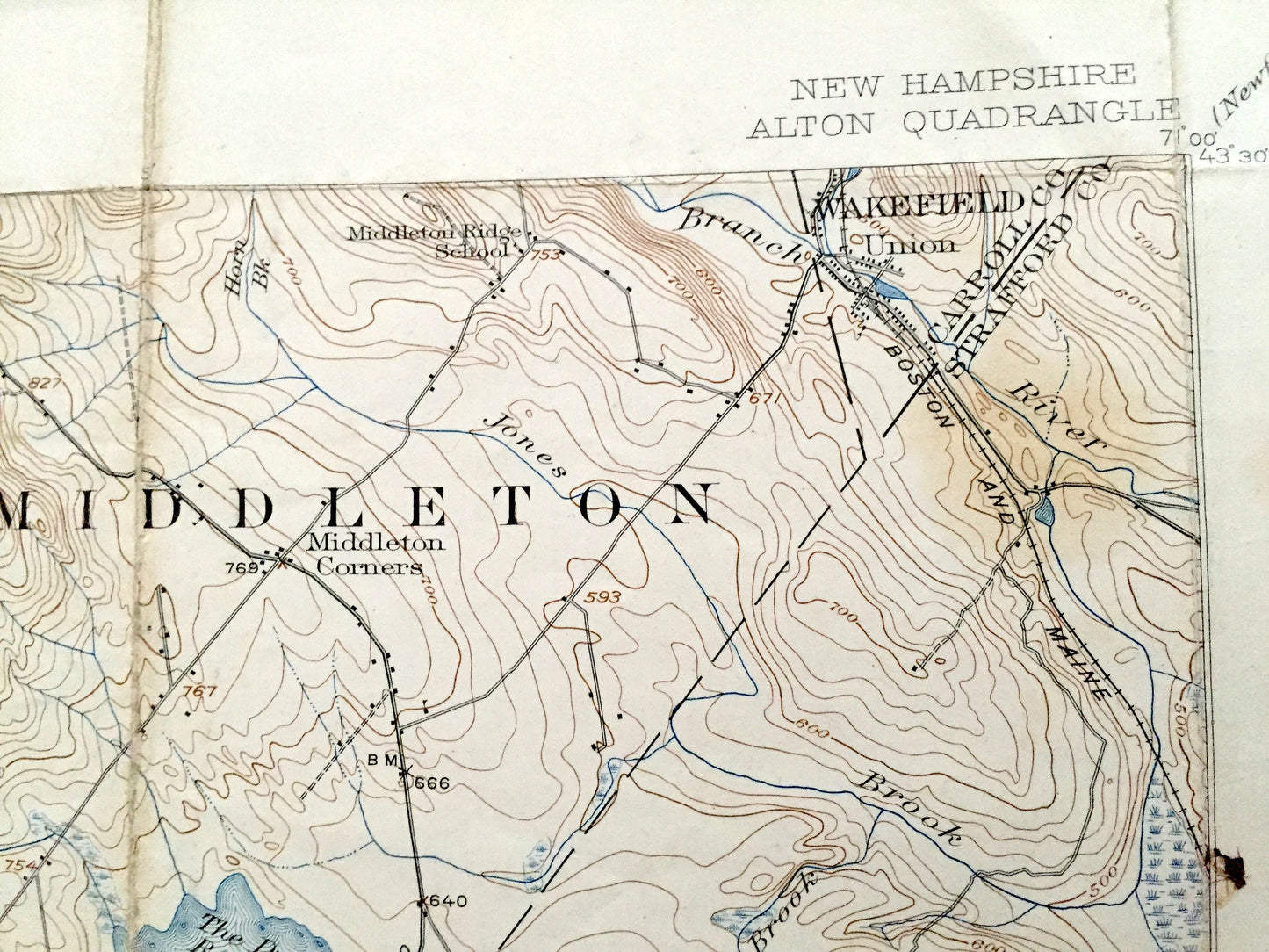
Antique Merrymeeting Lake, New Hampshire 1919 US Geological Survey Topographic Map – Alton Bay, New Durham, Farmington, Winnipesaukee, NH
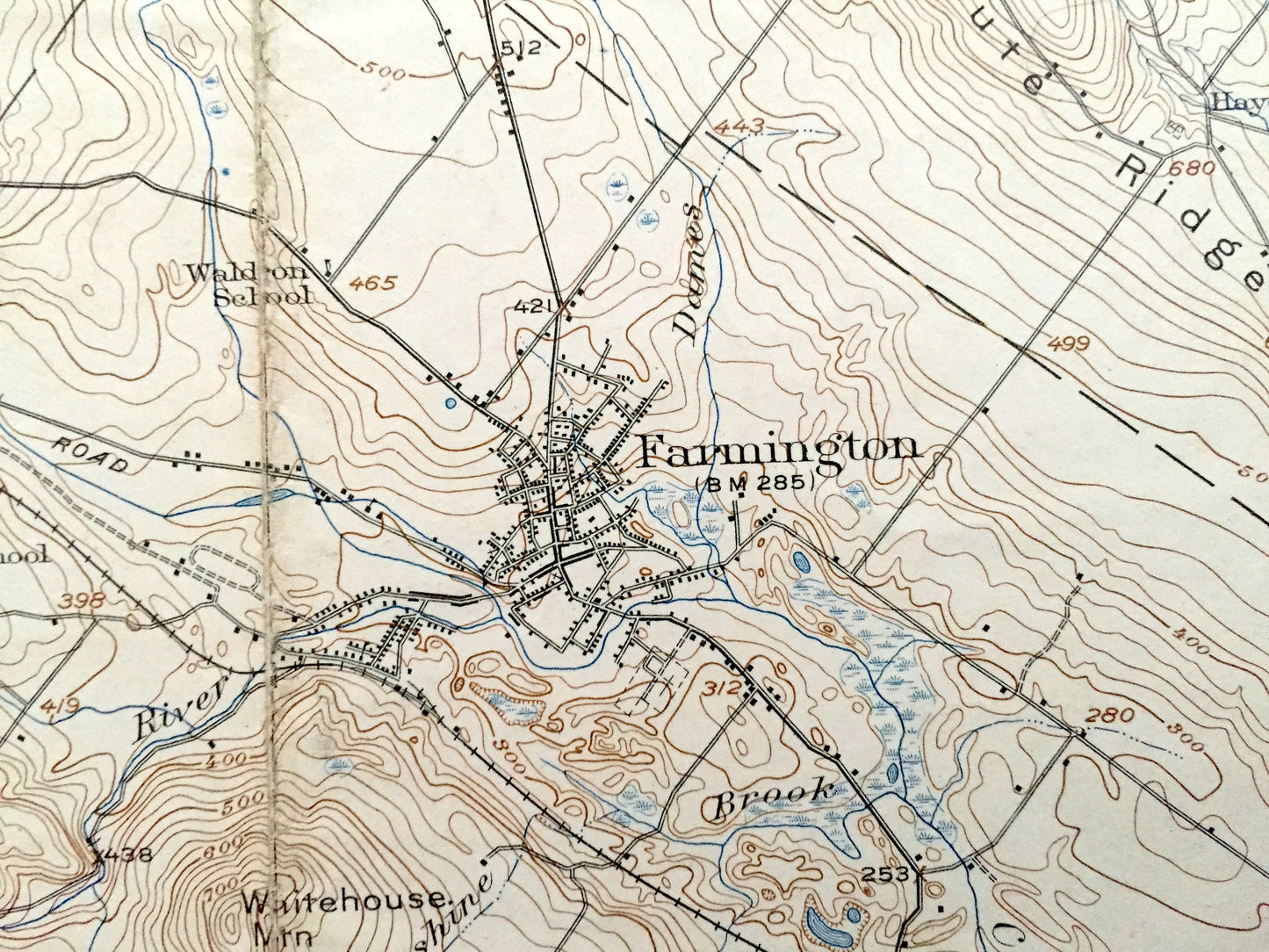
Antique Merrymeeting Lake, New Hampshire 1919 US Geological Survey Topographic Map – Alton Bay, New Durham, Farmington, Winnipesaukee, NH
Beautiful, antique map of Merrymeeting Lake, Alton Bay, Lake Winnipesaukee and Farmington, New Hampshire, including surrounding Belknap, Carroll & Strafford Counties. This is an authentic 1919 edition, 1942 print from the U.S. Geological Survey and NOT a computer reproduction.
See what the Lakes Region of New Hampshire looked like over 100 years ago. Lots of intricate details and geological contours. Map even has little squares for every house that existed at the time. The USGS cartographers were very thorough back then! On the back is a description of topographic symbols and map guide.
Perfect for the historian, map-lover, the curious or just as a conversation starter. Wonderful and rare. Vintage maps such as these make great gifts.
Edition of 1919, printed 1942
Dimensions: 16 1/2" width x 20" height
----
Features
Cities & Towns: Alton, New Durham, Middleton, Milton, Wakefield, Barnstead, Farmington, Pittsfield, Northwood, Strafford, Barrington, Rochester, Alton Bay, New Durham Corner, Union, Stockbridge Corners, Lockes Corner, Shackford Corner, Hornetown, Dexter Corner, Hills Corner, Hayes Corner, Place, South Barnstead, Center Strafford, Merrill Corners, Meaderboro Corner, Strafford Corner, Berrys Corner.
Points of Interest: Lake Winnipesaukee, Merrymeeting Lake, Merrymeeting River, The Dump Reservoir, Halfmoon Lake, Willey Ponds, Bow Lake, Ayers Pond, Round Pond, Cocheco River, Alton Bay, Wild Goose Pond, Jenness Pond, Long Pond, Rochester Reservoir, Birh Ridge, Ble Hills Range, Mt. Beat, Mt. Jesse, Teneriffe Mountain, Nute Ridge, New Durham Ridge, Whitehouse Mountain, Chesley Mountain, Hussey Mountain, Nubble Mountain, Parker Mountain, Ela River, Boston & Maine Railroad, and lots more hills, mountains, streams, ponds, marshes, camps, houses, islands, coves, roads, railroads.
Condition: Good or "Very Vintage" condition, commensurate with age. This map is in great shape for being over 75 years old. Has some edge wear, toning, foxing and folds as-issued, but these will flatten easily and all of which will read as vintage character.
----
We will happily adjust shipping price for multiple purchases. Maps are rolled up and shipped in sturdy mailing tubes, never folded.
Couldn't load pickup availability
Share