My Store
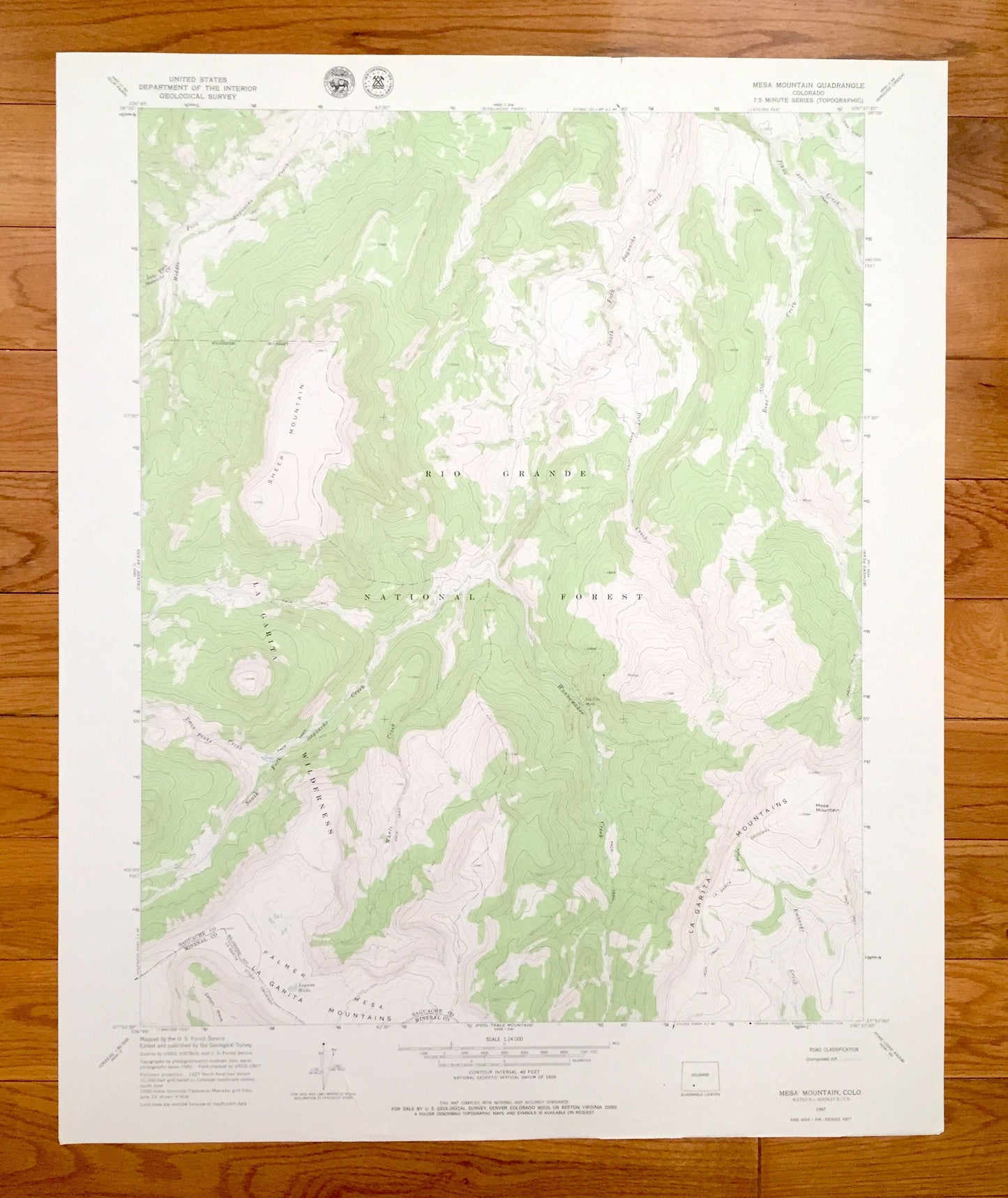
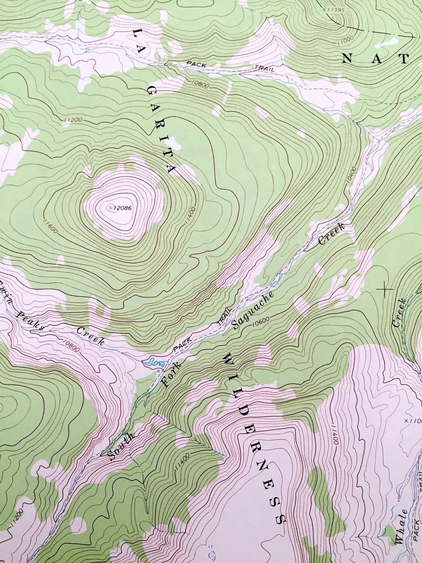
Antique Mesa Mountain, Colorado 1967 US Geological Survey Topographic Map – Saguache, Mineral County, Rio Grande National Forest, CO
Antique Mesa Mountain, Colorado 1967 US Geological Survey Topographic Map – Saguache, Mineral County, Rio Grande National Forest, CO
Beautiful, antique map of Mesa Mountain, Colorado and surrounding Saguache & Mineral County areas. This is an authentic 1967 edition, 1978 print from the U.S. Geological Survey and NOT a computer reprint.
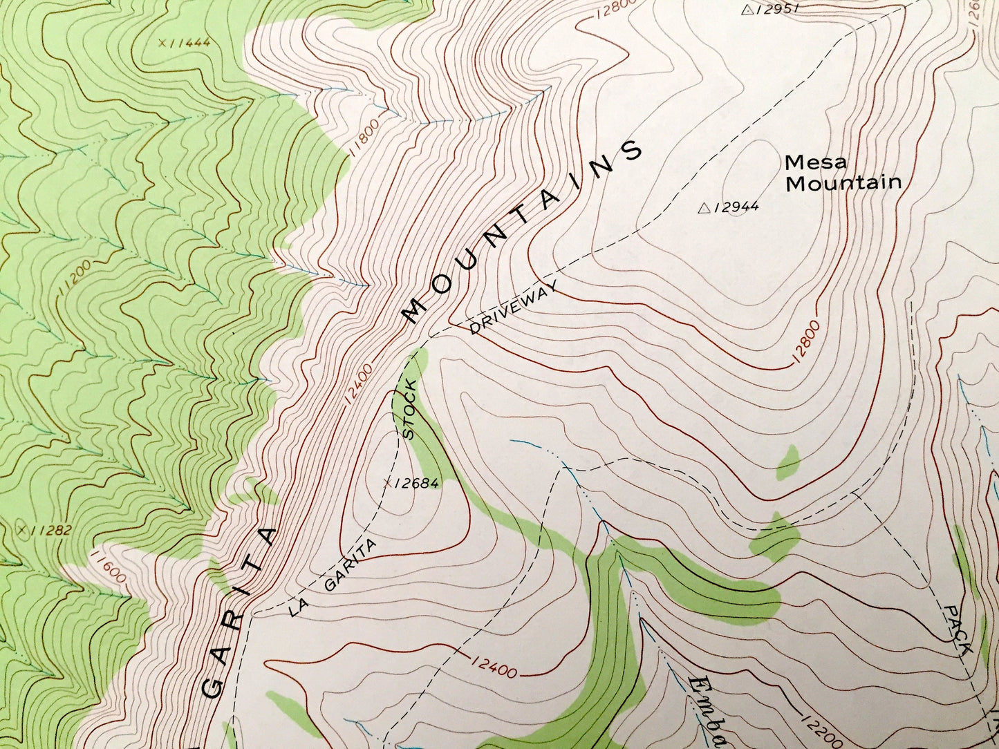
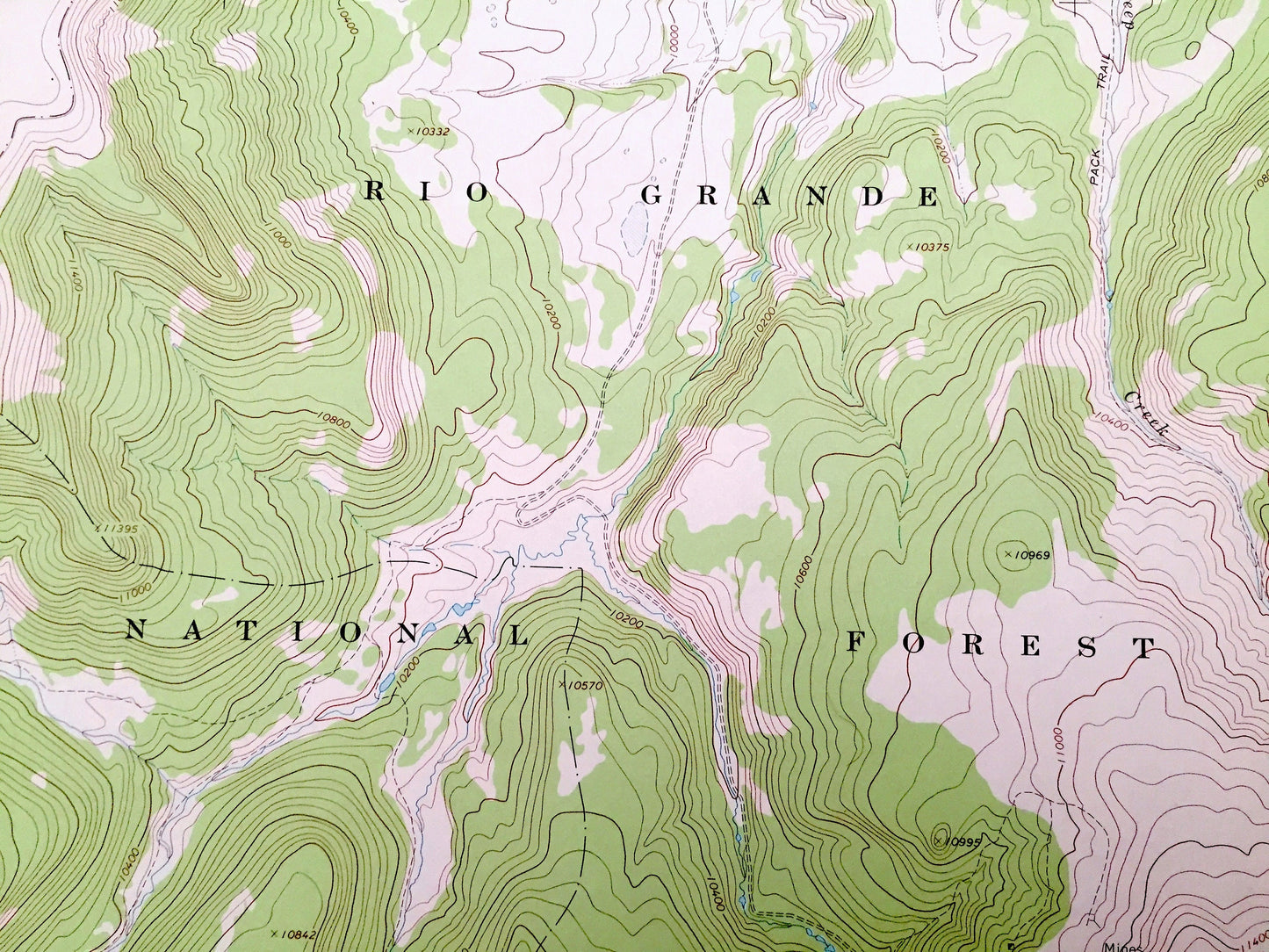
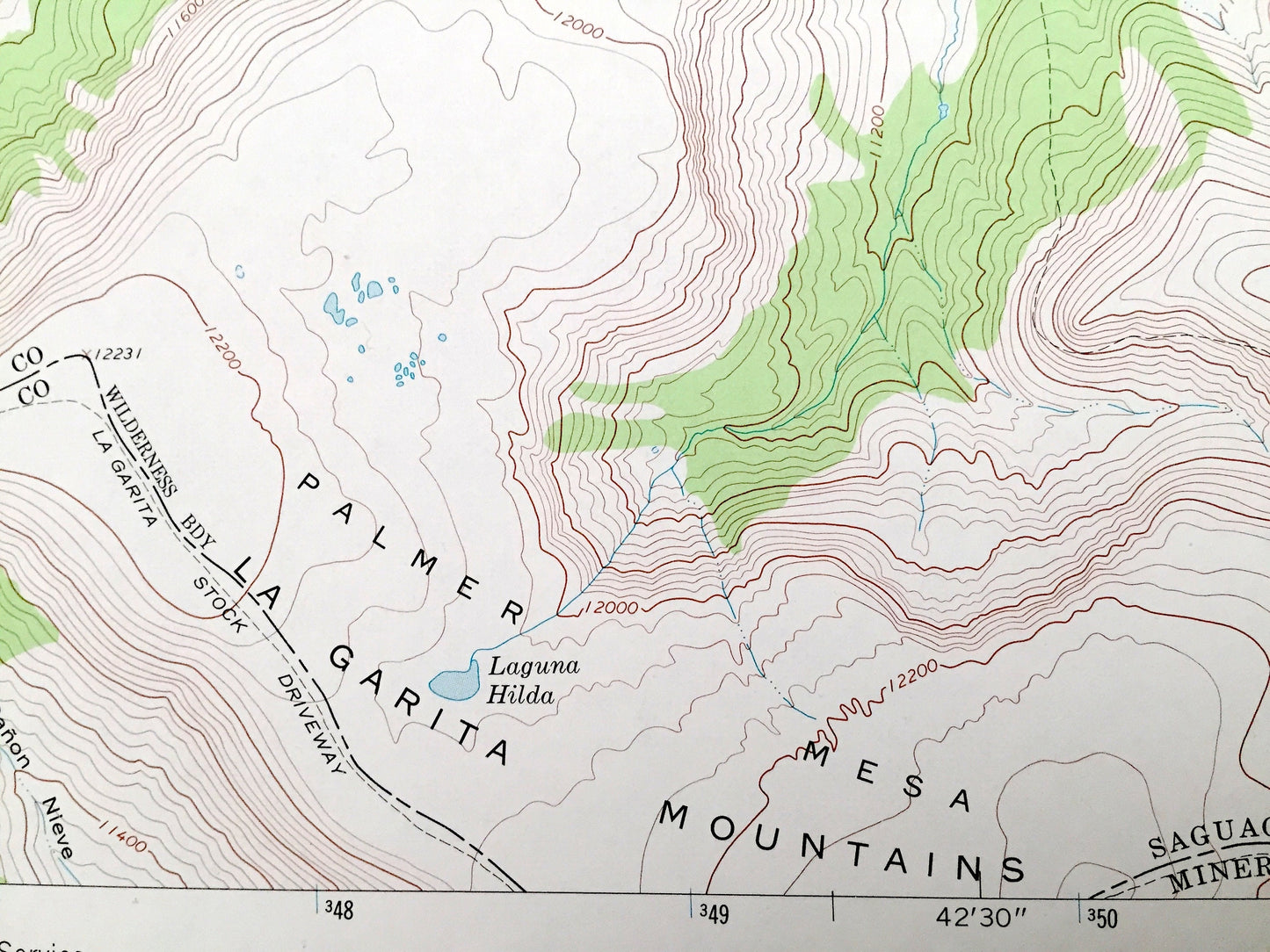
See what Colorado looked like over 50 years ago. Lots of intricate details and geological contours. Map even has little squares for every house that existed. The USGS cartographers were very thorough back then!
Perfect for the historian, map-lover, the curious or just as a conversation starter. Wonderful and rare. Vintage maps such as these make great gifts.
Edition of 1967, printed 1978
Dimensions: 22" width x 27" height
----
Features
Points of Interest: La Garita Wilderness, La Garita Mountains, Sheep Mountain, Palmer Mesa, Middle Fork Saguache Creek, Twin Peaks Creek, South Fork, Saguache Creek, Whale Creek, Wannamaker Creek, Embargo Creek, Deep Creek, Johns Creek, Bear Creek, Laguna Hilda, and many more hills, streams, ponds, houses, schools, railroads, churches and roads.
Condition: Very Good Vintage condition, commensurate with age. This map is in incredible shape for being over 40 years old. Has light edge-wear and a tear on the bottom edge, all of which will read as character when framed.
----
We will happily adjust shipping price for multiple purchases. Maps are rolled up and shipped in sturdy mailing tubes, never folded.
Couldn't load pickup availability
Share