My Store
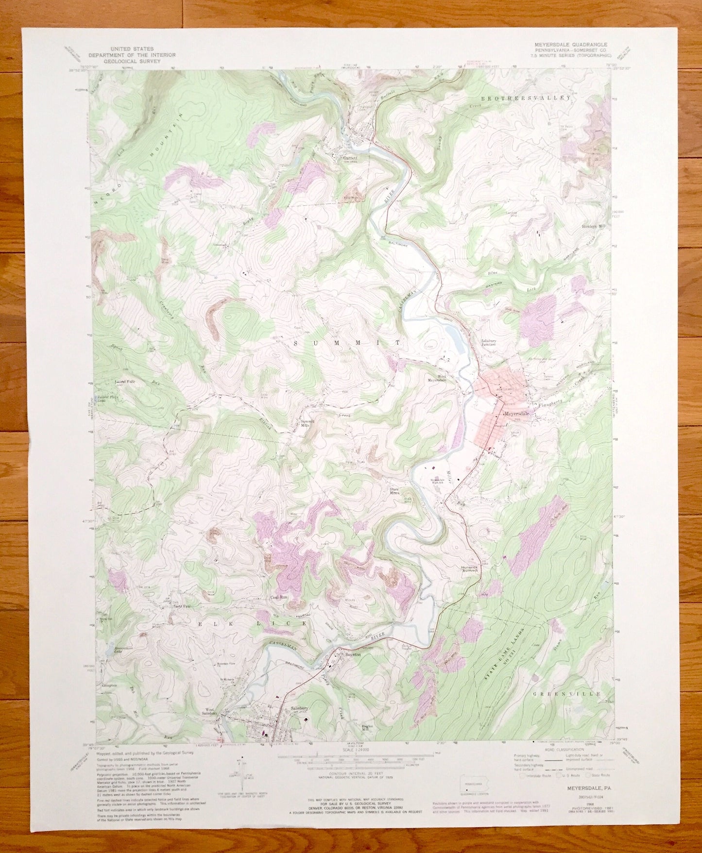
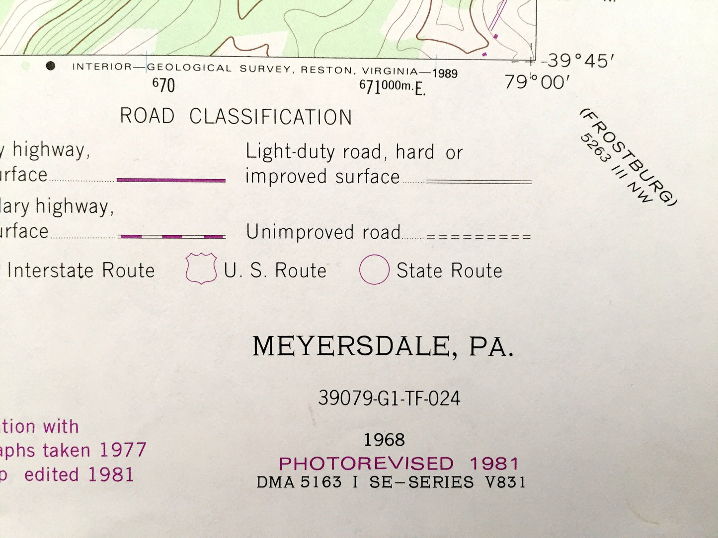
Antique Meyersdale, Pennsylvania 1968 US Geological Survey Topographic Map – Somerset County, Salisbury, Garrett, Saint Paul, Berkleys Mill
Antique Meyersdale, Pennsylvania 1968 US Geological Survey Topographic Map – Somerset County, Salisbury, Garrett, Saint Paul, Berkleys Mill
Beautiful, antique map of Meyersdale, Pennsylvania and surrounding Somerset County area. This is an authentic 1968 edition, 1981 print from the U.S. Geological Survey and NOT a computer reproduction.
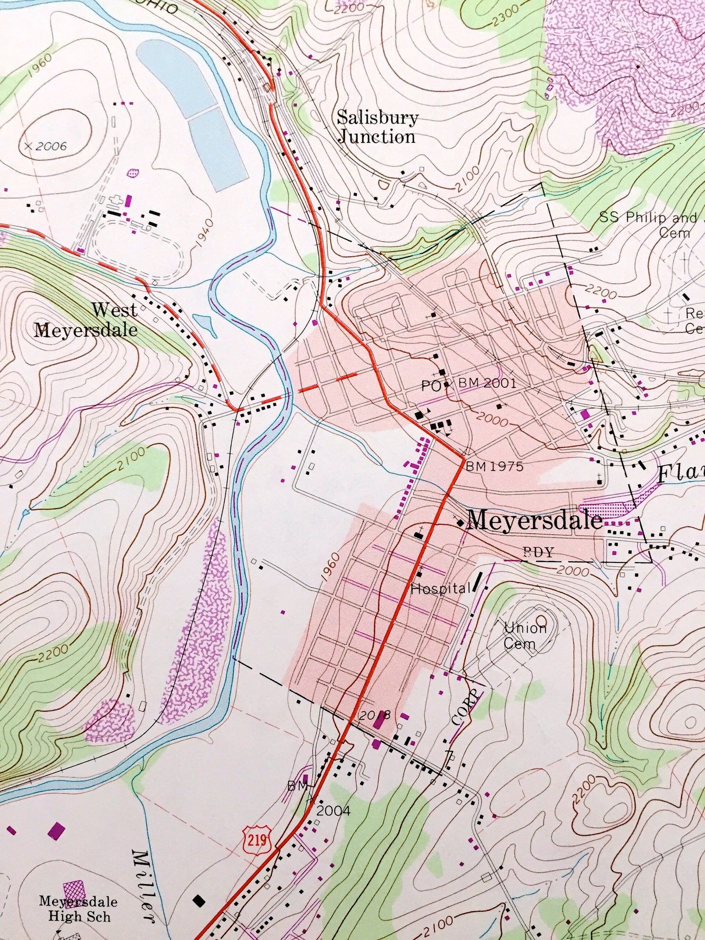
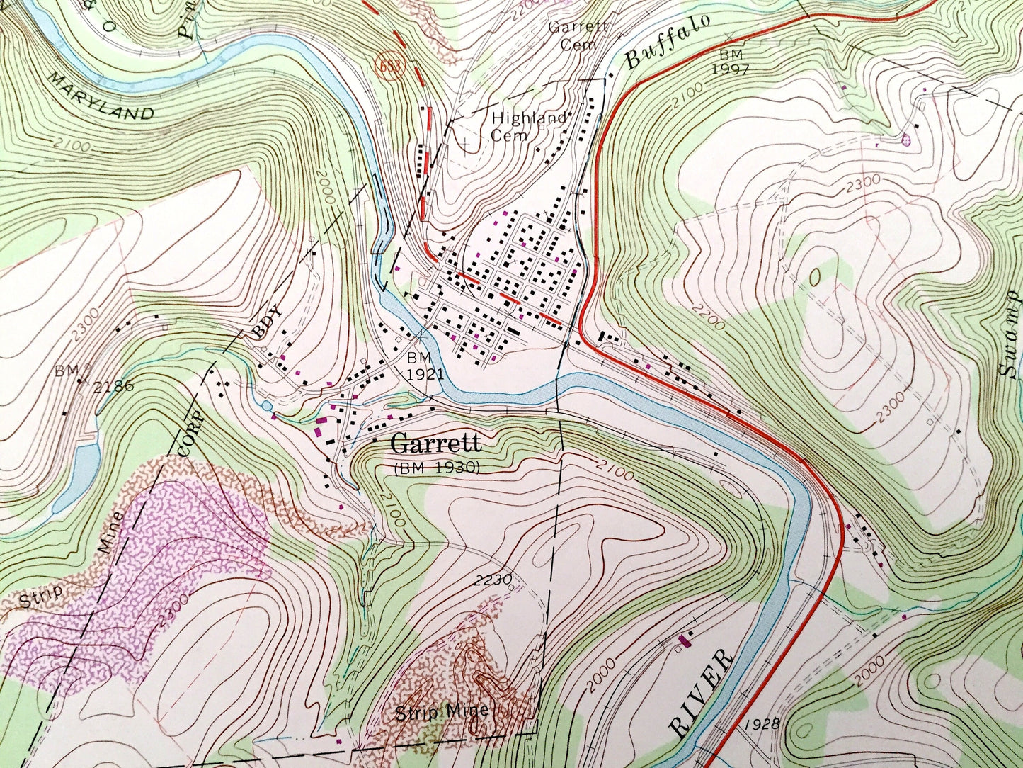
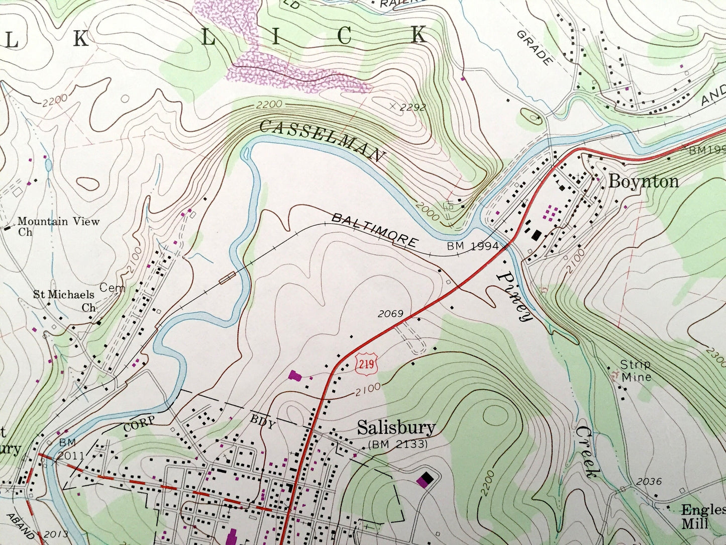
See what Pennsylvania looked like 50 years ago. Lots of intricate details and geological contours. Map even has little squares for every house that existed at the time. The USGS cartographers were very thorough back then!
Perfect for the historian, map-lover, the curious or just as a conversation starter. Wonderful and rare. Vintage maps such as these make great gifts.
Edition of 1968, printed 1981
Dimensions: 22" width x 27" height
----
Features
Cities & Towns: Meyersdale, Salisbury, Boynton, Salisbury Junction, Berkleys Mill, Garrett, Laurel Falls, Summit Mills, West Meyersdale, Shaw Mines, Saint Paul, Engles Mill, West Salisbury, Coal Run, Compton, Elk Lick, Greenville, Summit, Brothersvalley.
Points of Interest: Hunsrick Summit, State Game Lands, Casselman RIver, Brenneman Lake, Baltimore and Ohio Railroad, Cranberry Run, Negro Mountain, Western Maryland Railroad, Drive-in Theater, and many more hills, streams, ponds, houses, schools, churches and roads.
Condition: Very Good condition, commensurate with age. This map is in incredible shape for being almost 40 years old. This map was most likely used in the field. Has light-edge wear and pencil markings, but this will read as vintage character when framed.
----
We will happily adjust shipping price for multiple purchases. Maps are rolled up and shipped in sturdy mailing tubes, never folded.
Couldn't load pickup availability
Share