My Store
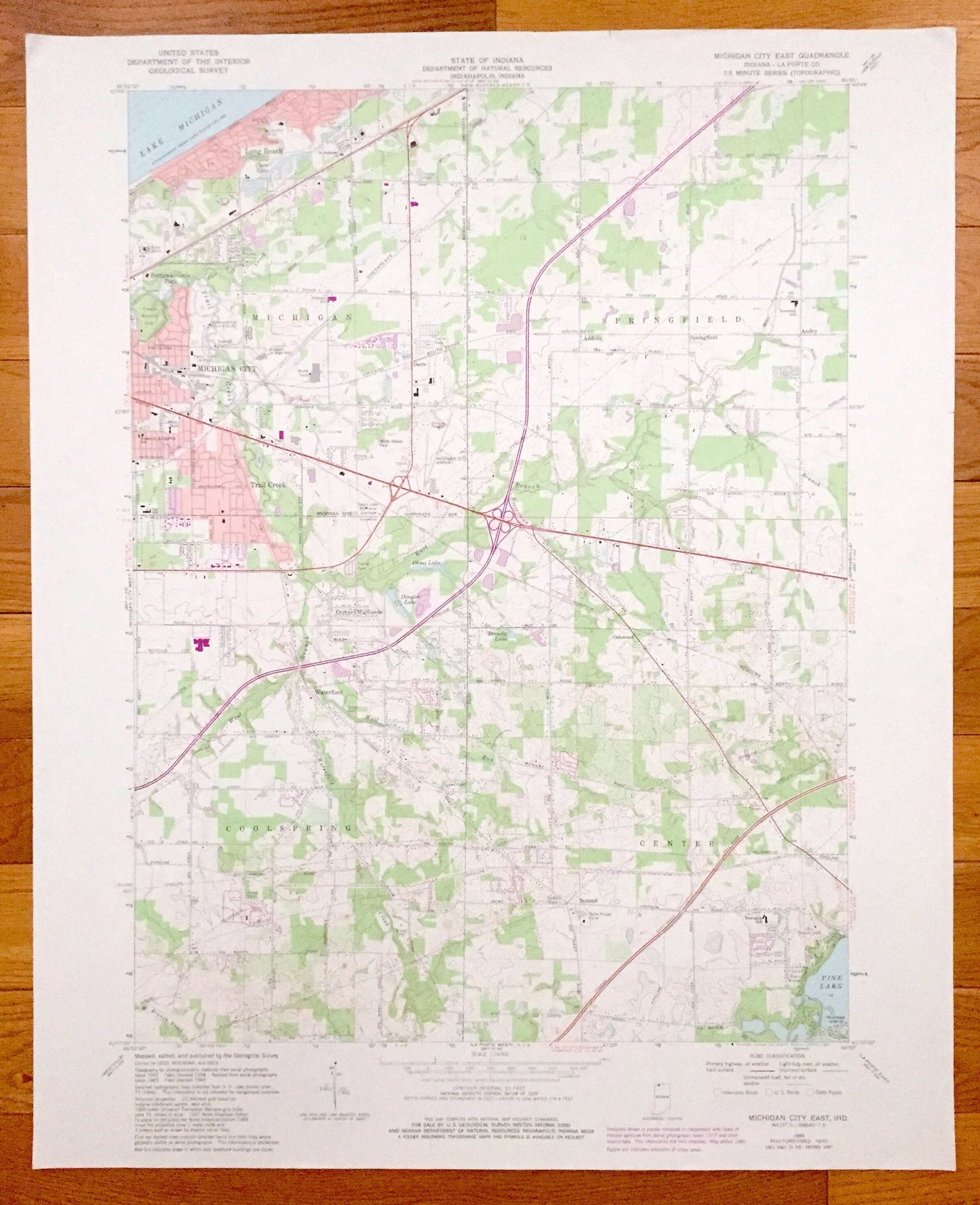
Antique Michigan City, Indiana 1969 US Geological Survey Topographic Map – Michigan, Springfield, Coolspring, Center, La Porte County
Antique Michigan City, Indiana 1969 US Geological Survey Topographic Map – Michigan, Springfield, Coolspring, Center, La Porte County
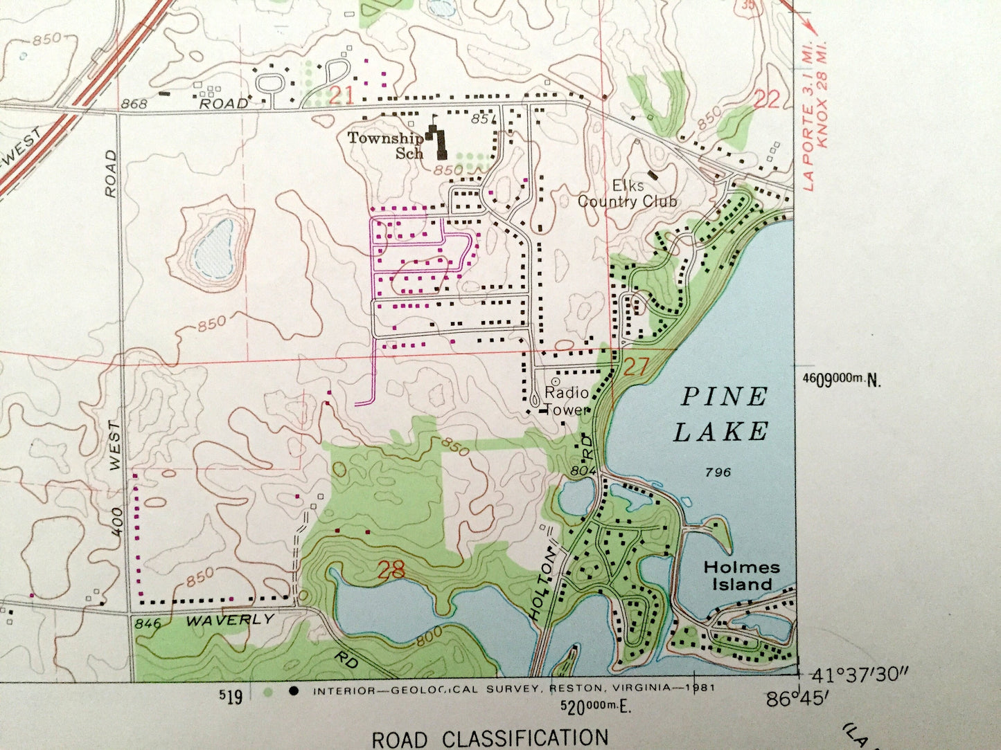
Beautiful, antique map of Michigan City, Springfield, Coolspring & Center, Indiana and surrounding La Porte County area. This is an authentic 1969 edition, 1980 print from the U.S. Geological Survey and NOT a computer reproduction.
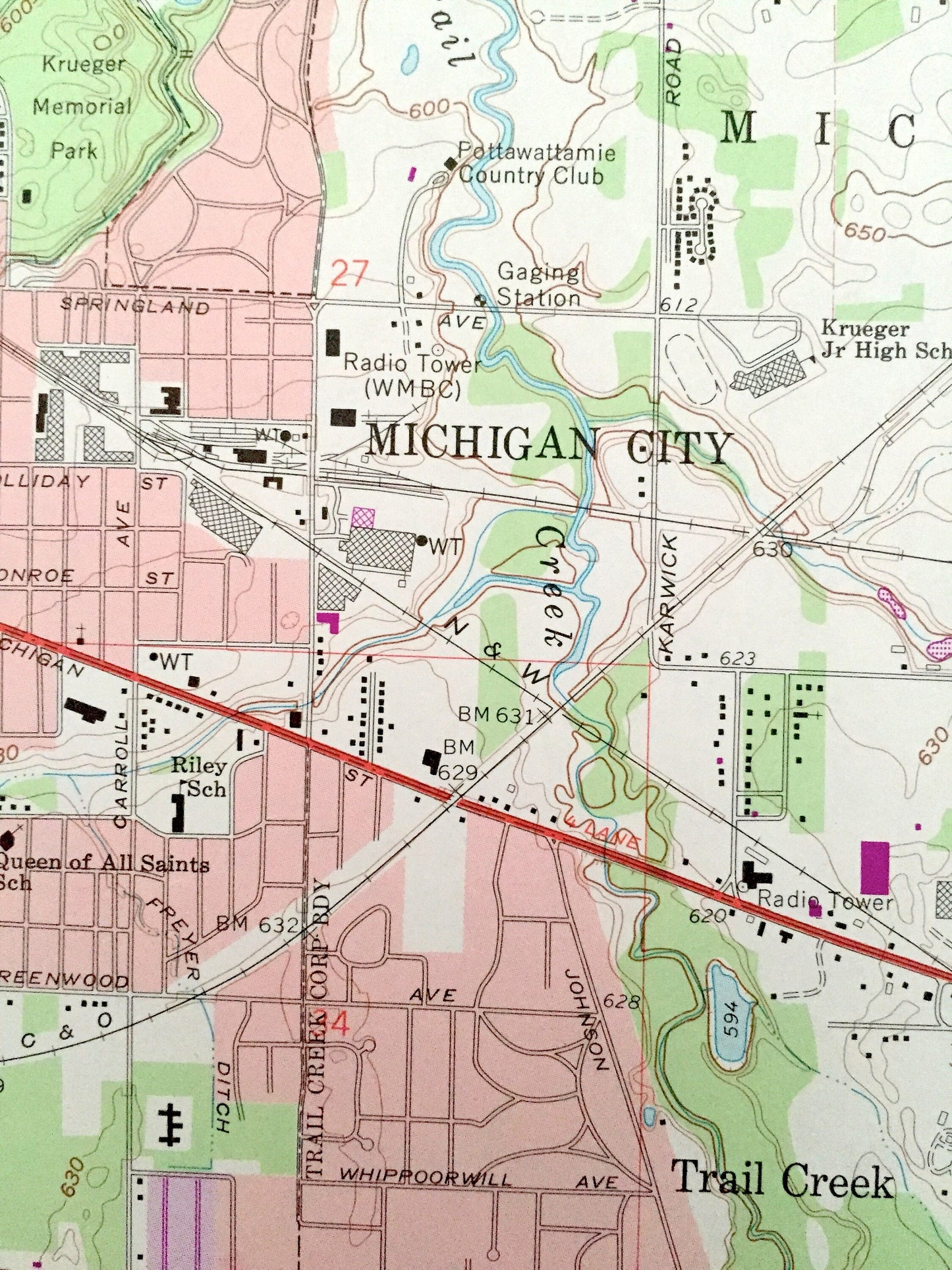
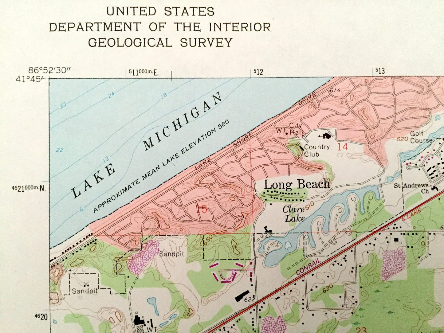
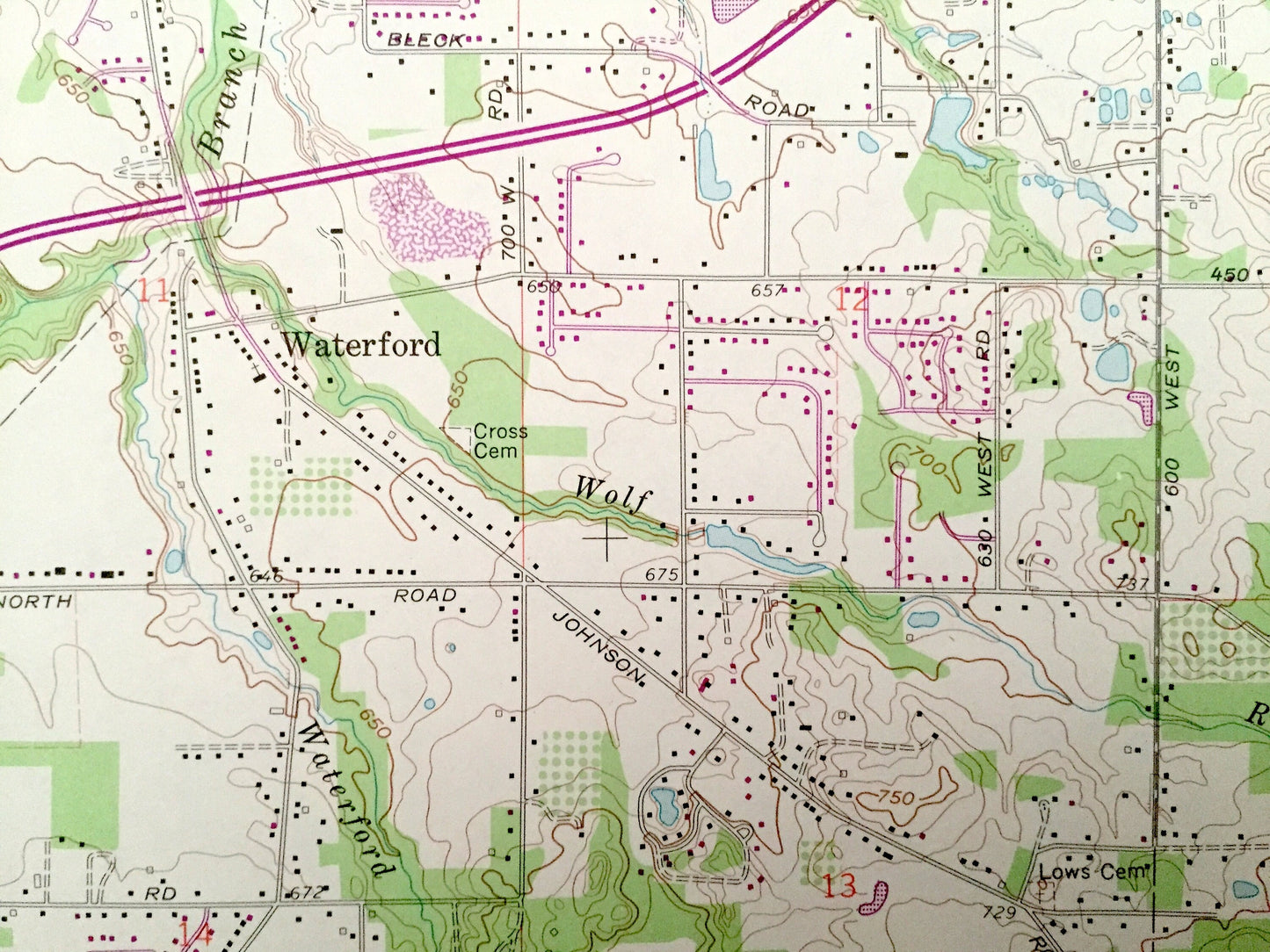
See what Indiana looked like almost 50 years ago. Lots of intricate details and geological contours. Map even has little squares for every house that existed at the time. The USGS cartographers were very thorough back then!
Perfect for the historian, map-lover, the curious or just as a conversation starter. Wonderful and rare. Vintage maps such as these make great gifts.
Edition of 1969, printed 1980
Dimensions: 22" width x 27" height
----
Features
Cities & Towns: Michigan, Springfield, Coolspring, Center, Long Beach, Pottawattamie Park, Michigan City, Trail Creek, Orchard Highlands, Ambler, Andry, Davis, Waterford, Summit, Oakwood.
Points of Interest: La Porte County, Lake Michigan, Pine Lake, Holmes Island, Clare Lake, Trail Creek, Michigan City Airport, Wolf Run, Krueger Memorial Park, Chicago South Shore Railroad and lots more creeks, hills, houses, schools, churches, train tracks and roads.
Condition: Very Good condition, commensurate with age. This map is in incredible shape for being almost 40 years old.
----
We will happily adjust shipping price for multiple purchases. Maps are rolled up and shipped in sturdy mailing tubes, never folded.
Couldn't load pickup availability
Share