My Store
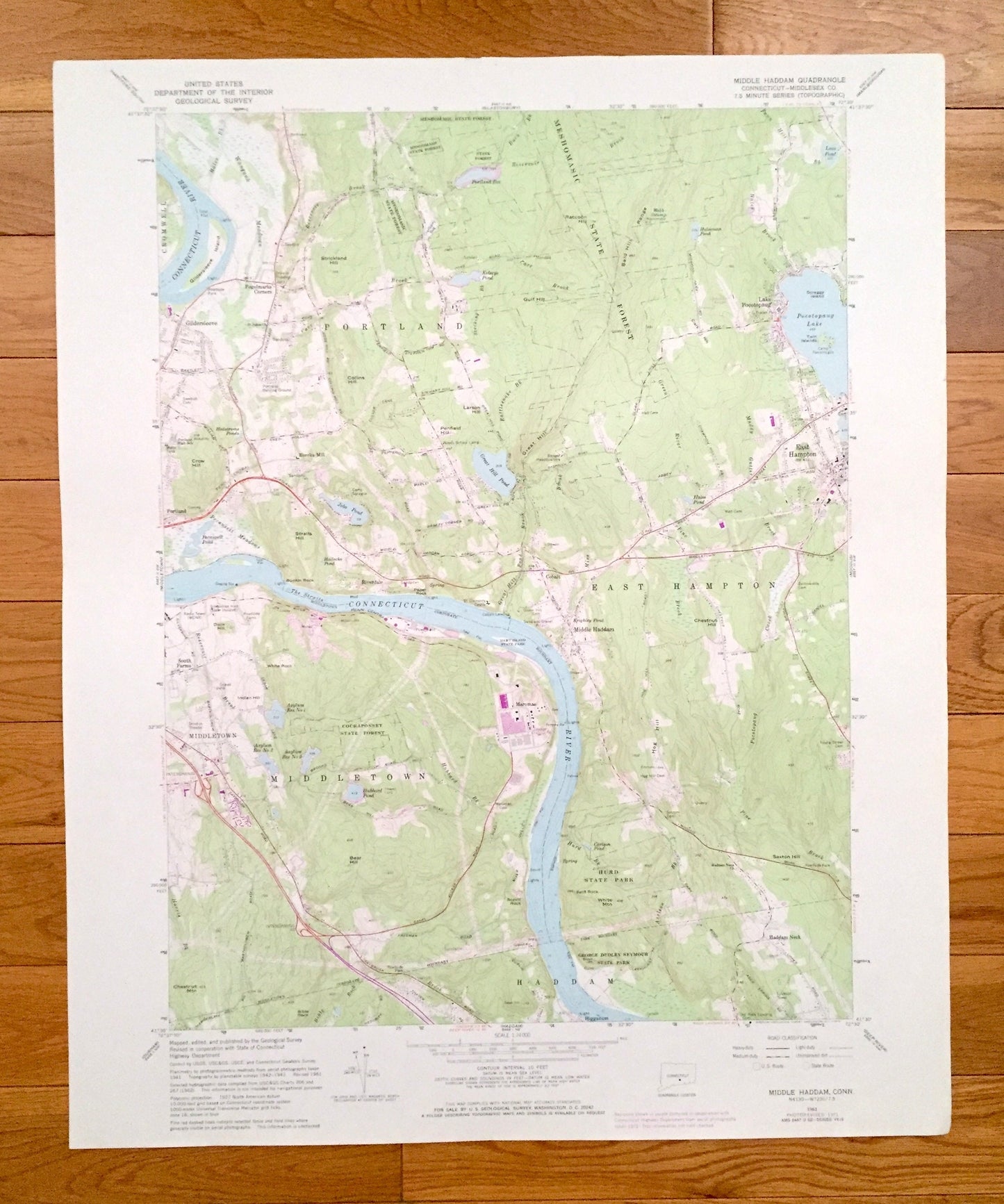
Antique Middle Haddam, Connecticut 1961 US Geological Survey Topographic Map – Middlesex County, Portland, Middletown, East Hampton, CT
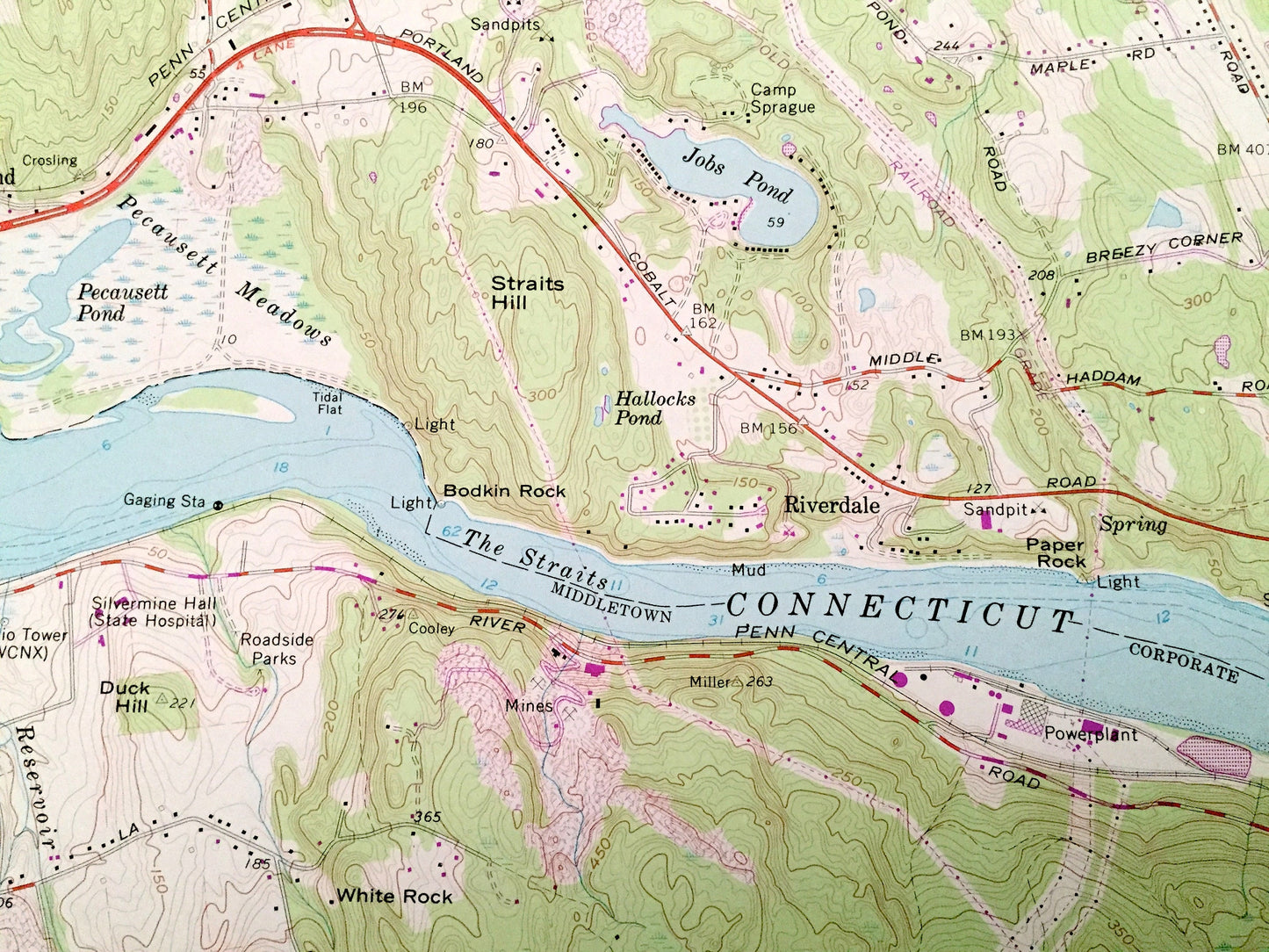
Antique Middle Haddam, Connecticut 1961 US Geological Survey Topographic Map – Middlesex County, Portland, Middletown, East Hampton, CT
Beautiful, antique map of Middle Haddam, Connecticut and surrounding Middlesex County area. This is an authentic 1961 edition, 1972 print from the U.S. Geological Survey and NOT a computer reproduction.
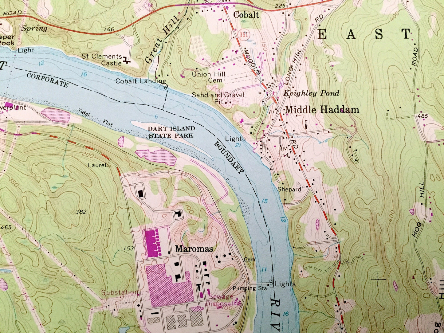
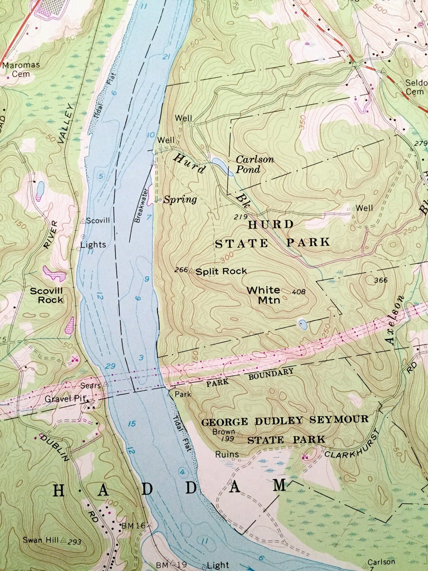
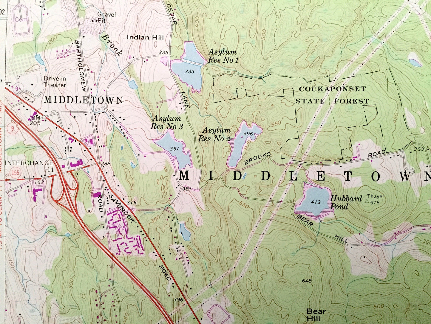
See what Connecticut looked like over 60 years ago. Lots of intricate details and geological contours. Map even has little squares for every house that existed at the time. The cartographers were very thorough back then!
Perfect for the historian, map-lover, the curious or just as a conversation starter. Wonderful and rare. Vintage maps such as these make great gifts.
Edition of 1961, printed 1972
Dimensions: 22" width x 27" height
----
Features
Cities & Towns: Cromwell, Fogelmarks Corners, Gildersleeve, Eureka Mill, Riverdale, East Hampton, Lake Pocotopaug, Haddam, Haddam Neck, Higganum, South Farms, Maromas, Cobalt.
Points of Interest: Meshomasic State Forest, Cockaponset State Forest, Dart Island State Park, George Dudley Seymour State Park, Hurd State Park, Twin Islands, Camp Terramugus, Camp Sprague, Strickland Hill, Great Hill, Bear Hill, Chestnut Mountain, Sexton Hill, Connecticut River, Green River, Muddy Gutter Brook, Carr Brook, Pine Brook, Lindquist Airport, and many more hills, streams, ponds, houses, schools, railroads, churches and roads.
Condition: Very Good Vintage condition, commensurate with age. This map is in great shape for being over 45 years old. Has subtle edge-wear but will read as character when framed.
----
We will happily adjust shipping price for multiple purchases. Maps are rolled up and shipped in sturdy mailing tubes, never folded.
Couldn't load pickup availability
Share